All Activity
- Past hour
-
-
52.9° +SHRA Hey why not?
-
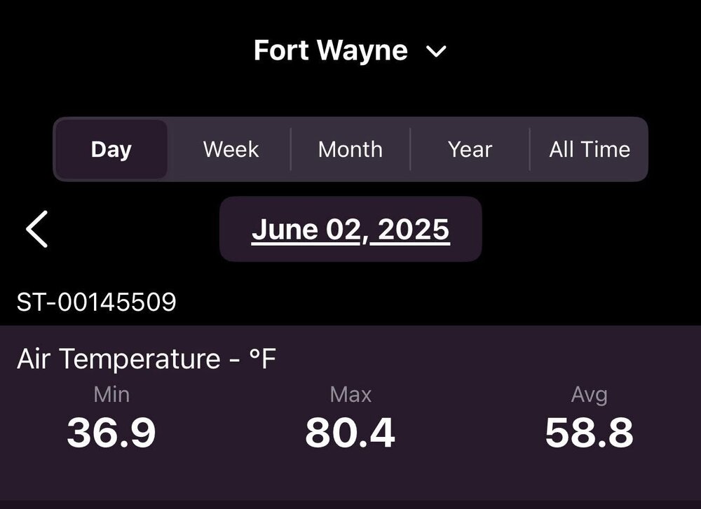
We did have a nice diurnal swing today, but not over 100 degrees.
-
possible strong tornado in E Weld County (close to Wyoming. ) I wonder if any storm chasers went out from Fort Collins to see this
-
I wouldn’t think 98-99 would be your kind of winter. Some great snow depth in January for awhile but it certainly wasn’t a cold, snow covered winter overall. I would actually put this past winter above 98-99 for overall wintery feel.
-
It is pretty active now with a south Bz. Don't snooze on tonight.
-

2025-2026 ENSO
40/70 Benchmark replied to 40/70 Benchmark's topic in Weather Forecasting and Discussion
1995-1996 2014-2015 2010-2011 2004-2005 2017-2018 2002-2003 -

2025-2026 ENSO
michsnowfreak replied to 40/70 Benchmark's topic in Weather Forecasting and Discussion
My favorite going back to 1990: 2013-14 2010-11 2007-08 2014-15 2004-05 2002-03 2008-09 2017-18 2000-01 1998-99 -
Yeah go team save Scott’s sanity. Ha
-
Happened again today. Nice storm, drifting northwest. I'm about 10 miles as the crow flies from Kiowa. By the time the storm got to me, it was sprinkles.
-
18Z euro also moved the wet axis north similarly.
-
That’s the likely scenario despite what Kooky Kenny thinks . Wagons north
-
18 ZGFS looks pretty good for Saturday …has the front pounding PF’s butt but it’s warm sector southeast of there
-
Highs today PHL: 75 EWR: 75 TEB: 74 ACY: 74 LGA: 73 New Brnswck: 73 JFK: 72 BLM: 72 ISP: 71 TTN: 71 NYC: 71
- Today
-
Can you imagine. Panicked over .31 inches of rain? Now THAT is Stein.
-

2025 Spring/Summer Mountain Thread
Maggie Valley Steve replied to Maggie Valley Steve's topic in Southeastern States
It was almost a perfect day, less that pesky Canadian smoke. Low was 56 and the high was 73 at the house today! - Yesterday
-
Yeah it was the Connecticut river valley that got swamped. Some were saying It was going to be way west. You knew...
-
Stick with your gut
-
Here it comes... it's only showers. Is your stepchild on board?
-
I don’t know. We shook.
-
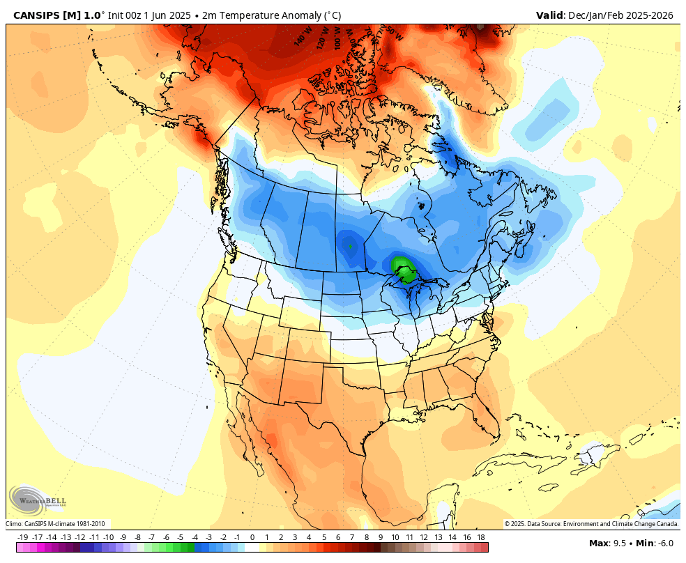
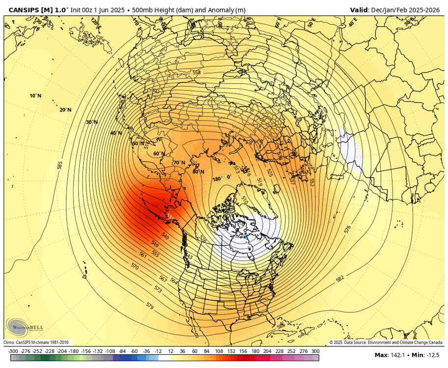
WB 6/1 Can. Seasonal Dec.- Feb.)


-

2025 hurricane season forecast contest -- enter by June 7 06z
nvck replied to Roger Smith's topic in Tropical Headquarters
18/9/4 -
Yes and it's not always about ENSO either. My favorite winters were a combo of different things. 1993-94 1995-96 2002-03 2009-10 2010-11 2013-14 2014-15 2017-18
-
and the solar maximum (though it's really great for northern lights displays even in the south.)
-
A dramatic warmup will is now imminent. The temperature will soar into the upper 70s to around 80° tomorrow and into the 80s by Wednesday. The temperature could reach the hottest levels so far this year on Thursday. Parts of the region could reach 90° for their first time this year. Temperatures will remain above normal into the weekend. The ENSO Region 1+2 anomaly was +0.2°C and the Region 3.4 anomaly was -0.2°C for the week centered around May 21. For the past six weeks, the ENSO Region 1+2 anomaly has averaged +0.08°C and the ENSO Region 3.4 anomaly has averaged -0.08°C. Neutral ENSO conditions will likely continue through at least mid summer. The SOI was -6.75 today. The preliminary Arctic Oscillation (AO) was +1.534 today.