All Activity
- Past hour
-
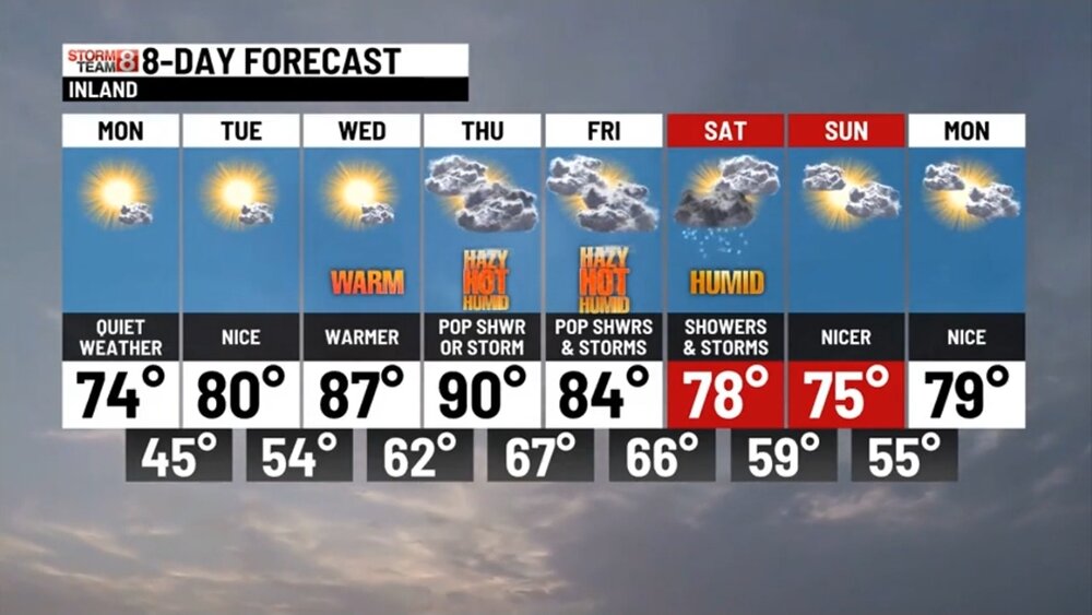
60 / 46 off a low of 43. Out of the cool/wet pattern and by tomorrow quickly to summer, Low 70s/mid 70s today - low 80s / mid 80s Tuesday and upper 80s to low 90s Wed - Fri / cooler coast.. 850 MB temps >17c Thu and again on Sunday could make a sneaky overperforming highs day pending on clouds/storms in between. Frontal boundary linger by Friday nigh - Sun AM so could see some pop up storms in the period and debris clouds Saturday (another weekend cloudy day potential). Sunday looks like the better day. Overall, warmer 6/9 and beyond.
-
Folks probably don't give a ratz ass how and why it rains on weekends at this point. The frustration doesn't care... But, I'm seeing this weekend's rain potential as more typically of summer - not being inundated with cold and NE flow type bs fwiw - There may be a warm/stationary front sort of stalled ALB to PSM type axis, like the current blend of the Euro/GFS, and associated rain/thunder ... More typical of 42 deg N latitude in early June. That set is up is normal synoptic frontal traffic this time of year. We get fronts... it's normal during both outstanding weather years, and piece of shit years, and all qualities in between. Cannot remove passing fronts, cool or warm, at this time of year. It would in fact be abnormal to have a big ridge anomaly with the westerlies and fronts all displayed way w-n ... If/when that ever sets up, that's more of a July and August thing. I get it that 12 weeks in a row of rain on weekends is some kind of maddening fractal ... I think the GGEM is full of shit... I'd take a blend of the Euro and GFS. If S of said axis above ... humid and warm with thunder in region. If your N of that, like Scott was saying ... rain intervals with thunder on Saturday. But mild-like. I would not take present depiction as gospel, anyway. The boundary could reposition N or S by 100 mb from this range.
-
Yes, 44 here as well
-

2025-2026 ENSO
40/70 Benchmark replied to 40/70 Benchmark's topic in Weather Forecasting and Discussion
Its also much easier to use any"forecast and analysis technique" with great success when you only go out three weeks into the future...start issuing an actual seasonal effort during the fall- -
2025-2026 ENSO
40/70 Benchmark replied to 40/70 Benchmark's topic in Weather Forecasting and Discussion
I don't think you are using analogs correctly if you are waiting for one to "verify"....it's not about finding a replica season, it's about determining which analog seasons have value and what element of each analog season offers said value. I thought the 2013-2014 (favorable east Pacific with roughing over NE USA) analog had a great deal of value last season....as did the 1999-2000 (PNA interludes during cool ENSO and too little too late SSW) analog. 1972-1972 (Pacific cold phase competing with potent warm ENSO) was a very telling analog for the prior season. The reason that last season was warmer than 2013-2014 is due to a combination of a vastly different West Pacific and background warming. I thinking understanding how to use analogs is of increasingly of paramount importance amid a changing climate. -
naso lucky today, getting plumed
-
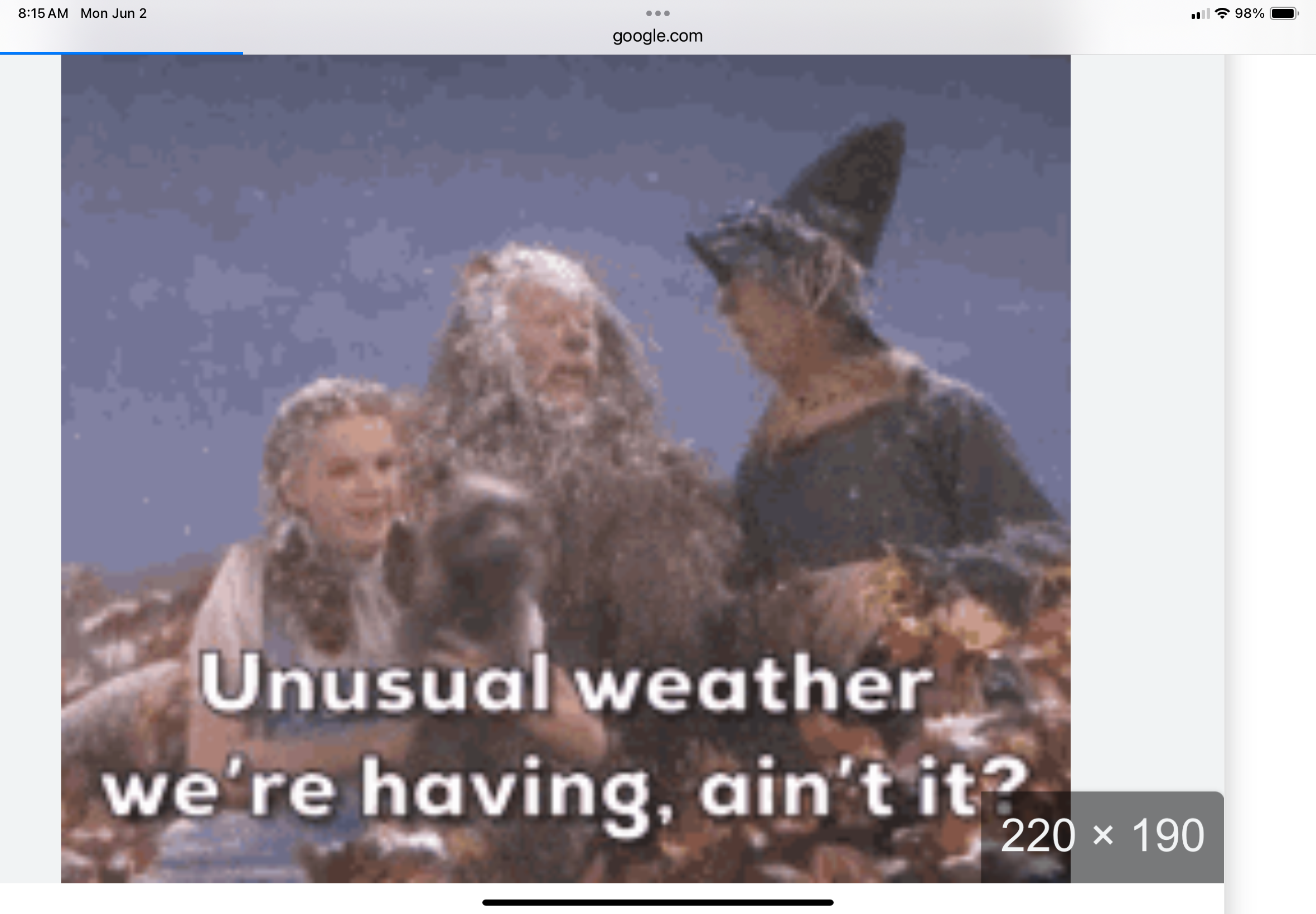
Color me surprised. I've just accepted it's going to rain every saturday
-
i know this is late, but i was busy Saturday and Sunday. That storm Friday night was worse then any remanents from any hurricane that we ever had. I have never been nervous about the big trees in my yard as i was Friday, early Saturday. Its sounded like a Phucking freight train. The FD started going on calls around 1030, never stopped answering alarms until about 4am, The Enola area had so many trees and wires down more then i can ever remember in all my years as a fireman. So many transformer were blowing it sounded like a war zone and we were being bombed.
-
Month of May total 7.19" at my station. Highest temp 84f, lowest 46.
-
Bet we see those weekend temps bump up a bit
-
Great week coming up. Love to see those first triple H's.
-
…… and some innocent bystanders. As always ……
-
Got down to 44 here this morning. Happy Summer!
-

June 2025 discussion-obs: Summerlike
LongBeachSurfFreak replied to wdrag's topic in New York City Metro
Yeah 40 mph gusts are common on the beach front with the Ambrose jet. The strongest events I have witnessed in 26 years of ocean life gaurding is probably close to 60mph. I have a hand held anemometer so I’ll take some readings this week. -
What you need to do is adjust the thermostat to a number lower than 75 haha
-
2 weekends in a row ruined for good beach weather now. Can’t get it much over 70 on the shore before either clouds/rain or the 40mph Ambrose Jet. There are days where that wind approaches 50mph.
-
Another gorgeous chilly morning. Great sleeping weather with windows open and fans on. 49 in paramus, nj when i got to work this morning.
-
 17/7/3
 -
Where did you think you moved to? Seriously though, I don't know if you actually understood the climate in New England. There have always been hot days, this isn't Labrador.
-
I haven't planted my cucumbers yet. Too cold. My tomato plants look the same as they did when I planted them 3 weeks ago. Just a little more unhealthy due to cold nights. Potatoes and cannabis don't seem to mind cold windy springs.
-
Smoke ‘em’ if you got em’?
-
We furnace we Stein this month
-
Low of 44 in Marysville on this 2nd day of June.
-
it's been interesting observing this unseasonable trough protect our region from smoke. The larger synoptic circulation associate with has kind of rampart the outside environment from getting into the interior trough axis. Folks may wanna keep in mind that today is the last day of said protecting... Not sure how/if smoke may factor into these "warm" days this week. MOS/machine guidance appears reasonable to me - normally I'd go a tick or two above during a recovery period in early Junes but trend to always be on the lowest side of correlations ( since last December really... ) always seems to find a way to perpetuate itself and this rendition it grabs a hold of smoke to perhaps keep us from making the illustrious 90 mark Wed/Thur haha. I mean like this spring's comically deducing means to prevent heat from materializing - despite the verified numbers ( relatively...)
- Today
-
40.2 for the low, currently 40.8/40.0 with clear skies.