All Activity
- Past hour
-
Stein
-
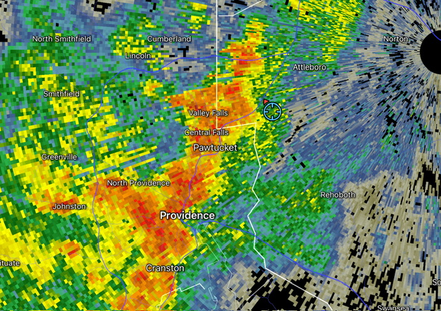
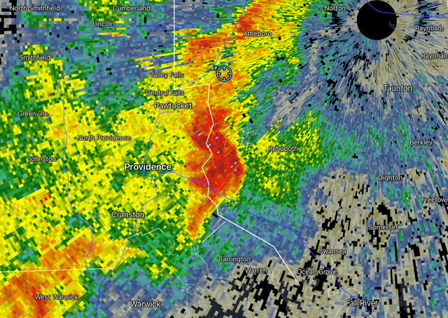
Over 2” an hour rates in this little cell
-
Dew point quickly dropping here 76/50
-
Congrats ! Lawn disease seems to have reversed here.
-
Oh don't get me wrong, I am not saying there is no comparison. There are several reasons why it could be an analog, I was just trying to note that there are many serious differences from a SSTA perspective that should not be glossed over.
-

Hurricane Katrina 20th Anniversary
WxWatcher007 replied to WxWatcher007's topic in Tropical Headquarters
Thank you for sharing. I think I just read the same thing. I know that eventually the new flood protection system was built which helped the city in future storms, but we saw its limits with big flash flooding during Francine last year. Not trying to make a political statement here, but what happened to that $140B is a real reminder that there has to be oversight and accountability from the start. -
The first NCAA football weekend of the year. This fall appears to be beginning at or below normal for temps. I am sure we will have some warmer temps as fall progresses, but what a great way to start it. Carry on
-
Relentless epic weather just hammering the area, front after front. This is almost worth the heatwave during peak fall color that we'll definitely be getting. My blighted out tomato plants even rebounded a little bit. Just stunning weather for Aug.
-
That's pretty much always been the case for us down here to get any snow, especially as you go south of the PA/MD border.
-
Saw turnpike troubadors at the salt shed last night. The weather made a really good show truly great.
-
luckyweather started following August 2025 General Discussion
- Today
-
-
Maybe some straight line winds there
-
Cell entering Seekonk looks nasty
-
About .3” from earlier stuff.
-
My pic above shows a large storm 2 years back. Was it a narrow band, 100% yes, but it shows it will still snow. Also had a 50"+ season just a few years ago. Anyone thinking otherwise is a complete loon
-
Almost time to open up a September 2025 thread very soon.....
-
Yeah, it’s pretty bad. Well into moderate drought state now.
-

September 2025 OBS-Discussion centered NYC subforum
donsutherland1 replied to wdrag's topic in New York City Metro
At this lead time, August looked warmer than normal and the number of lows in the 50s that we've seen was almost inconceivable. There's no guarantee that the temperature will fall into the 40s next month, but even a short but sharp push of cold air that wouldn't necessarily show up in the weeklies, can't be ruled out during the second half of the month. Weekly forecasts lose skill beyond two weeks. Daily forecasts are unreliable beyond even 7-10 days. It would be interesting to examine how the daily numbers for September fare vs. climatology. -
The coolest air mass so far this season will move into the region tonight. As a result, this weekend will see low temperatures fall into the 50s in New York City with some 40s in the colder suburbs. Highs will generally reach the middle and upper 70s. Generally cool and dry conditions will persist into next week. A system could bring at least some rain during or after the middle of next week. The ENSO Region 1+2 anomaly was -0.1°C and the Region 3.4 anomaly was -0.4°C for the week centered around August 20. For the past six weeks, the ENSO Region 1+2 anomaly has averaged +0.45°C and the ENSO Region 3.4 anomaly has averaged -0.28°C. Neutral ENSO conditions will likely continue into early autumn. The SOI was +19.60 today. The preliminary Arctic Oscillation (AO) was +0.815 today. Based on sensitivity analysis applied to the latest guidance, there is an implied near 100% probability that New York City will have a cooler than normal August (1991-2020 normal). August will likely finish with a mean temperature near 73.6° (2.5° below normal). That would make August 2005 the coolest August since 2000. Supplemental Information: The projected mean would be 1.6° below the 1981-2010 normal monthly value.
-
Finally I can come out of the cave and do some painting and yard work. Its been just miserable since July
-
-
September 2025 OBS-Discussion centered NYC subforum
rclab replied to wdrag's topic in New York City Metro
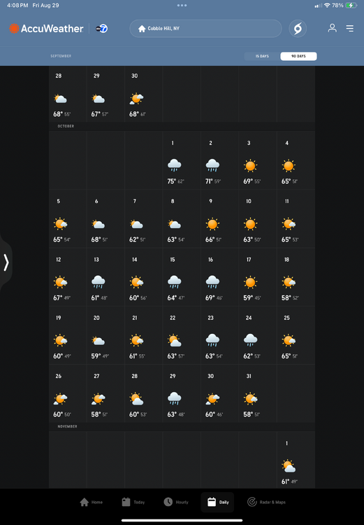
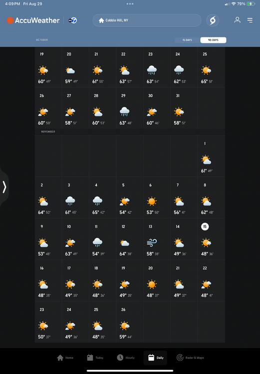
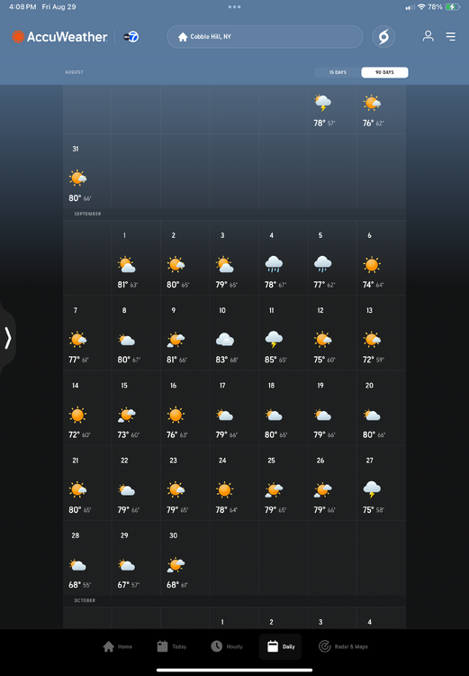
Accu weather long range is more pessimistic, the lowest September temperature is 55 degrees., it holds off the first low in the 40’s until October 12th and the first low in the upper 30’s until November 11th. That’s as of today’s long range. Stay well, as always …. -

2025-2026 ENSO
40/70 Benchmark replied to 40/70 Benchmark's topic in Weather Forecasting and Discussion
It began in 2015-2016 with the super El Niño....mid Atlantic just lucked out with the KU, NE did not. -
Mid to long range discussion- 2025
WinstonSalemArlington replied to wncsnow's topic in Southeastern States
The first 40% of September likely to be cool overall




.thumb.png.4150b06c63a21f61052e47a612bf1818.png)
