All Activity
- Past hour
-

October Comes Early: Late September Multi-Hazard Hybrid Storm
weatherwiz replied to WxWatcher007's topic in New England
The NAM very well may go out on a very sad demise -

2026-2027 Record-breaking El Nino
bluewave replied to Stormchaserchuck1's topic in Weather Forecasting and Discussion
Yeah, my guess is that the Arctic may have been related. We also had a strong -PDO during the summer of 2023 and it still managed to produce a more typical developing super El Niño summer 500 mb pattern. If it wasn’t related to the Arctic, then perhaps it would be more indication of how strong these mid-latitude 500mb ridge patterns driving the -PDO +AMO have become independent of ENSO. -

October Comes Early: Late September Multi-Hazard Hybrid Storm
WinterWolf replied to WxWatcher007's topic in New England
The NAM model is a mess. -
October Comes Early: Late September Multi-Hazard Hybrid Storm
WinterWolf replied to WxWatcher007's topic in New England
What happens in September…the atmosphere will remember….. -

October Comes Early: Late September Multi-Hazard Hybrid Storm
Bostonseminole replied to WxWatcher007's topic in New England
yeah, pretty Meh -

Septorcher 2026 Discussion - Endless Summer
Typhoon Tip replied to Damage In Tolland's topic in New England
It's significance is being masked some by CC. We have to consider this in a relativistic sense - Earth as we type and read is putting up the 2nd warmest it has ever been since humanity developed any awareness of the subject matter - a.k.a. hundreds of years. But this is also probably true in climate recreation/reanalysis going back much farther... It is a reasonable assumption that relative to that state of affairs, we have to be quite cold in fact to even get a negative anomaly day at all. It's both anecdotal, as well as objectively clear just by record and empirical data, that is easier to be above normal, if only by decimals, than it is to be below by that same margin. ...etc Just a personal observation ... current hourly observations have 62 to 65 F over eastern Mass/coastal sites. From near I-495 and points went, we're 57-ish. We are actually getting an inverse thermal conditioning penetrating from the ocean. It's not that unusual to do so in general? During the cold months/winter, when there is a coastal cyclone with flow coming from the NE/E, this often takes place. However, doing it under fair where not full sun, in September, during this latter leg of CC no less... very relative. Particularly when/while the rest of the planet is so warm, ... it may even argue that we are, in the relative sense, one of the coldest locations there is per latitude at this moment. When it is long proven harder to actually get a negative day at all. -

2026-2027 Record-breaking El Nino
LakePaste25 replied to Stormchaserchuck1's topic in Weather Forecasting and Discussion
Getting there…seeing less and less N Pac -ENSO flavored ridging out there. Does seem it’s possible we might go straight from cool ENSO pattern to full blown super Nino style (cool season) jet extension at some point between now and mid November.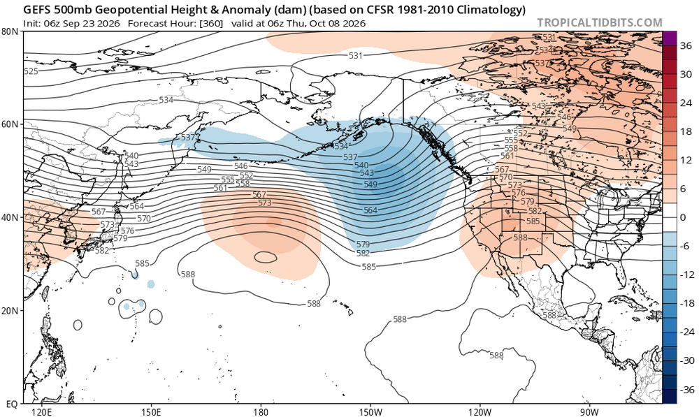
-
2026-2027 Record-breaking El Nino
LakePaste25 replied to Stormchaserchuck1's topic in Weather Forecasting and Discussion
I agree with this. A lot of emphasis in this thread about the -PDO but I think the Arctic had much to do with it. In any sense it likely enhanced the -PDO over the summer. -
If the difference is mostly on clear nights with calm winds, then it could just be variations in radiational cooling. Even a very light wind can make a difference between a spot that has completely calm winds. Plus there could be some differences related to varying altitudes. Data for September 1, 2026 through September 23, 2026 Click column heading to sort ascending, click again to sort descending. PA POCONO MOUNTAINS MUNICIPAL AIRPORT WBAN 53.9 NJ HIGHLAND LAKES 1SW COOP 54.7 NJ BELVIDERE BRIDGE COOP 56.5 NJ SCHOOLEY'S MOUNTAIN 1 SW COOP 56.5 NJ SUSSEX AIRPORT WBAN 56.8 PA MARTINS CREEK COOP 57.2 PA EAST STROUDSBURG COOP 57.7 PA LEHIGHTON 1SSW COOP 57.9 PA BELTZVILLE DAM COOP 58.3 PA BLUE MARSH LAKE COOP 58.4 NJ FLEMINGTON 5 NNW COOP 58.4 NJ SOMERSET AIRPORT WBAN 58.8 PA ALLENTOWN LEHIGH VALLEY INTERNATIONAL AIRPORT WBAN 59.6 NJ PHILLIPSBURG-EASTON BRIDGE COOP 59.7 NJ BOONTON 1 SE COOP 59.7 PA SELLERSVILLE COOP 59.8 NJ AEROFLEX-ANDOVER AIRPORT WBAN 59.8
-

Strong Nor'Easter/Hybrid Storm Late September 2026
wthrmn654 replied to Rjay's topic in New York City Metro
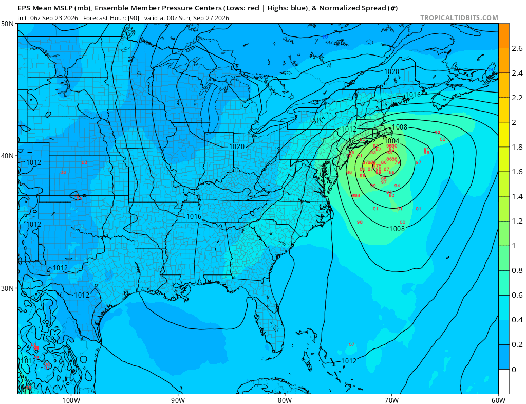
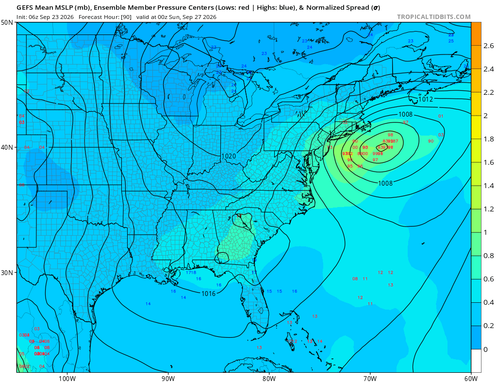
I mean here is the 6z eps and gefs at hour 90 for both they both look, to my eyes heavier on the western side of things track wise. One of these models is going be more right just who is still unknown. It's 00z Sunday but still just an example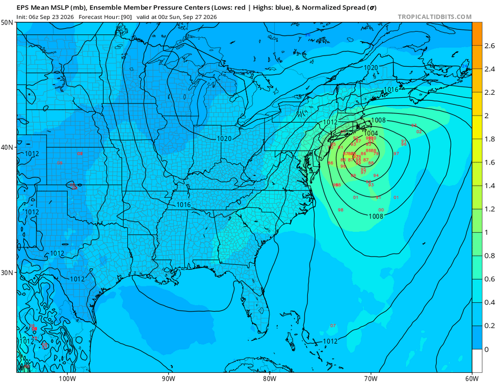
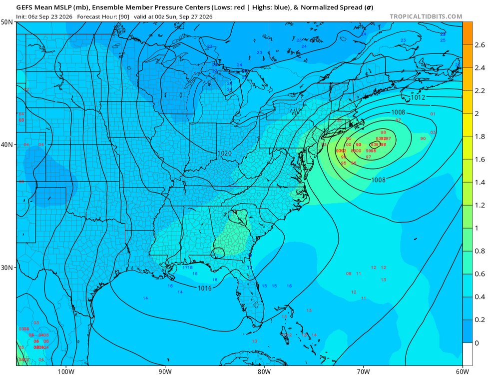
-
Strong Nor'Easter/Hybrid Storm Late September 2026
wthrmn654 replied to Rjay's topic in New York City Metro
This has and will likely always be a eastern Nassau County all of Suffolk County storm rain wise, with region wide erosion and coastal flooding with some wind for everyone else. -

October Comes Early: Late September Multi-Hazard Hybrid Storm
CCHurricane replied to WxWatcher007's topic in New England
12Z NAM (12km) an absolute mess -
Strong Nor'Easter/Hybrid Storm Late September 2026
wthrmn654 replied to Rjay's topic in New York City Metro
Euro was west. Precip is up at 6z... Tony -
(002).thumb.png.6e3d9d46bca5fe41aab7a74871dd8af8.png)
Central PA Summer 2026 Discussion/Obs Thread
ChescoWx replied to Voyager's topic in Upstate New York/Pennsylvania
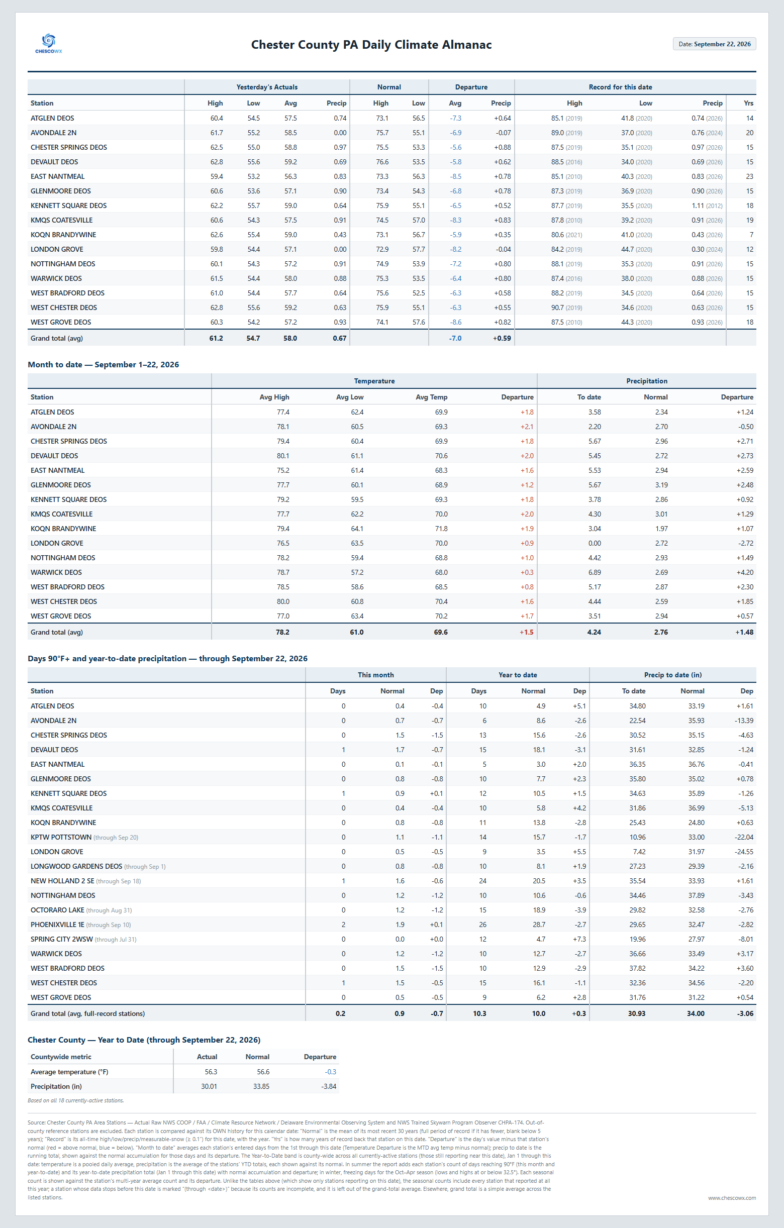
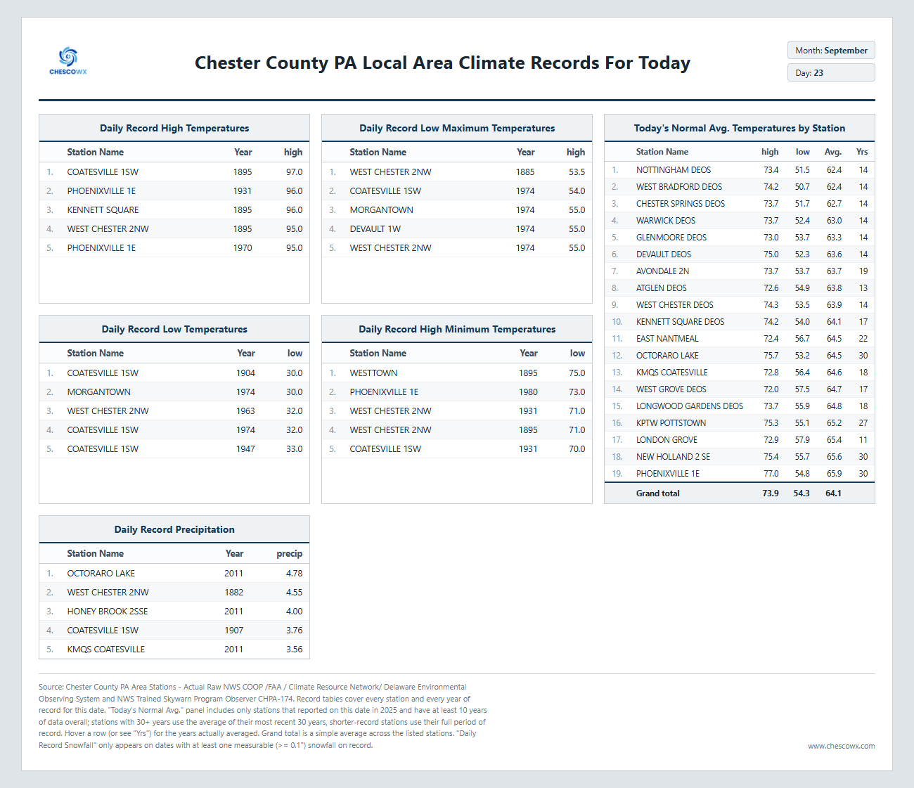
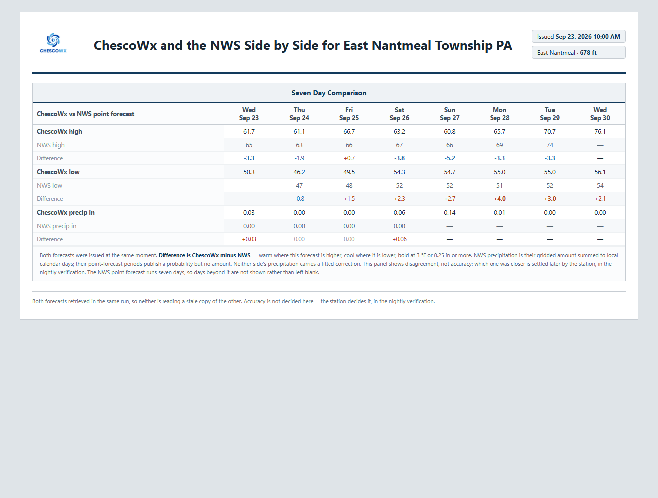
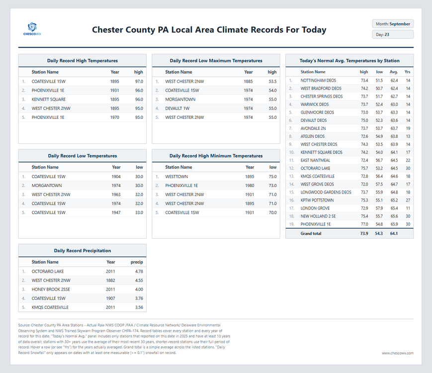
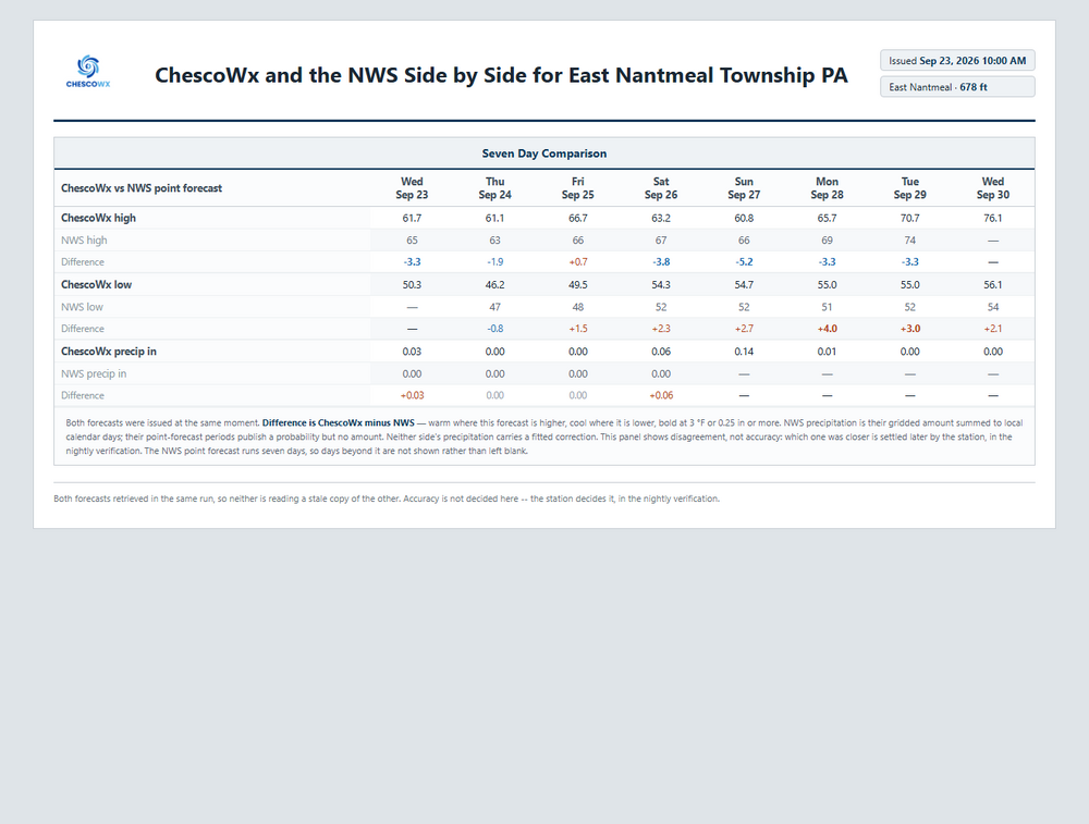
Our stretch of below normal temperature days looks to continue through the weekend before a nice moderating trend next week. We look mainly dry through Friday and then we will have to watch what the coastal storm does to see what if any impacts in may bring this far west of the coast. See the ChescoWx vs. The NWS 7 day forecast for EN below.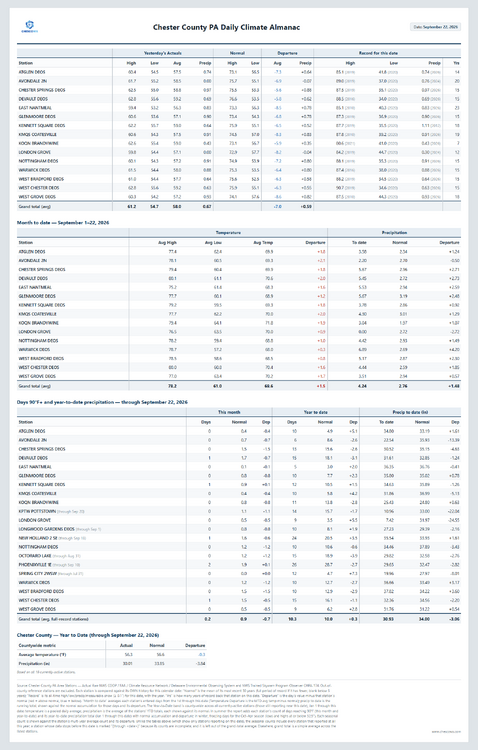
-
E PA/NJ/DE Autumn 2026 Obs/Discussion
ChescoWx replied to PhiEaglesfan712's topic in Philadelphia Region
Our stretch of below normal temperature days looks to continue through the weekend before a nice moderating trend next week. We look mainly dry through Friday and then we will have to watch what the coastal storm does to see what if any impacts in may bring this far west of the coast. See the ChescoWx vs. The NWS 7 day forecast for EN below.
-
Absolutely perfect sleeping weather. Feels like October! Overnight low here of 48.
-
That was quite a change from the rain and thunderstorms to a chilly, windy start to January. With the roads still wet and temperatures dropping I imagine driving conditions were a bit uncomfortable especially later in the day. It is the kind of weather where having reliable transportation matters, something I have also noticed when using Patriots Limousine for winter travel. Did the wind stay strong into the evening, or did it calm down later?
-

October Comes Early: Late September Multi-Hazard Hybrid Storm
HoarfrostHubb replied to WxWatcher007's topic in New England
That would be a nice track for a snowstorm... but alas -
Not necessarily...we had neutral after 2016 were neutralish in 16-17, nina 17-18, but then niño (albeit very weak) in 18-19
-

October Comes Early: Late September Multi-Hazard Hybrid Storm
Ginx snewx replied to WxWatcher007's topic in New England
5H is sick. Man give us this late January -
October Comes Early: Late September Multi-Hazard Hybrid Storm
Ginx snewx replied to WxWatcher007's topic in New England
Guess you are throwing out the Euro again. -
October Comes Early: Late September Multi-Hazard Hybrid Storm
WinterWolf replied to WxWatcher007's topic in New England
Haven’t been on in months…I just looked at this Monday night, so before that I knew nothing about it. Was actually nice not looking at this from 8-10 days out. -
Maybe we can hit 90 on Halloween.
-
80 degrees in my forecast, and also for the DC area next week is forecasted by Accu Weather and Mount Holly. Might only be for a day, but we are going to warm up at least into the upper 70's middle part of next week before we cool down again.
-
Just awful around here with close to 30 inches of rain since 7/1.