All Activity
- Past hour
-

Augdewst 2026: Summer's Last Stand
CoastalWx replied to Prismshine Productions's topic in New England
That’s got SE CT and RI written all over it. But there’ll be some stuff popping this afternoon too I think. -

Augdewst 2026: Summer's Last Stand
Damage In Tolland replied to Prismshine Productions's topic in New England
Utah? -
Augdewst 2026: Summer's Last Stand
CoastalWx replied to Prismshine Productions's topic in New England
His current side piece? -
Augdewst 2026: Summer's Last Stand
Damage In Tolland replied to Prismshine Productions's topic in New England
That Delmarva stuff may sort of sideswipe River East. It’s got Easterly component -
Augdewst 2026: Summer's Last Stand
Damage In Tolland replied to Prismshine Productions's topic in New England
Which wife? -

E PA/NJ/DE Summer 2026 Obs/Discussion
Hurricane Agnes replied to PhiEaglesfan712's topic in Philadelphia Region
Now up to 1.40" with light rain (1.82" 2-day). Temp 75/dp 74. -
Harrison, NJ is on track for their first 9 consecutive years with over 30 days reaching 90°. The last time they had under 10 days was 1996. That year is still the reigning champ for the most snow and least 90° days across the area. Time Series Summary for HARRISON, NJ - Jan through Dec 90° Days Click column heading to sort ascending, click again to sort descending. 2026 26 151 2025 37 0 2024 41 0 2023 33 0 2022 44 0 2021 38 0 2020 39 0 2019 39 0 2018 47 0 2017 23 0 2016 40 0 2015 32 0 2014 16 0 2013 25 0 2012 35 21 2011 31 30 2010 50 30 2009 15 42 2008 22 19 2007 22 5 2006 30 4 2005 41 9 2004 17 6 2003 14 8 2002 47 8 2001 30 7 2000 15 14 1999 39 4 1998 18 2 1997 20 5 1996 8 17
-

Augdewst 2026: Summer's Last Stand
RUNNAWAYICEBERG replied to Prismshine Productions's topic in New England
You would think. Warm and wet, shoot me now… -

Central PA Summer 2026 Discussion/Obs Thread
Itstrainingtime replied to Voyager's topic in Upstate New York/Pennsylvania
Finished with a paltry 0.12" in Maytown. Seem to be at the bottom of the totem pole for weeks now. Also, the forecast for today has really changed! Today was to be a heavy rain/flood risk, it now appears that skies clear out this afternoon with likely no rain at all until Wednesday. -

Augdewst 2026: Summer's Last Stand
dendrite replied to Prismshine Productions's topic in New England
You’ll have a lot of explaining to do if your wife ever reads this forum lol -
Augdewst 2026: Summer's Last Stand
CoastalWx replied to Prismshine Productions's topic in New England
Gonna semi stein here while Tblizz gets into the gravy train with stuff down in NJ. -

Augdewst 2026: Summer's Last Stand
TauntonBlizzard2013 replied to Prismshine Productions's topic in New England
Lmao. Good grief. -

Augdewst 2026: Summer's Last Stand
Brian5671 replied to Prismshine Productions's topic in New England
in an el nino? wet winter -
Augdewst 2026: Summer's Last Stand
RUNNAWAYICEBERG replied to Prismshine Productions's topic in New England
We’ll dry out come December though and stein our way through winter… -

Augdewst 2026: Summer's Last Stand
Bostonseminole replied to Prismshine Productions's topic in New England
Pouring at the office in Bedford, MA— feels like Miami . -
Augdewst 2026: Summer's Last Stand
Brian5671 replied to Prismshine Productions's topic in New England
mod rain here continuing-next batch gearing up...probably going to end with 4+ -
Augdewst 2026: Summer's Last Stand
Damage In Tolland replied to Prismshine Productions's topic in New England
1.26” so far . This has gone pretty much like we thought with a narrow zone getting high totals but most just getting downpours . That thing that went overhead here had some solid 45-+ gusts with it -
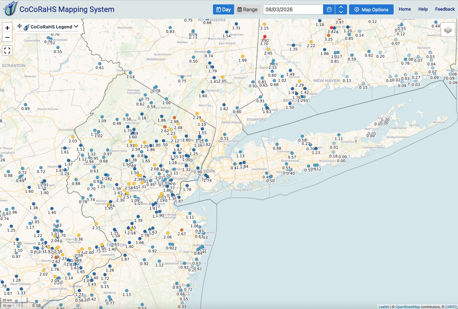
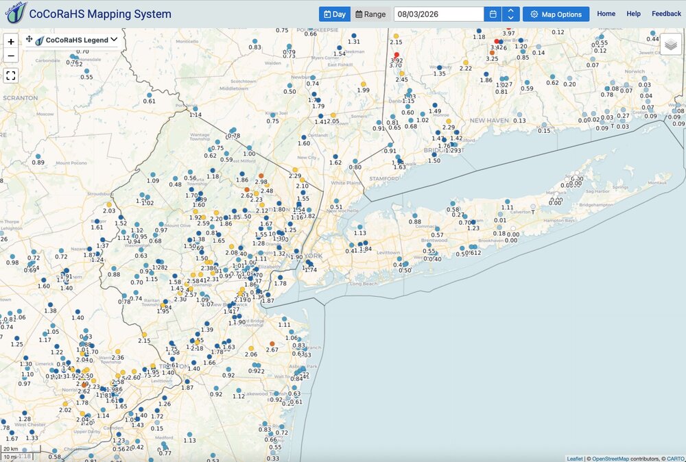
Rainfall totals through about 8am from current event. The places that have gotten the most rainfall recently continue to get soaked.
-
Augdewst 2026: Summer's Last Stand
dendrite replied to Prismshine Productions's topic in New England
Flash dating warning -
 Beaucoup de patients témoignent de leur satisfaction concernant [url=https://newsfrrx.sbs/#]obtenir des conseils sur les traitements érectiles[/url].
 -
Augdewst 2026: Summer's Last Stand
RUNNAWAYICEBERG replied to Prismshine Productions's topic in New England
Is TWives expecting just some drizzle? -
I don’t really have any other options with the trees and hills. It’s fairly accurate even in the sun except possibly earlier in summer
-
SPC mentions the Mid-Atlantic in its Day 4-8 disco for Thursday and the weekend. Doesn't sound like anything huge... but the threat is there Day 4-8 Convective Outlook NWS Storm Prediction Center Norman OK 0329 AM CDT Mon Aug 03 2026 Valid 061200Z - 111200Z ...DISCUSSION... ...Day 4/Thursday... Broad troughing is forecast from the northern Plains through the Great Lakes with a series of disturbances moving through that airflow pattern. Elsewhere, an elongated vorticity ribbon will progress from the central and southern Appalachians into the Northeast. At the surface, a front initially from the southern Great Lakes into the southern Plains is forecast to weaken. Over the eastern CONUS, southerly winds will maintain a broad corridor of 70+ F dewpoints along and east of the Appalachians, which will contribute to moderate instability by afternoon. Aided by the approach of the disturbance aloft, thunderstorms are expected to increase in coverage through the afternoon with some severe weather possible. Generally weak vertical shear and the absence of a coherent front in the region lead to uncertainty in where the greatest threat may materialize. An isolated severe threat may also develop along the front from the Ozark Plateau into the southern High Plains, and in AZ during the afternoon and evening. ...Day 5/Friday... An intense mid/upper-level low is expected to evolve over central Canada with upper highs situated over the Great Basin and off the Mid-Atlantic Coast. Between those features, corridors of stronger mid-level flow are forecast from the northern Rockies into the northern Plains, and to a lesser extent over the Northeast. Some severe weather threat may again materialize from the Mid-Atlantic into southern New England in the vicinity of a surface trough. However, the strongest vertical shear is forecast to be displaced to the north of the stronger instability, leading to uncertainty in the extent of the severe weather threat. Isolated severe storms also appear possible along a front moving into the upper MS Valley. ...Days 6-8/Saturday through Monday... The various 00Z ensemble means indicate an upper low initially over Hudson Bay shifting east into northern QC with persistent ridging over the southern CONUS. Between those features, a belt of enhanced mid-level flow is forecast across the northern tier of states with some signal for continued troughing through Sunday over the Great Lakes into the OH Valley. At the surface, there is ensemble member clustering in surface low positions over the northern Plains along a front extending into the upper Great Lakes. There is a model signal for the front to continue into the Great Lakes and Midwest, where some severe weather threat appears possible. A separate severe weather risk may also persist from the Mid-Atlantic into New England. ..Mead.. 08/03/2026
-
.thumb.gif.f92b16c631a1d15d405ed77b33f0710d.gif)
Augdewst 2026: Summer's Last Stand
Torch Tiger replied to Prismshine Productions's topic in New England
Ripping, heaviest of summer -

Central PA Summer 2026 Discussion/Obs Thread
Mount Joy Snowman replied to Voyager's topic in Upstate New York/Pennsylvania
Yeah it's been a few weeks, as we keep getting caught in the middle. I managed to squeeze out .21" yesterday but we were up in Morgantown for most of the day where they got much more. Low of 73 as the muggies roll along. #DogDays