All Activity
- Past hour
-
-
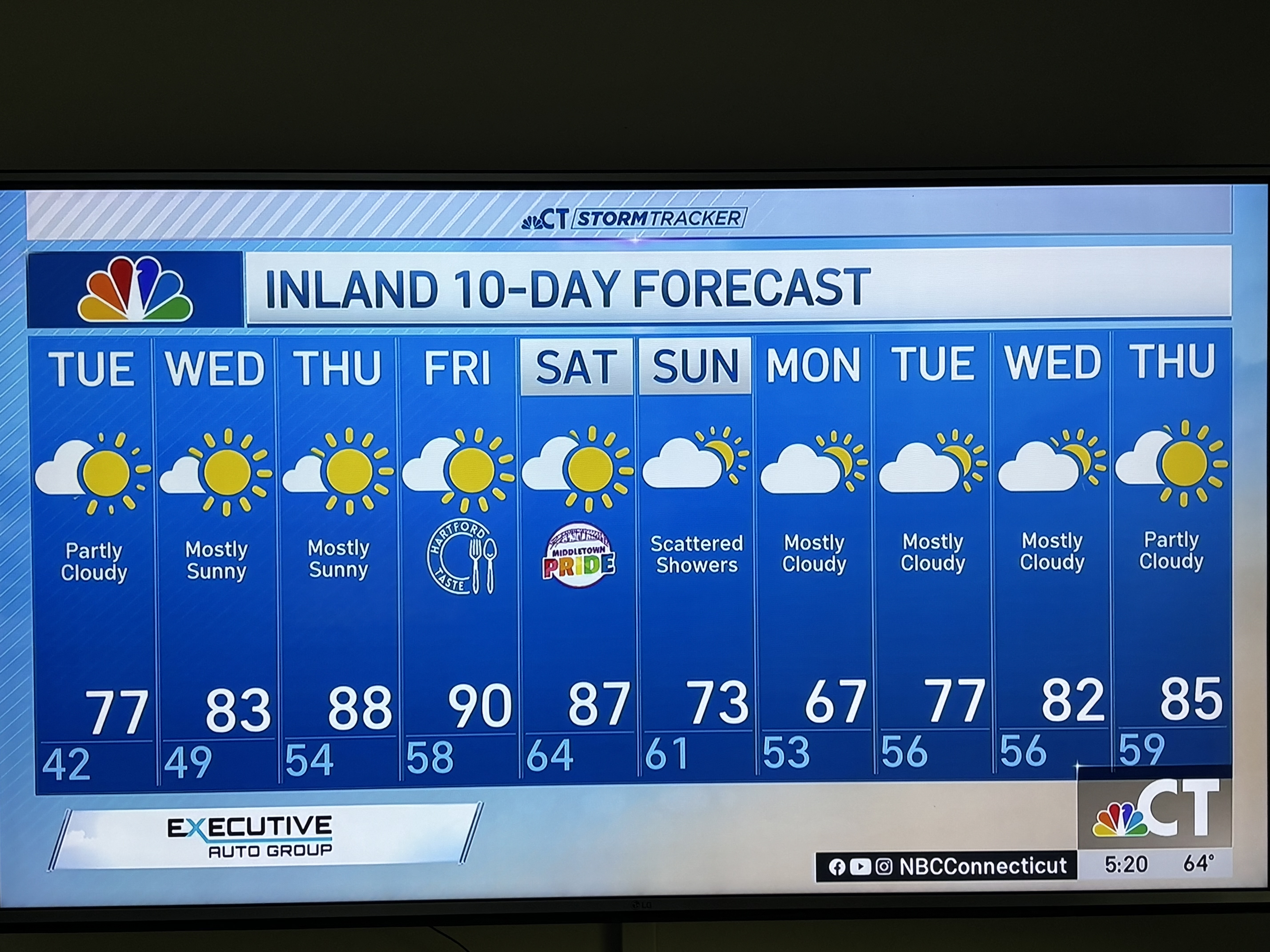
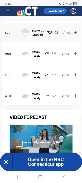
Pretty pumped that after a coolish May ill be looking at a 10 day alaskan forecast with highs/lows in the upper 50s/upper 40s dominating. Really makes the summer more tolerable when you shorten the heat part.
-
Actually I am down towards the Dodge and Toyota dealerships and only picked up .37" total today from 3 different rains.
-

Junorch obs and discussion 2026
Damage In Tolland replied to Damage In Tolland's topic in New England
Exactly . No cool chill there. Thank you ! -

2026-2027 Strong/Super El Nino
michsnowfreak replied to Stormchaserchuck1's topic in Weather Forecasting and Discussion
December 2015 was just a trainwreck but the rest of the winter wasnt bad here. One of the hallmarks of strong ninos tends to be one real shitty month and the rest of the time ok. -
2026-2027 Strong/Super El Nino
michsnowfreak replied to Stormchaserchuck1's topic in Weather Forecasting and Discussion
Its the primary key for how stormy/snowy winter will be. But you absolutely have to expect thaws/non-winter stretches in a strong nino. The snow season lasts Nov-Apr, so unlike last winter which was steady cold/white during DJF, you go into this winter knowing there will be interruptions and shitty spells but if you can settle into an active pattern, plenty of snow chances too. -
That's not what you go to station says.
-
aaand its cold. again. Can the wind stop blowing from the fucking east off the 55 degree water? another day ruined by this incessant crap. at least it finally warms up wednesday here. then monday some models plunge us into the low-mid 60s early next week. are you fkin kidding me
-
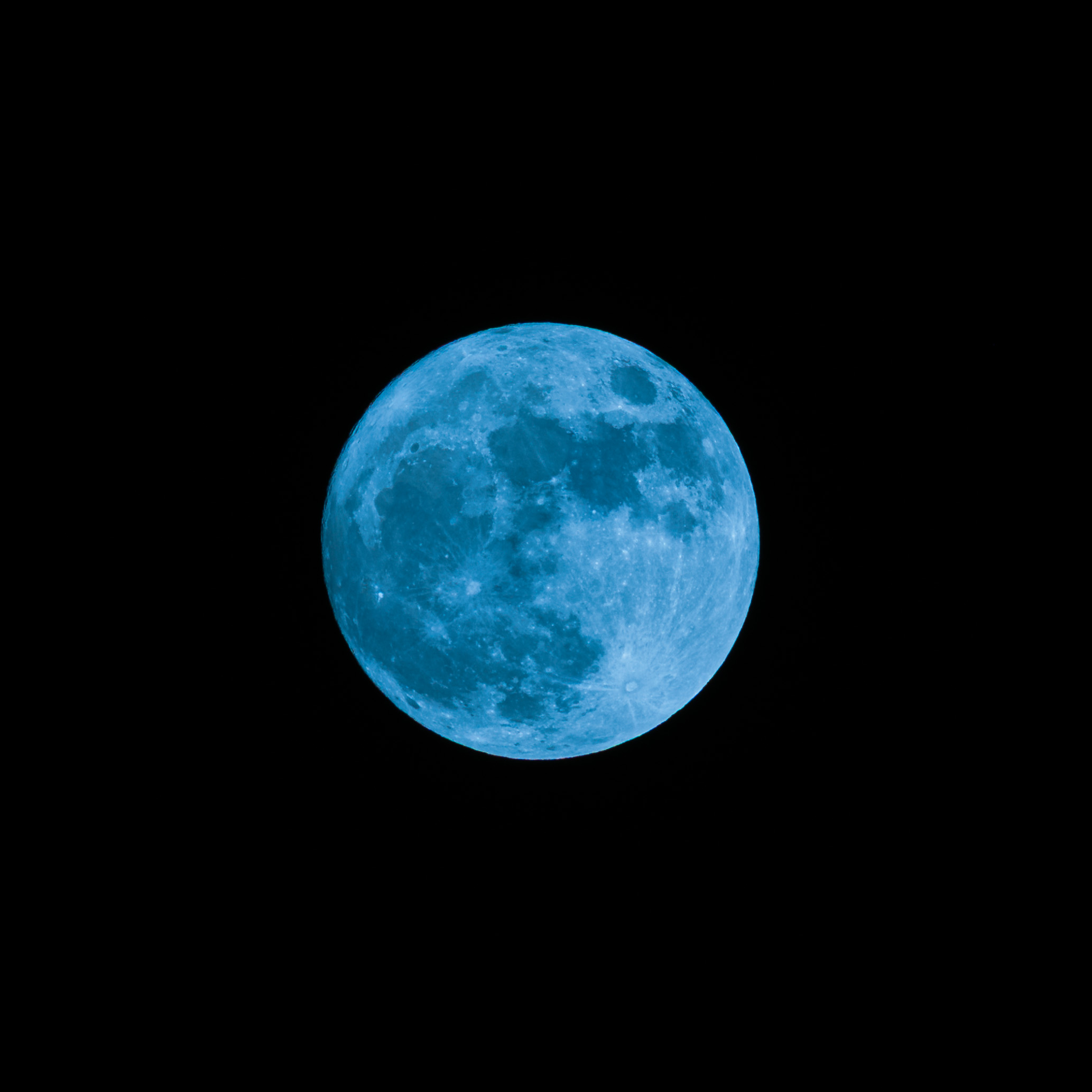
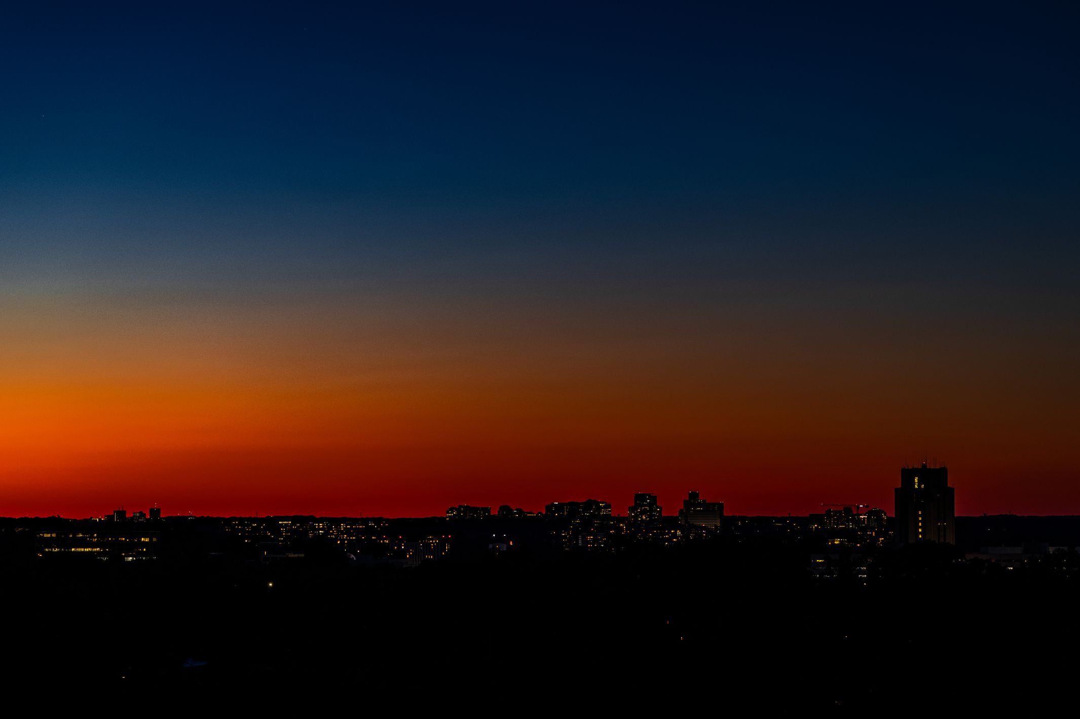
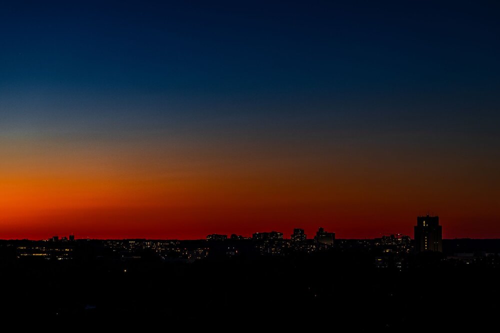
Took this photo of the "blue moon" this past weekend (2nd full moon in May). Altered the white balance and added some blue tint to make it a "blue" blue moon!! Also, same evening, some remarkable sunset glow to the north (looking toward Rockville, for those in the MD/DC/VA area).

-
But there is a discrepancy in station data from moves. It all depends, like moving to/from large bodies of water, or inner city/town to more semi-rural/rural or vice versa, and significant elevation changes. Then you'll get diurnal changes, regardless of the equipment used. Then you have micro site changes that can affect that as well. Long term records are fraught with this stuff. It is what it is, and there has been lots of debate on adjustments that are made, or not made. Won't go any further with that.
-
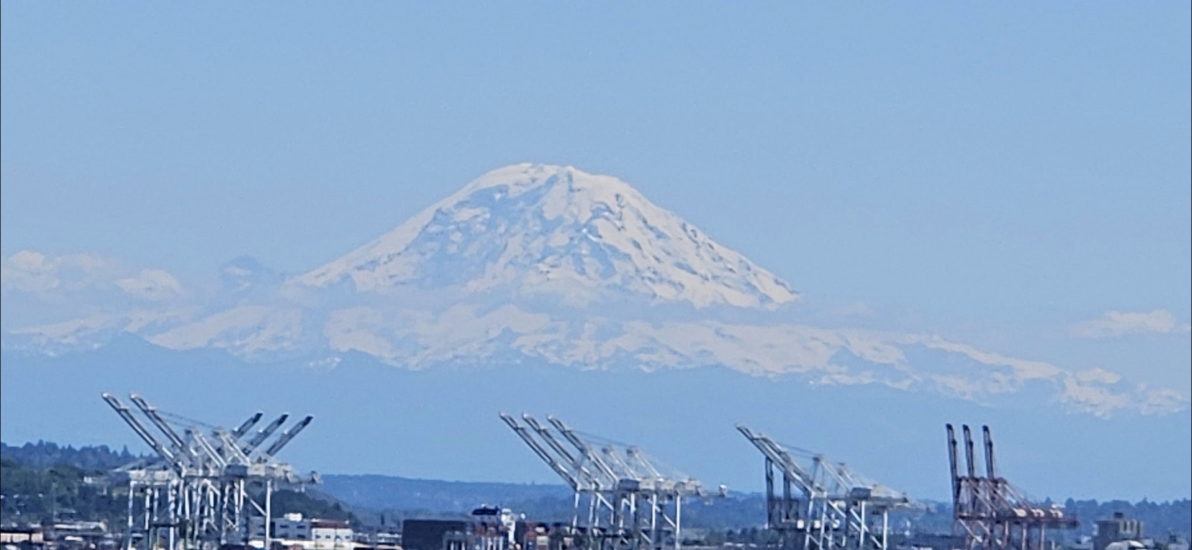
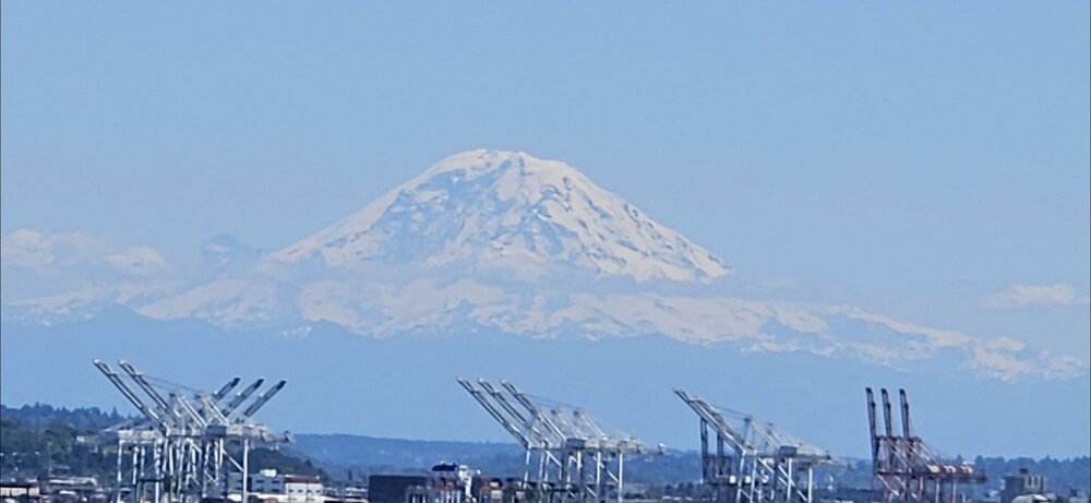
A few nice views heading up here yesterday.
-
He knew

-
This happened earlier. You can't even see the city names near Denver because the screen is covered with local storm report hail icons and MPING hail icons. Probably the new storm north of US-36 is the storm that chasers are heading to now.
-
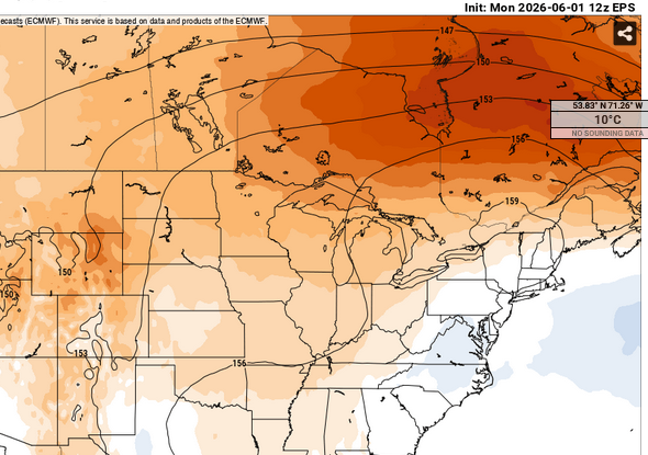
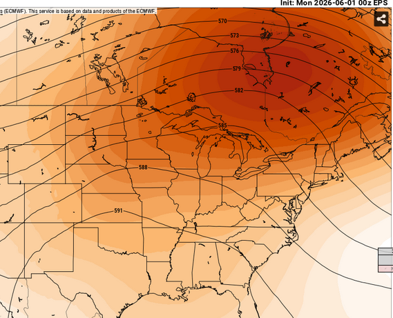
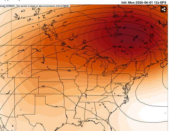
I wouldn't have any problem with the notion that this is too cold for it's own deep layer mean, a failing not uncommon to ensembles at this range. Aside, the idea was 'modestly impressive' - we're not looking for a UK redux just yet.
-

Junorch obs and discussion 2026
TauntonBlizzard2013 replied to Damage In Tolland's topic in New England
Definitely looks warm. Thought I saw rain though -
Junorch obs and discussion 2026
TauntonBlizzard2013 replied to Damage In Tolland's topic in New England
-
This is what DTW Jan-May warmest mins look like. ASOS mins rather robust compared to pre aprt years by the looks of it. Man, some people's kids I tell ya! 1998 mint 37.5 1 1 1 0 2012 mint 36.7 2 2 2 0 2024 mint 36.4 3 3 3 0 1921 mint 35.8 4 4 4 0 2017 mint 35.6 5 5 5 0 2006 mint 35.1 6 6 6 0 1882 mint 34.9 7 7 7 0 1880 mint 34.5 8 8 8 0 2023 mint 34.4 9 9 9 0 2010 mint 34.4 9 9 10 0 1991 mint 34.4 9 9 11 0 1878 mint 34.1 12 10 12 0
-
-
 Summer's of our most recent 2 Strong/Super El Nino's 2015 was strong +PDO We are nothing like 1997 anymore
 -
Some impressive hail and localized rain Denver and metro south and east. But a nice cell that was headed my direction dried up before it got to me.
-
I know 2002 was dry. I don't think there are actually many cases of hot Summer's in El Nino. Something global is shifting around now, jet stream is lifting north. Edit: 2002 was above average
-
 Any cases of an emerging El Nino with a hot summer, then a cold and wet winter?
 - Today
-
Spring finished tied w/ 1987 & 2000 for 8th warmest on record of 153 at Detroit. Naturally it was 100% due to March/April, as May finished cooler than avg. An about face from the 44th coldest winter.
-
Junorch obs and discussion 2026
Damage In Tolland replied to Damage In Tolland's topic in New England
That front looks like it sits up over NNE or maybe CNE. leaving us warner and more humid. Nino Climo it looks like -
@yotaman I know you got a lot today it was coming down hard in new Bern and James city a little while ago on 70 road was flooded in the construction area