All Activity
- Past hour
-
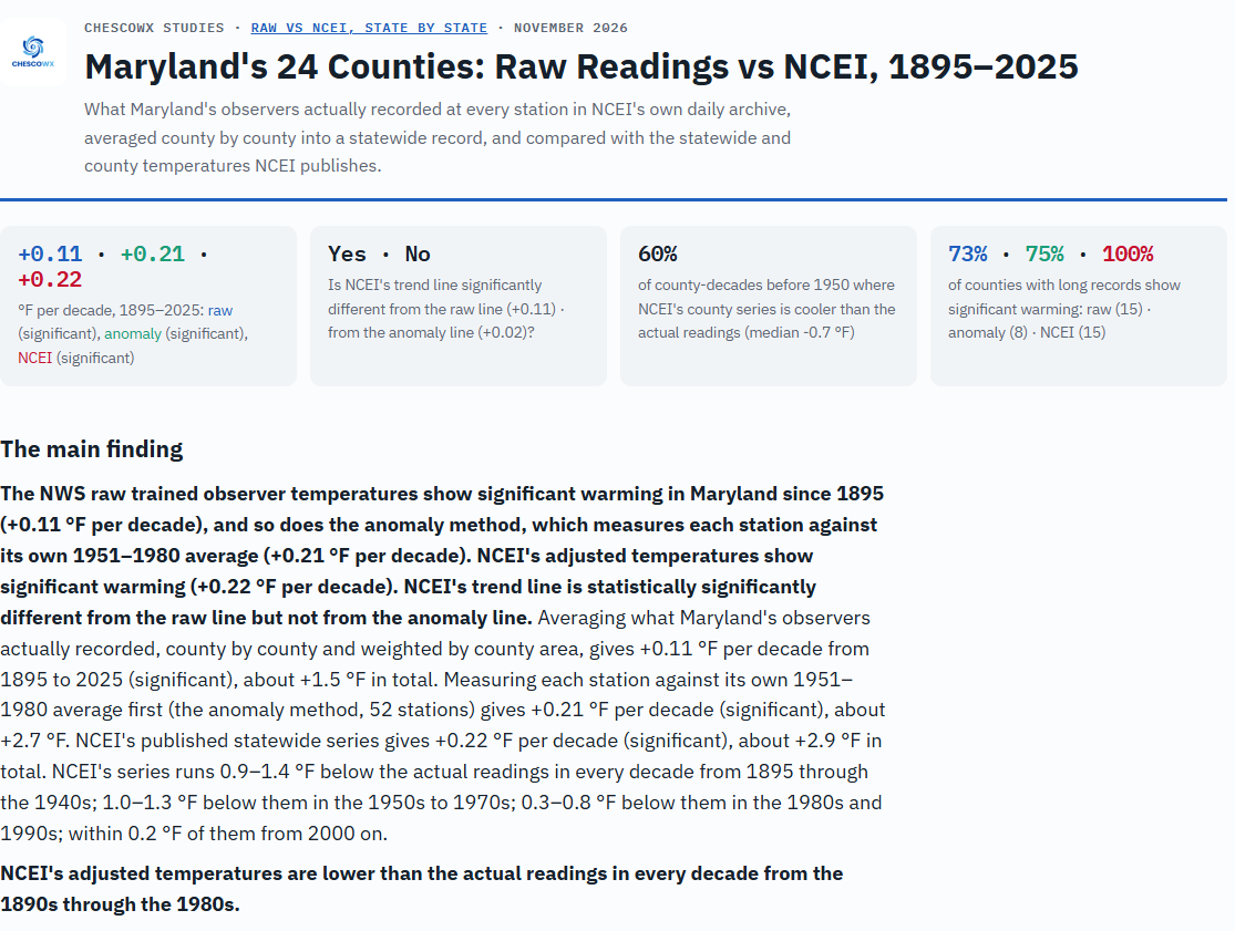
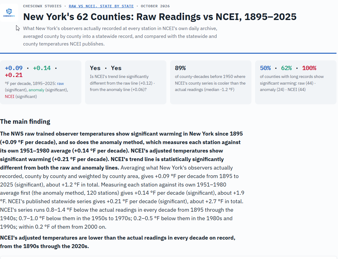
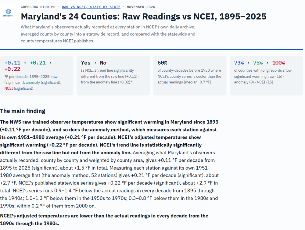
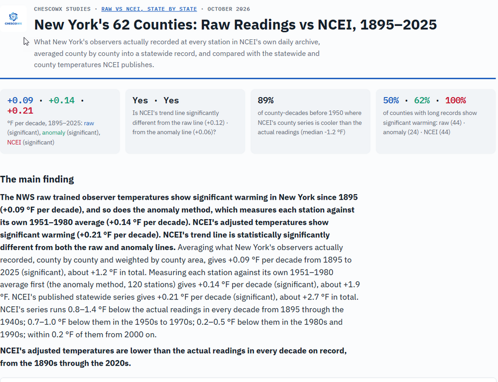
 Below is both Maryland and New York State in our latest study release under the Actual vs. Adjusted Data Research Report https://chescowx.com/raw-vs-ncei-maryland/ https://chescowx.com/raw-vs-ncei-new-york/
-

2026-2027 Record-breaking El Nino
GaWx replied to Stormchaserchuck1's topic in Weather Forecasting and Discussion
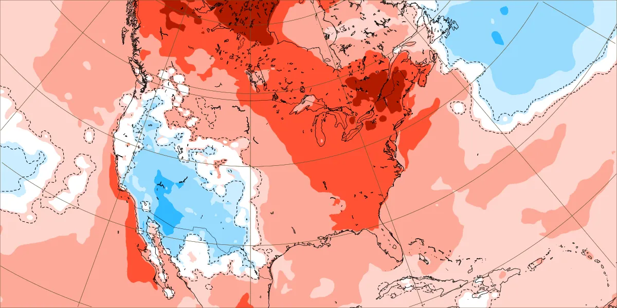
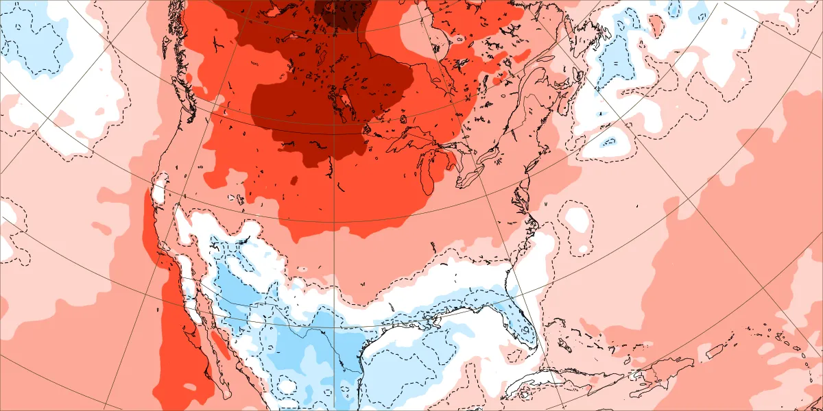
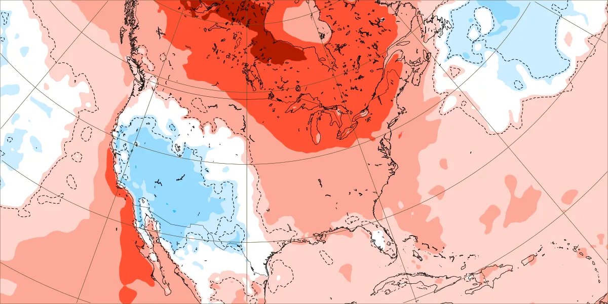
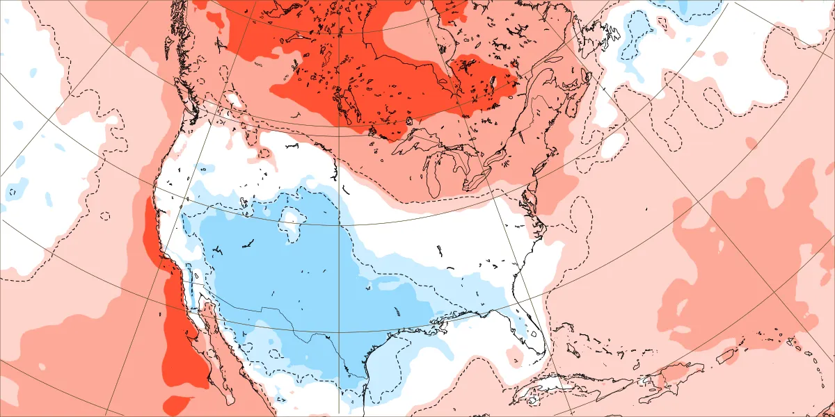
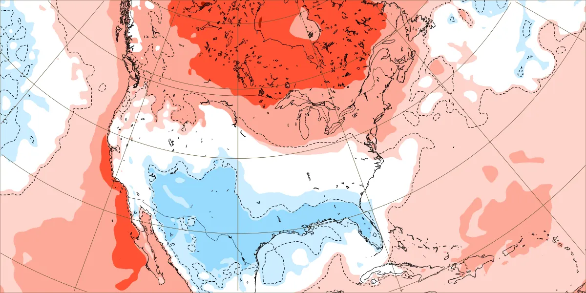
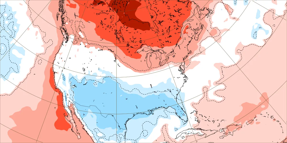
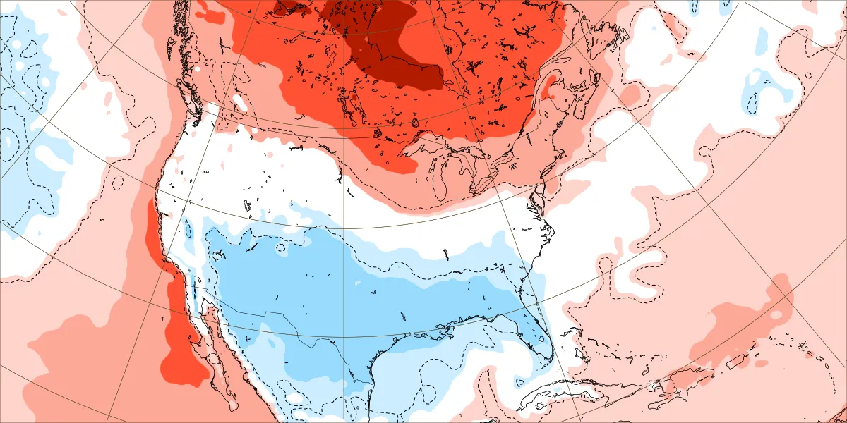
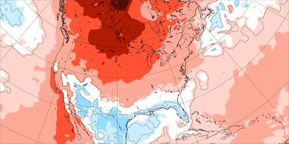
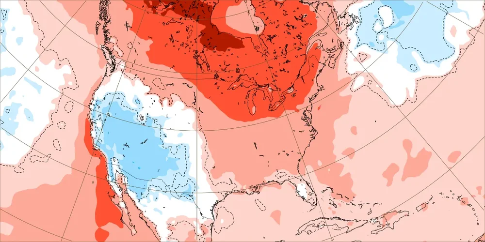
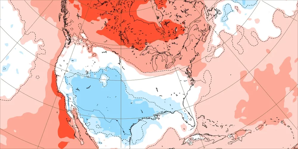
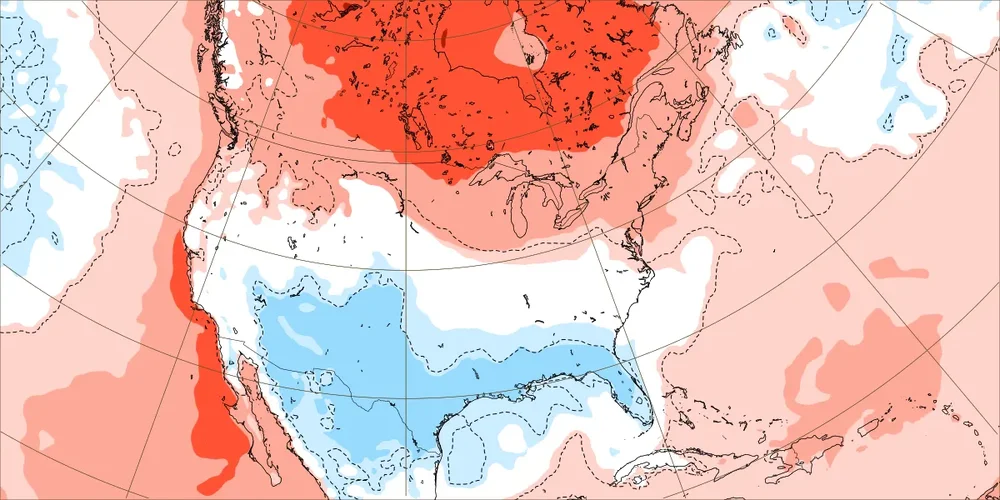
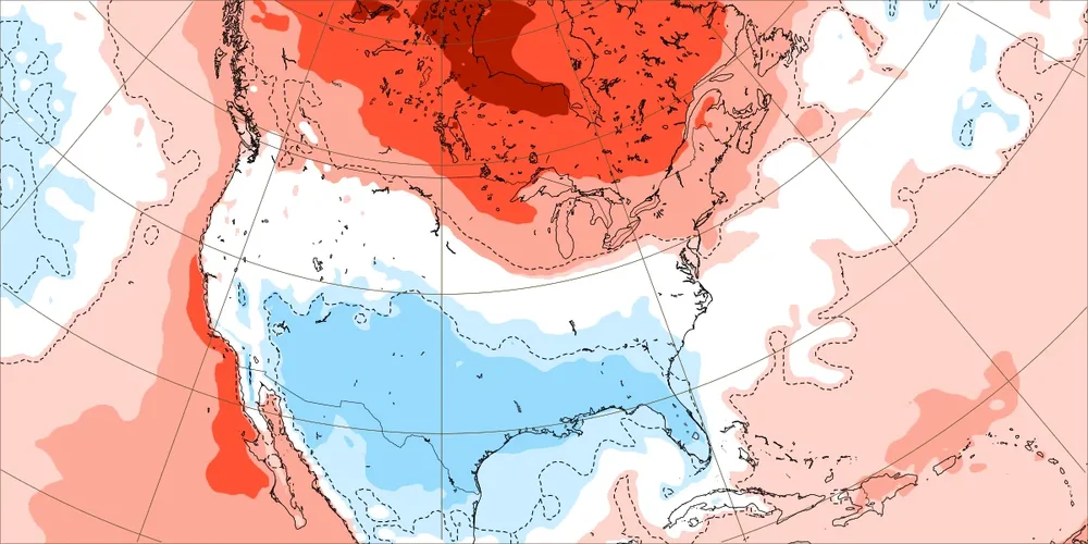
^These on this EW run are very warm weeks in much of the U.S., weeks 1-3: OTOH: These (weeks 4-6) are not very warm weeks in much of the U.S. as the very warm is restricted mainly to Canada and the entire S 2/3 is literally NN to slightly BN: see the difference?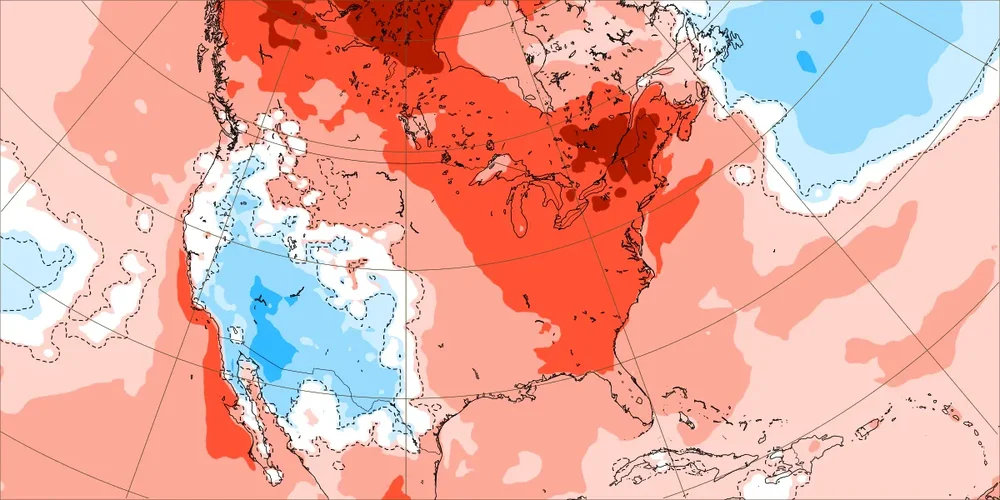
-
Another busted sunny forecast-looks cloudy most of the day
-
Don't know if this was mentioned in here already... but FYI
-
November 2026 Medium/Long Range Discussion
nw baltimore wx replied to WxUSAF's topic in Mid Atlantic
-
The same groups that chastised the (cold) Euro weeklies last winter for their expected inaccuracy is now tweeting day 45 lol. Day 45, btw, which shows temps slightly above avg in the north, average mid, and slightly below avg in the south, versus day which is above avg everywhere. Not to mention averages are some 13-20° warmer today than Dec 17th lol.
-
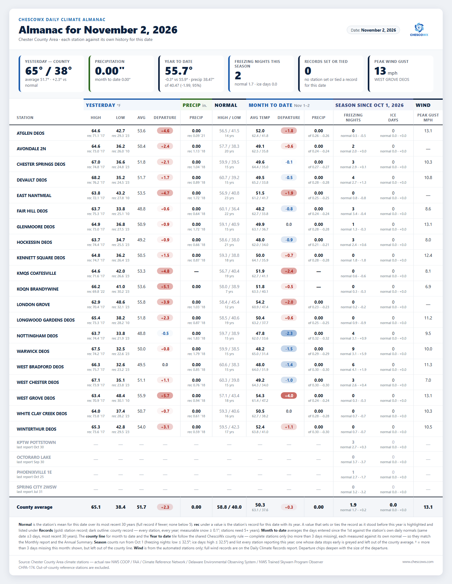
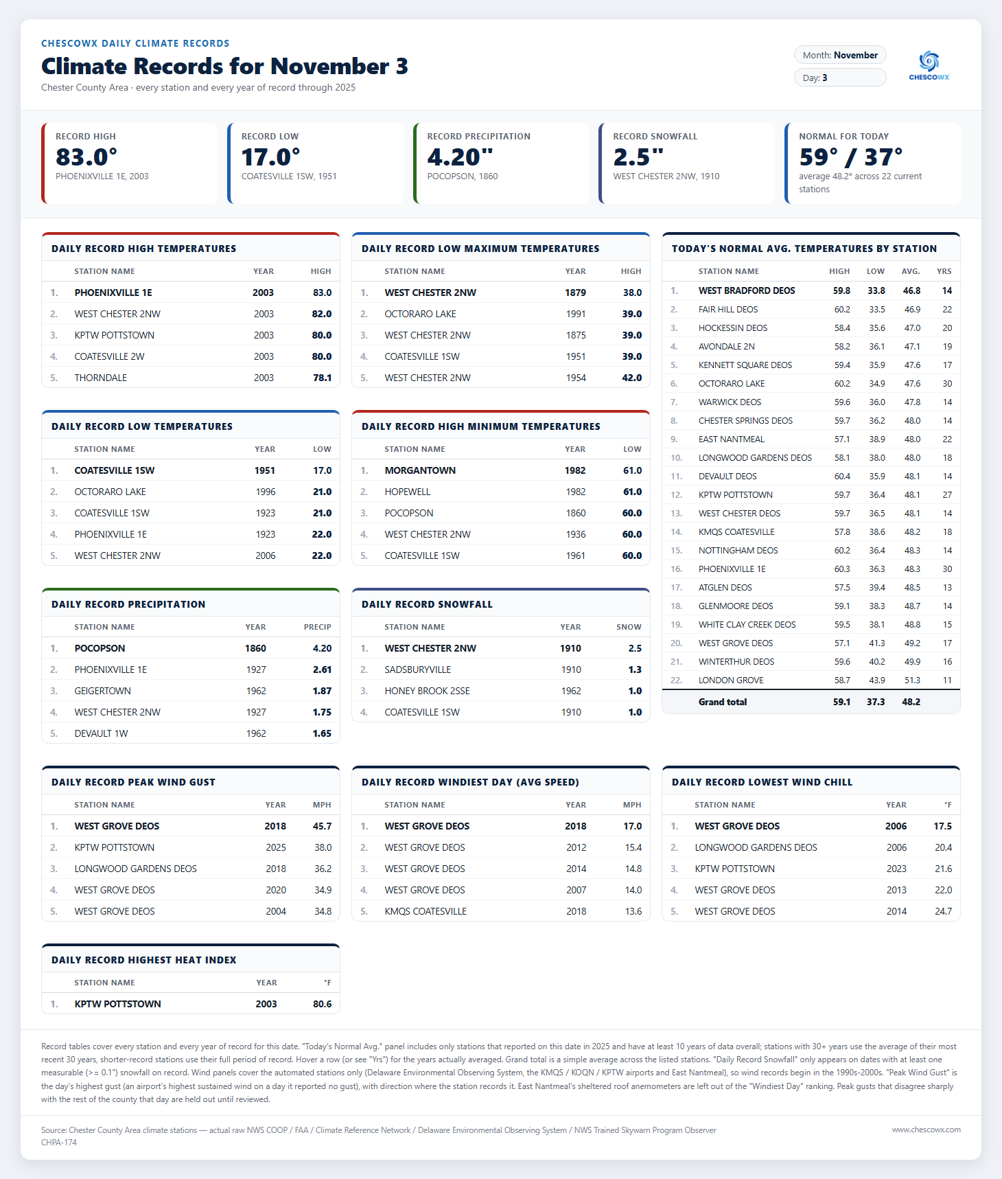
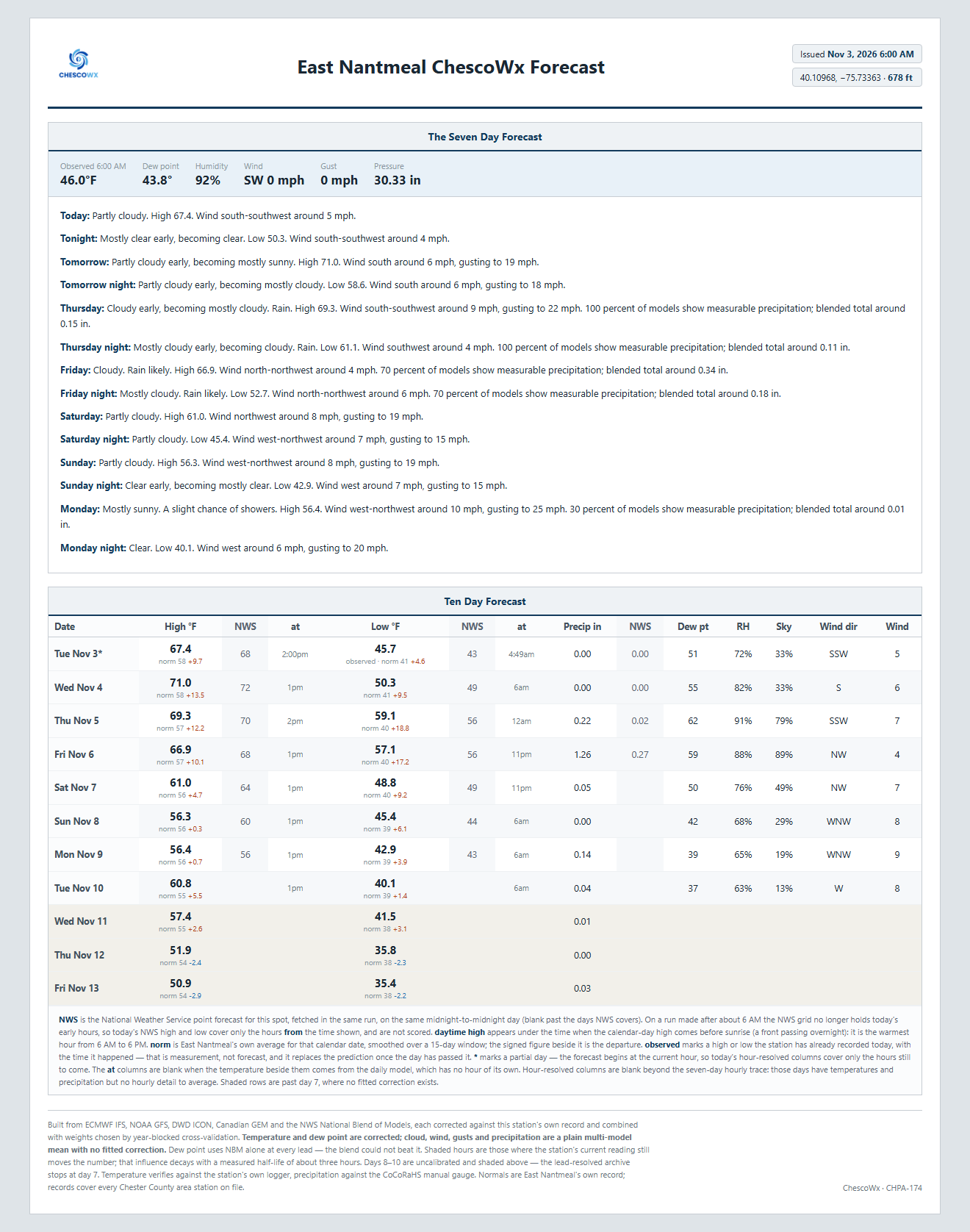
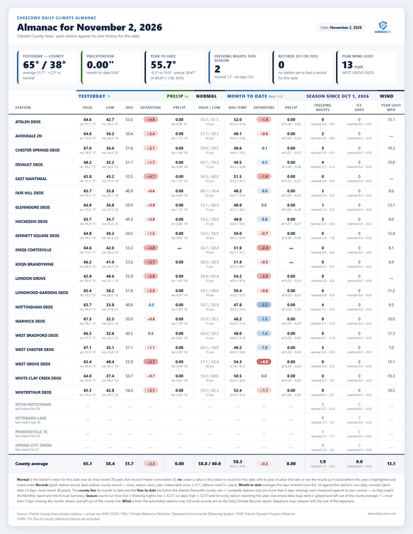
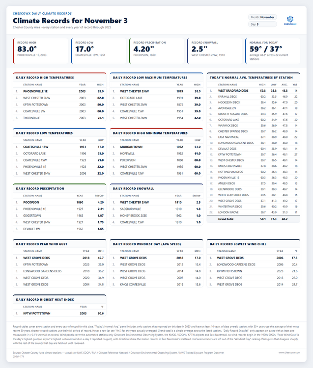
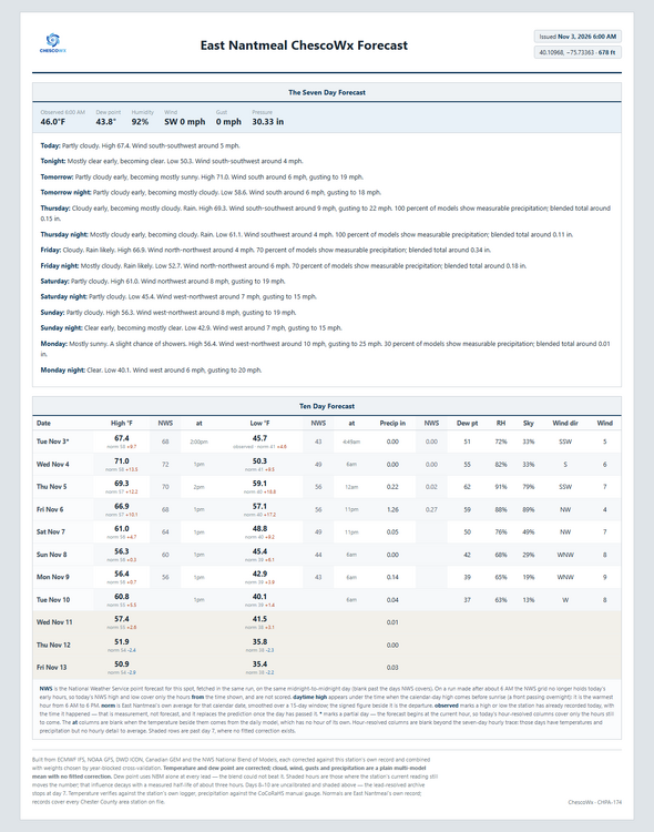
Happy Election Day I hope all who can get out to vote! Weather will not be the excuse! Today we should see highs from upper 60's in ridge locations to the low 70's in valley spots. This is about 6 degrees above normal with lows tonight in the mid 40's to low 50's. Temperatures will peak on Wednesday with highs in the low 70's which is about 12 degrees above normal before we return to near normal by Monday, but by the end of next week we should see a sharp turn to chillier weather with temperatures at least a few degrees below normal. It has been a while since our last rain but our next soaking rain looks to arrive Friday with around 1.3" possible according to the ChescoWx model. By next Tuesday morning we should see lows in the mid 30's to low 40's, not far from freezing in the colder valleys! Of note on this date back in 2003 Phoenixville 1E hit 83 degrees and the county as a whole averaged 79.3 for a high...making it our warmest November 3rd since records began in 1890.
-
E PA/NJ/DE Autumn 2026 Obs/Discussion
ChescoWx replied to PhiEaglesfan712's topic in Philadelphia Region
Happy Election Day I hope all who can get out to vote! Weather will not be the excuse! Today we should see highs from upper 60's in ridge locations to the low 70's in valley spots. This is about 6 degrees above normal with lows tonight in the mid 40's to low 50's. Temperatures will peak on Wednesday with highs in the low 70's which is about 12 degrees above normal before we return to near normal by Monday, but by the end of next week we should see a sharp turn to chillier weather with temperatures at least a few degrees below normal. It has been a while since our last rain but our next soaking rain looks to arrive Friday with around 1.3" possible according to the ChescoWx model. By next Tuesday morning we should see lows in the mid 30's to low 40's, not far from freezing in the colder valleys! Of note on this date back in 2003 Phoenixville 1E hit 83 degrees and the county as a whole averaged 79.3 for a high...making it our warmest November 3rd since records began in 1890.
-
 https://pharmastash.com/# india pharmacy
-
I see cliff jumping over a single run fluke is alive and well.
-
2026-2027 Record-breaking El Nino
GaWx replied to Stormchaserchuck1's topic in Weather Forecasting and Discussion
It isn’t a “cold pattern” by any means, but it literally is BN at 2m in the S US though on the same EW run where the cool heights are Dec 7-13 as opposed to being “very warm” and the “very warm” is actually restricted to mainly in Canada/N Plains: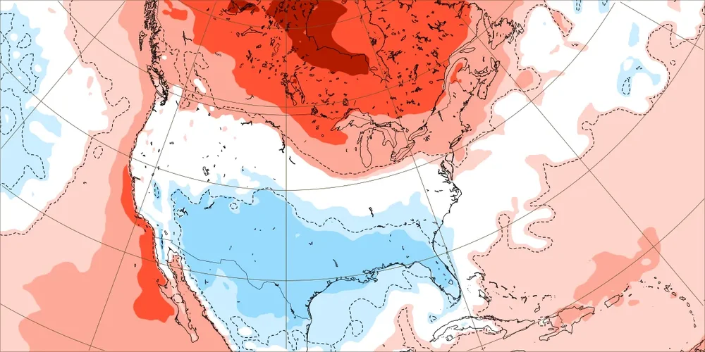
-
Everybody bad-mouthed it so much over the years that it finally quit and went home crying.
-
Wetter look east
-
Records: Highs: EWR: 81 (2003) NYC: 79 (2003) LGA: 80 (2003) JFK: 75 (2003) Lows: EWR: 29 (1951) NYC: 28 (1875) LGA: 32 (1951) JFK: 32 (1980) Historical: 1890 - The temperature at Los Angeles, CA, reached 96 degrees, a November record for 76 years. (David Ludlum) 1927 - Somerset VT was deluged with 8.77 inches of rain to establish a 24 hour record for the state. (3rd-4th) (The Weather Channel) 1927: Historic flooding occurred across Vermont from November 2nd through the 4th. The flood washed out 1285 bridges, miles of roads and railways, and several homes and buildings. Eighty-four people were killed from the flooding, including Lt. Governor S. Hollister Jackson. Click HERE for additional information by Tom Moore. 1956: (1st-3rd) Eastern CO thunderstorms turned into a blizzard by night (1st); drifts to 12 feet high. 16 head of cattle were driven by winds against a fence where they were apparently killed by lightning. Another 33 head drowned when forced into a river by the storm. (Ref. Weather Guide Calendar with Phenomenal Weather Events 2011 Accord Pub. 2010, USA) 1961 - A rare November thunderstorm produced snow at Casper, WY. (3rd-4th) (The Weather Channel) 1966: An early season snowfall, which started on the 2nd, whitened the ground from Alabama to Michigan. Mobile, Alabama, had their earliest snowflakes on record. Louisville, Kentucky measured 13.1 inches, Nashville; Tennessee reported 7.2 inches, and Huntsville, Alabama, had 4 inches of snow. 1980: The 24 °F temperature range in the local area with a low of 19°F in northwest suburbs to 43° in Washington, DC was very unusual. (Ref. Washington Weather Records DCA) 1982: Surface high pressure along the Mid Atlantic combined with upper level high pressure off the Bahamas brought unseasonably warm weather to the East Coast. Sterling (Dulles Airport), VA: 82°, Georgetown, DE: 80°, Philadelphia, PA: 76°-Tied, Binghamton, NY: 75°, Williamsport, PA: 74°, Albany, NY: 74°, Burlington, VT: 74°, Syracuse, NY: 74°-Tied and Worcester, MA: 73°. (Ref. Wilson Wx. History) 1987 - Twenty-one cities, mostly in the Ohio Valley, reported record high temperatures for the date. The afternoon high of 80 degrees at Columbus OH was their warmest reading of record for so late in the season. Showers and thundershowers associated with a tropical depression south of Florida produced 4.28 inches of rain at Clewiston in 24 hours. (The National Weather Summary) (Storm Data) 1988 - A sharp cold front brought about an abrupt end to Indian Summer in the north central U.S. Up to a foot of snow blanketed Yellowstone Park WY, and winds in the mountains near the Washoe Valley of southeastern Wyoming gusted to 78 mph. Unseasonably warm weather continued in the south central U.S. Del Rio TX tied Laredo TX and McAllen TX for honors as the hot spot in the nation with a record warm afternoon high of 91 degrees. (Storm Data) (The National Weather Summary) 1989 - Cold weather prevailed in the central U.S. Six cities in Texas, Minnesota, and Michigan, reported record low temperatures for the date. The low of 7 above zero at Marquette MI was their coldest reading of record for so early in the season. (The National Weather Summary) 1991: Brownsville, TX recorded its first snow since 11/28/1976. Only a trace fell but this stands out as significant, since snow occurred so far south so early and the fact that Portland, ME had not recorded its first snow of the season up to this date. The last measurable snow in Brownsville was way back in February 1895 when the local paper reported 5 inches on the ground. Brownsville did not receive measurable snow on any date in the 20th century.(Ref. AccWeather Weather History) Record cold prevailed across Colorado behind the "Halloween Mega Storm". Pueblo dropped to -17°, breaking the previous record for the day by an amazing 28 degrees. Alamosa recorded -26°, breaking the old daily record by 18 degrees. Other daily record lows included: Havre, MT: -15°-Tied, Lander, WY: -12°, Glasgow, MT: -11°, Helena, MT: -8°, North Platte, NE: -6°, Bismarck, ND: -4°, Scottsbluff, NE: -4°, Colorado Springs, CO: -2°, Sioux Falls, SD: -2°, Norfolk, NE: -2°, Missoula, MT: 0°, Clayton, NM: 0°, Fargo, ND: 0°, Grand Forks, ND: 0°, Rapid City, SD: 0°, Grand Island, NE: 0°, Valentine, NE: 0°, St. Cloud, MN: 0°, Aberdeen, SD: 1°, Huron, SD: 1°, Lincoln, NE: 1°, Goodland, KS: 1°, Dodge City, KS: 3°, Sioux City, IA: 3°, Concordia, KS: 4°, Rochester, MN: 4°, Omaha, NE: 6°, Amarillo, TX: 7° (broke previous record by 11 degrees), Lubbock, TX: 7° (broke previous record by 16 degrees), Des Moines, IA: 7°, Minneapolis, MN: 8°, Waterloo, IA: 9°, Kansas City, MO: 10° (broke previous record by 10 degrees), Oklahoma City, OK: 11° (broke previous record by 10 degrees) plus additional cities.(Ref. Wilson Wx. History) Alamosa, Colorado:In Alamosa, the temperature plunges to -26 °F (-32 °C) shattering the old record by 18 F degrees (10 C deg) as record cold grips Colorado. (Ref. WxDoctor) 2001: Hurricane Michelle reached peak intensity on this day as a Category 4 storm. Michelle made landfall on November 4-5, between Playa Larga and Playa Giron, Cuba, as a Category 4 hurricane, the strongest to strike the country since 1952's Hurricane Fox. The storm caused an estimated $2 billion US dollars in damage to Cuba. 2002: A Magnitude 7.9 earthquake struck central Alaska. The quake is the 9th largest to be recorded in the US. 2007: Dense fog in the early morning hours resulted in a 100 vehicle pile-up just north of Fowler, CA on I-99. Two people were killed, and 41 others were injured. The thick seasonal fog is known as "Tule fog" and typically occurs in Central California in late fall and winter.
-
RIB (Rest in Bits) to the NAM. Anyone have any eulogies?
-
56 / 45 some clouds rolling through otherwise the dry and sunny low 70s int he warmest stations. Continues and warmth peaks tomorrow with sw flow and mid 70s perhaps better in the warmest spots. Enjoy this stretch as First rain since Oct 16 or Oct 14th for our area and a chance of >1.00 inch between Thu PM and Sat AM. Beyond there near normal and likely turning wetter it'll be interesting going from 18-20 days of dry to see if we can get 3 days between rain chances moving past nov 5th. Ridging and overall warm look to head back this way towards Nov 14th and beyond but liekly staying wetter.
-
Another great forecast of Mostly Sunny today by Upton GOES-EAST US PSeUdo-Color LOOP
-
Only got down to 53.1° for the low, thread title FTW... so far
-
2026-2027 Record-breaking El Nino
40/70 Benchmark replied to Stormchaserchuck1's topic in Weather Forecasting and Discussion
Absolutely, but I think that there are more subtle seasonal undertones afoot that will provide at least one window for an event the likes of the Megalopolis blizzard of Feb 1983, the January blizzard of 2016 and the December 23, 1997 short-term crippling snow event across interior SNE. Will SOMEONE be left out? Probably- -
I totally expect one brutally stupid cold shot in Feb amidst a sea of warmth to screw with my fruit trees. Probably a late freeze after a week of 70s too.
-
We troll and joke about a snowless winter, but it’ll come…even with positive temp departures. We’re just going to need an active pattern and accept that there will likely be a lot of messy or pure rain events as well. I suppose an epic ratter is on the table if things line up poorly, but I wouldn’t stress over that on 11/3. CON had 50” in 1877-78 with 3 events of 6”+ and the largest total being 12” on 2/1/1878. There was very little snow in Dec and Mar though…most of the season was Jan/Feb.
-

2026-2027 Record-breaking El Nino
snowman19 replied to Stormchaserchuck1's topic in Weather Forecasting and Discussion
There is no doubt in my mind that we see a record-breaking STJ over the next 4+ months with a non stop train of storms into the west coast….strongest east-based super El Nino in history, ++PMM, strong +QBO…..there aren’t too many locks in weather but this is one of them - Today
-
we discussed it last month... possible NYC stays above 32 all winter?
-
2026-2027 Record-breaking El Nino
40/70 Benchmark replied to Stormchaserchuck1's topic in Weather Forecasting and Discussion
Agreed....I called that January blizzard over the summer down to within a week. -
2026-2027 Record-breaking El Nino
brooklynwx99 replied to Stormchaserchuck1's topic in Weather Forecasting and Discussion
I wouldn't call those storms flukes. they took advantage of some pretty anomalous blocking patterns