All Activity
- Past hour
-

Outta gas and Outta Time: Early March Winter Storm finale
NorthArlington101 replied to Ji's topic in Mid Atlantic
In all seriousness, my one takeaway from the early mostly-joke mesos is that they try to be snow with that second portion at the start. That would be a good trend. -
-1.1 at WXW2 and -9 at SLK 27.4° here in CT lol
-

"Don’t do it" 2026 Blizzard obs, updates and pictures.
vortex95 replied to Ginx snewx's topic in New England
Sounds like CoastalWx! LOL. Earlier this winter, he went "I AM DONE WITH NNE" b/c they were doing well so early. -

"Don’t do it" 2026 Blizzard obs, updates and pictures.
40/70 Benchmark replied to Ginx snewx's topic in New England
I really don't giver a rat's ass how much falls 70 miles from where I live. -
No grass here at all. Definitely a lot more snow than there was in syosset area today. The only grass here is right along the edges of the driveways. Otherwise it’s a solid 4-6” in sunny areas, 7-8” in shaded areas.
-
This current arctic outbreak is obnoxious. 5/-10 at 930pm. -6F already at SLK, ha.
-
Outta gas and Outta Time: Early March Winter Storm finale
NorthArlington101 replied to Ji's topic in Mid Atlantic
Since this is kind of a joke event, why not randomly post the ARW control. We can dream! -
Thanks, Charlie. Don’t forget to consider a “relative” RONIlike adjustment downward. That could be ~-0.3C.
-
"Don’t do it" 2026 Blizzard obs, updates and pictures.
vortex95 replied to Ginx snewx's topic in New England
I am looking at SNE as a whole. Regardless of what happens for rest of the snow season, all 5 SNE CLI sites will have an avg or above avg winter snowfall, w/ PVD and BDR well above avg. That's how you have to look at it b/c having a "CoastalWx IMBY I want it all" () attitude going to frustrate/disappoint one often! Not every winter is going to be a 1992-93, 1995-96, 2004-05, or 2014-15. I would say earlier in Jan before the first biggie when CoastalWx got 6" and said it looked "VIOLENTLY BEAUTIFUL" out there, that said a lot! Little did he know that nearly 50" of "white gold" was coming for Weymouth in the next month! And the two blockbuster snowstorms this winter were rather non-standard meteorologically. The Jan event has among the weakest sfc lows I have ever seen for so much coverage of 20"+, and the most recent storm? Well, I talked about its "weirdness" earlier on this thread. And how about the model forecasts leading up to that storm? What a "coup" for the GFS, and in general, the long and medium range forecasts for all the global models were really bad/inconsistent! -

Late February/Early March 2026 Mid-Long Range
stormtracker replied to WxUSAF's topic in Mid Atlantic
Let’s get thru this bs warm up and get back to tracking by the weekend. -
Outta gas and Outta Time: Early March Winter Storm finale
stormtracker replied to Ji's topic in Mid Atlantic
Despite this being advertised here as N and W thing, i think we all get in on some snow TV at least. -

Central PA Spring 2026 Discussion/Obs Thread
Itstrainingtime replied to Voyager's topic in Upstate New York/Pennsylvania
It's too bad we're essentially out of time for wave 1 because it has moved significantly north over the past 48 hours. A southern VA hit is now a central to even northern MD event. -

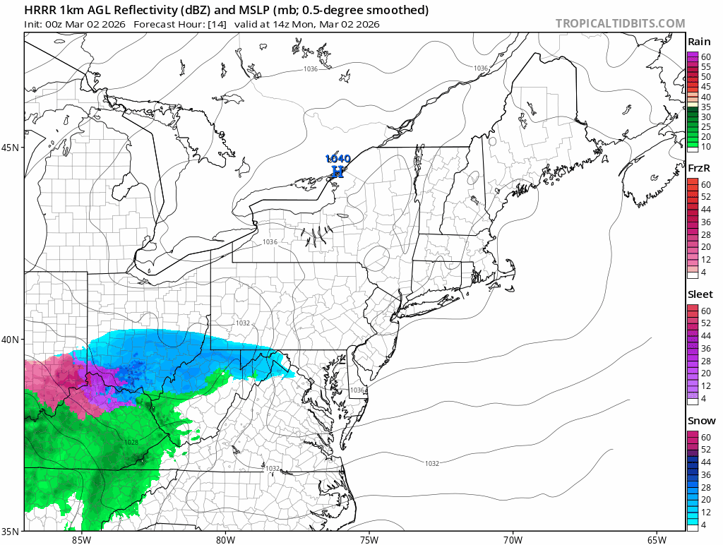
Outta gas and Outta Time: Early March Winter Storm finale
high risk replied to Ji's topic in Mid Atlantic
While a messy Tuesday morning rush hour has been in the cards for a while now, I'm becoming increasingly intrigued by the Monday afternoon snow event. My question is what the road temps will be like Monday after a couple of warmer days but a cold night. The NAMs and HiResW FV3 suggest that temps will only barely go above freezing tomorrow before arriving snow cools it back a few degrees. It's still tough to imagine messy roads during the daytime, but maybe if it comes down hard enough? Ultimately, it's *probably* just going to whiten grassy surfaces until you get further west and northwest, but the Monday afternoon through Tuesday morning period will be a nice reminder of winter before the big warmup. -

Outta gas and Outta Time: Early March Winter Storm finale
poprock49 replied to Ji's topic in Mid Atlantic
12k NAM looks solid, better than 18z -
Heh who knows about after the 15th that’s beyond the end of 360 hours of modeling; it is complete speculation with extremely low odds. I was just speaking in deference to this single model run … People that are claiming that this is cooling things back off again within those frames probably had trouble letting go of the tooth fairy in their youth. I don’t know.
-
'bdcf' looks like a swear word, which is fitting. Also, I'd argue that on a lot of those bdcf days, the spine of LI - 495 if you will - is often more similar to unaffected central NJ than it is to the south shore of LI. I remember many times stepping out of work in Mineola/Garden City, to blue skies and 70s, only to head south on the Meadowbrook or Wantagh and see odd darkness/haziness on the horizon. By the time I got to Sunrise Hwy I'd be in misty and damp low 50s.
-
I still have a ways to go, probably by the end of the week here. The snow left here is glacier, the snowmelt during the day ices up and freezes into the snow on the ground and makes it bulletproof. It’ll be great when I can hang out on my deck for a while and get some sun.
-
It's mostly torchy. It'll cool off at times but signal is very warm. There's no 2018 style comeback coming
-
Ouch . Look at SE Canada there
-

Outta gas and Outta Time: Early March Winter Storm finale
MDSnow93 replied to Ji's topic in Mid Atlantic
I would take that in MoCo all day
-
Oh I know and I love it. I hate when gross snow piles stick around. I’ll have my yard back this week for the next 8 months. Couldn’t come soon enough!
-
Huge differences in the shaded vs sun zones here. Shaded spots still have several inches while sun spots it's mostly grass.
-

Outta gas and Outta Time: Early March Winter Storm finale
WEATHER53 replied to Ji's topic in Mid Atlantic
Dews dropping dramatically nirth filtering south . Something is afoot -
That’s March 1 sun for you. It’s bad for snow retention in general here near the coast-this year is tops for sure on retention but sooner or later as the sun gets higher in the sky every day it does its thing.
-
Very unusual to such a large temp difference between Chicago and Detroit. DTW (27.8°) was 5.3° colder in Feb than Chicago. For the winter, Detroit finished 1.8° colder than Chicago. Detroit experienced the 7th driest Feb (0.39"). Though only 4.9" of snow fell, significant snowcover was present the first half of the month.