All Activity
- Past hour
-
Because it’s fakiational cooking. Look at ORH.
-
Going to be funny when it just stays dry all winter too lol
-

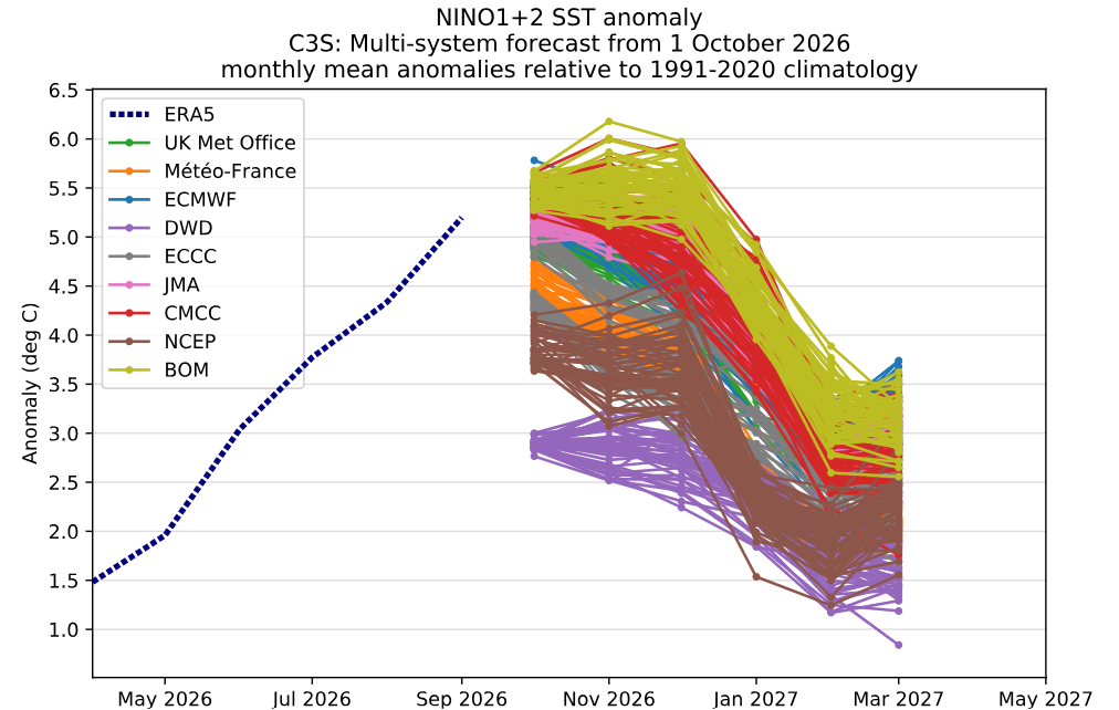
2026-2027 Record-breaking El Nino
mitchnick replied to Stormchaserchuck1's topic in Weather Forecasting and Discussion
All the ensembles have been heading toward a SE trough (or weakening of heights as a possible precursor of the troigh) in one form/location/strength or another consistent with seasonal modeling. Of course, they maybe, like so often, early with the pattern. But it's encouraging to see it happening nonetheless. -
32 degrees this morning but no frost. Had to get up early and make a local airport run for my Aunt who flew up to visit and see the leaves. She’s heading to Charlotte.
-
low of 28, some frost
-
2026-2027 Record-breaking El Nino
EasternLI replied to Stormchaserchuck1's topic in Weather Forecasting and Discussion
Nice big +EAMT leading to a Pacific jet extension on the 11-15 day EPS. -
same here. oaks are starting to shed the leaves, had very few on the ground until Monday, now the lawn is covered with them.
-
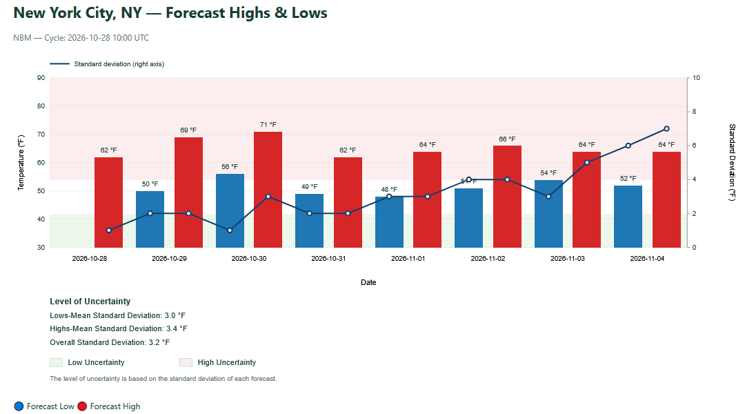
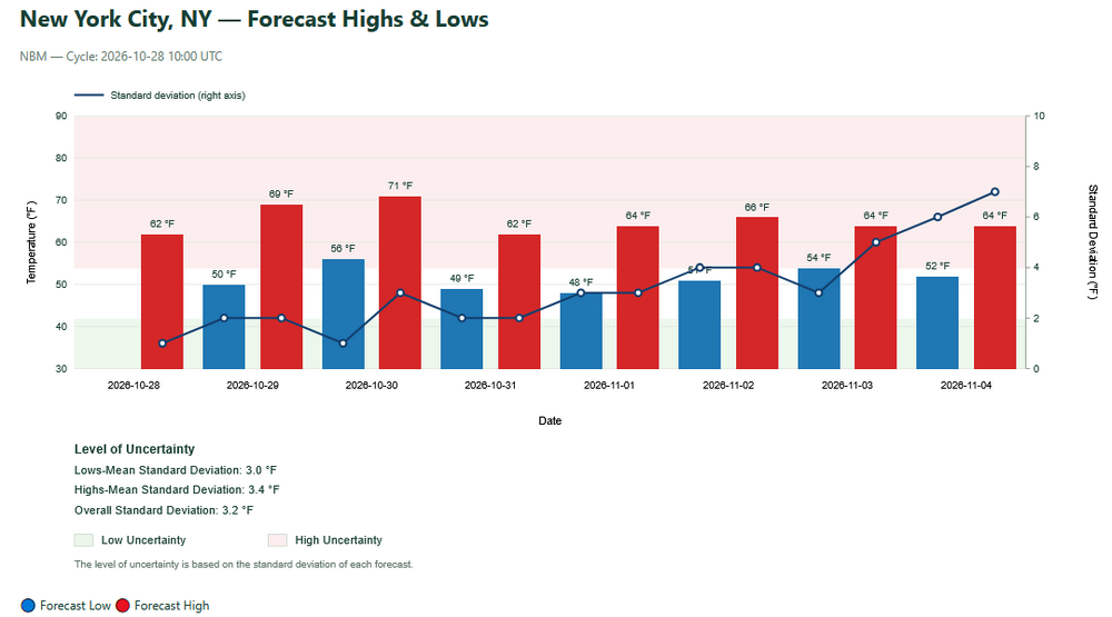
The latest NBM remains very mild for the start of November. Uncertainty increases at the end of the run.
-
His spot really amazes me.. I've had frost just about every morning.. not sure why his spot is always warmer.
-
37.4 for the low and FTW
-
2026-2027 Record-breaking El Nino
LakePaste25 replied to Stormchaserchuck1's topic in Weather Forecasting and Discussion
Nice to see Eric latch on to this idea! I’ve been saying this for awhile now and so has @40/70 Benchmark. The shutdown of MC forcing combined with stronger E pac forcing could enhance the eastward extent of the southern stream in the E US, which would keep the ridge further north in Canada. -
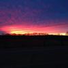
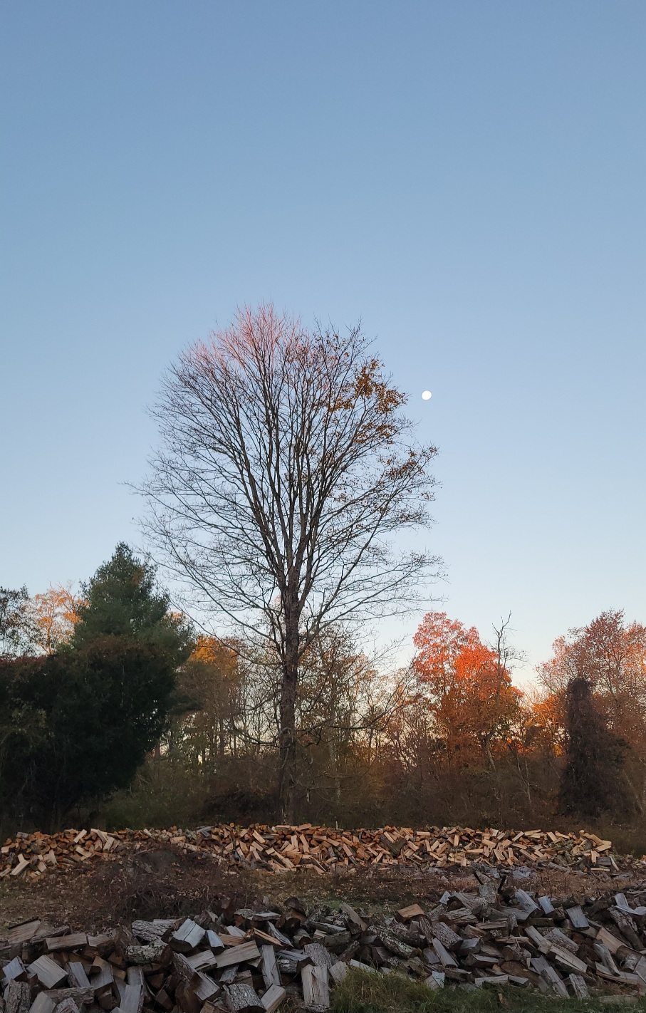
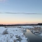
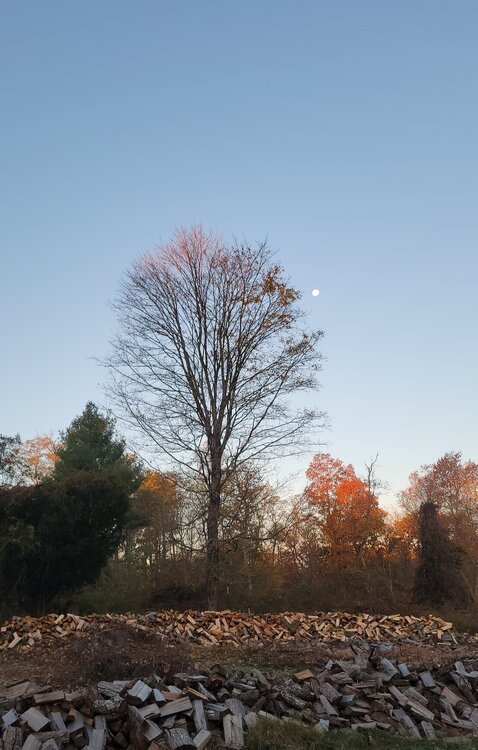
Pretty morning.
-

2026-2027 Record-breaking El Nino
csnavywx replied to Stormchaserchuck1's topic in Weather Forecasting and Discussion
There are definitely issues with maintaining the initialized thermocline slope. CFS some of the worst among them. Ofc that won't affect its near term weekly forecasts, but it absolutely does have an effect later on. Sliding through the 3.4 measurement window wasn't on the menu of plausible events before this year, but here we are.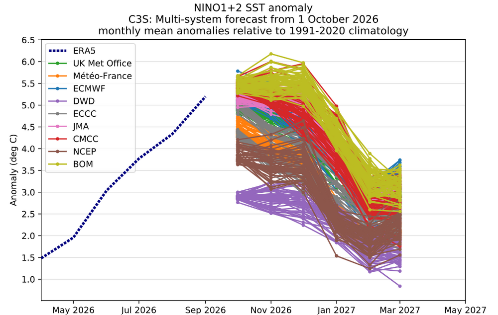
-
35 this morning.
-
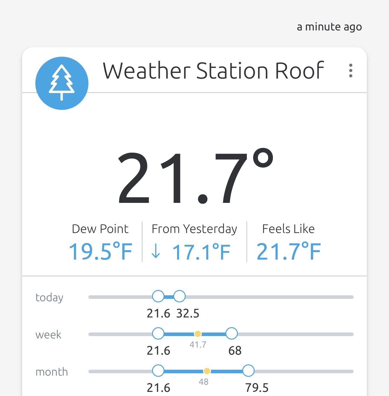
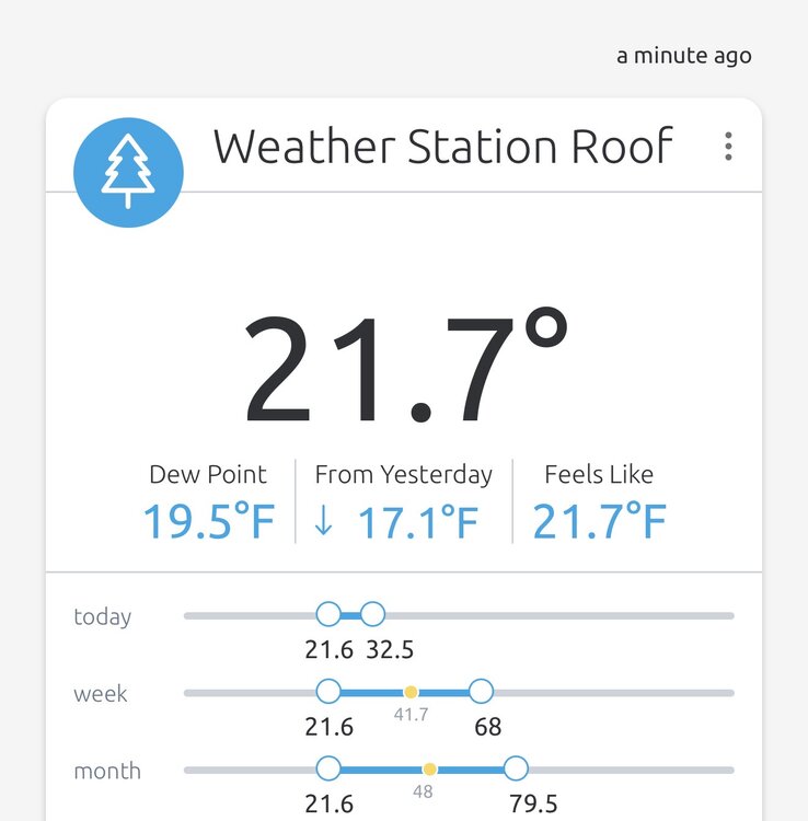
21.6F was the low, 21.7F currently, Cold morning outside this morning.
- Today
-
 canada rx pharmacy or canadian pharmacy store canadian pharmacy reviews https://maps.google.lu/url?q=https://canpointerx.com canadian pharmacy 365and https://www.trendyxxx.com/user/mqcwwutfth/videos canadian pharmacy king [url=http://www.qqfuzhi.com/portal/play.php?url=http://canpointerx.com]reputable canadian online pharmacy[/url] canadian drug pharmacyand [url=http://bbs.51pinzhi.cn/home.php?mod=space&uid=8506916]canadian pharmacy reviews[/url] canada pharmacy online
-
Finally hit freezing for first time. 31.8°
-
canada rx pharmacy or canadian pharmacy store canadian pharmacy reviews https://maps.google.lu/url?q=https://canpointerx.com canadian pharmacy 365and https://www.trendyxxx.com/user/mqcwwutfth/videos canadian pharmacy king [url=http://www.qqfuzhi.com/portal/play.php?url=http://canpointerx.com]reputable canadian online pharmacy[/url] canadian drug pharmacyand [url=http://bbs.51pinzhi.cn/home.php?mod=space&uid=8506916]canadian pharmacy reviews[/url] canada pharmacy online
-
Yup…a frosty autumn for the vast majority of us. At some point DIT will get to participate.
-
Central PA Autumn 2026
Mount Joy Snowman replied to canderson's topic in Upstate New York/Pennsylvania
43 upon house departure. MDT looking lively from the train this morning. Carry on. -
It's starting to look drier next week. The trend is our friend for us business owners that operate outdoors. We're having a strong finish to a fantastic season. I'm looking forward to some rest, peace, and snow on Tug Hill this winter. How about that polar vortex disruption in the forecast? Wow
-
canadian pharmacy meds: CanPointe Rx - canadian drug pharmacy
-
28F. Heavy frost abounds. Oaks now crying for mama.
-

2026-2027 Record-breaking El Nino
bluewave replied to Stormchaserchuck1's topic in Weather Forecasting and Discussion
My guess is that all these stratospheric disruptions in recent years are linked to the Kara-Barents Seas warming and loss of sea ice there. Many recent studies how focused on this region. Notice how in most of the recent summers the Pacific side has done better than the Atlantic side. While the Pacific side enjoyed the coldest start to summer in a while this year, there was record breaking warmth with low sea ice on Barents and Kara areas. So we have had quite a run of SSWs and weakened vortices since 2020. The successful SSWs and weaker PV for winter weather fans were in January 2021 and November 2025. These events were able to get the Pacific to back off. Even though it took nearly three months following the November 2025 weak PV in late February for our first KU in four years to finally click. Fast forward to the disruption of the PV in February 2023 and we saw the disappointing result of what such an overpowering Pacific leading to the Baja trough that winter could do. Next up were the twin SSWs in January 2024 and March 2024 during our last weaker super El Niño. But we saw quick snap backs of the PV following those events with the very hostile Pacific continuing. Now this early PV disruption is forecast to have a quick rebound. So it’s quite possible that we see another weakening sometime from January to March. But with such an extreme east based El Niño, it’s an open question how much success it will result in. Since it could very well follow the 2024 quick rebound script. https://www.climate.gov/news-features/understanding-climate/understanding-arctic-polar-vortex How Barents Sea Ice Affects the Stratosphere Heat and Moisture Flux: When sea ice retreats in the Barents-Kara Seas, open water exposes the relatively warm ocean to the atmosphere in autumn and early winter. This releases extra heat and moisture. [1] Planetary Wave Enhancement: The added heat creates local thermal anomalies that alter lower-atmosphere pressure patterns. This change enhances upward-propagating planetary waves (Rossby waves) from the troposphere into the stratosphere. [1, 2] Vortex Disruption: When these energetic waves break in the stratosphere, they deposit momentum and heat, weakening or distorting the high-altitude circumpolar winds known as the stratospheric polar vortex. In extreme cases, this triggers an SSW, where stratospheric temperatures jump tens of degrees in just a few days. [1, 2, 3] https://repository.library.noaa.gov/view/noaa/67133 Major sudden stratospheric warmings (SSWs) occur in the Arctic around six times per decade. During winter 2023/2024, two major SSWs occurred – a relatively rare event, having occurred on average only once per decade. Here, we summarise the evolution of the two SSWs, their dynamics and impacts on stratospheric chemical processing and tropospheric weather patterns. While both SSWs were displacement events, they evolved remarkably differently. The 16 January SSW was short‐lived and did not exert a canonical influence on surface weather. In contrast, the 4 March SSW followed a more typical evolution, albeit with only weak coupling to the troposphere.