All Activity
- Past hour
-
 Of course I do, and tog into January. But im more or less off the water for both jobs from mid January until mid March.
 -
Again, the path we are on here is Coughlin and the Giants. He won 2 SBs. It got stale. The fans were restless and saw the need for change. Clamoring for it. Same as we are now. The front office sat on its hands. It got worse. 3 straight losing seasons- they still didn't fire him! He fucking resigned.
-
Go find something else to do if you don't like discussing interesting weather.
-
Then check out the mountain west thread. Vancouver weather doesn’t belong here
-
I care
-
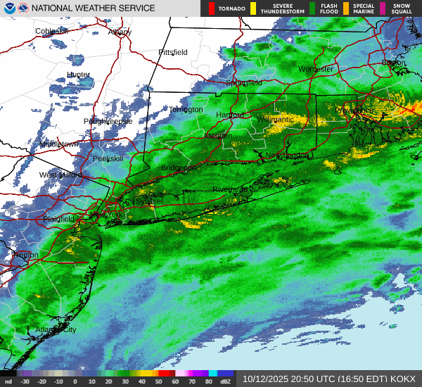
 SNJ Coastal Flooding video. https://x.com/i/status/1977412609877123362 https://x.com/i/status/1977439577813172611
 -

Central PA Fall Discussions and Obs
WmsptWx replied to ChescoWx's topic in Upstate New York/Pennsylvania
Buyout likely coming from the sale of assets from WPSU, as well. -

Central PA Fall Discussions and Obs
Superstorm replied to ChescoWx's topic in Upstate New York/Pennsylvania
Wind speeds picking up. . -
Harbaugh and the coaching staff into the damn sun.
-
You may be underestimating Harbaugh's innate resistance to making a coaching change. He gets dug in sometimes (i.e. Greg Roman). So who knows, smh
-
First time in franchise history, smh
-
SNJ Coastal Flooding video. https://x.com/i/status/1977412609877123362 https://x.com/i/status/1977439577813172611
-
Finally someone throws a fucking bone around here thank you
-
I don't remember the Ravens starting 1-5. That's gotta be the surprise of the season so far.
-

E PA/NJ/DE Autumn 2025 Obs/Discussion
Birds~69 replied to PhiEaglesfan712's topic in Philadelphia Region
Stuck in a band of heavy drizzle, windy with temps in the 50s. Feels like Christmas... -
 Power outages on the rise on long Island
 -
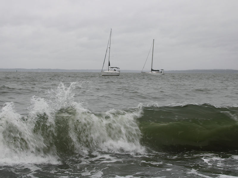
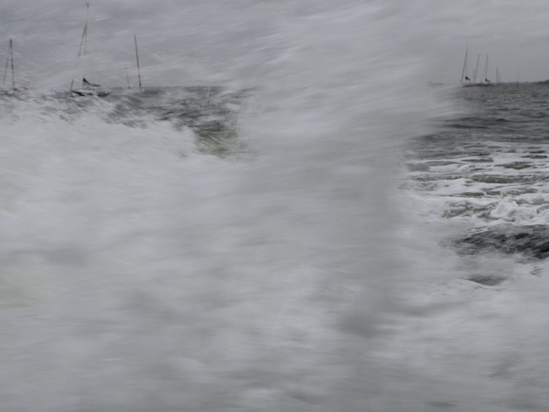
Two photos from late this afternoon from the Long Island Sound:
-
A nor'easter will continue to bring periods of rain and strong winds to the region into early Tuesday. A general 1"-3" rainfall is likely across the region with locally higher amounts. The wind will gust to 40 mph in New York City and its nearby suburbs, and 60 mph along portions of the Jersey Shore and eastern Long Island. Coastal flooding and beach erosion are likely. Following the nor'easter, a fresh shot of cool air will move into the region during the middle of next week. Some parts of the region could experience their coolest temperatures so far this fall. Dry conditions will likely prevail through the remainder of the week. In the 18 past years where Central Park saw at least two 80° or above highs and Newark saw at least two 84° or above highs during the first week of October, the temperature returned to 70° or above on at least one day during the second half of October in 17 (94.4%) of those cases. For all other cases, 84.1% saw at least one such high temperature during the second half of October. Therefore, the sharp cool spell very likely won't mean that New York City has seen its last 70° or above high temperature. The ENSO Region 1+2 anomaly was -0.1°C and the Region 3.4 anomaly was -0.5°C for the week centered around October 1. For the past six weeks, the ENSO Region 1+2 anomaly has averaged -0.15°C and the ENSO Region 3.4 anomaly has averaged -0.43°C. La Niña conditions will likely continue through mid-winter. The SOI was +8.31 today. The preliminary Arctic Oscillation (AO) was -0.008 today. Based on sensitivity analysis applied to the latest guidance, there is an implied 61% probability that New York City will have a warmer than normal October (1991-2020 normal). October will likely finish with a mean temperature near 58.8° (0.9° above normal). Supplemental Information: The projected mean would be 1.9° above the 1981-2010 normal monthly value.
-
Hey Raindance, Did you figure in the QBO? It appears you didn’t and/or don’t feel it’s important enough to consider it. I’m saying that because your 2 prime analogs for Oct-Feb, 2013-4 and 2024-5, had the exact opposite QBO of where 2025-6 will be. Please explain. Thanks.
-
Well there's a daily posting on this subforum of historical weather events all over the country (by Sacrus) and quite often I see posters discussing those, so I don't think the above is true but anyway I did post some of the info on the mountain west thread so I will shuffle on back there and shoot grizzlies off my front porch.
-

E PA/NJ/DE Autumn 2025 Obs/Discussion
RedSky replied to PhiEaglesfan712's topic in Philadelphia Region
Snizzle -
If this were a snowstorm I would be as happy as a pig in shit:
- Today
-
That’s fair, but you could send him a message with this info. Nobody else cares
-

E PA/NJ/DE Autumn 2025 Obs/Discussion
JTA66 replied to PhiEaglesfan712's topic in Philadelphia Region
Finally picking up a steady mist, 58F.


