All Activity
- Past hour
-
.thumb.gif.f92b16c631a1d15d405ed77b33f0710d.gif) Yeah you have to wonder if it ends up mostly dry for some..time will tell
Yeah you have to wonder if it ends up mostly dry for some..time will tell -
Spc has McD out for counties in south ky and also Clarksville and Robertson counties in tn watch probabilities 80% .
-
I thought that was just December...
-
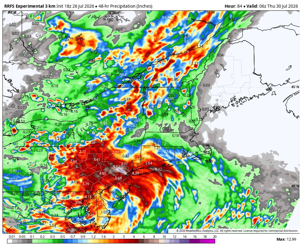
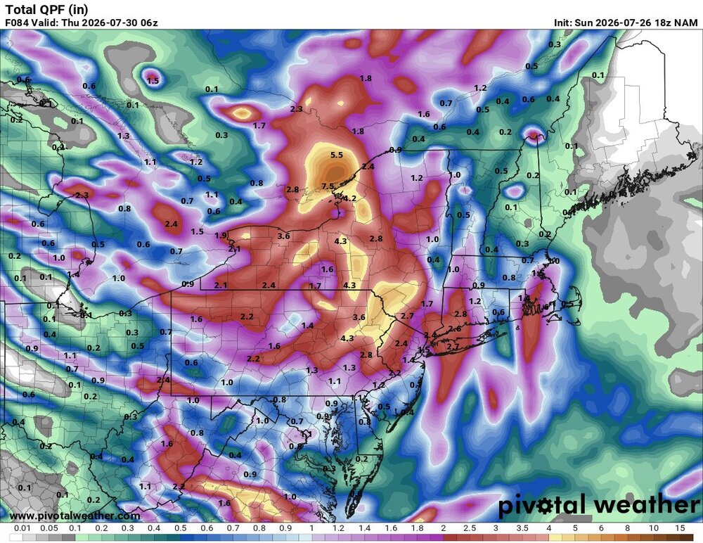
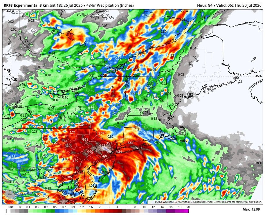
 RRFS follows same theme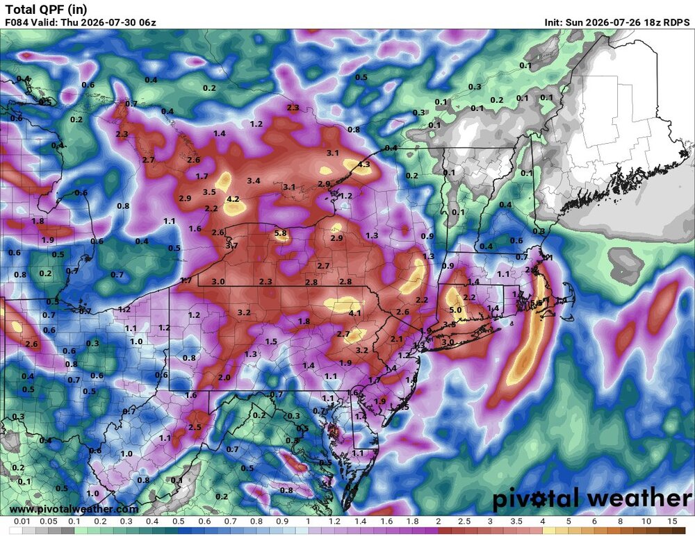
-
Starting pitching has been better than not bad than the last two months. I mean in July alone their ERA is first in the majors, and they have been fantastic since late May. Something to build on next year, imo Elias gotta go--our hitting woes and just being unclutch with poor fundamentals goes back to his system, imo Fundamentals especially were problem when Alby got here and the players all brought it to him...which means it runs deeper. I don't think anything gets better until they make the change. If they don't we could be sitting right here having the same convo next season (whenever it starts anyway, lol)
-
I think I'd say......one team is more fundamentally sound/clutch and over the course of a long season it adds up. The Braves arent without their flaws as was shown this series w two cases of losing the lead late but they didnt make as many dumb mistakes and were better with RISP. The Os were 2-11 with RISP fri and 0-10 today. Just brutal. Reality is that starting pitching really hasn't been that bad but man they suck at defense and in key situational hitting.
-
HORT TERM... (Rest of today through Tuesday) Issued at 1145 AM CDT Sun Jul 26 2026 There are 2 main concerns through Tuesday: heat and storms. A Heat Advisory was issued for our far western counties starting this afternoon, then expanding across most areas west of the Plateau starting Monday morning. The advisory will last until 8 PM Tuesday. The hot ridge over the Rockies and High Plains will bulge eastward, giving areas west of the Plateau highs in the mid 90s with heat index values well over 100. This results in Heat Risk levels reaching Major Risk level (3 out of 4). Although atmospheric moisture has decreased since yesterday with precipitable water values dropping below 2 inches, near surface moisture remains high with dew points in the 70s. Dew points can be expected to remain high through Tuesday and those PW values will climb again giving fuel for storms with heavy rainfall. So what are the details on storms? First of all, in this hot, steamy environment with some residual boundaries, we cannot rule out some storms any time, especially in the heat of the afternoon and evening. But, models are continuing to indicate an overnight MCS for tonight into early Monday morning. There are inconsistencies with track and intensity, but that is typical of this pattern. We know that very moist and unstable conditions will be present into the late night hours, so any storms that dive down from KY will have the potential to produce damaging winds and localized flash flooding. At this time, we are under a level 2 out of 5 severe risk north of I-40 with a level 1 out of 5 to the south. It would be wise to monitor updates through the evening and be prepared for possible severe storms in the overnight hours. Along with locally developing scattered storms, we cannot rule out another big storm cluster later Monday. Basically, we need to be watching to our north northwest through the next 48 hours. As we wrap up Tuesday, we will see a medium to high chance for storms ahead of a cold front. This Tuesday evening frontal passage will turn off the storms and drop temperatures to normal levels for the rest of the week.
-
Interesting thought. Not sure if It’s the cause, or maybe the choice of vaccine—my widowmaker 100-% blockage occurred in 2017 and resulted in 2 stents
-
 best online pharmacy india: Online medicine home delivery - buy medicines online in india
 -

2026-2027 Super El Nino
snowman19 replied to Stormchaserchuck1's topic in Weather Forecasting and Discussion
The OHC is all the way up to +2.8C. We have blown away 1997’s record of +2.5C -
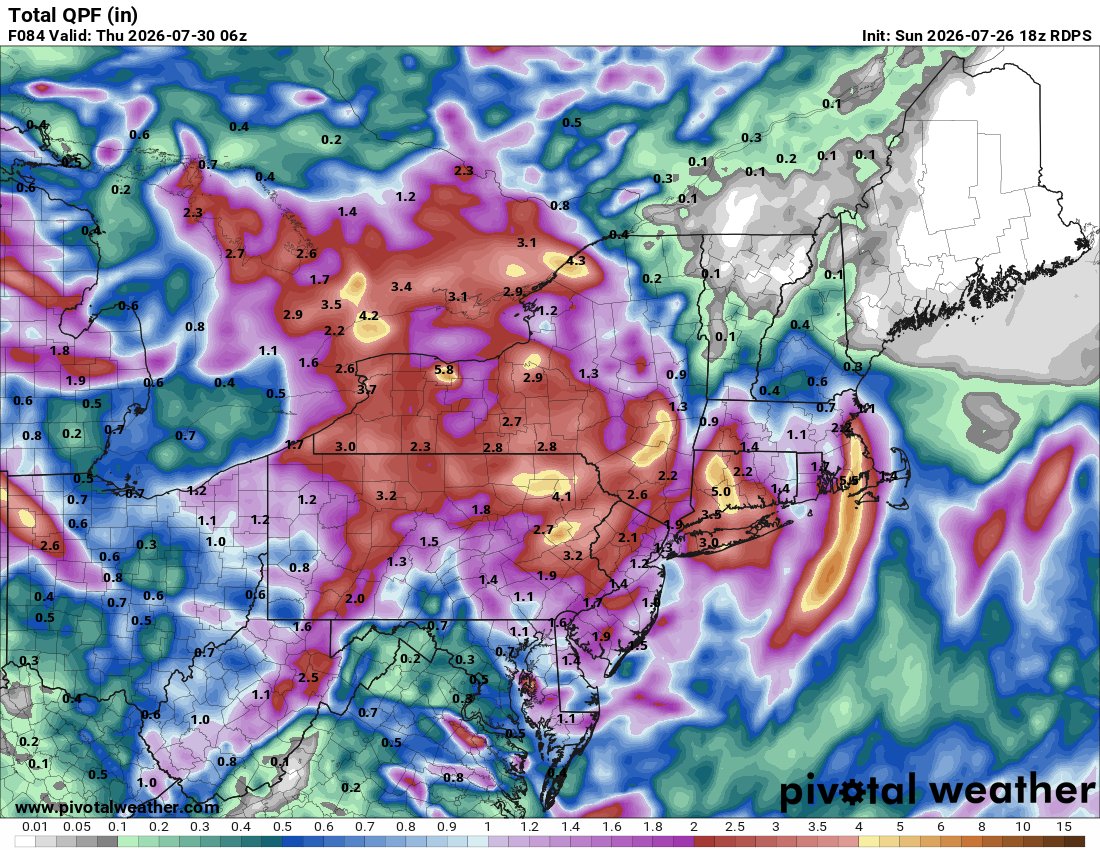
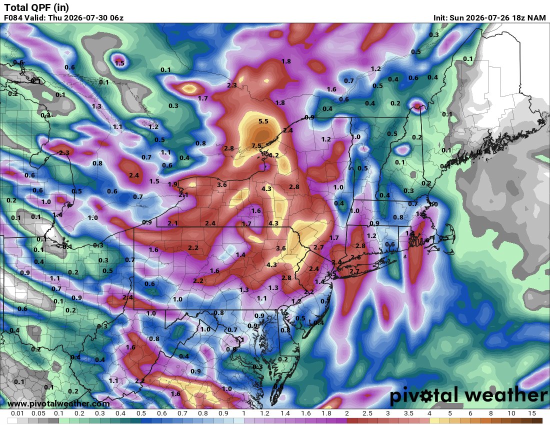
Not there yet.. but starting to wonder if this ends up congrats NY state and ends up shafting at minimum river East . 18z Reggie and NAM
-
Whole city was at the beach
-
Not going to lie I didn't see my Twins only be one game out of a wild card spot at this point. They need an arm or two for the bullpen and perhaps a bat. Starting pitching is solid although i wouldn't balk at an A+ starter
-
Dew of 83 here earlier. Currently sitting at 92/82/115.
-
covid, duh
-
One team is much better than the other. Good teams often find a way to win. Bad teams...
- Today
-
About as even of a series as you can get and the Os come up on the short end of it. Frustrating.
-
I just got measurable rain for the 1st time in ~10 days with a quick popup shower moving quickly ESE (a somewhat unusual direction). It gave me no more than 0.1”.
-

2026-2027 Super El Nino
raindancewx replied to Stormchaserchuck1's topic in Weather Forecasting and Discussion
The PNA is negative to barely positive in July in a lot of the big El Ninos on this data set. https://psl.noaa.gov/data/correlation/pna.data 2023: +0.65 2015: +0.29 1997: +0.10 1982: +0.49 1972: -1.13 July was negative in 2018, 1963, 1965, 2004, etc along with 1972 Was also negative in Aug 1997. -
 Oh trust me, I know. That area can torch right into the western Dakotas. But they did another record yesterday with 107F. They were +6.9F MTD before today and they put up another 100+ today. The 9th 100+ of the month.
 -
Interesting. Sub-tropical or just a tad too far north?
-
 Yeah only 12” this month. It’s been dry.
 -
Tomorrow Monday has marginal out for majority of middle and east tn 5% wind risk .
-
Solid north west trend almost across the board with 12z and not done yet with 2 days + to go
-
Also SPC has day 3 marginal slight risk out for Cumberland plateau marginal and also east tn slight .