All Activity
- Past hour
-
Nothing out here either... Disappointing system for sure...
-
Did we not work out something with Mexico with regard to potential threats? Granted, Polo likely avoids landfall, but it will pass close enough to cause problems (i.e. flooding). We may have. The first time I recall a scheduled recon into a EPAC system was Linda in Sep 1997 b/c it was originally fcst to recurve and hit srn CA! Other than that, it was just the occasional NOAA research mission. It may be if the TC is fcst to get intense and is close to Mexico, they do recons.
-
would not upwelling be a issue if the storm moves at 2 mph.
-

Septorcher 2026 Discussion - Endless Summer
Layman replied to Damage In Tolland's topic in New England
I too am curious what you folks are paying down that way. Prices range all over the place up here depending on where you are in the state. A few weeks back we got 2 cord kiln dried delivered from about 20 miles away for $450/cord. Most I've paid in years however, for kiln dried, that has been typical for for what I've seen posted about. We typically do green in the spring but ironically, and sadly, I recently learned that the reason why our normal firewood guy wasn't returning calls was because his home burned completely to the ground. Heard this second hand and understand he and his wife are OK but it sounds like it's going to be an uphill climb for them. -

2026-2027 Record-breaking El Nino
GaWx replied to Stormchaserchuck1's topic in Weather Forecasting and Discussion
This is tricky. Whereas cyclonicwx’s OISST graph has indeed had it at +2.5 for the past 10 days including last week, keep in mind that NOAA had it at only +2.1 for last week. Thus, NOAA had it 0.4 cooler than cyclonicwx’s OISST graph. Actually, NOAA has been cooler than cyclonicwx by 0.4 for 9 straight weeks! NOAA labels their weeklies as OISSTv2.1. Thus, I wonder if cyclonicwx uses an older version of OISST. If so, that could possibly explain the 0.4 difference for the last 9 weeks. Note that cyclonicwx in late June/early July was warmer by only 0.1. I wonder if the latest version of OISST started being used just after that. So, per NOAA, last week’s equivalent RONI (based on OISSTv2.1) was still only +2.1. So, with that being the case, there’s quite a ways to go to see if it actually does reach a +3.0 trimonthly peak per NOAA. NOAA Weeklies: https://www.cpc.ncep.noaa.gov/data/indices/rel_wksst9120.txt *Edit: I just found out that OISSTv1.2 was first implemented way back in 2020: https://www.ncei.noaa.gov/products/optimum-interpolation-sst -
 Fuck no buddy, considering going from downtown Brattleboro to now surrounded by trees on Rt30?
 -

2026 Atlantic Hurricane Season
vortex95 replied to Stormchaserchuck1's topic in Tropical Headquarters
See my edit. I'm not upset at all. I just need to be clear. That's ok. Being clear on social media is not always easy. Context and tone is often challenge! I think that's were emojis come in. -

2026-2027 Record-breaking El Nino
Keith Central PA replied to Stormchaserchuck1's topic in Weather Forecasting and Discussion
1983 went into a moderate Nina in the fall...1998 it went into a strong nina in the Spring. Both had warmth continuing at 1-2 for a while. -
2026 Atlantic Hurricane Season
vortex95 replied to Stormchaserchuck1's topic in Tropical Headquarters
To clarify, I don't know for sure the exact reasons why Sandy was not called a hurricane at landfall, but I think one reason is there were no hurricanes warnings in effect N of ORF. How does that look from a agency PR standpoint? No warnings? You know how that sentiment goes in the public's eye. Yes, there were non-tropical warnings out by local WFOs covering the dangerous conditions, but really, which do you think the public would react to more and take seriously, gale/storm/high wind warnings, or hurricane warnings? And this was not doing it for the sake of jacking up the level or warnings for public safety, there was a significant chance that Sandy would still be a hurricane at landfall, and NHC has a relatively low threshold policy for model probabilities when they issue tropical watches/warnings. You can see this often and I'm sure some notice at times. TS warning that far away or in that location and you ask yourself, "are the chances for sustained 34 kt winds that probable?" You can see this a lot for systems passing offshore from the Mid-Atlantic and Northeast, where you can't apply the same reasoning to TC wind fields here as in the tropical and subtropics since TCs become asymmetrical and move faster at mid-latitudes And we knew the storm surge alone was going be very high/record impact in NJ and NYC. Sandy is one of the few times truly the absolute intense hype days ahead of time IMHO was warranted for this region, since a NW moving, large hurricane making landfall in NJ was unheard of prior. -

Septorcher 2026 Discussion - Endless Summer
Brewbeer replied to Damage In Tolland's topic in New England
what the going rate for a dry cord split and delivered in metro west ? -
I have no idea what the 12z GFS is smoking, but it brings our nor'easter up the coast and slams it into Maine then has it at the same latitude as New Jersey.
-
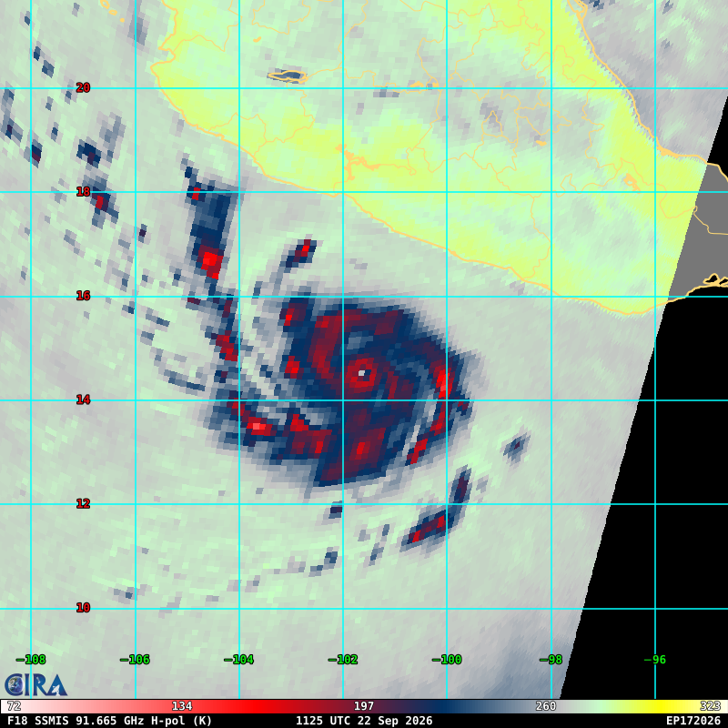
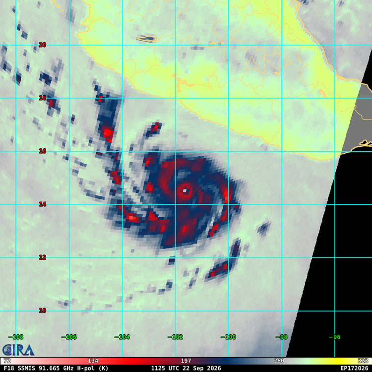
Looks good for today. But you will notice those are some intense outer bands. I'd say a concentric eyewall will most likely develop by tomorrow given that banding structure.
-
Yeah we had some big 32 degree snowstorms in 2015-2016. I know we’re in an east coast thread right now so even if the mean temp ends up higher than 97-98, it doesn’t mean the east coast can’t get a massive event with just enough cold air if the timing is right. This is what I mean by saying you can’t just look at 97-98 and say it’s going to be a duplicate winter and expect little to snow on the east coast because of it. Like I said, the atmosphere isn’t that simple.
-
 order ed meds online and affordable ed medication buy erectile dysfunction pills online http://www.allbeaches.net/goframe.cfm?site=http://edboldrix.com online ed prescription and http://georgiantheatre.ge/user/crofwdnacq/ ed prescriptions online [url=http://www.integralife.eu/redirect.php?&url=edboldrix.com]cheapest online ed treatment[/url] ed meds on line and [url=http://la-maison-des-amis.com/user/pqhltejxpw/]online ed prescription[/url] ed doctor online
 -
Always a great time when the ultimate snow weenie has thrown in the towel in September
-
Happy 1st day of Fall everyone! Fall is an amazing season in our region, soak it up and enjoy it!
-

October Comes Early: Late September Multi-Hazard Hybrid Storm
Masswx replied to WxWatcher007's topic in New England
Too bad -

October Comes Early: Late September Multi-Hazard Hybrid Storm
HIPPYVALLEY replied to WxWatcher007's topic in New England
Do you really want strong winds? I like having power on. My location is pretty windproof outside of sever weather anyway. -

October Comes Early: Late September Multi-Hazard Hybrid Storm
WxWatcher007 replied to WxWatcher007's topic in New England
It’s in the envelope of possibilities, but man, it’s really on an island right now. -
Not sure we're getting that ERC anytime soon after all
-
While milder than avg winter is a given (2 colder than avg winters followed by a strong El Nino, no way its not), snowfall and precip remains the wildcard. If I am not mistaken, your area got a lot of snow in 2015-16. That was a crazy year where snowfall ranged from slightly below avg in Detroit to slightly above in the northern burbs to well above in Flint. My first guess for Detroit for 2026-27 is 33". Im taking the middle ground of strong Nino snowfall and will adjust if anything becomes more clear once winter begins. EDIT- I thought this was the main thread, then realized it was the New England one lol. The wet signal in the east is crazy. Makes you think that well inland will really pile up the snow numbers by April even if there are a lot of mix events and not the best snowcover.
-

October Comes Early: Late September Multi-Hazard Hybrid Storm
Sey-Mour Snow replied to WxWatcher007's topic in New England
I like to compare 12z to 00z, Gfs is a bit east of 00z and less impactful, but well west of the 6z east outlier. All options still on the table. -

Central PA Summer 2026 Discussion/Obs Thread
mahantango#1 replied to Voyager's topic in Upstate New York/Pennsylvania
Someone needs to start the fall thread. It is fall after all. Where are all our pumpkin spice lovers at? -

Winter 2026-2027 Seasonal Outlook
WinstonSalemArlington replied to WinstonSalemArlington's topic in Southeastern States
Hmmm, that is interesting. I‘M using a pic hosting site that seems to work otherwise. -
Did we not work out something with Mexico with regard to potential threats? Granted, Polo likely avoids landfall, but it will pass close enough to cause problems (i.e. flooding). Not sure but it makes sense to just go ahead and do a mission for training and research purposes in a dead quiet hurricane season.