All Activity
- Past hour
-
So much whiskey that you probably fainted.
-
It could be that I’ve gotten into some whiskey this evening, but I can faintly see my breath outside.
-

2026-2027 Record-breaking El Nino
GaWx replied to Stormchaserchuck1's topic in Weather Forecasting and Discussion
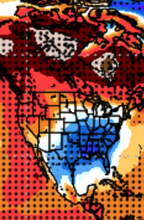
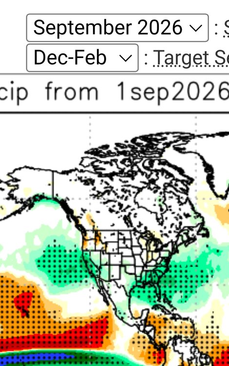
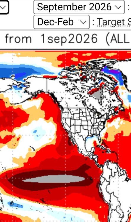
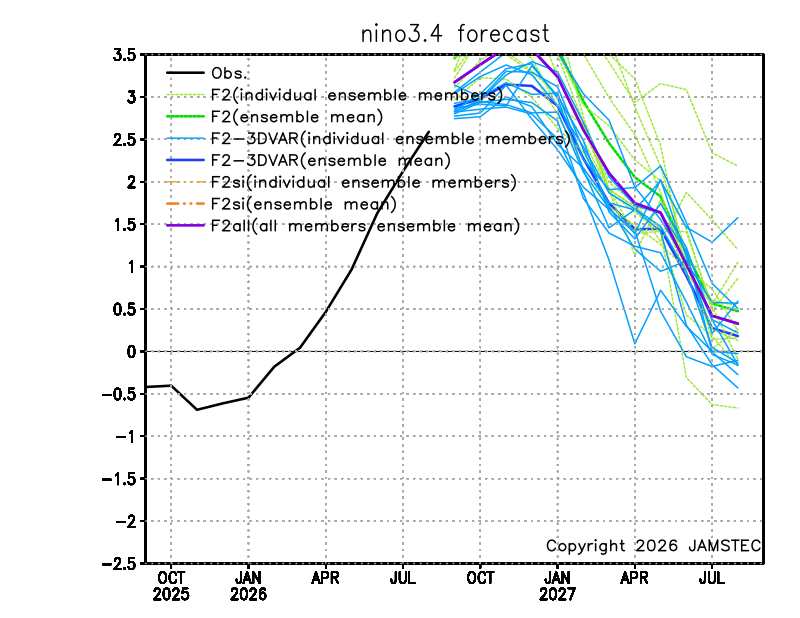
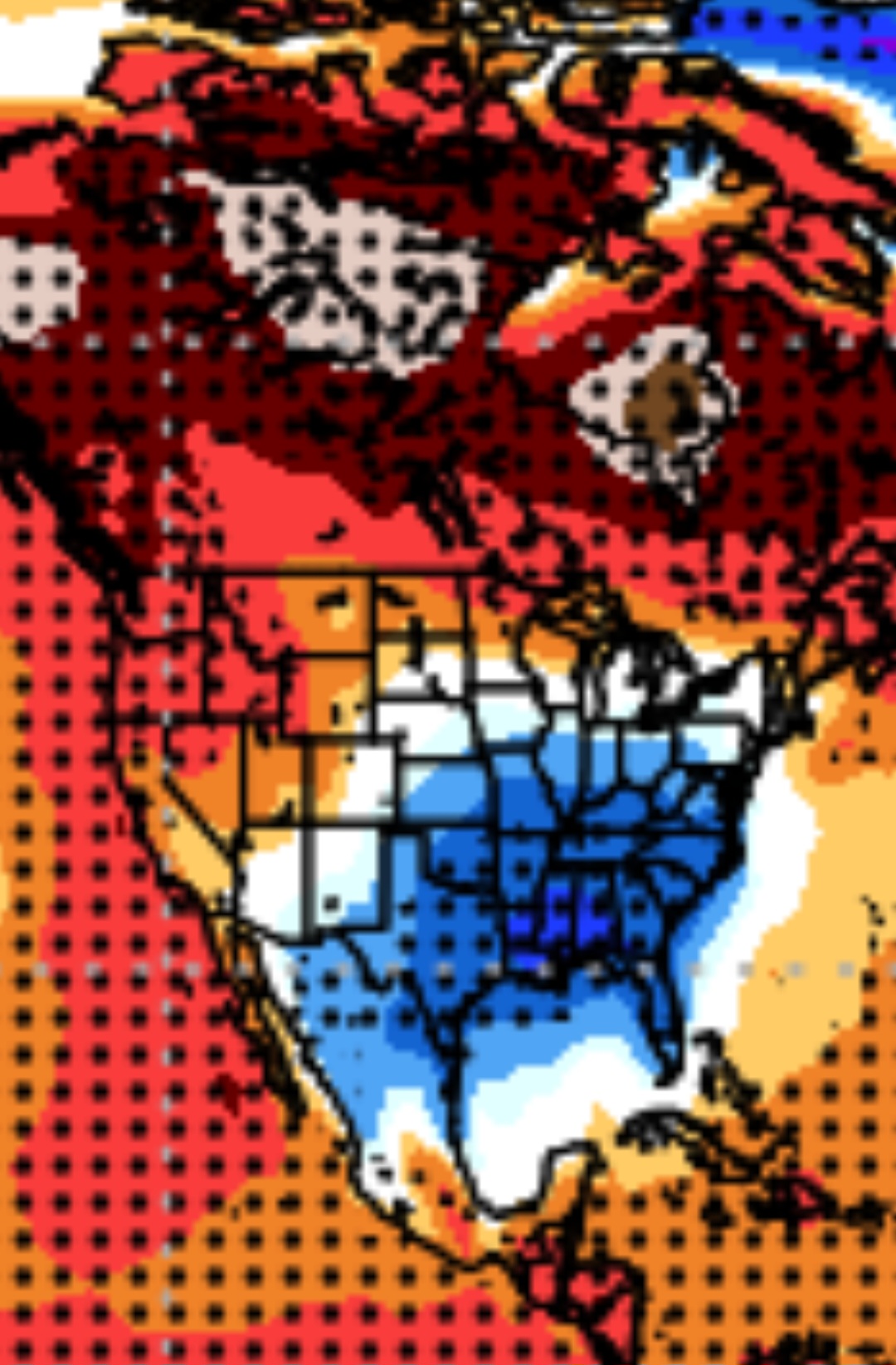
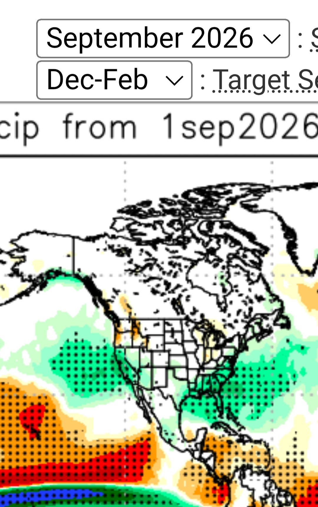
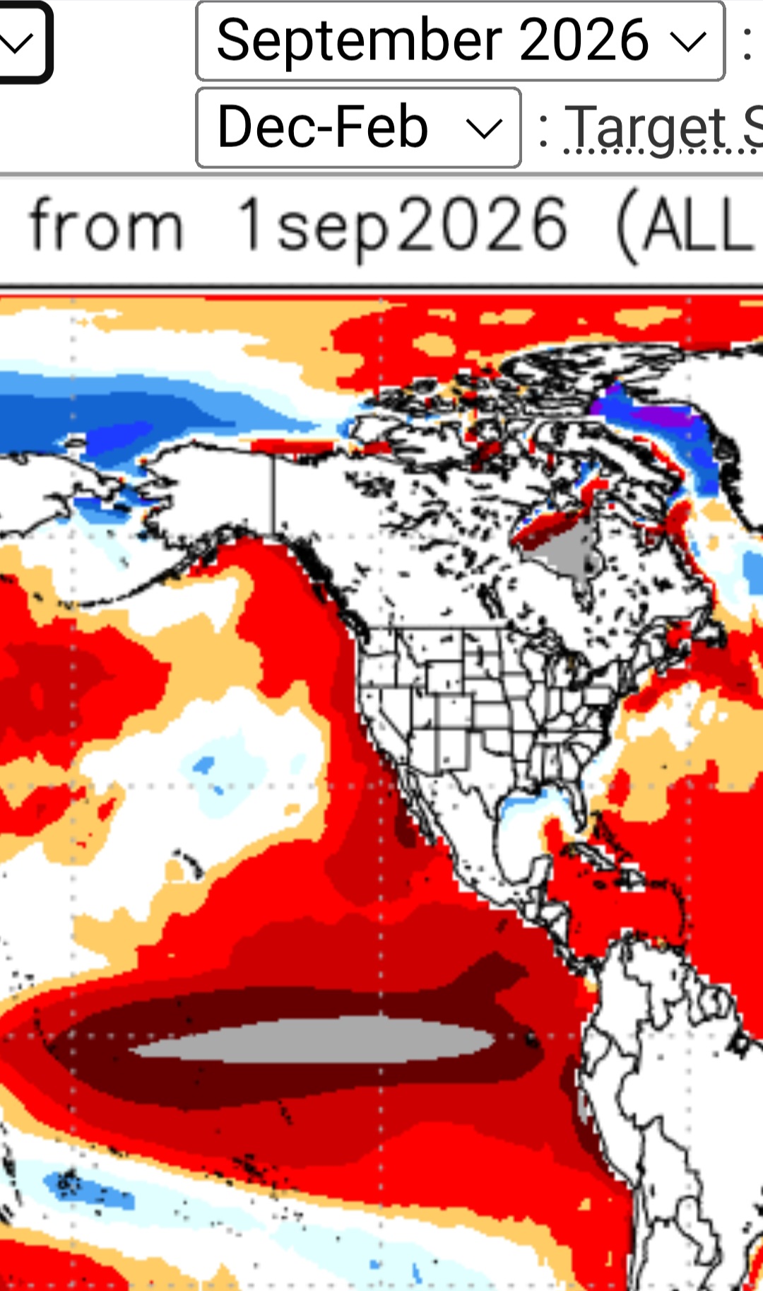
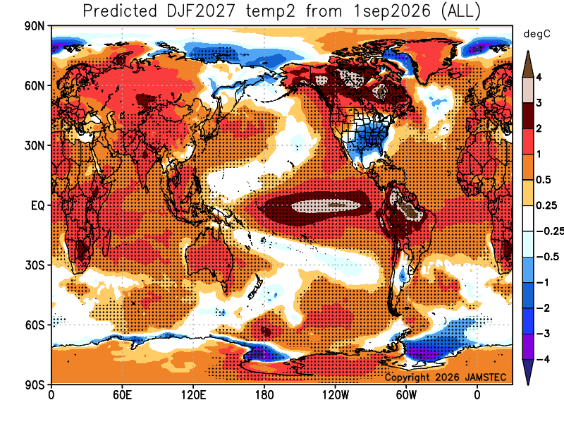
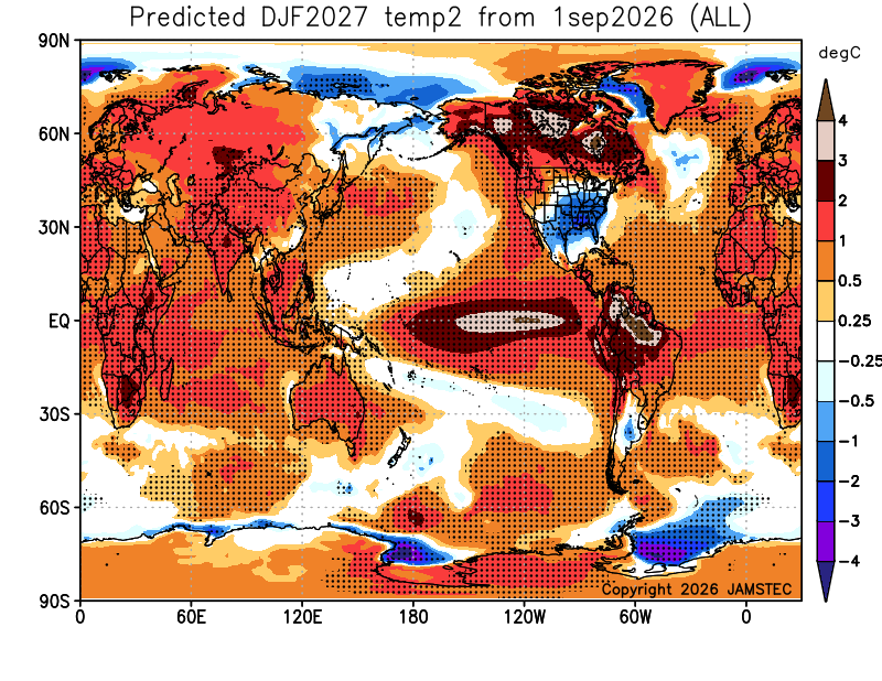
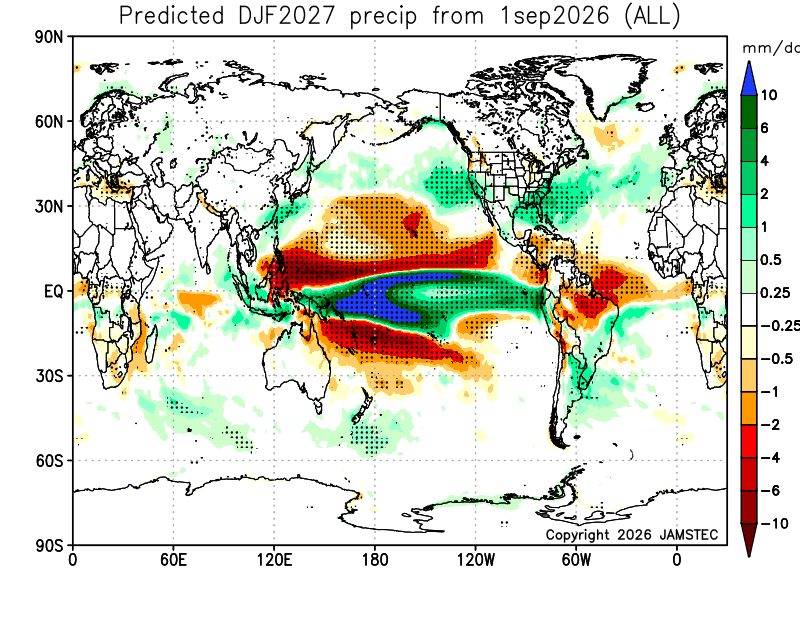
-Sep Jamstec winter forecasts going back to 2017-8 are available at the site to compare to -Sep ‘26 is vs all Sep forecasts back to ‘17 by a good margin the coldest DJF in the CONUS overall, by a very wide margin the coldest DJF in the E 1/2 overall, and is easily the coldest for the SE, midsouth, S Plains, Ohio Valley, and Mid-Atlantic. I couldn’t even find a colder one than this for the corridor from Chic to NYC. -Sep ‘26 is the wettest overall for the E US vs the other Sep DJF forecasts -June-Sep ‘26 are all very similar in the CONUS for DJF ‘26-7 and are the most consistent of any DJF forecasts back to 2017-8! Here’s the ‘23 Sep forecast for DJF for comparison (the 2nd coldest since ‘17): coldest is -0.5 to -1C: Compare that to ‘26: like night and day with coldest -2 to -3C! This would easily be the coldest winter for the SE, Mid-South, and S Plains since 2014-5: How did Sep JAMSTEC verify in the E US overall? ’17: too warm NE/close SE ’18: close NE/too cold SE ’19: too cold ’20: close NE/too warm SE ’21: N/A ’22: too cold ’23: too cold ’24: too warm ’25: too warm So, for these 8 winters, Jamstec: -in NE was too warm 3 times, too cold 3 times, and close twice…so neutral bias -in SE was too warm 3 times, too cold 4 times, and close once…so, very slight cold bias but pretty neutral overall -Keep in mind that this cold E US forecast is with Jamstec progging an E based super Nino.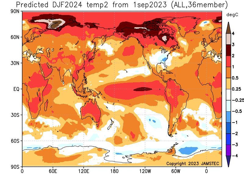
-
 http://indiagenericstore.shop/# online drugs
 -
Niiiiice, so you’re predicting a blizzard this year…
- Today
-
canada pharmacy world: canadian drugstore online :: reputable canadian pharmacy
-

Occasional Thoughts on Climate Change
stadiumwave replied to donsutherland1's topic in Climate Change
Blaming Trump for the El Nino is about as stupid as Trump taking credit for no hurricanes. Just stupid! If we went net zero 10 yrars ago we'd still have this Super El Nino. 10 years didn't do it. -
What if? Well...at least q-Schmegma loved your comment
-
Nice to see your fresh take on a new season.
-

Septorcher 2026 Discussion - Endless Summer
powderfreak replied to Damage In Tolland's topic in New England
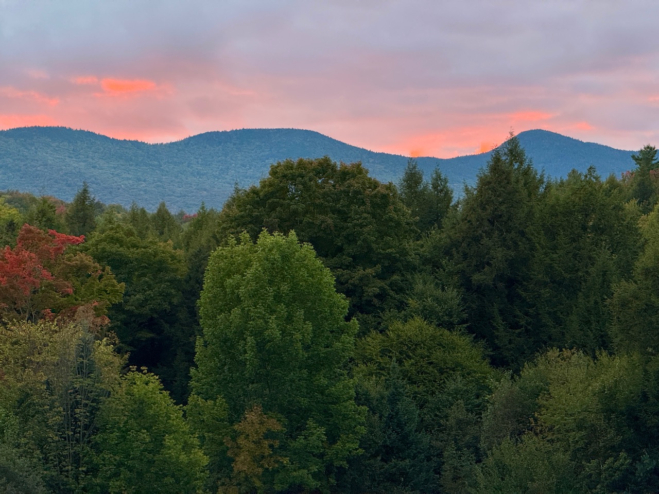
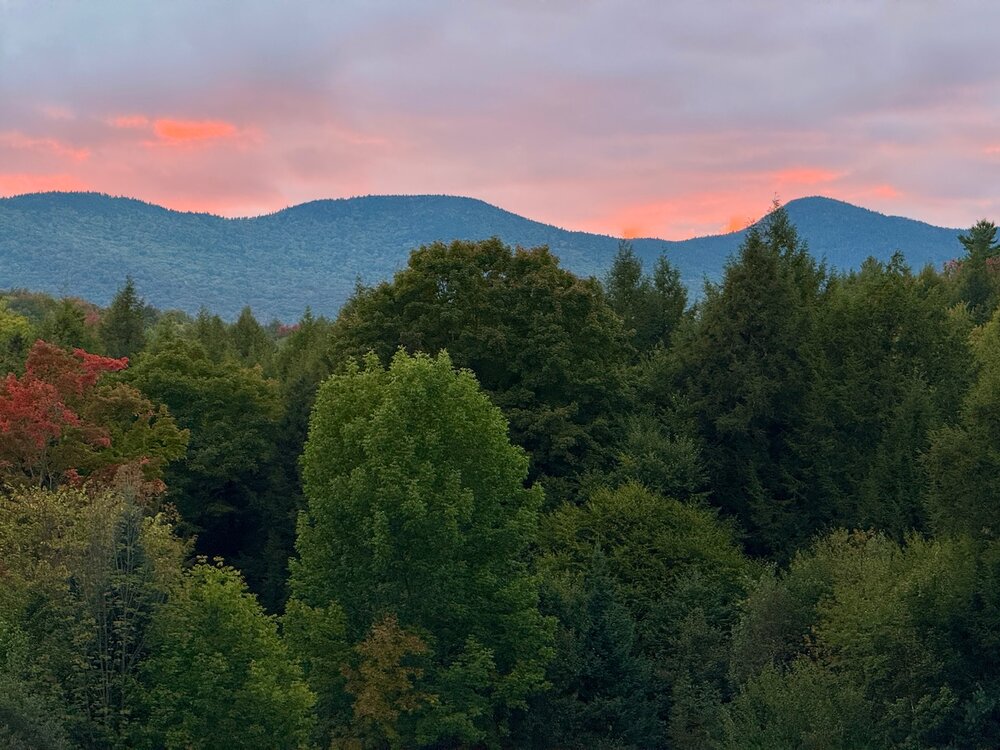
Nice evening up this way. Felt like fall today at the homestead.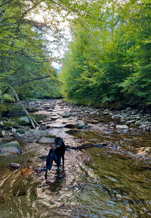
-

Septorcher 2026 Discussion - Endless Summer
CT Valley Snowman replied to Damage In Tolland's topic in New England
Down to 52. Gonna be a crisp morning. -

Septorcher 2026 Discussion - Endless Summer
HIPPYVALLEY replied to Damage In Tolland's topic in New England
It was pretty nice in Greenfield today. Full sun, mid 70s. A little bit too breezy to make temperatures optimal, but we take. -
My DP fell from 73 to 53 since midnight
-
Today's Highs: PHL: 78 New Brnswck: 77 BLM: 77 JFK: * 77 ACY: 77 EWR: 76 TEB: 75 LGA: 75 TTN: 75 NYC: 74 ISP: 73
-

Central PA Summer 2026 Discussion/Obs Thread
WmsptWx replied to Voyager's topic in Upstate New York/Pennsylvania
Dude. Your wife sucks lol. -

Septorcher 2026 Discussion - Endless Summer
CoastalWx replied to Damage In Tolland's topic in New England
COC is 80+. Not Chamber of Cold. -
Septorcher 2026 Discussion - Endless Summer
CoastalWx replied to Damage In Tolland's topic in New England
Far from it -

2026-2027 Record-breaking El Nino
mitchnick replied to Stormchaserchuck1's topic in Weather Forecasting and Discussion
September Jamstec. It may not get the forecast right, but it'll at least get you to make an optometrist appointment.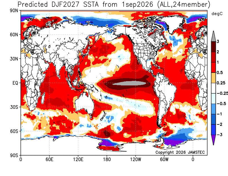
-

Septorcher 2026 Discussion - Endless Summer
40/70 Benchmark replied to Damage In Tolland's topic in New England
It's on the Ambient Network...not sure how to link it. -

Occasional Thoughts on Climate Change
Typhoon Tip replied to donsutherland1's topic in Climate Change
You didn’t ask me, but it was most likely related to the IA circum-global teleconnector -
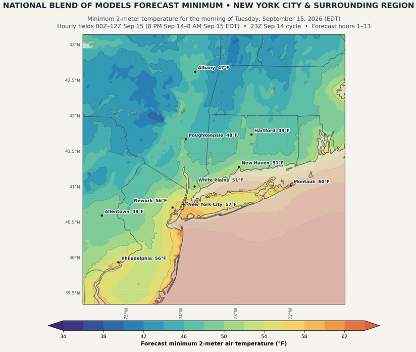
The New York City area will see its first lows in the 50s this season tomorrow morning.
-
More likely warm and sunny.
-
Chilly, wet day with highs around 60(briefly) in town, 50's inland with ~1/2" of rain. More like Oct wx today. Brr!
-
The coolest air mass is continuing to push into the region. Highs tomorrow and Wednesday will reach the lower and middle 70s. New York City will see lows in the upper 50s to lower 60s. As a result, Central Park will experience its first reading below 60° this season tomorrow morning. the timing matches well with the last two El Niño events: 2015-2016: September 14 and 2023-2024: September 15. Wednesday through Friday will see temperatures recover mainly to the upper 70s. However, additional cool air will likely arrive some time during the next weekend. The ENSO Region 1+2 anomaly was +4.5°C and the Region 3.4 anomaly was +2.9°C for the week centered around September 9. For the past six weeks, the ENSO Region 1+2 anomaly has averaged +4.23°C and the ENSO Region 3.4 anomaly has averaged +2.65°C. The ongoing strong El Niño, will continue to strengthen through the mid-fall. The SOI was -25.91 today. The preliminary Arctic Oscillation (AO) was +1.373 today. Based on sensitivity analysis applied to the latest guidance, there is an implied near 54% probability that New York City will have a warmer than normal September (1991-2020 normal). September will likely finish with a mean temperature near 69.4° (0.2° above normal). Supplemental Information: The projected mean would be 1.4° above the 1981-2010 normal monthly value.
-
JAMSTEC Updated 2m Temp Precip SST