All Activity
- Past hour
-
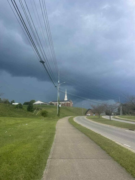
That severe line that moved through Johnson City. Sent from my SM-G998U using Tapatalk
-
Saturday would be a SLGT on the NAM Nest, with even some potential for supercells. But the forecast dew points may be too high, and the occurrence/location of a mesolow is of course in doubt at this range.
-
Cold ENSO 3.4 and warm ENSO 1+2 is still a La Niña, just a different kind of La Niña (modoki La Niña). At times it didn’t behave like a La Niña, but that is more because it was so weak than what ENSO 1+2 was doing. In Feb though the storm track was consistent with a modoki event. In modoki events storms tend to take more of a northern track, which is why they are unfavorable for big snows outside of NNE. There was a lot of low level cold though, so it got icy.
-
some of our better forecasters starting to get bullish on severe possibilities out here on Saturday
-
Look I apologize for posting this stuff in the modeling long range thread. But I need a real meteorologist like Millville Wx to explain this nomenclature to me. My fields are software engineering and AI engineering, not these apparently statistical terms. This paragraph is from today's AFD for AUS. The rainy and cloudy weather will support cooler temperatures beginning this weekend. With a thermal trough in our area during this period, showers and storms could be more effective at producing rain-cooled air. The approaching front may also contribute some cooler air depending how far south it gets, though given the time of year, most of the cooler temperatures will probably be rain and cloud driven. This introduces significant uncertainty in temperatures as illustrated by 7 to 10 degree interquartile ranges in NBM QMD maximum temperatures on Sunday and Monday. Given the large uncertainties, the current temperature forecast is aligned with the NBM, featuring highs in the 80s to low 90s Sunday and Monday before gradually warming back up into midweek after the active weather pattern passes. What I would like a meteorologist to do for me here is to please explain to me in 4th grade terms, what interquartile means. This stuff is WAY above my paygrade as well as centuries above my IQ level too. lmao Thanks in advance, I am sorry for posting this in the long range thread BUT I need a real Met to try and explain this term to me.
-
We have seen significant cooling in the ENSO 3.4 region in the past month, it is already down to -0.8 on the daily, and -0.4 on the weeklies. When taking into account the current guidance and historical precedence (the last 3 strong El Niños were immediately followed by multi year La Niñas), it is the logical conclusion to make. So I would disagree that people are jumping the gun about the ENSO state for this winter. The big question is will the La Niña be east based, basin wide, or a modoki event. Right now guidance is favoring an east based event.
-
No surprise, but the HRRR is a bit too dry at the surface today. 16z wants to mix DC out to DPs in the 53-54 range. Seriously doubt that.
-
Rain!!!!!
-
Saturday I’ll be at Thunder Over New Hampshire and it looks like it’s going to be as toasty as it was last time. Because we’re part of the STEM exhibit, it’ll also be a long day. I hope any storms don’t impact the flights; people will have been waiting hours in the sun.
-
Well we got our half day of beautiful weather up here. I will say, though, radar looks unusually good for the Frederick precip shadow locales.
-
absolutely pouring—finally some rain.
-
Picked up .20” off this storm. First rain we had in awhile.
-
Picked up .95 today so far, one severe warned storm but the wording at the bottom said "tornado possible" with it.
-
LOL, didn't even hit 0.01 in the gauge..... we shall see if the stuff to the SW holds together in about 45-60 minutes.
-

Occasional Thoughts on Climate Change
donsutherland1 replied to donsutherland1's topic in Climate Change
From a scientific standpoint, such insight would be valuable. However, IMO, from a policy standpoint, it would be unlikely to matter much. Society has effectively chosen to stay the course. It has chosen to continue to rapaciously burn fossil fuels unleashing gigatons of CO2 into the atmosphere and kicking off a range of feedbacks. Neither the promise of cheaper, cleaner alternatives nor the staggering $7 trillion in annual fossil fuel subsidies has shifted policymakers’ calculus. Instead, emboldened by the applause of a loud minority of bad actors, they have doubled down on their intransigence. In the U.S., there is even a neo-Luddite effort underway to roll back progress on cleaner alternatives, amidst what appears to be a broad and accelerating split with science far beyond climate science. Although these policymakers seem to believe that their unyielding defense of fossil fuels will grant them immunity from the laws of physics, it won't. The laws of physics are not negotiable. Those laws will prevail regardless of human arrogance or ignorance. For scientists, there may be some comfort in knowing that their warnings were grounded in well-tested and well-proven principles. After all, well-understood laws played out exactly as they were understood. From a knowledge standpoint, that's a very good thing. In short, generations of scientists did their job. They did it well and they did it courageously. Full responsibility for the consequences will fall squarely on those who knowingly chose to maintain their unsustainable path in the face of clear warnings and insurmountable evidence. They will be the authors of a sea-level rise that could swallow tens of trillions of dollars of coastal land. They will be the ones who made that wholly avoidable outcome possible. Unlike the rapid sea-level rise around 8,000 BCE when prehistoric humans had no understanding of the forces at work, the ongoing rise during the 21st century and beyond will not be the result of uncontrollable or unknown circumstances. It will be the outcome of deliberate choice with complete knowledge of the consequences of that choice. -
Tornado warning posted for Oak Ridge and Oliver springs. Box is heading eastward.
- Today
-

September 2025 OBS-Discussion centered NYC subforum
SACRUS replied to wdrag's topic in New York City Metro
Records: Highs EWR: 95 (2018) NYC: 97 (1929) LGA: 93 (2018) JFK: 93 (2018) Lows: EWR: 52 (1997) NYC: 47 (1883) LGA: 64 (1997) JFK: 53 (1997) Historical: 1766: A hurricane made landfall at modern-day Galveston, Texas. The following is from David Roth of the Weather Prediction Center. “A mission, named San Augustine de Ahumado was located in what is nowadays known as Chambers County. This mission was destroyed and subsequently abandoned. A seven-foot storm surge put the area under water. A richly-laden treasure fleet of 5 galleons en route from Vera Cruz to Havana was driven ashore and had to wait many weeks for assistance to come. La Caraqueña wrecked on Galveston Island while El Nuevo de Constante sank along the western Louisiana coast. Fortunately, much of the treasure and people aboard were saved.” 1939 - A thunderstorm deluged Washington D.C. with 4.4 inches of rain in two hours. September of that year was very dry across much of the nation, and Washington D.C. received more rain in that two hour period than most other places in the country that entire month. (David Ludlum) 1941: A violent tornado ripped through Northeast and North Minneapolis shortly afternoon on this day. The hardest-hit location was the Soo Line Railroad’s Shoreham Yards where four people died, and at least 50 were injured. The death toll at Soo Line could have been higher, but the tornado struck five minutes after the lunch bell went off, meaning 100 men left the shops. 1945: Record heat blasted parts of the Southwest into the Plains. The high of 108° established the record high for the month of September at Liberal, KS. Other daily records included: Yuma, AZ: 116°, Phoenix, AZ: 112°, Las Vegas, NV: 109°, Tucson, AZ: 106 °F. (Ref. Wilson Wx. History) 1965: Hurricane Betsy stalled 350 miles east of Jacksonville, FL just before the busy Labor Day holiday weekend, causing major headaches for weather forecasters. (Ref. AccWeather Weather History) 1970 - The greatest natural disaster of record for Arizona occurred. Unprecedented rains caused rivers in central Arizona to rise five to ten feet per hour, sweeping cars and buildings as far as 30 to 40 miles downstream. Flooding claimed the lives of 23 persons, mainly campers, and caused millions of dollars damage. Water crested 36 feet above normal near Sunflower AZ. Workman's Creek was deluged with 11.40 inches of rain in 24 hours to establish a state record. Moisture from Pacific Tropical Storm Norma led to the severe flooding. (4th-6th) (The Weather Channel) 1983: Record heat occurred across parts of the Midwest and Plains ahead of a strong cold front. Record highs included: El Paso, TX: 101°, Roswell, NM: 100°-Tied, Chicago, IL: 95 °F -Tied. (Ref. Wilson Wx. History) 1986 - An unusually strong dust devil moved across the Flagstaff Pulliam Airport. The dust devil blew open the doors of the National Weather Service office scattering papers and bringing down a ceiling-mounted light fixture. (Storm Data) 1987 - Thunderstorms developing along a stationary front produced heavy rain across the Southern Atlantic Coast States. Up to eight inches was reported north of Charleston SC. Serious flooding was reported in Monks Corner SC. Seven cities in the northeastern U.S. reported record low temperatures for the date. Houlton ME dipped to 32 degrees. (The National Weather Summary) (Storm Data) 1988 - The western U.S. experienced another day of record heat. The afternoon high of 91 degrees at Stampede Pass WA established an all-time record for that location, and Los Angeles CA equalled their all-time record high with a reading of 110 degrees. A record high of 107 degrees at San Diego CA was their hottest reading in 25 years. Red Bluff CA was the hot spot in the nation with an afternoon reading of 118 degrees. (National Weather Summary) 1989 - Overnight thunderstorm rains of four and a half to seven inches drenched eastern Nebraska during the morning hours, pushing creeks out of their banks, and flooding fields, country roads and city streets. Totals ranged up to 6.97 inches south of Creston. It was also a soggy Labor Day for northern Florida. Jacksonville reported 6.82 inches of rain, and evening thunderstorms produced 2.75 inches of rain in one hour at Sandlewood. (Storm Data) (The National Weather Summary) 1996: Hurricane Fran reached peak strength of 120 mph 275 miles off the east coast of Florida. The Space Shuttle Atlantis had to be rolled back from its launch pad at Cape Canaveral as the storm threatened the east coast of Florida. The storm would make landfall the following evening on the North Carolina coast to become the most damaging hurricane of the 1996 Atlantic season. (Ref. AccWeather Weather History) 1998: Scottsbluff, NE equaled their warmest September temperature with a high of 102°. Other record highs included: Fort Smith, AR: 109°, Dallas, TX: 108°, Dallas (DFW), TX: 108°, Wichita Falls, TX: 108°, Oklahoma City, OK: 107°, Tulsa, OK: 107°, Waco, TX: 106° and Austin (Camp Mabry), TX: 101°. (Ref. Wilson Wx. History) 2000: Houston and College Station, Texas recorded their hottest day on record when highs reached 109° and 112° respectively. Houston has tied their record on August 27th, 2011. Other daily record highs included: Wichita Falls, TX: 111°, Waco, TX: 111°, Dallas, (DFW), TX: 111°, Austin, (Bergstrom), TX: 110°, Austin (Camp Mabry), TX: 110°, Dallas, TX: 110°, Victoria, TX: 110°, San Antonio, TX: 109°, Shreveport, LA: 108°, Corpus Christi, TX: 107 °F. 2006: A slow moving low pressure system triggered scattered thunderstorms across northern Illinois during the afternoon. A series of slow moving storms moved into and sat over the east side of Rockford. As much as 5 to 10 inches of rain fell in a localized area, while less than 3/4 inch fell nearby at the airport. Damage was estimated around $20 million dollars. (Ref. Wilson Wx. History) 2007: Hurricane Felix came ashore in the pre-dawn hours as a Category 5 storm on the northeastern coast of Nicaragua. At the time of its landfall, the maximum sustained surface winds were approximately 160 mph. Felix killed at least 130 people along the coast, with damage in Nicaragua totaling $46.7 million. 2008: The remnants of Hurricane Gustav brought heavy rains to southern Lower Michigan. Muskegon set a daily rainfall record of 3.25 inches and Grand Rapids sets a record with 2.82 inches. (Ref. Wilson Wx. History) 2011: The center of Tropical Storm Lee moved ashore around sunrise. However, it would be a while before Lee would weaken to a depression as it remained nearly stationary while the southern half of the circulation was over water where it could continue to derive additional energy from the warm ocean. Lee brought torrential rains to Louisiana, Mississippi, and Alabama. 2016: An EF1 tornado developed in the open country area north of Merna, Wyoming. The tornado caused tree damage along its 2.45-mile path. At its widest, the tornado produced sporadic tree damage approximately 300 yards across. The trees fell on some fence line but otherwise caused no property damage. -
Just got wollloped with a windy rainstorm out here in Lock Haven...lol
-

2025 Atlantic Hurricane Season
BarryStantonGBP replied to BarryStantonGBP's topic in Tropical Headquarters
-
Kind of what I'm thinking but until we actually get a center to pop this is all kind of minute anyways but these shifts south with the wave are noteworthy. I wonder if the modeled size being so small is a factor in this too
-
That Saturday line is tasty.
-
September 2025 OBS-Discussion centered NYC subforum
SACRUS replied to wdrag's topic in New York City Metro
82 / 56 - warmest day in a while and tomorrow and Saturday (pending on clouds) the warmest since Aug 17th. Scattered showers/storms Fri / Say s front clears. Overall warmer - onshore will keep any chance for heat at bay much of the first part of next week with ridge north again. -
Might pull a 00z euro.
-
Eh. The question moreso is why the qpf output on the GFS is so paltry. Everything else on the same run/model points to a good soaking. GFS is selling well on another bone dry day today but dews really spike throughout the day tomorrow into Saturday. Your bias will change probably when the swamp azz returns…
-

September 2025 OBS-Discussion centered NYC subforum
steve392 replied to wdrag's topic in New York City Metro
When my dog runs around the backyard it's like watching a horse run through the wild west with all the dust and dead grass getting kicked up lol


