All Activity
- Past hour
-

E PA/NJ/DE Summer 2026 Obs/Discussion
Hurricane Agnes replied to PhiEaglesfan712's topic in Philadelphia Region
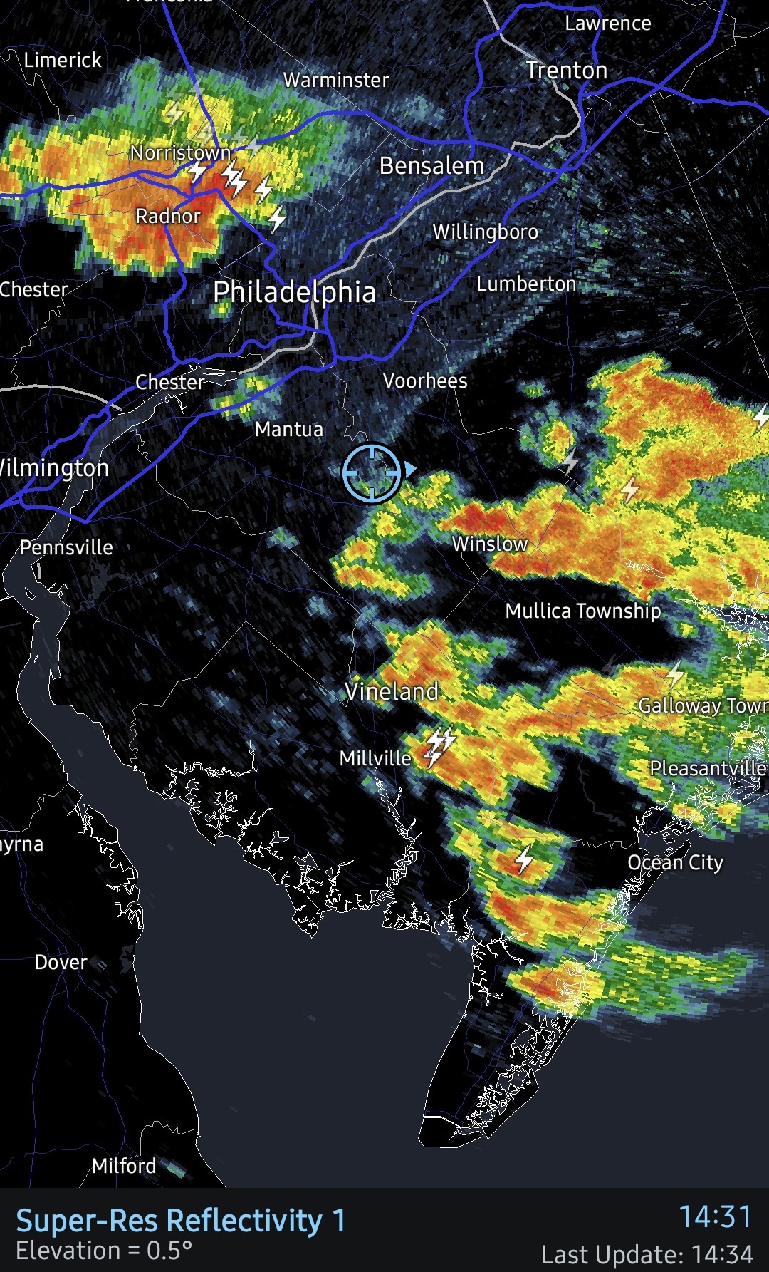
Under a red blob but just getting tupjca thunderstorm rain. My sister whose flight to FL was already 90 minutes late (due to overbooking), finally got off the ground about 45 minutes ago as the storm cells were approaching. Currently have 0.06"with temp 75, dp 73. -

E PA/NJ/DE Summer 2026 Obs/Discussion
BBasile replied to PhiEaglesfan712's topic in Philadelphia Region
Been living on the edge of this rain for a couple hours. A few drops have been falling periodically. Gust front is approaching now. Hopefully that triggers some more activity. 0.02" this far.
-
K1L8 - Hurricane UT K68S - Davenport WA KE35 - Fabens TX KNWL - Corpus Christi/Waldron NOLF US TX KRIF - Richfield UT
-
Wonder when the STW will go up today?
-

E PA/NJ/DE Summer 2026 Obs/Discussion
JTA66 replied to PhiEaglesfan712's topic in Philadelphia Region
0.50” in the bucket. -

2026-2027 Super El Nino
PhiEaglesfan712 replied to Stormchaserchuck1's topic in Weather Forecasting and Discussion
All I know is that if we get a 5.0 and the PDO stays negative, then we're likely in a permanent -PDO. -
Definitely wasn't expecting that much
- Today
-

2026-2027 Super El Nino
snowman19 replied to Stormchaserchuck1's topic in Weather Forecasting and Discussion
Here comes another DWKW ”40 knot westerly wind anomalies potentially emerging right over the warmest water east of the dateline. The synoptic elements are too small scale to be accurately predicted here. What it's indicating is enhanced risk of seasonally extreme equatorial westerlies through the middle and into the end of July.” -
Have a great time!
-

2026-2027 Super El Nino
Keith Central PA replied to Stormchaserchuck1's topic in Weather Forecasting and Discussion
How do we know that a 5.0 would act differently than a 2.5?.. more flooding in California?..All Super el nino's have done is give warm weather through most of the country for the winter and more rains in the southwest. Somehow that doesn't seem like a big deal, or maybe I'm missing something. This has really been hyped by social media. -
 How could I forget ‘55! No doubt. I just thought their average highs would be much lower. Of course Denver isn’t feeling like South Beach on July 10…That would be rough lol though I wonder if they’d take that over wildfire risk.
 -
Just got a quick .15" here in a 5 minute downpour
-
I'm in Piscataway but near the border of South Plainfield. Those heaviest red radar echoes went right over me. It was a quick half inch.
-
Yesterday hit 99 at 4pm, 0.19" of rain.
-
 Two rain events sandwiched around a Steinmmer the rest of the time. Mem Day and the days after the 4th only real rains . Next one probably Labor Day
 -
E PA/NJ/DE Summer 2026 Obs/Discussion
JTA66 replied to PhiEaglesfan712's topic in Philadelphia Region
Getting a good downpour. Glad the NAM and HRRR sniffed it out. 77F/DP 74F -
That HoCo/MoCo border area getting it again
-
clearing is headed this way for mid - late afternoon - temps will rebound to close to 80 or above in some areas but high humidity for awhile
-
If you get enough sun in between, I've experience double the fun before. What I miss are those nights where you get storm after storm. It seems like it thunders all night long. Best sleep ever.
-

Central PA Summer 2026 Discussion/Obs Thread
Storm Clouds replied to Voyager's topic in Upstate New York/Pennsylvania
Sorry about your bad experience! Mine was put to the test yesterday with that batch of storms that moved through. Even though I wasn’t home, I was getting plenty of lightning alerts and rain start notification. I have the Nearcast rain feature turned off to make sure I get the raw rainfall amount recorded for my backyard. It recorded .11 which correlates well with two other nearby stations…one recorded .12 and the other .15. So far so good! -
Heading to you're area in a few for a grad party. Hope it stops soon for it.
-
I remember feeling a little off the rest of the day after riding the ferry. If you’re anything like me, take a Dramamine.
-
Dropped .80” in Morristown - wasn’t expecting anything but will definitely take the moisture.
-
It always worries me when I get a pop up storm right over me this early in the day. It makes me feel like I’ll miss out on all the good stuff later.
-
Same. I'm still waiting to mow my lawn for the first time this year. Just random patches of green weed in a sea of brown.