All Activity
- Past hour
-

December 2025 regional war/obs/disco thread
Snowcrazed71 replied to Torch Tiger's topic in New England
But you said north of the pike, and then one of your other posts... You specifically said thie Tuesday event is only good for NNE. Listen... Yes, it sucks to not get that Wintry weather around the holidays. But, you also live in a region that unfortunately has the kind of Climo that doesn't support many Snow events before January. Hold out a little bit longer and I truly feel you will do better for January and February. -
73mph Duxbury
-
Some light front end stuff has been shown for the storm that’ll roll through then. Accumulations doubtful.
-
Don't forget the ongoing meta analysis of the emotional rollercoastering. Also the trolling to mock and/or incite the emotional rollercoastering. And ofc the extra-meta posts like this one
-
I feel like that happened in our childhood (not sure if you’re my dad’s age or mine), and now it’s either rose-colored glasses, denial, more propensity of it to occur because of the background conditions, or a combination of all three. I feel like we all think everything was always like the cover of the Time Life Treasury of Christmas CD that used to be hawked on TWC thirty years ago. .
-
Should pick up significantly in the afternoon and evening.
-
I’m not sure why LWX added a 40% chance of snow Monday night into Tuesday in my forecast today? Is any model even showing snow in this time frame?
-
Glad he's ok.
-
Very windy here but mostly in gusts-not really sustained.
-
Also the AIGFS had a similar solution. It actually kept the storm under us and there’s a nice coastal but base state is still too warm, probably would be a mixy messy thing.
-
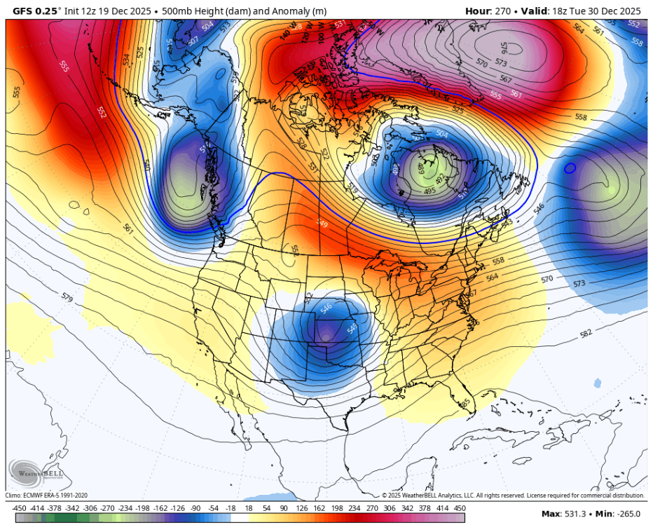
The mechanism to build continental cold is alive and well. We don't need cross polar flow or arctic express stuff for snowfall. All we need is Canada to produce high pressure in the lee of the rockies. Where we get into serious trouble is when the trop PV is pushed over on the other side of the pole and Canada is flooded with Pac maritime air. Which has happened multiple times in the last handful of years. Right now the only serious problem is a persistent trough in the PacNW pumping up heights/ridging downstream in the conus. This bottles up cold high pressure to the north and storm track well to our NW. It's a crap pattern for snowfall here but it's also only one roll forward or retro move away from things being conducive for cold and/or snow possibilities becoming less hostile. For the time being it's a sit on your hands period and wait and see. It's not a multi step process to be back in the game. It's really just one step.
-
-
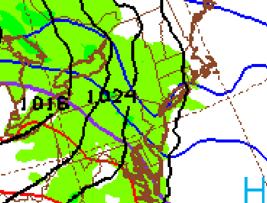
Most models have a light overrunning signal for Tuesday December 23rd for N NJ/NYC/S NY State/CT. New GFS signals a chance for 1" - 3" for most of the subforum.
-
Son in law stuck between 2 trees and wires in Thompson. Got blocked by front tree, turned around, 2nd tree fell in front again. Lucky fella
-
Yeah strikingly similar to yesterday’s 06z but we just don’t have the Atlantic side of things as buttoned up as we did on that run. High was 10-15 hPa weaker. Need to get a good traffic jam going, and then the general shortwave progression (strong sw, perhaps big cutoff rolling through the southwest and central US) would have ended much better this time.
-
this isn’t like the old days where you went up to 44 with rain. 60F nothing sticking around. We cut nowadays it turns into April
-
Sorry to hear you moved. Clinton Rain band?
-
Massive gusts around 11 am here in Clinton. New to the shoreline and holy crap does it howl. Power is out
-
Temp down 5 degrees from earlier high. Now 47.6
-
Martinsburg gusted to 59.
-
shortwave was in a decent spot but there's this weird blue blob under the NAO which kinda screws up things
-
56kts Logan. Definitely had some near 60 here
-

E PA/NJ/DE Winter 2025-26 Obs/Discussion
RedSky replied to LVblizzard's topic in Philadelphia Region
It sounded like a hurricane kept waking me up -

December 2025 regional war/obs/disco thread
weathafella replied to Torch Tiger's topic in New England
The problem is that the next 1-2 weeks feature opportunities only when northern stream systems pass south of us bringing enough of the Canadian icebox to snow on SNE. Then said systems blow up in the Atlantic but don’t curl up closing the door on the cold and allowing warmth to return in relatively short order. I did see improvements in the 11-15 on last night’s eps so January should offer hope of it holds. -
Too warm as in marginally or too warm as in "the only 20s on the map are the amount of degrees above normal it is"?


