All Activity
- Past hour
-
And this is before the Big Beautiful Front comes through tomorrow! This morning, GSO is at 64 with a 62 dewpoint, after a high of 79 yesterday. This is going to be a wonderful last week of August!
-
And save money on A/C. Pull them out of the windows and open up.
-
Just Stein and droughts and burning and wells drying, . Take dews away.. take rain away
-
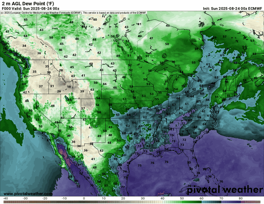
Keep in mind that those probability maps don't predict actual temps, just the likelihood of above or below normal. The Euro weeklies, of course, do...for what they're worth since they change every day. Lol https://charts.ecmwf.int/products/extended-anomaly-2t?base_time=202508230000&projection=opencharts_north_america&valid_time=202509010000
-
COC k s on fire
-
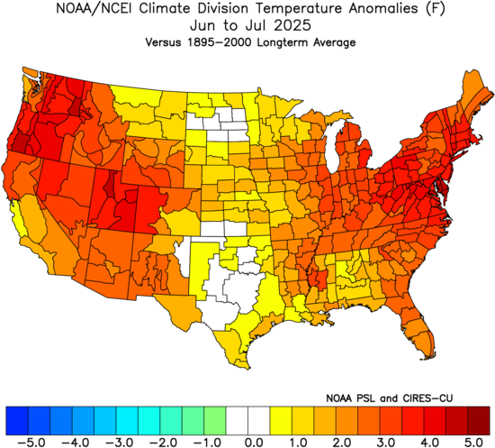
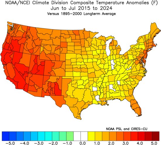
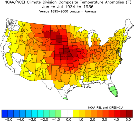
Yeah, this has been the opposite of the Dust Bowl pattern over the last decade. Record summer warmth in the West and East with less warm over the middle section of the CONUS. The Dust Bowl pattern had the record summer heat in the middle and cooler along both coasts.
-
Consistently more humid up near Hudson Bay than New England.
-
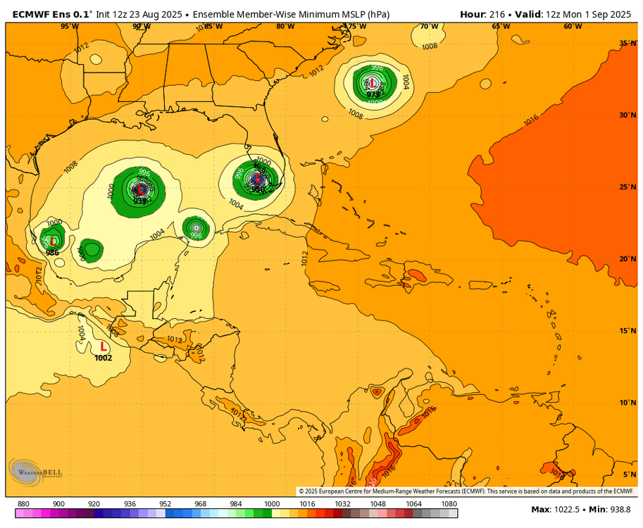
However, the 0Z Euro ens wasn’t nearly as active as the 12Z EE. The 6Z GEFS by my eyeballing has 5 (17%) TS+ members. So, not dead by any means but not all that active either.
-
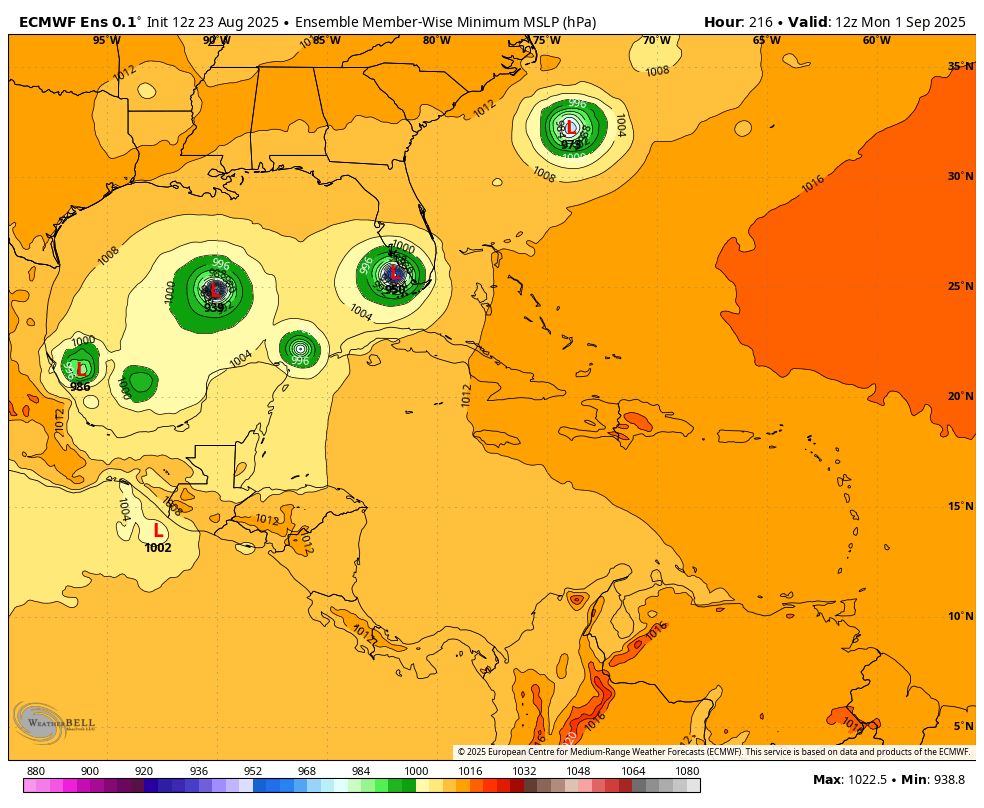
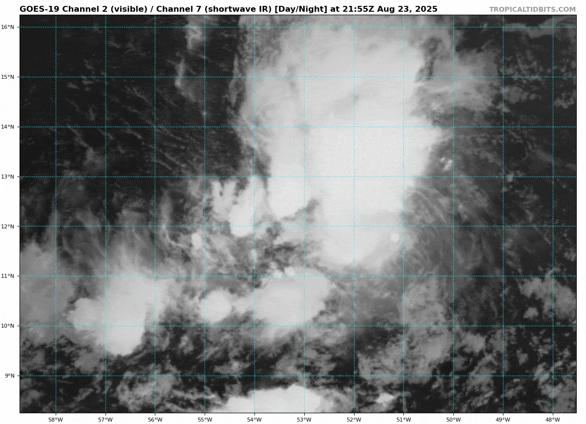
Literally no one talking about 99L. Lol
-
Shut your mouth. lol Yes, we will pay[emoji3517] .
-
It’s over. The really soupy stuff has been shunted south for awhile now. Next 15 days it can’t even escape the gulf coast.
-
You'll get a little but it won't be long-lived.
- Today
-
Surprise little shower line coming in. Had to rush out and cover the deck furniture. Had not used it for awhile but yesterday was glorious.
-
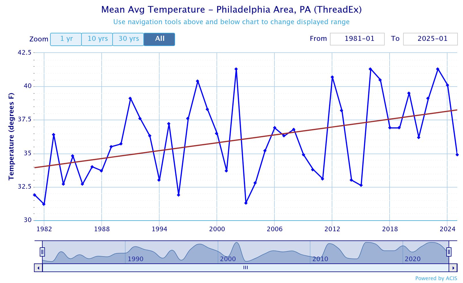
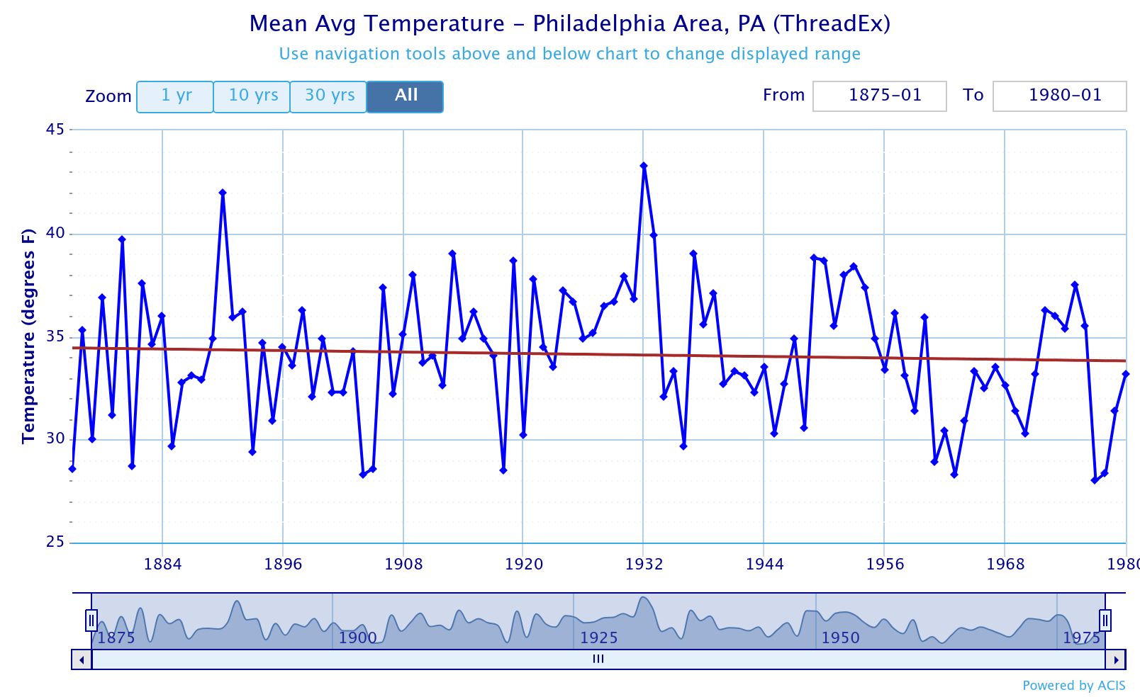
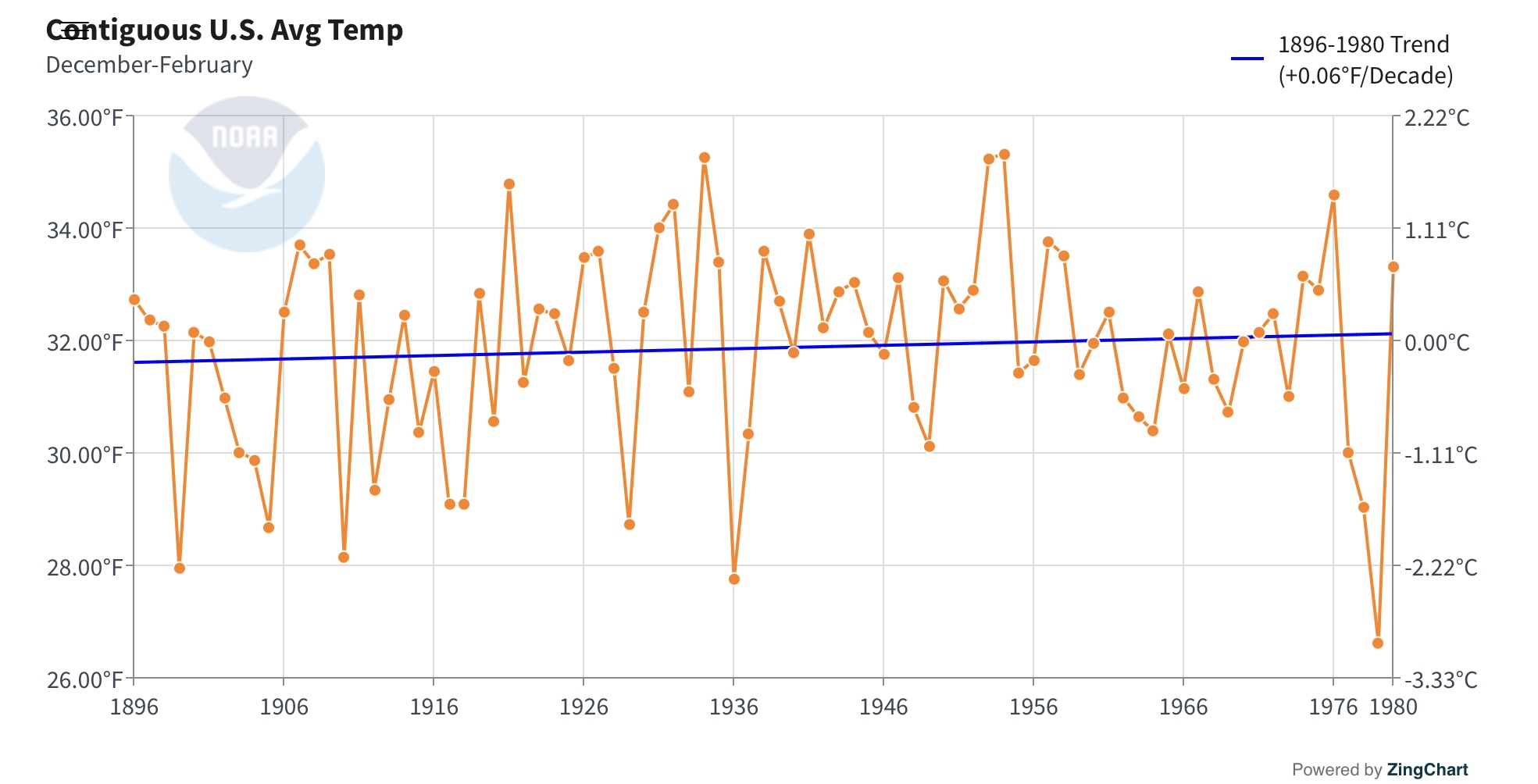
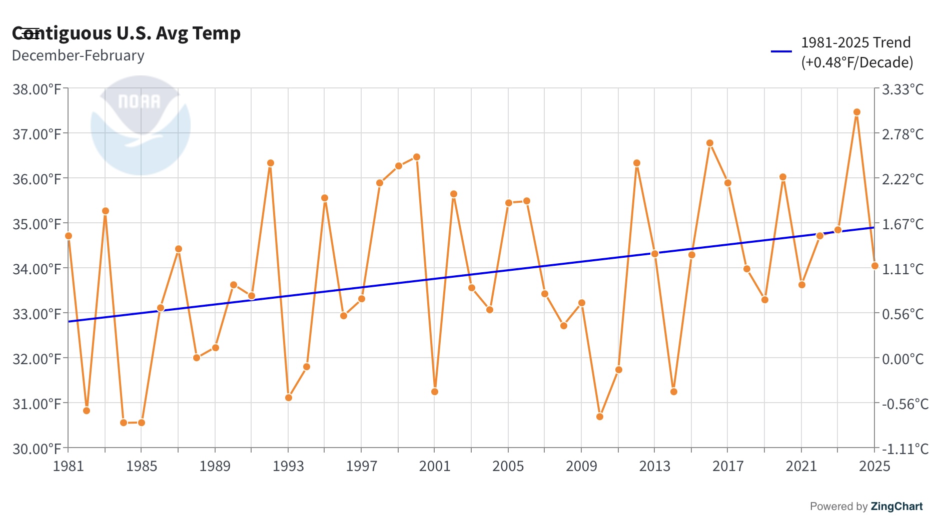
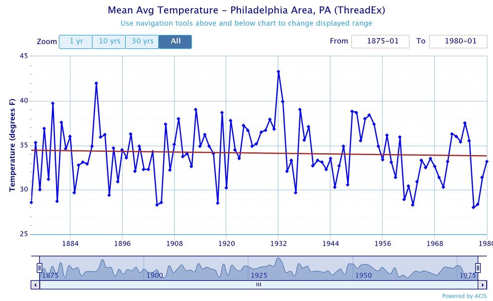
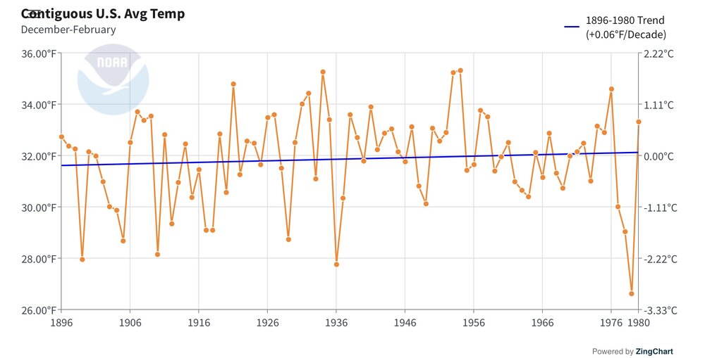
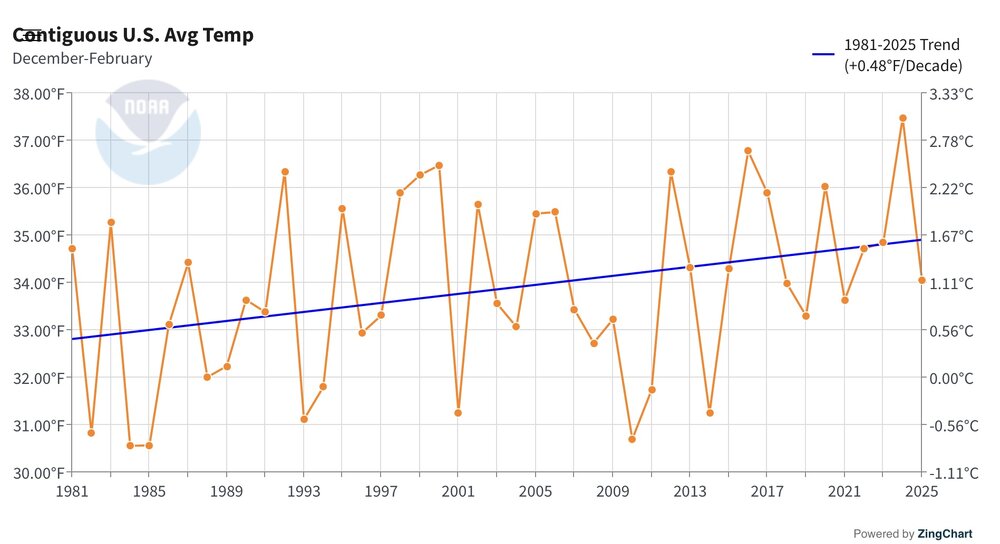
Yeah, all the warming at Philly has been since 1981. The climate from 1875 to 1980 was very stable like the rest of the world and the U.S. There was a slight -0.6° decline in winter temperatures over this period. Since 1981 Philly is up +4.3° during the winters. This is the main reason the U.S. hasn’t seen a top 10 coldest winter since the 1970s.

-
Yeah give me dews and instability so we can at least pop some convection. This sucks.
-
62 here this morning
-
They want COC, they’ll get fires.
-
That was a pretty perfect Saturday for August weather. Headed to the Fair this AM - looks like another nice day ahead. Warmer start to things - 67 in Fallston.
-
It’s so much like last year. Just stopped raining in late Aug right thru the fall . Remember the fires? They’re coming
-
This is getting stupid
-
^That is a big part of the reason why I question 2013-14 as a “good analog”. This year has a much better chance of seeing a La Niña in the fall/early winter than 13-14 ever did, 13-14 did not have a -IOD event as we do now, it did not have a strong -PDO; in fact it was a Victoria mode PDO which is a pseudo +PDO setup and was only very weakly negative, it was not -PMM and it was a strongly positive QBO all winter, see my monthly QBO numbers above AND it did not have record low arctic sea ice. The only resemblance to this year that I see is the Atlantic tropical season (**so far**) and the big cold pool south of Greenland and up Davis Straight, other than that, big meh as an analog IMO….. @donsutherland1 @bluewave
-
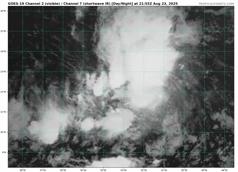
Satellite loops this Sunday morning show 99L has a small circulation. This is confirmed by two satellite wind estimates (ASCAT and microwave-based MIRS). Model guidance is playing catchup big-time with #99L, with deep convection and strong vorticity persisting for several days despite model forecasts that 99L would remain an open wave with little convection. 99L's small size is likely a big factor in this (we something similar before Oscar formed last year). Read my in-depth analysis of 99L and its potential to organize further late this week into this weekend in the western Caribbean and eventually BOC/GOM: https://hurricanehacker.substack.com/p/caribbean-cruisin
-
WTF?
-
0z GEFS has some interesting members now
-
 63, crystal clear skies up here in Allamuchy township. Cool breeze. Amazing how getting an hour outside of NYC hiw black the skies are. So many stars.