All Activity
- Past hour
-
Evacuation Orders on the Outer Banks. Absolutely fascinating watching the evolution. Beating a dead horse for one last time. Yah, Yah, Yah I know...
-

Hurricane Erin: 140 MPH - 935 mb - NW @ 12
Windspeed replied to BarryStantonGBP's topic in Tropical Headquarters
I concur. It looked like it was really going to take off again this morning, but concentric banding and increasing shear are keeping Erin's core in check. The windfield continues to expand. Slill a large and powerful major hurricane, but it should weaken, albeit slowly, from here on out. -

2025 Short Range Severe Weather Discussion
Chicago Storm replied to Chicago Storm's topic in Lakes/Ohio Valley
The SPC is too hung up on that struggling MCS across S WI and N IL. Main focus will be south near remnant outflow, which is partially washing out to the far west in IA. E IA into N IL will be more of the focal point for new development this afternoon. -
Solid garden variety storm
-

Hurricane Erin: 140 MPH - 935 mb - NW @ 12
NorthHillsWx replied to BarryStantonGBP's topic in Tropical Headquarters
I think we’re in the slow weakening phase now. With the core looking disrupted and wind expanding in all quadrants and the system now experiencing some northerly shear (which its northerly motion now put it directly in the line of fire with) I expect a slow rot of intensity. Likely remains a major through midweek but I believe we’ve already witnessed our secondary peak -
Not what I want to hear. Moving my daughter into ODU on Wednesday. Don’t need rain. Will be windy enough from Erin approaching
-
Lots of U30s
-
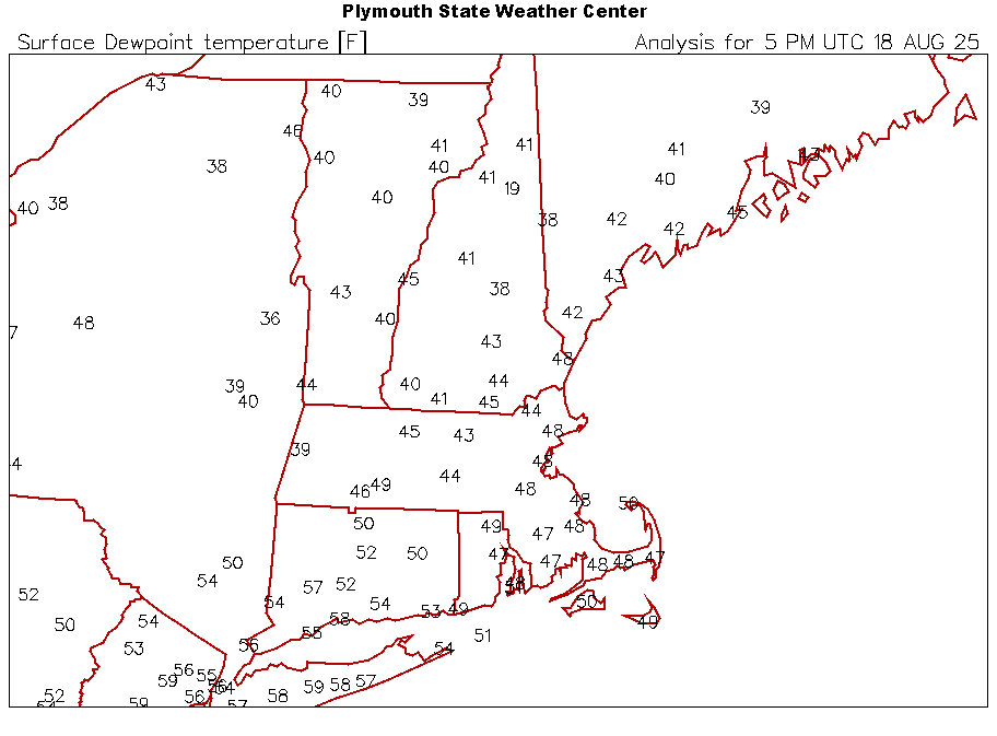
69.4/39 with full sun Yore
-

2025 Short Range Severe Weather Discussion
madwx replied to Chicago Storm's topic in Lakes/Ohio Valley
We are getting some clearing right after the line so there’s still a chance of storms this evening -

Hurricane Erin: 140 MPH - 935 mb - NW @ 12
Wannabehippie replied to BarryStantonGBP's topic in Tropical Headquarters
Eye obscured, and looks to be open to the south. -

2025 Short Range Severe Weather Discussion
CheeselandSkies replied to Chicago Storm's topic in Lakes/Ohio Valley
SPC already trimmed the slight out of southwestern WI behind the ongoing band, so looks like they expect primary severe threat to be with that and not any redevelopment later this afternoon. -
Cloudy and windy on the shore today. Ocean is choppy; not too many in the water. No rain yet...
-
NAM looks stout. As in beer.
- Today
-
 fwiw... for those who need rain: 12z/18 NAM suite in particular has iso 3-6" near ABE and spotty SNE just outside our forum. 12z/18 Canadian and GFS coming up. No thread but monitoring. I think the NAM is telling us something that could happen around here but far too early, in light of model spread, to start a thread. Right now, I'll monitor WPC to see if start adding a little qpf to our NYC subforum. Yesterdays 2-5" vicinity Philly was not well handled by the SPC HREF.
 -
 Im not sure but suspect they might have seen plenty of cloud cover this month.
 -
Some clearing slowly working its way down 73 / 58 socked in clouds but some brightening
-

E PA/NJ/DE Summer 2025 Obs/Discussion
MGorse replied to Hurricane Agnes's topic in Philadelphia Region
Picked up 0.05 inches this morning, with a total now of 1.38 inches. -
70/48, deep blue skies, sun.
-

2025 Atlantic Hurricane Season
BarryStantonGBP replied to BarryStantonGBP's topic in Tropical Headquarters
hemp -
Hurricane Erin: 140 MPH - 935 mb - NW @ 12
BarryStantonGBP replied to BarryStantonGBP's topic in Tropical Headquarters
GET IN LADS SHE JUST COOKED US SOME MORE SCRAN Atlantic - Caribbean Sea - Gulf of America Tropical Weather Outlook (en Español*) 800 AM EDT Mon Aug 18 2025 Tropical Weather Discussion 1215 UTC Mon Aug 18 2025 Hurricane Erin Satellite | Buoys | Grids | Storm Archive ...ERIN STRENGTHENS... ...EXPECTED TO GROW EVEN LARGER... 11:00 AM EDT Mon Aug 18 Location: 23.1°N 70.8°W Moving: WNW at 10 mph Min pressure: 935 mb Max sustained: 140 mph -

Hurricane Erin: 140 MPH - 935 mb - NW @ 12
Boston Bulldog replied to BarryStantonGBP's topic in Tropical Headquarters
Yeah the northerly shear is pretty apparent with the restricted outflow on the northern part of the circulation. Compare the extent of outflow on the north side to the south side, huge difference. -
Nooners: 73 and cloudy. More muggy than I expected but nice out
-
about 24-36 hours of humid, tropical air. This upcoming weekend should feel very refreshing
-

Hurricane Erin: 140 MPH - 935 mb - NW @ 12
olafminesaw replied to BarryStantonGBP's topic in Tropical Headquarters
IR appearance has degraded considerably in the last hour or two. Trying to complete an ERC and probably feeling more of the shear now. May gradually weaken until shear can abate


