All Activity
- Past hour
-
-

Augdewst 2026: Summer's Last Stand
CoastalWx replied to Prismshine Productions's topic in New England
NW CT and Berks. Yawn. -

Augdewst 2026: Summer's Last Stand
weatherwiz replied to Prismshine Productions's topic in New England
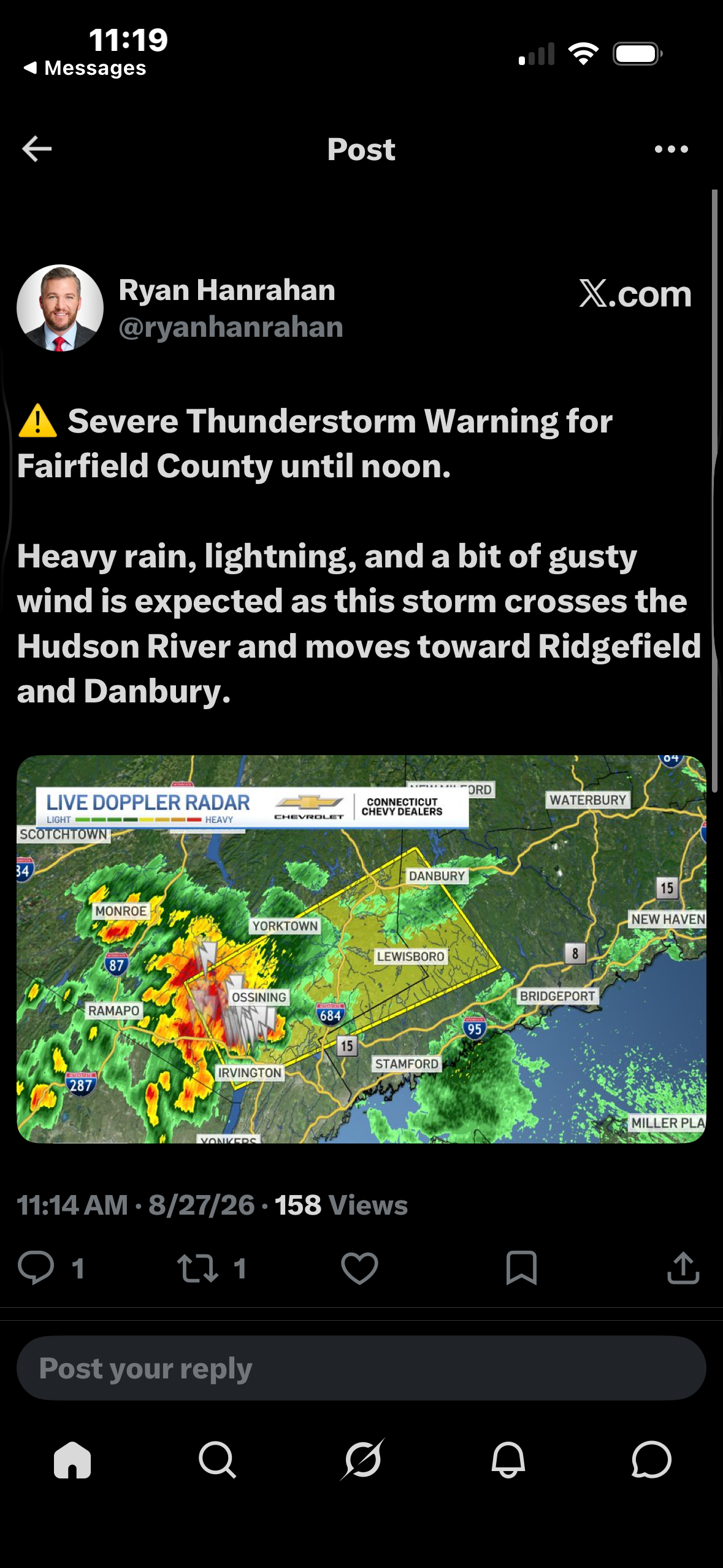
Nice mid-level meso on that cell headed towards Fairfield County. -

Augdewst 2026: Summer's Last Stand
Damage In Tolland replied to Prismshine Productions's topic in New England
In shocking news …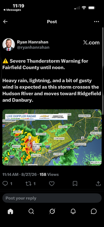
-
Severe Watch Possible SWO from KWNS
-
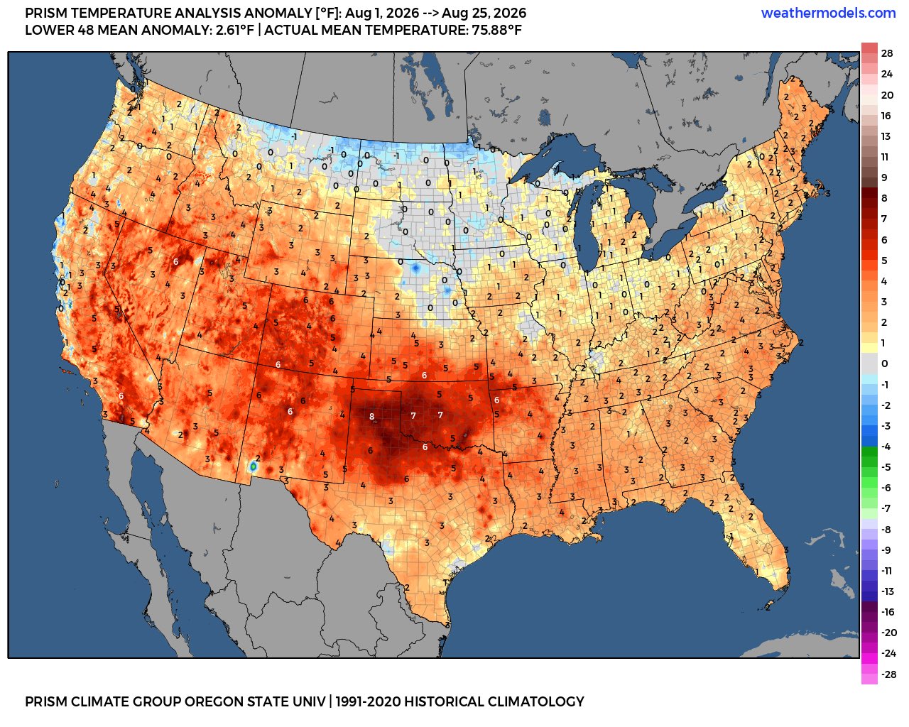
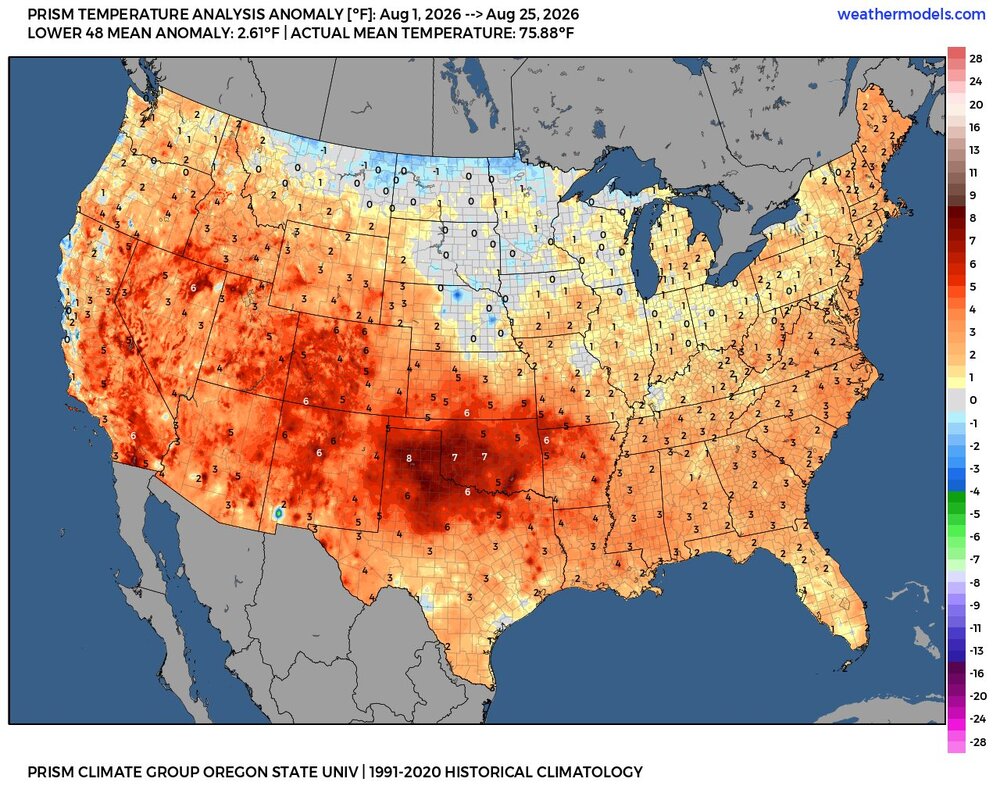
August was warmer than normal for most of the area using the warmest 1991-2020 climate normals.
-
I've said that one way to cheat our way into a good winter is to get something like Dec 1997 pattern (pretty close to normal temps that month) but instead of Feb 1998, we get a more classic Nino Feb.
-
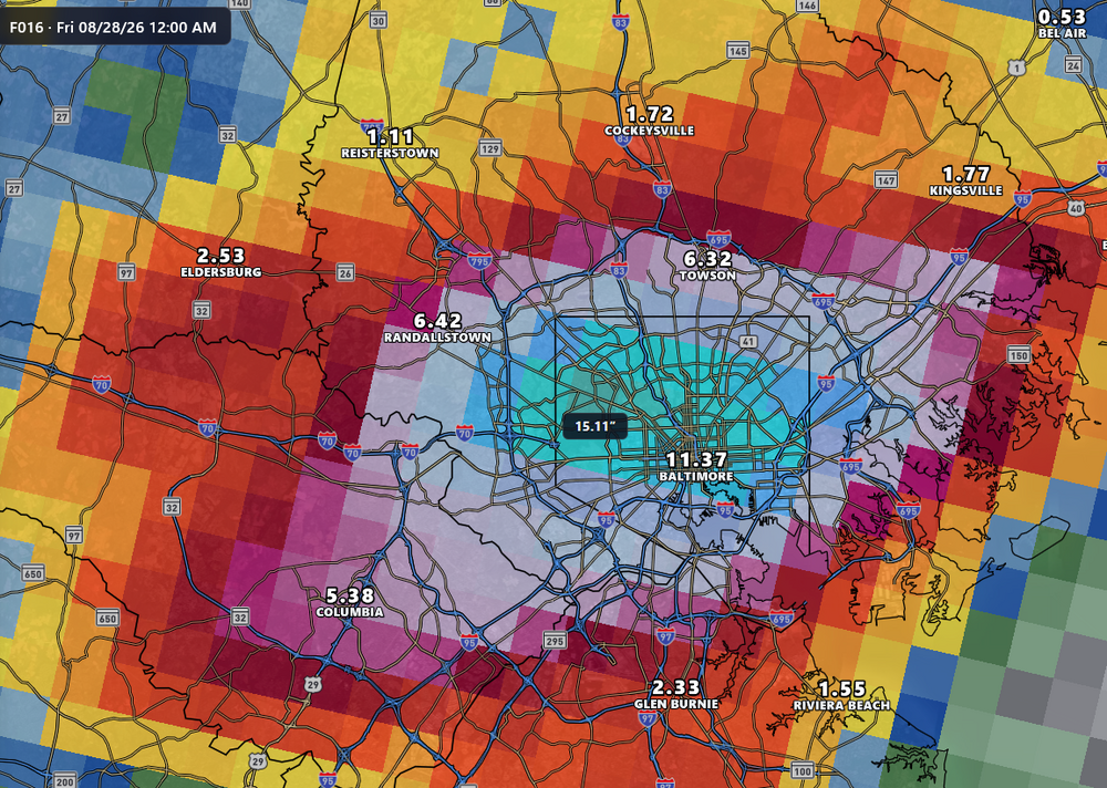
That's an all-timer from the NAM3K
-
The aren't, they are calling for post-tropical aka open wave
-

Augdewst 2026: Summer's Last Stand
Brian5671 replied to Prismshine Productions's topic in New England
Always appreciate your input-thanks! -
August was near normal here. Seems like this guy lives in the Plains and west.
-
Augdewst 2026: Summer's Last Stand
weatherwiz replied to Prismshine Productions's topic in New England
This is a good thing...allowing more breaks of sun and stronger instability to build. There is a subtle pre-frontal trough back across eastern PA to west of the Hudson. This should slide east during the day and that's when we'll see storms develop across the Hudson and western MA/CT...at least this is what I ws envisioning yesterday occurring but guidance does show this eastward shift. I still think it will be an active day for western sections -
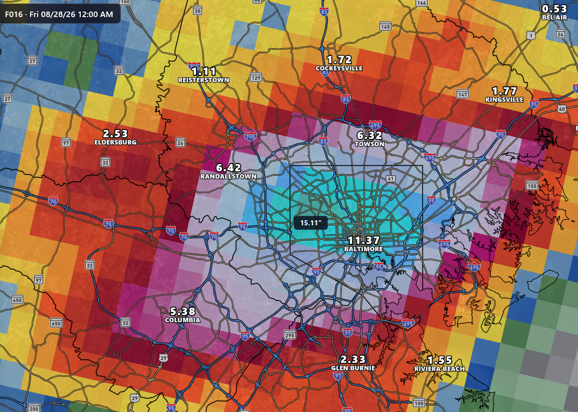
There's a 14" value somewhere in there. Gonna miss the crazy NAM.
-
Total here for August: 8.12" including .28" that fell earlier this morning.
-
Interesting they are calling for it to go subtropical as it approaches the lesser Antilles. Not sure that I've ever seen a subtropical sorry that far south
-
Picked up .28" here in two rounds of fast moving T-Showers. Lots of thunder. Wow, school starting early. I can never remember going back until Tuesday or Wednesday after Labor Day. Driving around yesterday I saw some trees starting to show some color, not brown but reddish orange in spots. Fall is coming.
-
Augdewst 2026: Summer's Last Stand
Brian5671 replied to Prismshine Productions's topic in New England
had a quick shower here but everything's hitting a brick wall around the CT/NY border -
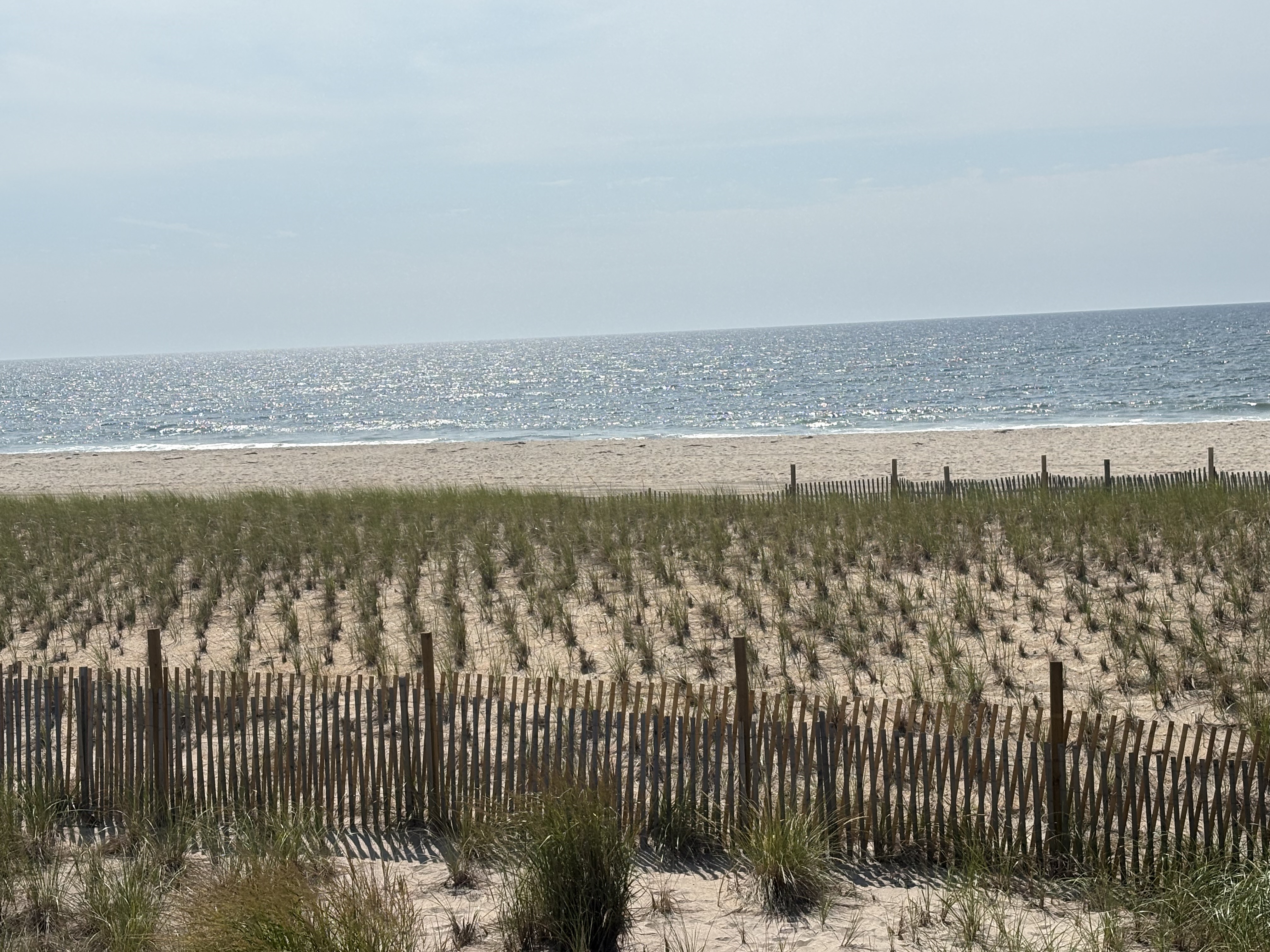
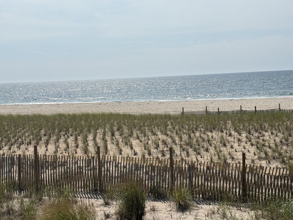
Beautiful morning on fire island
-
Augdewst 2026: Summer's Last Stand
weatherwiz replied to Prismshine Productions's topic in New England
Its a really good pattern for MCS developing across the Great Lakes and propagating ESE across the Northeast (whether that ends up being just to our southwest or more across northern VT/NH and ME). One thing really lacking is some stout EML advection, though the GFS does hint at some plumes of steeper lapse rates trying to move in at times but they lose their integrity. If we can get a clear signal for EML advection we could rock next week -

2026-2027 Record-breaking El Nino
qg_omega replied to Stormchaserchuck1's topic in Weather Forecasting and Discussion
Record warm AUGUST across CONUS, who forecasted that? -
.thumb.gif.f92b16c631a1d15d405ed77b33f0710d.gif)
Augdewst 2026: Summer's Last Stand
Torch Tiger replied to Prismshine Productions's topic in New England
next Tuesday could be fun, esp. SW NE? -
Congrats to the rest of the country. Don S post yesterday: Based on sensitivity analysis applied to the latest guidance, there is an implied near 53% probability that New York City will have a cooler than normal August (1991-2020 normal). August will likely finish with a mean temperature near 76.0° (0.1° below normal).
-
Pretty wild the NHC had to include this in its discussion this morning: The timing of the use of the name Dolly for this storm is purely coincidental. Tropical storm and hurricane names for the North Atlantic Basin originate from six pre-determined rotating lists established by the World Meteorological Organization Region IV Hurricane Committee. The name Dolly replaced Diana after the 1990 hurricane season and was first used in 1996.
-

Augdewst 2026: Summer's Last Stand
SouthCoastMA replied to Prismshine Productions's topic in New England
September is the new August -
Holy thunder & Lightning