All Activity
- Past hour
-
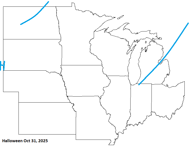
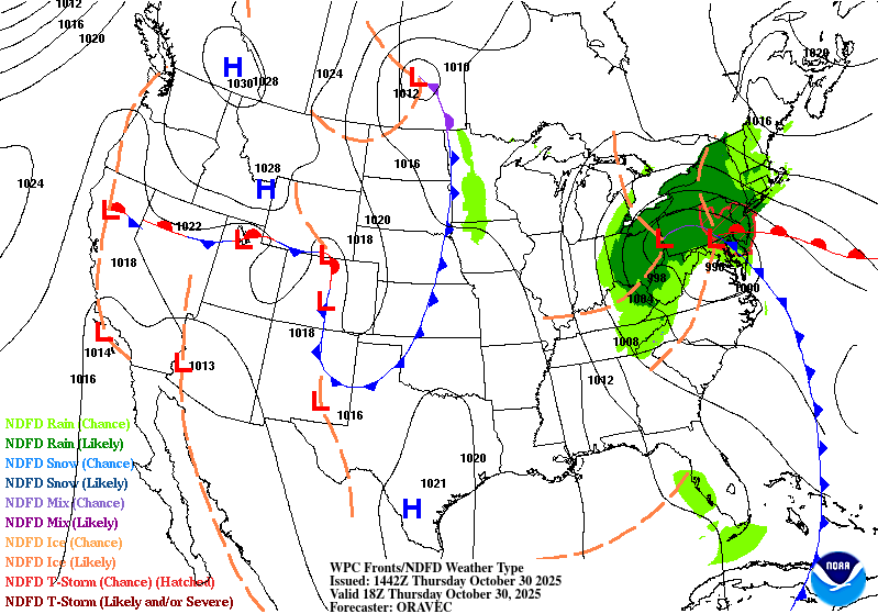
The system clearing as quick as it did is really good news for Halloween festivities - kid and adult. And extra good news for those us who will be lining up for the Billy Strings concert. Super happy we won't be getting poured on.
-
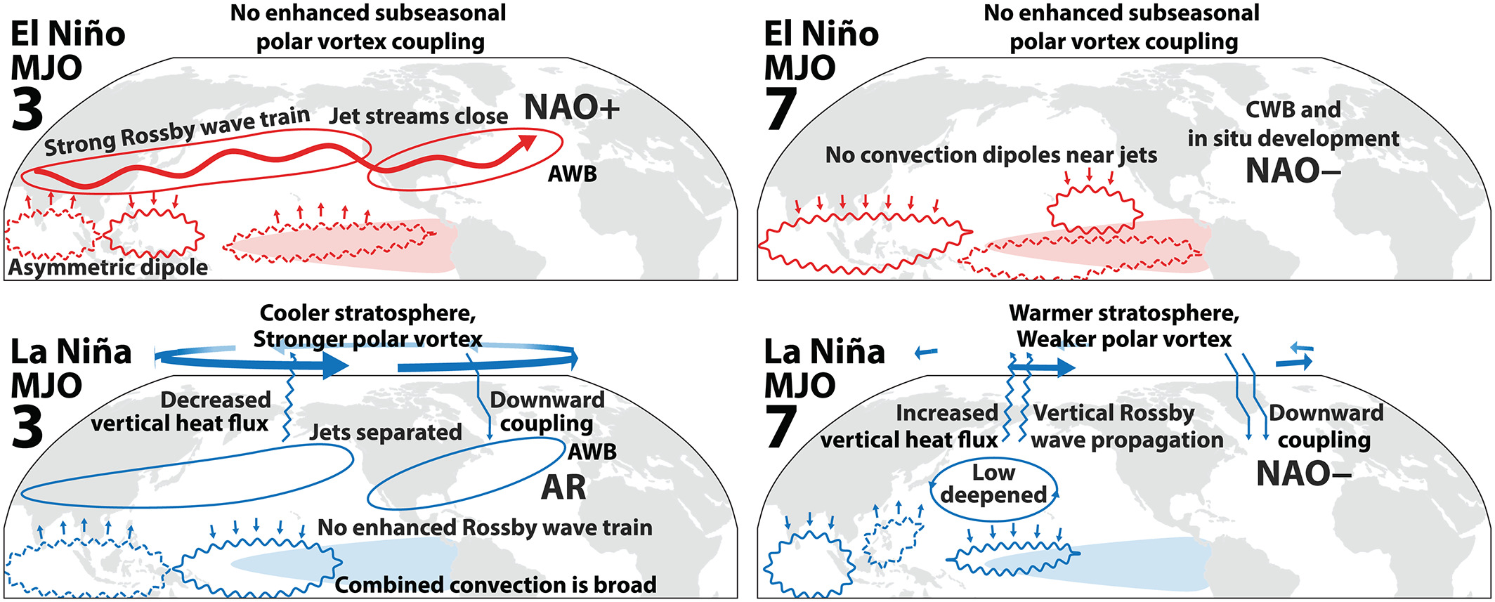
From Eric Webb at another BB just now: A few other things I think that are playing into our favor at least for December: Being in a La Niña with a slower-moving and more amplified MJO (due in part to the easterly QBO) makes a subsequent -NAO and weaker polar vortex/-NAM more likely. The current global tropics SSTa are also almost the exact opposite of the MJO phase speed & SST correlation pattern derived from Suematsu & Miura (2021), favoring slower MJO events that typically have stronger and more consistent extratropical teleconnections as Yadav et al (2024) + Yadav & Straus (2017) and Tseng et al (2020) have argued respectively.

-
It doesn't look like a Thursday washout! Here comes the sun!
-

Spooky Season (October Disco Thread)
tamarack replied to Prismshine Productions's topic in New England
Go all the way to Fort Kent - Northern Door Motel, Breakfast at Rocks Cafe then head west. If you don't mind some ungroomed trails, Deboullie is spectacular. Then stop at Two Rivers Lunch in Allagash, maybe motor up to Estcourt Station (unless you've already been to that northernmost tip of the state). Temp was 28 at 11 last evening but the clouds were beginning to sift in, and it was 30 at 7 this morning. Otherwise we would've been down near 20. -
 Been getting some good heavy rains all morning.
 -
1.77 event total...
-
Miserable day today
-
 1/2"/hr n-s stripe near PHL with lightning now. not sure where this will end up but should rock a bit this aft-eve in our area...even e LI later this eve.
 -
Noting power outages increasing PA-NJ .. over 7000 in NJ and some of it seems high terrain, esp ne PA.
-

E PA/NJ/DE Autumn 2025 Obs/Discussion
JTA66 replied to PhiEaglesfan712's topic in Philadelphia Region
Thunder! I invoke the "Wiggum Rule". Just over 1.00", 58F. -
really... very nice. Maybe you head for 2.5". Thinking some spots in our forum I95 westward 3-3.5" in 9 hours soon.
- 70 replies
-
- 1
-

-
- heavy rain
- damaging wind? squalls?
- (and 2 more)
-

Major Hurricane Melissa - 892mb - 185mph Jamaica landfall
GaWx replied to GaWx's topic in Tropical Headquarters
Live feed from chaser Jeff P. is linked at the bottom. He’s been stationed in a house in Santa Cruz (~20 miles inland and ~15 miles W of worst wind damage. Yesterday, he/his host tried to drive to Black River but could go only a couple of miles west to Lacovia due to roads that were washed out, had big potholes, had deep mud from the prior 4-6+ feet of extreme rainfall induced flooding/landslides coming off the nearby ridges, and had debris such as trees and utility poles (some made of concrete!) blocking the road. So, they kept having to turnaround and try different routes to no avail and thus went back to home base. Here’s a link to the recording of that 2 hr, 51 min never a dull moment live feed from yesterday (this isn’t live): ———————— In today’s (LIVE) feed, it looks like they took a different route initially to the E and SE (i.e. further away from the worst hit area) instead of W. Then they turned back W further S (only couple of miles from coast). They went W through Junction (15 miles SSE of Santa Cruz), Bull Savanna, and Flagaman. They were temporarily stopped at Pedro Cross, just a few miles E of Treasure Beach, because the road was being cleared. They resumed a NW course approaching Newell. LIVE feed: -
Not too bad. LP in the E with another weak LP moving in from the NW with some shwrs, and LER (some mix possible).
-
1.1” here no thunder or heavy rain
-
2.12” with a little more to my south
-

E PA/NJ/DE Autumn 2025 Obs/Discussion
Birds~69 replied to PhiEaglesfan712's topic in Philadelphia Region
Heavier red stuff moving up from the south. May be our noon time/early afternoon potential thunder-banger... -
 1.14" here so far. We should get another inch this afternoon to bring the total to over 2 inches -- finally a big soaking that will put in a good dent in the drought.
- 70 replies
-
- 1
-

-
- heavy rain
- damaging wind? squalls?
- (and 2 more)
-
At work in Charlestown wv this morning.

-
.89” underwhelming but least it rained
-

Spooky Season (October Disco Thread)
powderfreak replied to Prismshine Productions's topic in New England
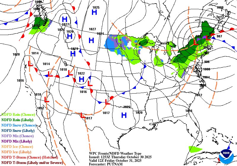
Agreed. Looks like backside snow levels and upslope showery precip could coat the high valleys of the ADKs. -
We had to put the leaves in those brown recycling bags growing up and I remember after a rainy day like today, having the standing water on those bags ice up.
-
We’re heading in the right direction, though. Summer was canceled early, temps have been chilly, and it looks like the Gulf of Mexico is starting to wake up from a multi-year sabbatical.
-

Spooky Season (October Disco Thread)
WxWatcher007 replied to Prismshine Productions's topic in New England
WXW2 may actually get on the board with this storm @powderfreak. Maybe a half inch or so. -
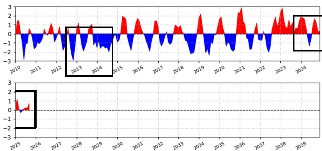
This is a very linear approach so tfwiw - but to help elucidate the concern in using 2013 as analog, let's look at the 2013 WPO, and compare it to recency. Below on the left is the 2013-2014 WPO ( provided by CPC), and on the right, 2024-present 2013 1 0.07 2024 3 0.97 2013 2 1.49 2024 4 0.73 2013 3 0.59 2024 5 -0.27 2013 4 -1.86 2024 6 -1.29 2013 5 -1.13 2024 7 -0.77 2013 6 -0.47 2024 8 1.06 2013 7 -0.88 2024 9 1.38 2013 8 -0.17 2024 10 0.91 2013 9 1.93 2024 11 -0.20 2013 10 -0.09 2024 12 -0.33 2013 11 -0.04 2025 1 1.02 2013 12 -2.01 2025 2 0.32 2014 1 0.54 2025 3 0.77 2014 2 -1.37 2025 4 -0.83 2014 3 -0.43 2025 5 -0.49 2014 4 -1.36 2025 6 1.27 2014 5 -0.85 2025 7 -0.58 2014 6 -0.30 2025 8 -0.31 2014 7 -1.63 2025 9 1.22 2014 8 -0.77 2014 9 -1.23 2014 10 -0.32 2014 11 0.13 2014 12 -0.13 graphically ... What sticks out is that the WPO was predominately negative in the 2013-2014 period, but has been predominately positive lately. That particular index is quite important as it loads the Pacific ... We can root it ultimately back to Asia for that matter. All that, and also feed-backs (constructive or destructive interference ) from the MJO frequency... which also has at least a say in the ENSO distribution... Quagmire that ultimately giggidies or glorifies our winter tendencies over N/A. But, that is a big difference in that particularly circulation mode/manifold comparing back whence to now ... So it really - for me - adds to the uncertainty if not doubt.