All Activity
- Past hour
-
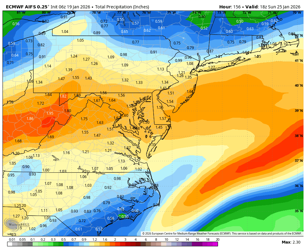
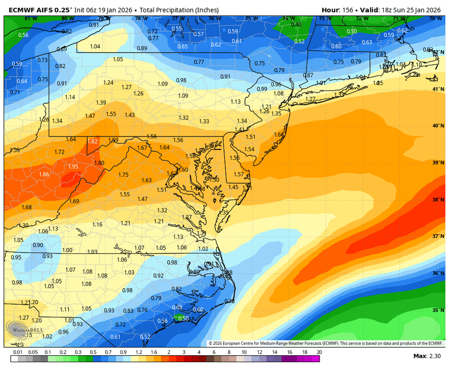
6z Euro looking pretty nice at the end. Starting to feel like...as long as we don't have any guidance go the opposite way (more squashed) and have everything at least hold steady today that would be encouraging
-
This. It’s going to be an ice storm for someone. No sugar coating it.
-
It’s a good sign for you guys up in Nova and MD if I’m starting to sweat the mixing line down at UVA. Better not happen though because I do NOT want to have to drive up to Nova for this.
-
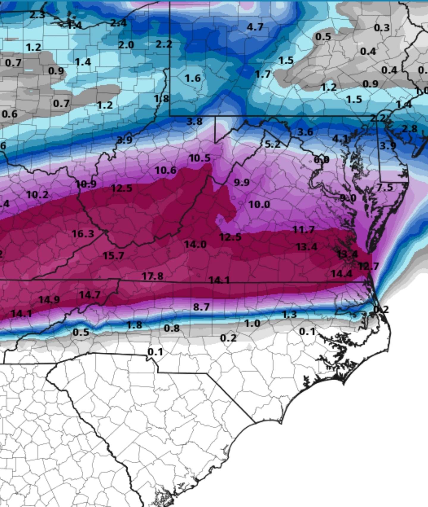
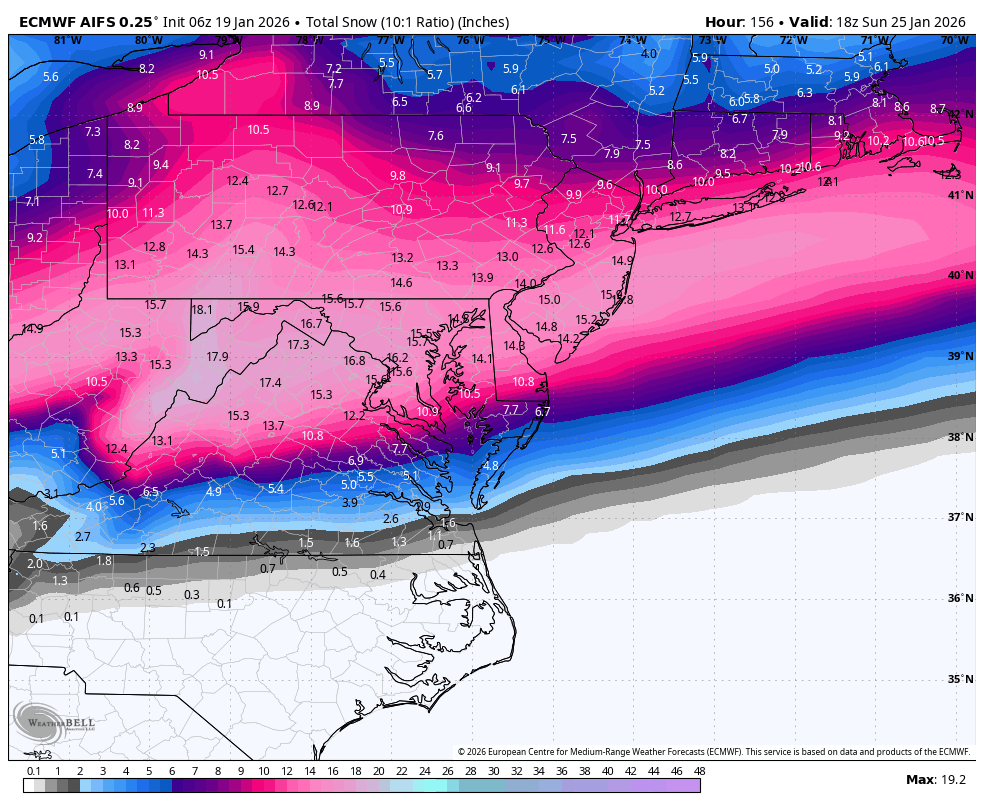
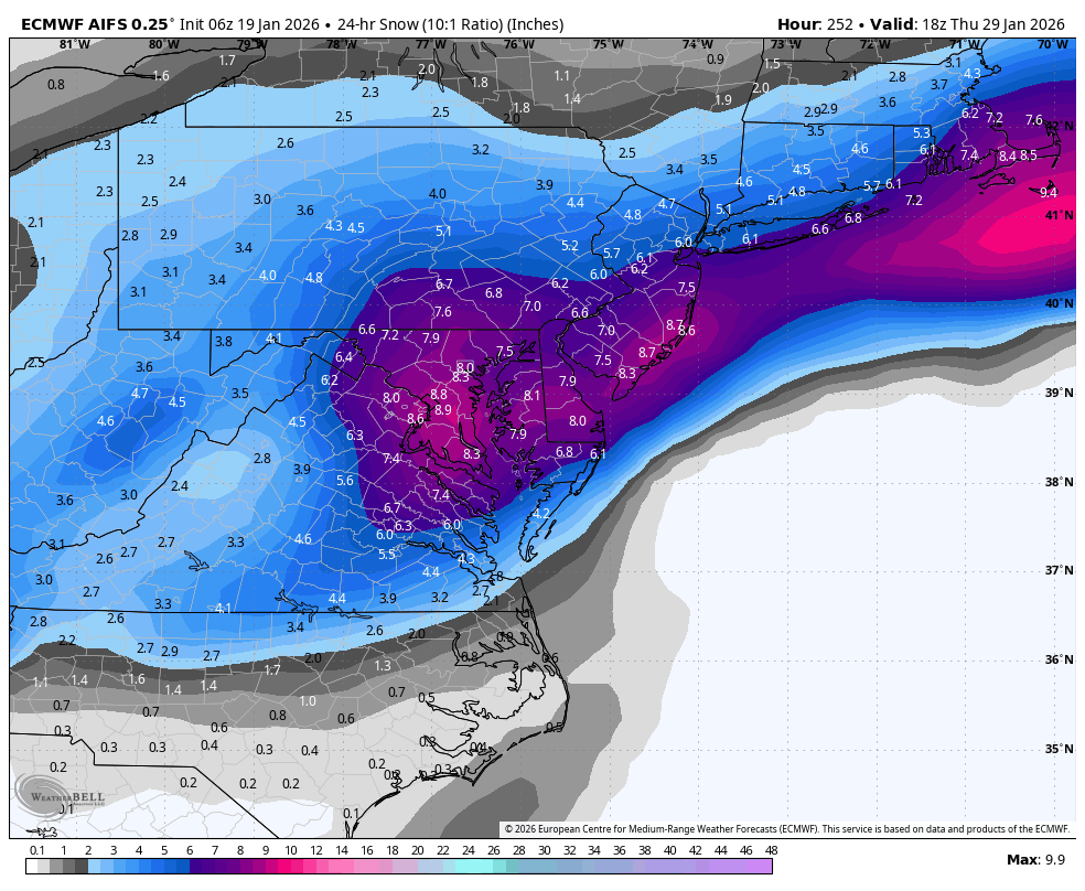
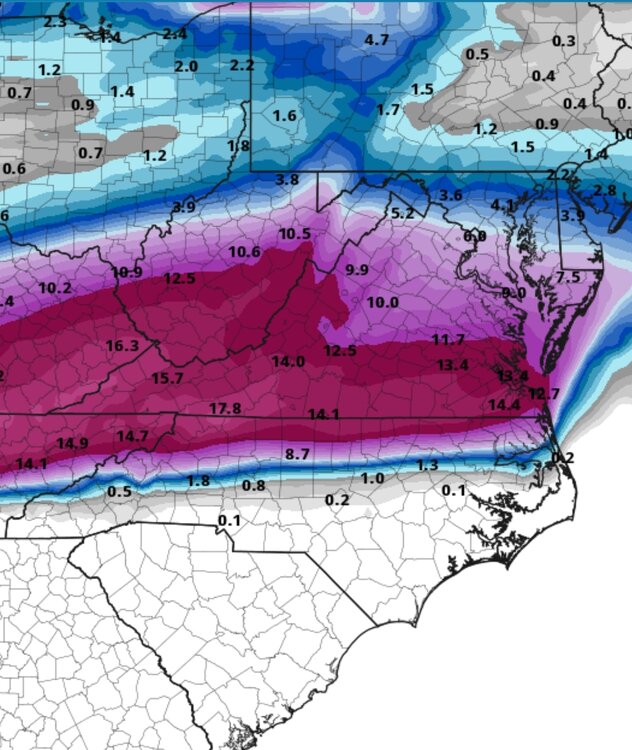
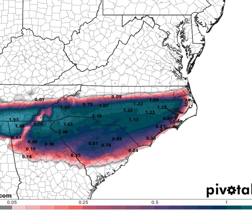
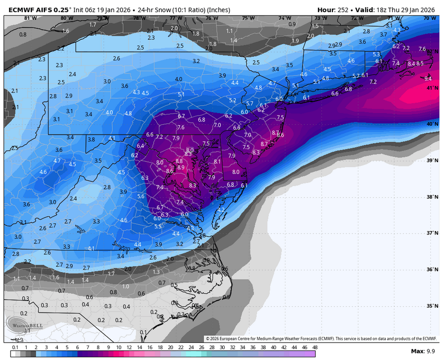
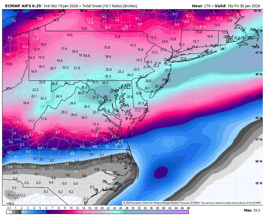
6z EURO Snow/ICE Maps. Still going at the end of the run
-

January 2026 regional war/obs/disco thread
mahk_webstah replied to Baroclinic Zone's topic in New England
You have to think this comes north substantially. Might be on the northern fringe up here but in the end, I bet it’s moderate to heavy all the way from central New England down through DC. I realize that suppression is real and that that could happen but over running trends north usually especially in large scale over running set ups. -

January 2026 Medium/Long Range Discussion
Stormchaserchuck1 replied to snowfan's topic in Mid Atlantic
Best thing about it is, it gets really cold after the storm.. like single digits or below zero. Then we stay below average probably through the first week of Feb. It would stick around for a long time. -
This has the potential to be a pretty significant rug pull...if you don't own a pair you better borrow or buy a pair of big boy undies
-

Central PA Winter 25/26 Discussion and Obs
mahantango#1 replied to MAG5035's topic in Upstate New York/Pennsylvania
Enjoy those frosty temps. -
Meh...disappointing How'd i do ji?
-
If only. Would be best back to back smokes since 09-10
-

Rise of the Machines: January 18-19 Winter Storm Obs Thread
Baroclinic Zone replied to WxWatcher007's topic in New England
Wow. Nice storm gorgeous out, can’t wait for sunrise -
Magnolia Delaware long range has snow in the forecast for 28th.
-
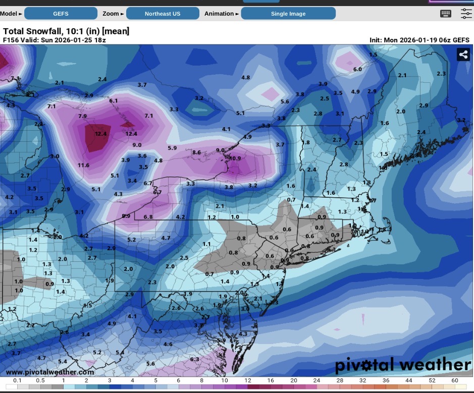
Next weekend. GEFS is a work in progress.


-
Better than the 1050H, while it will take days for models to home in, it will be interesting to see if that shows back up or if the models are over doing it.
-
I will go with 12 hours before the storm.
-

E PA/NJ/DE Winter 2025-26 Obs/Discussion
Ralph Wiggum replied to LVblizzard's topic in Philadelphia Region
AI guidance im told have good verification scores at this range. This is right now at day 6 considered their wheelhouse. I am still concerned about suppression in this pattern but having some reliable guidance continue to move North makes me feel a little bit better. I will say im my experience, 90% or more of the time, these high pressures or extreme cold tend to be overdone and things in general come North as we approach game time. This may be the 1 out of the 10 times though...so Im playing it cautious wrt my expectations. -
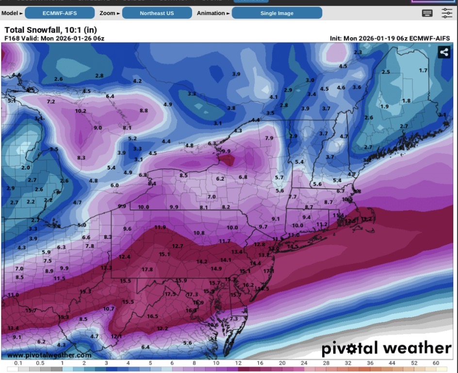
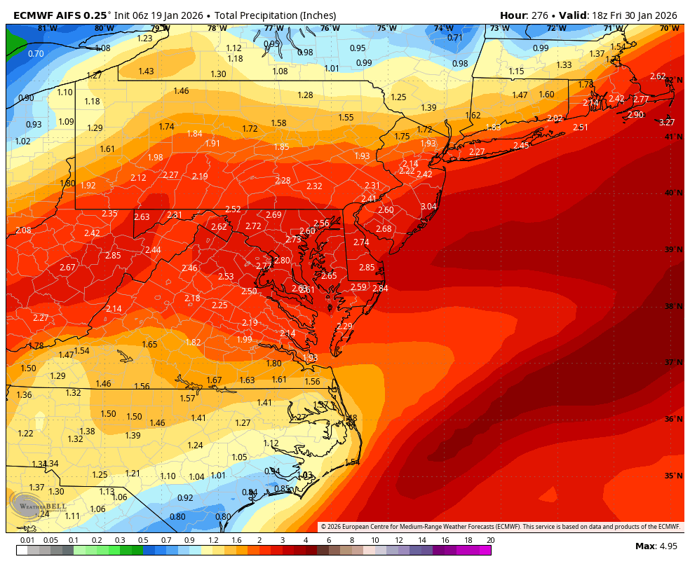
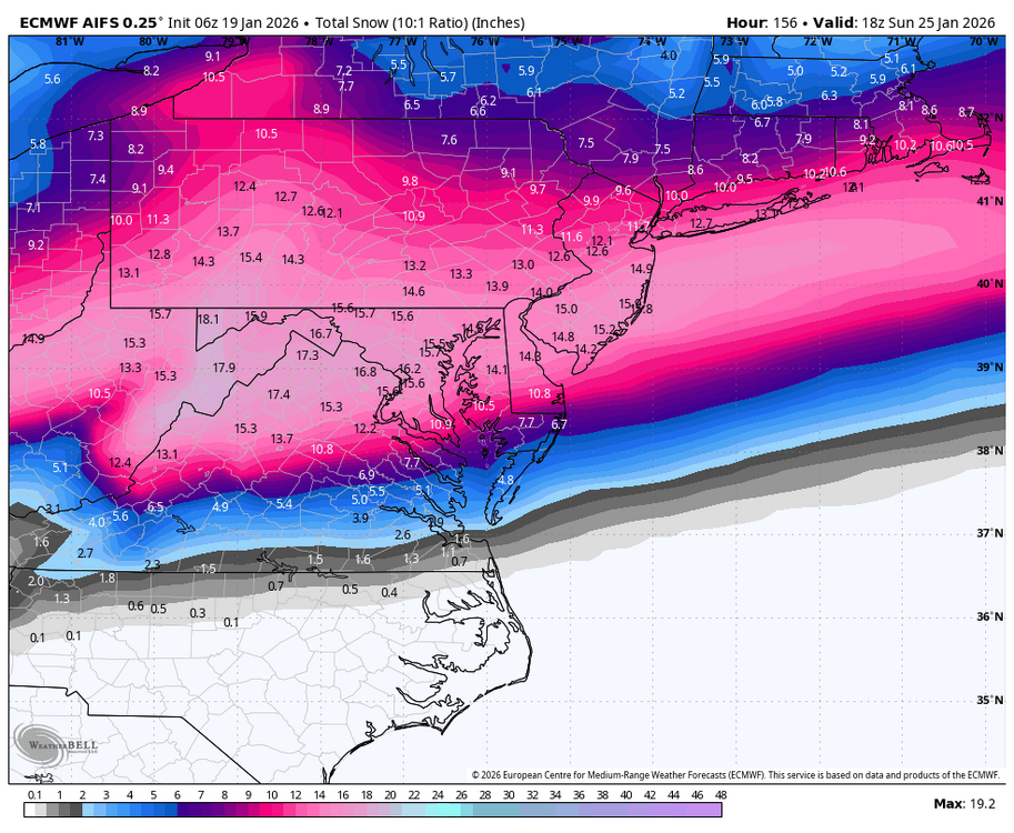
WB 6Z EURO AI upcoming weekend; week from Th.; Total run!!!!!


-

Central PA Winter 25/26 Discussion and Obs
Itstrainingtime replied to MAG5035's topic in Upstate New York/Pennsylvania
31 with heavy frost on the car and grass here in Palm Coast FL. -
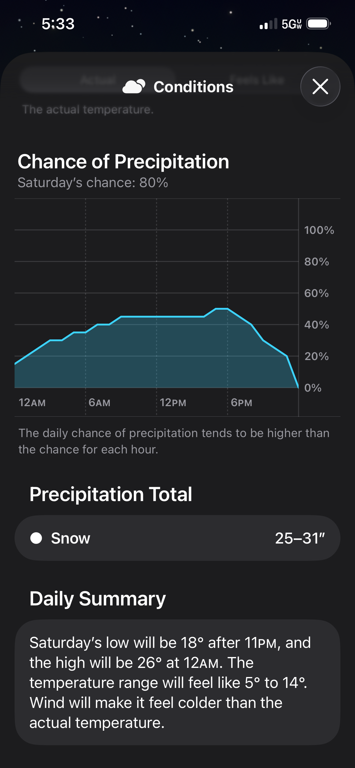
That would be devastating, most of the precip falls between 21-26 degrees. Pull for sleet if that's the case. All temps on all models during the heart of storm now are locked in to the low 20s. So temps seem to be one thing that is really starting to set in place. This seems to be a classic full on wedge and a lot of times those will get even stronger as the models get closer. Regardless the temps that are currently being modeled are something we have not seen in a long time with a potential storm coming in.
-
What the!?!
-
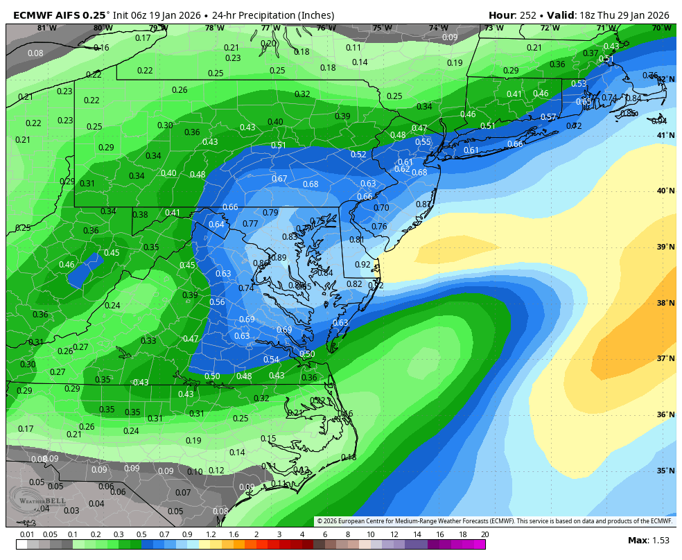
Euro AI brings in another Winter Storm mid next week.
-
Euro ai 6z is a weenie run. Smokes us this coming weekend then another hammer a few days later.
-
6z Euro AI is just to far north for snow on most of this board. Plenty of ice though taken literally
-
I think at this point we still put 100% stock in ensembles and EPS and GEFS is keeping everything south. I'd like to see individual members if anyone has them.
-

E PA/NJ/DE Winter 2025-26 Obs/Discussion
Duca892 replied to LVblizzard's topic in Philadelphia Region
In your experience and with the AI scores do you expect the GFS to follow them? I actually keep meaning to tag you because you did a great job mentioning possible suppression a few days ago