All Activity
- Past hour
-
Most people are going low for this year, and I think they will be right. But for shits and giggles, I’ll throw this out there: BWI: 29” DCA: 24” IAD: 38” RIC: 11” SBY: 13”
-

2026-2027 Record-breaking El Nino
GaWx replied to Stormchaserchuck1's topic in Weather Forecasting and Discussion
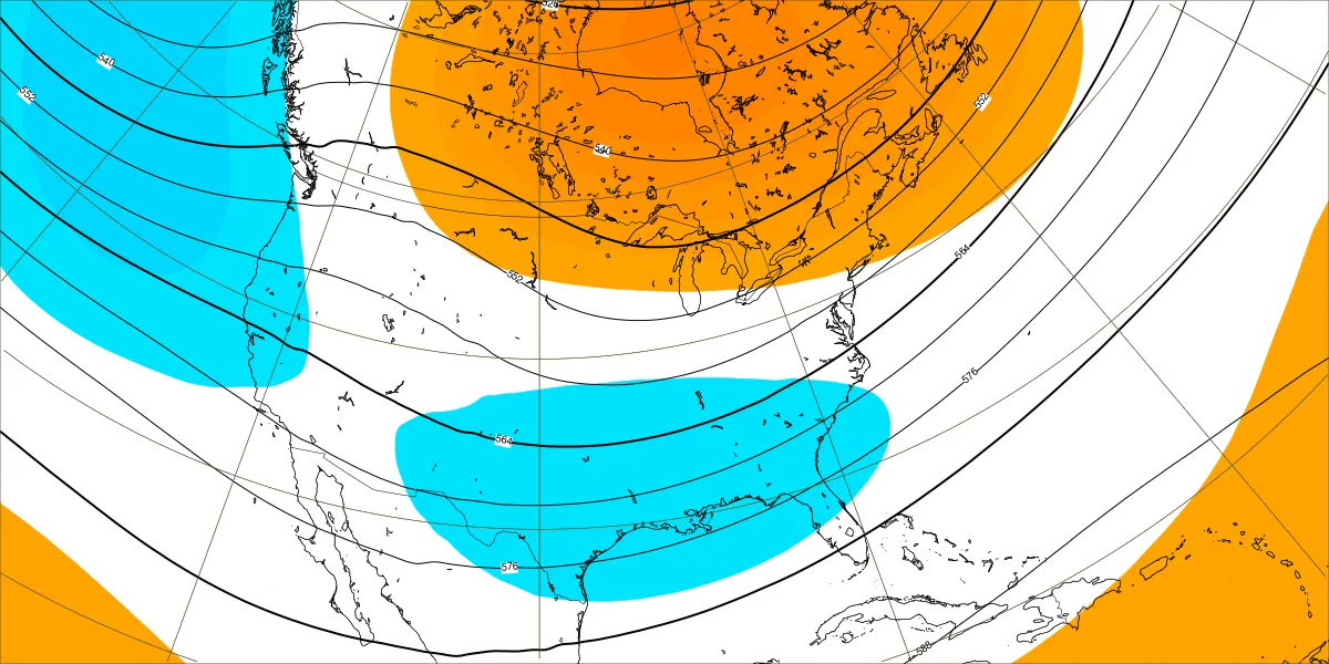
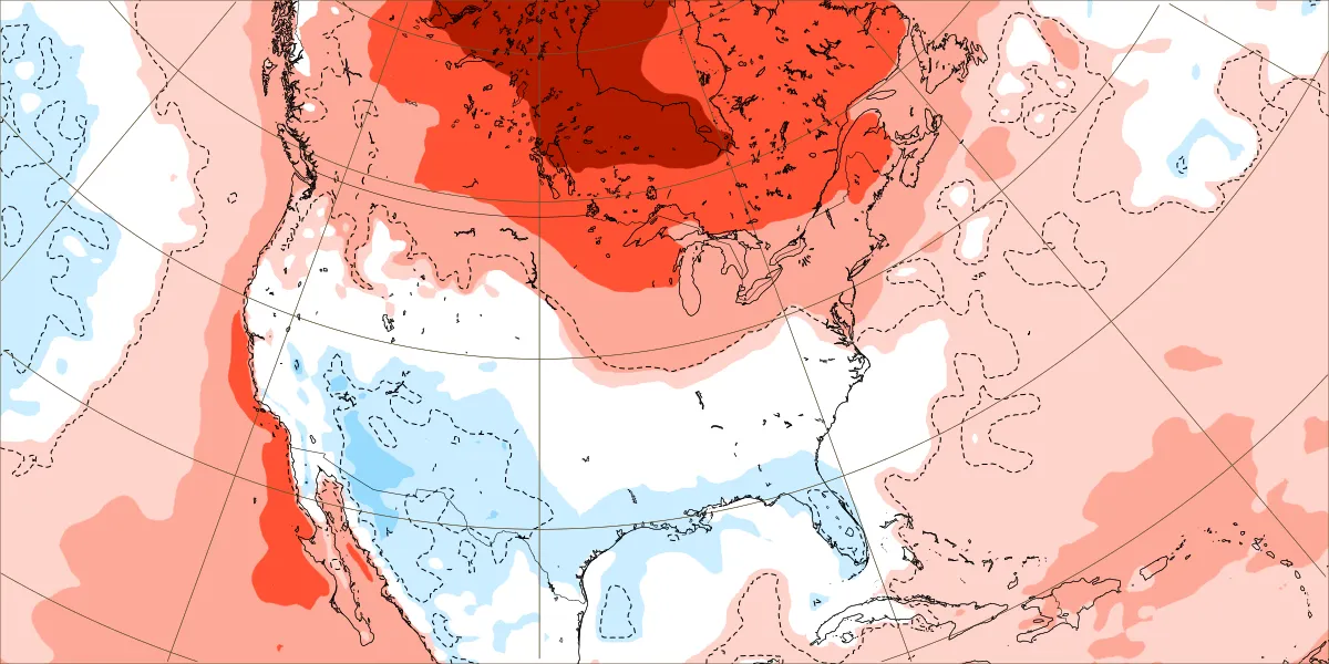
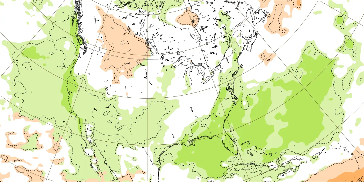
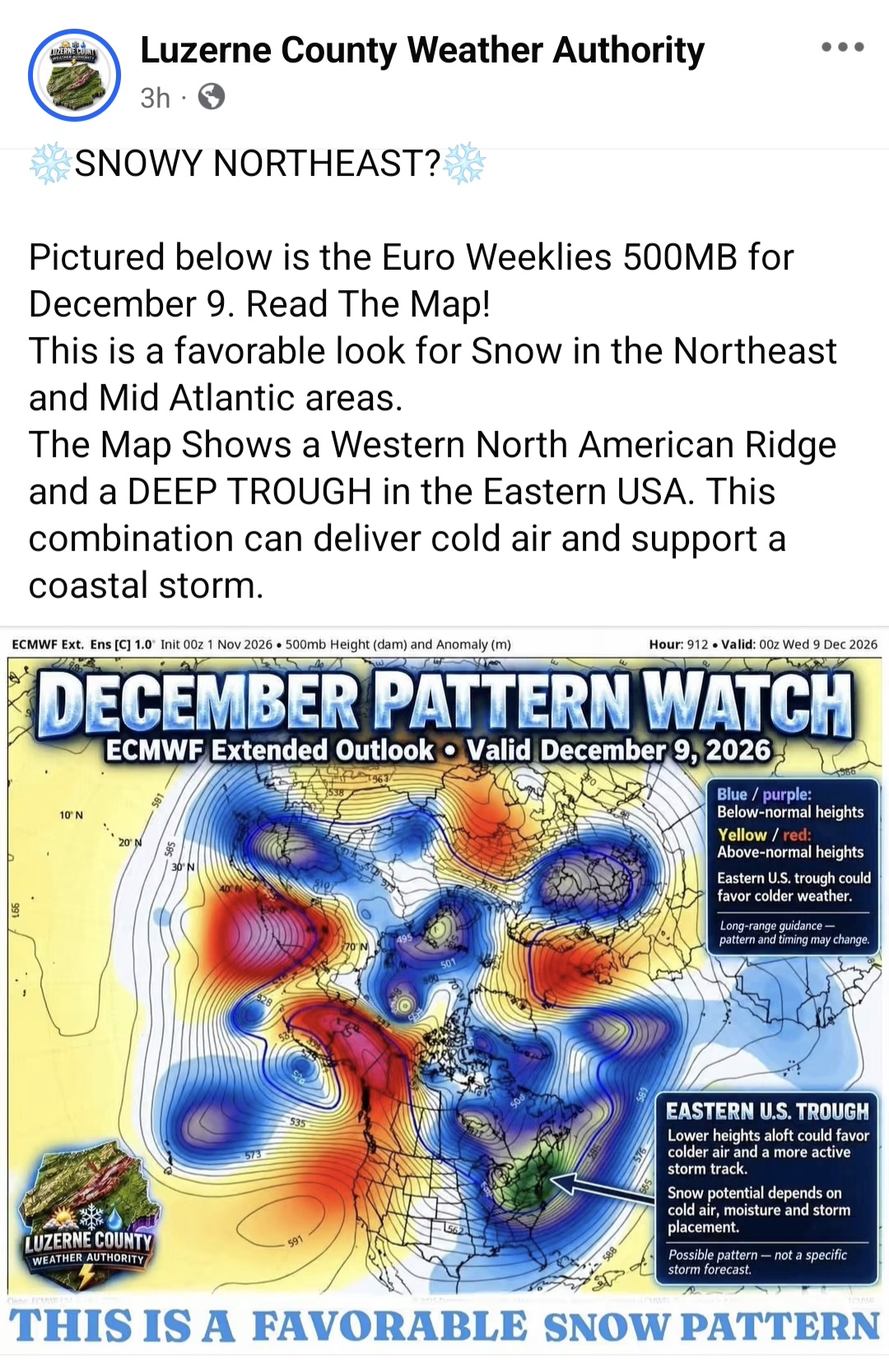
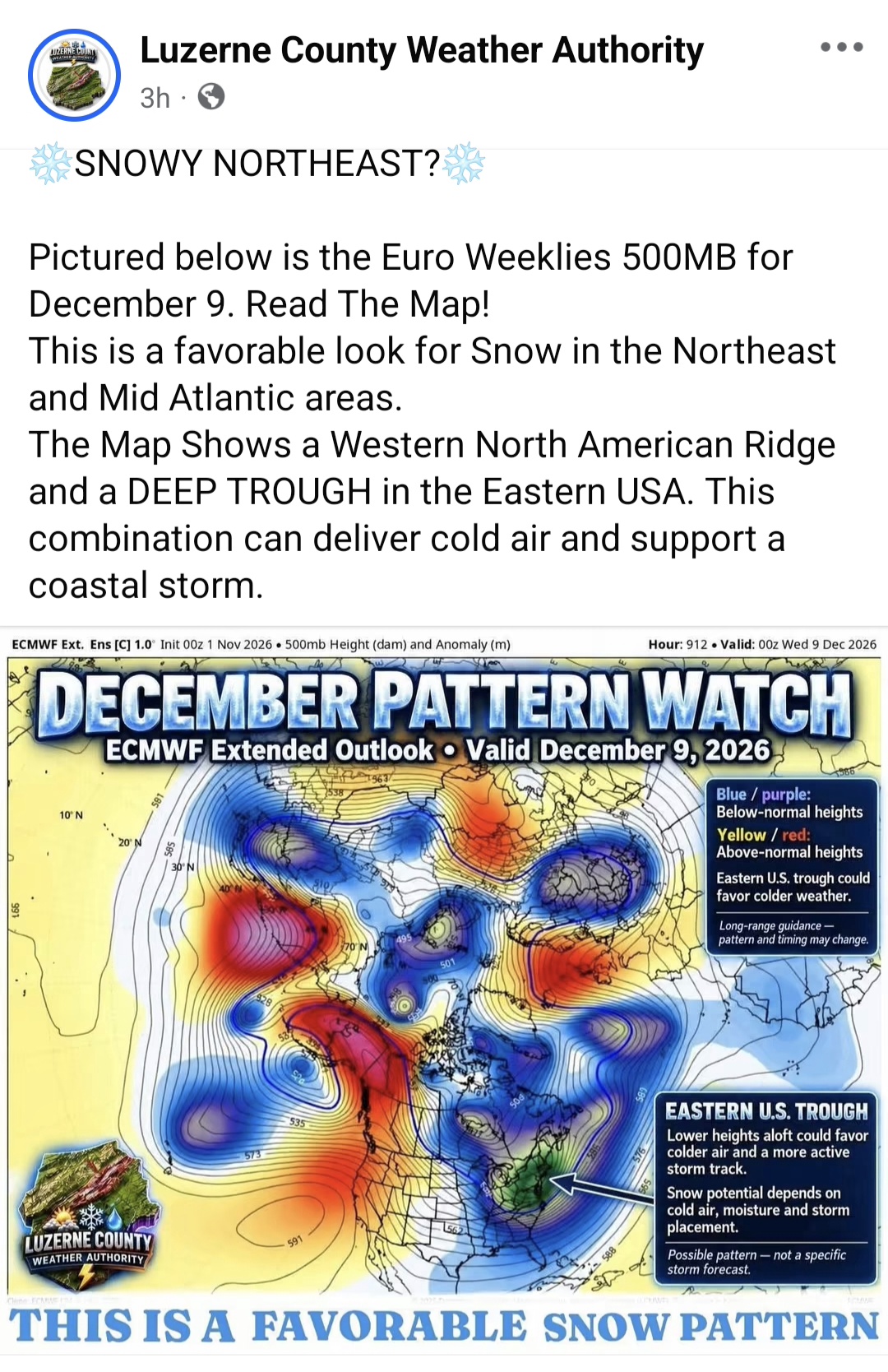
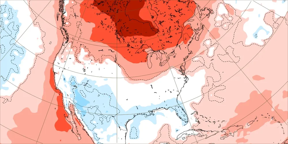
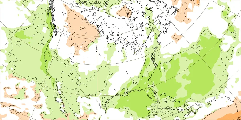
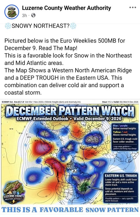
Thanks, Anthony, for posting that. I don’t disagree with this post done by Luzerne County. What I mean by that is IF there were to happen to be an actual H5 similar to that, it could favor a snowstorm then. But, and this is very important: this is as it says just the control run for EW hour 912 (0Z on 12/9/26) rather than the EW mean for hour 912. So, this is like an op Euro at hour 912, which of course has no forecasting skill and will change notably from run to run the vast majority of the time. For that matter, I’d say this about hour 312 or even earlier of the op Euro or op anything. I know you know this, but you may not realize this is just the near worthless way out in the extended control run. They clearly want clicks and thus was a bad post imho. A more informative post would have shown the EW means for the week covering that period, Dec 7-13: H5: 2m temps: Precip: Not the worst pattern by any means but far from great. @mitchnick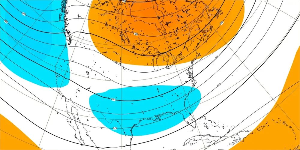
-
Can't get mad at Fagnano struggling in his first regular season action behind such a horrid offensive line that already allowed for the two QBs higher up on the depth chart to get pummeled. Also Malaki Starks has to be one of the biggest first round DB busts in history, dude got absolutely eviscerated on a route by the friggin TE
-
Seems the pattern has been to push rain further and further out. Meanwhile mid-70s arrive again this week.
-

2026-2027 Record-breaking El Nino
bluewave replied to Stormchaserchuck1's topic in Weather Forecasting and Discussion
Remember, SSWs can also reinforce existing warm patterns rather than lead to a colder outcomes. This seems more likely now since it’s so warm with the historic super El Niño. Think how many times in recent years we had warmer patterns prior to the SSW only for the warmth to continue after the event. 2022-2023 and 2023-2024 were great examples of this. -

2026-2027 Record-breaking El Nino
mitchnick replied to Stormchaserchuck1's topic in Weather Forecasting and Discussion
That's not what Euro site shows. https://charts.ecmwf.int/products/extended-anomaly-z500?base_time=202611010000&projection=opencharts_north_america&valid_time=202612140000 -
Weeklies
-
Yeah, i'll never complain about 60s/70s and sunny, any time of the year. didn't think I'd get that up here, though, in november
-

2026-2027 Record-breaking El Nino
MJO812 replied to Stormchaserchuck1's topic in Weather Forecasting and Discussion
Weeklies favorable?
-
 ed meds cheap [url=https://erectamedsonline.com/#]ErectaMeds Online[/url] ed meds cheap
-
When I run that request for HGR the totals do not add up to me so not sure I trust the data on it.
-
it's like Indian Summer used to come after a period of substantial frosts and/or even a snow fall back in the days of lore... Now? all we have to be is relatively cooler, than we get near 80
- Today
-
You the one talking about him not being here not me. It sounded like you were talking about next year instead of the year after. Either way I still believe he's gonna be extended, imo You can't rebuild with a cap hit like that.
-

13th Annual Mid-Atlantic Snowfall Contest
RickinBaltimore replied to RodneyS's topic in Mid Atlantic
BWI: 4.0" DCA: 3.1" IAD: 3.8" RIC: 2.4" SBY: 1.2" -
Tear it down to the studs. The Ravens need a rebuild at this point. Lots of issues on the O-Line, secondary, pass rush, and kicker. Short term pain for long term gain. Also, EDC needs to be on the hot seat for his neglect of the O-Line
-
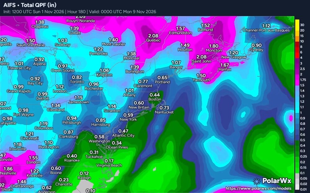
It backed waaayy off . Had 2-3” earlier runs
-
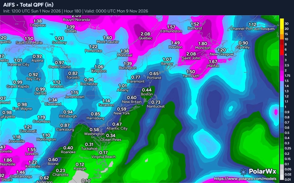
Euro AI shows overwise
-
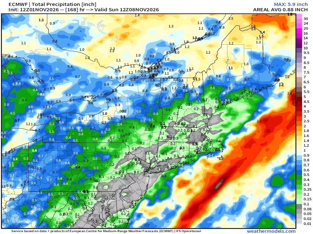
12z Euro through next weekend pretty dry across the region... maybe a little rain out to i81 corridor... but it looks like less than half an inch... rain finally becomes more plentiful and widespread by Day 9 on
-
Euros going Stein end of week
-

Mountain West Discussion
mayjawintastawm replied to mayjawintastawm's topic in Central/Western States
October came in for Denver at 2nd warmest ever. Precip was 0.44", same as at my house and about 40% of normal. Centennial Airport just south of me (airport is 3 miles S, measuring station is at the south end of the runway) got only 0.02". Gotta change this pattern just a little. -
2026-2027 Record-breaking El Nino
GaWx replied to Stormchaserchuck1's topic in Weather Forecasting and Discussion
1. There may be an increased chance at an overall significant DJF averaged -AO after a Nov SSW during El Niño. I found only 4 Nino Novs with a SSW (>15 dip of 10 hPa/60N winds to <10): 1968: dropped ~37 to ~-8 on ~Nov 27th; DJF AO -2.3 (3rd lowest of all winters since 1950) 1976: dropped ~26 to ~+4 on ~Nov 15th; DJF AO -2.6 (2nd lowest of all winters since 1950) 1979: dropped ~24 to ~+6 on ~Nov 23rd; DJF AO -0.6 (31st lowest of all winters since 1950) 2009: dropped ~17 to ~+6 on ~Nov 15th; DJF AO -3.4 (lowest of all winters since 1950) So, avg DJF AO for these 4 winters was way down at -2.2 —————— 2. At least one major SSW followed during each of these 4 winters. -
Hi fellow Christmas lover! Im the same. Got tye Halloween/Fall decor down now bringing up the Christmas tubs. I actually would rather have milder weather to start November to finish raking, winterizing, decorating because often times it bodes well for cold/snow near Thanksgiving. No guarantees of course. My mind is ready for snow, but i know hiw November weather patterns work.
-
That looks long term. Maybe the season? Damn.
-
Orioles. Ravens. Why, lol UNLESS...these things lead to necessary changes last year.
-
It'd be a miracle at this point if NNE gets even close to seasonal snowfall. We can already see a preview of the winter pattern next week with the screaming pac jet and arctic air bottled up to nunavut.