All Activity
- Past hour
-
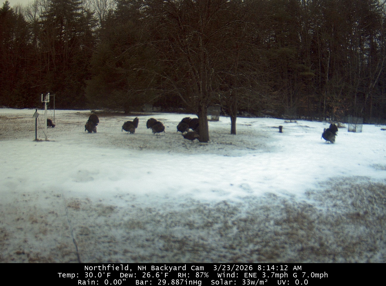
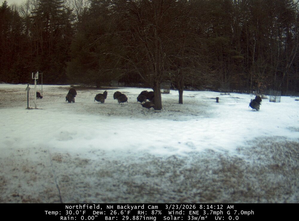
Sausage fest here. Turkey sausage.
-
I was kidding with him. Pelting with a few flaws here. Ground whitening.
-
Set a new record high for the date of 83.9 degrees, beating old mark of 81 degrees from 2012. Interesting morning here, had two rounds of thunderstorms almost back to back between 4 and 6 am. First one had a 35 mph gust, AND the temp rose 8 degrees (from 56 to 64) in just a few minutes right in front of the first storm.
-
A little surprised it's actually icy.
-
Time to the subscriptions before the monthly violation.
-
Bit a coating starting when I left a couple of hours ago.
-

E PA/NJ/DE Spring 2026 Obs/Discussion
LVLion77 replied to PhiEaglesfan712's topic in Philadelphia Region
0.86“ of rain for the event. We got very little precip and no severe weather on the front end, but a good amount of precip on the back half. We often head into spring with a rainfall deficit, but not this year. -
79 yesterday at home. Mid 80s in Laurel where I spent my weekend. And of course it’s damp, foggy and dreary this morning.
-

Occasional Thoughts on Climate Change
Typhoon Tip replied to donsutherland1's topic in Climate Change
https://phys.org/news/2026-03-planet.html "The amount of heat trapped by Earth reached record levels in 2025, with the consequences of such warming feared to last for thousands of years, the UN warned Monday." -
Beautiful AM with fluffy snow falling. Light coating
-
Seems high
-
That's nuts
-
Just about 1/3 of an inch in methuen...Hopefully the measurement isn't called into question for being too high or too low lol
-
Kind of the kitchen sink. Sleet accumulating on windshield. Deep winter is back.
-
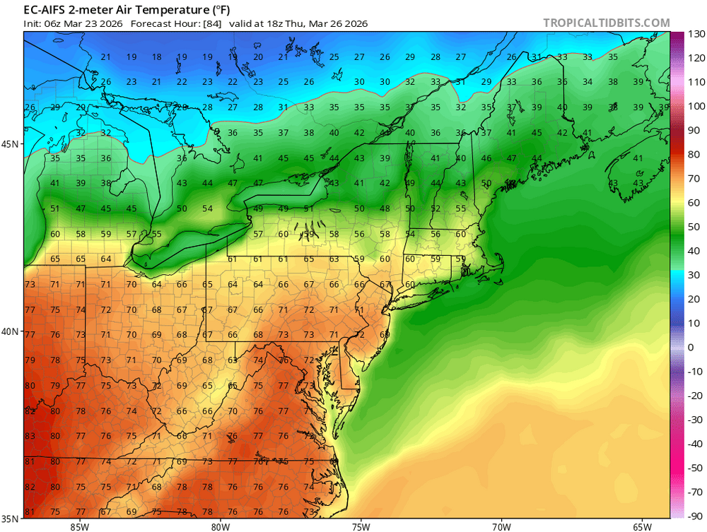
AIFS showing mid 80s to start April. Anytime there's some ridging we hit record highs, doesn't take much at all.
-
0.26” of
-
.thumb.jpg.6a4895b2a43f87359e4e7d04a6fa0d14.jpg)
Central PA Spring 2026 Discussion/Obs Thread
Yardstickgozinya replied to Voyager's topic in Upstate New York/Pennsylvania
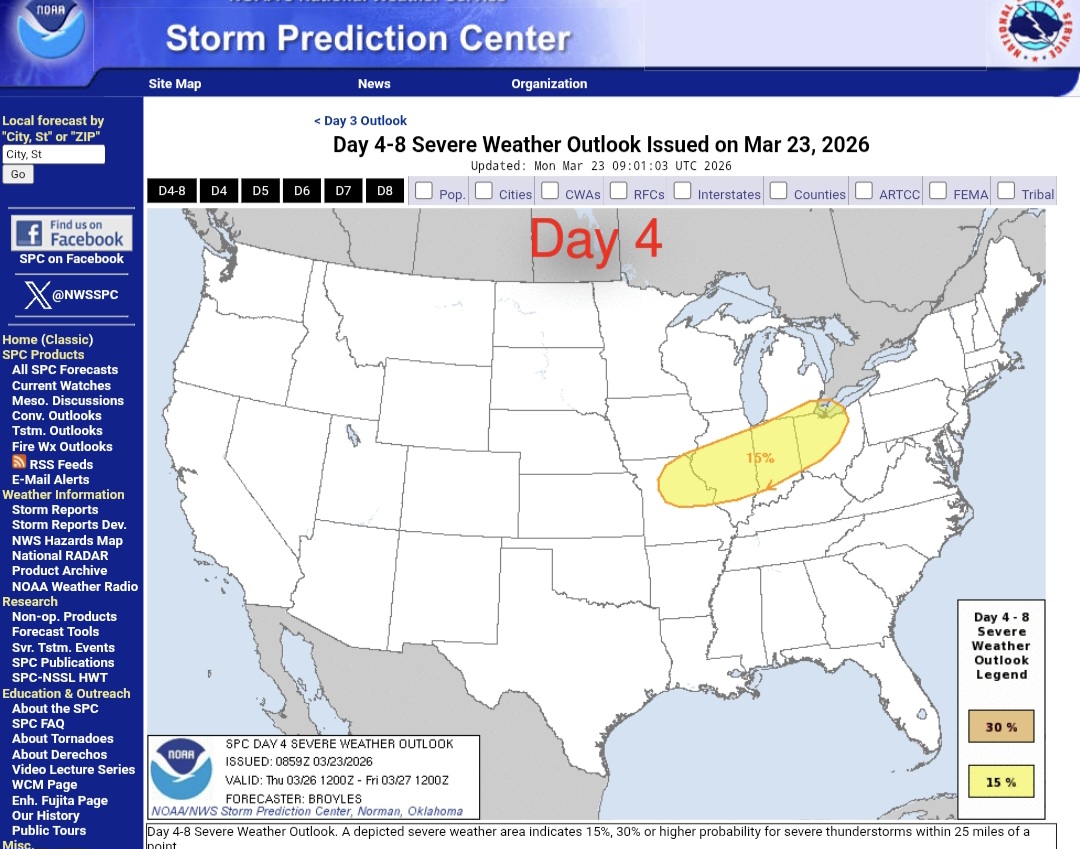
There's some severe risk on Thursday in the Upper Mississippi and Ohio valleys. Getting an expansion and shift this for east, is asking for a lot, but, I don't think it's outside the realm of possibilities considering the expansions, we've seen the last two weeks. Expansion/ shifts or not. It keeps up the pattern of early spring severe risk being displaced north and east.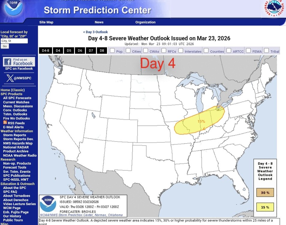
-
It began as snow around 6am when I left home.
-
march 2012 naso special after all these mega ridges are just gonna happen now
-
The AIFS has 70° potential also in NJ on Thursday and takes middle ground between the Euro and GFS. But the warmth struggled to get much further north yesterday. So it’s possible that NYC and points north and east doesn’t get as warm as the 0z OP Euro. I will gladly take a AIFS compromise and get warmer than the GFS but not as warm here on the CT Shore as the OP Euro.
-
<0.2" of precip since yesterday.
-
Yeah there’s nothing later
- Today
-
1.65" so far here
-
Thats if the eps is right. It has been too warm this past winter in the mid to long range. Not saying its wrong but the gefs is cooler with temps in the 40s and 50s.
-
Checked Cocorahs. Closer to 1.6”