All Activity
- Past hour
-
Oof
-
LFG


-
You should follow the weather. Warned of it yesterday. You shouldn't have to wake up surprised.
-
The same repeating pattern year after year. Same background state. Different night, same ending
-
Where did this heavy rain come from? Certainly not modeled like this
-
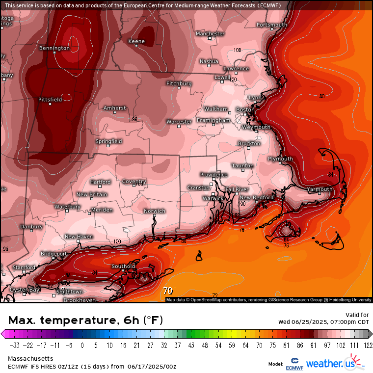
MEX already has 97° for BDL Tue.
-

Central PA Summer 2025
Mount Joy Snowman replied to Voyager's topic in Upstate New York/Pennsylvania
Low of 63 with a hefty .73” of rainfall. -
Love that NBC has the records on the graphic. What a summer about to roll in.
.thumb.png.4035c715ffd0f2f4708b5372744ed6a3.png)
-
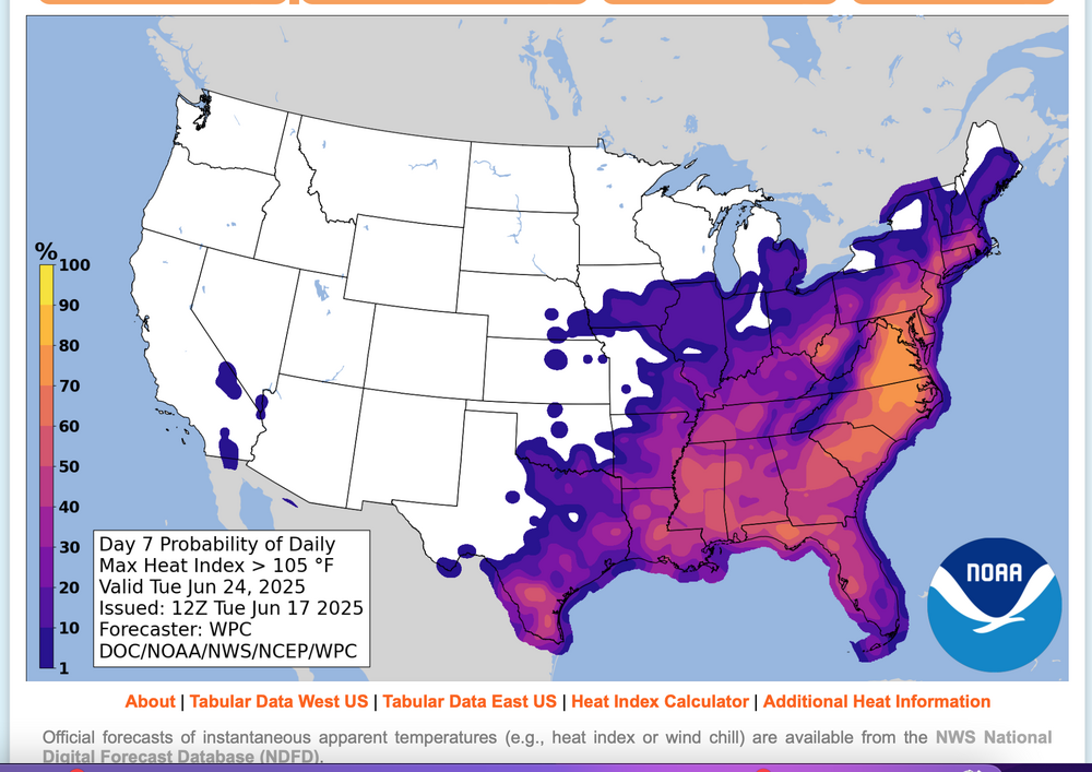
Considering, but not acting upon a possible thread for interior NJ first June 3 or more 100 degree days, occurring next week. Blend of Models is several degrees under 100. I want to see how temps play this Thursday (KEWR 90?), and subsequent modeling. Much can interrupt excessive heat, including sea breezes, thunderstorms, cloud debris. TOO early but for me, worthy of monitoring. 105 "heat index" - think that is our warning criteria up here, has according to WPC statisitcs is around a 60% chance of occurrence Monday and Tuesday. Here is Tuesday's early morning WPC prediction for Tuesday. Click for clarity and use the graph for probability interpretation.
-
This is not your typical heat wave coming up. Ensembles and model runs are getting more intense every day. This is some historic stuff coming up. 600dm showing up on GFS
-
Hottest euro run yet
-
.65" in the last 12 hours, 2.46" for the month.
-
Another. 07 overnight event total 2.84. I'm not sure if anymore is on the way before we bake but I'd bet all of the wet from me on south mutes some of the heat coming up. Instead of 97 it will probably be 95
-
Picked a good week for vacation https://bsky.app/profile/wxmvpete.bsky.social/post/3lrs7sohee222
-
.65" in the last 12 hours now.
-
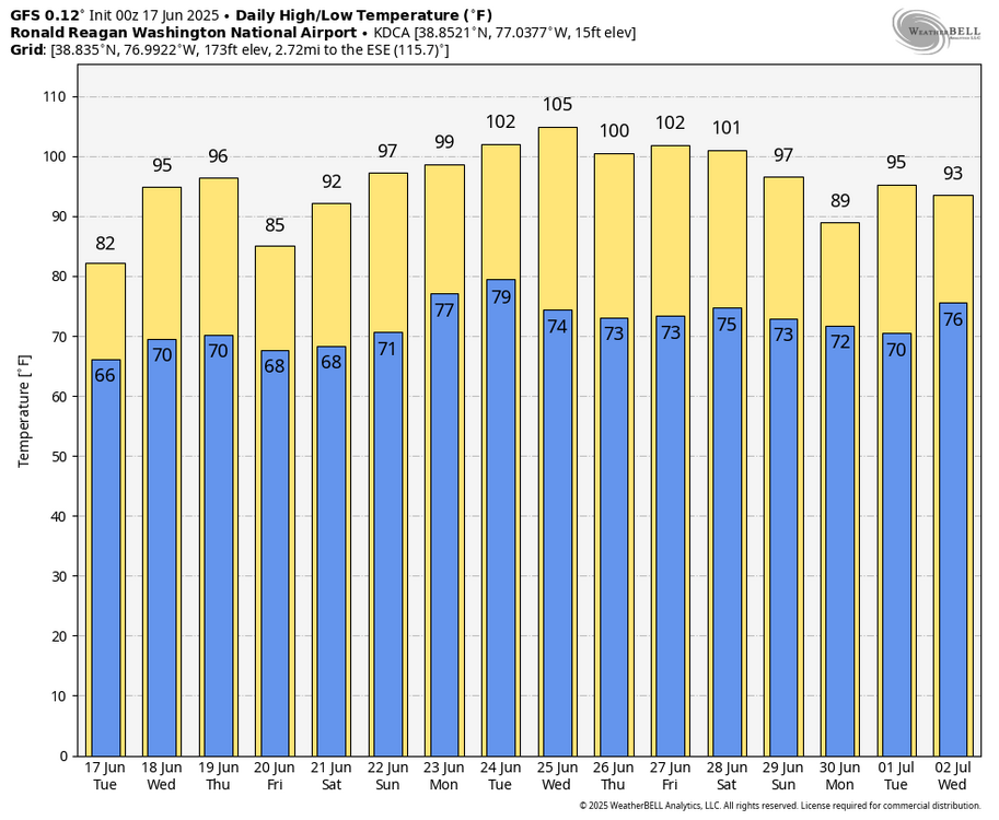
WB 0Z GFS is hot next week as well...
- Today
-
What does GFS show. Thought Euro ran several degrees too high, but still we roast.
-
We’ve had continuous light drizzle all night. Wondering how much we are up to since this event began last Friday. Every drop counts with this projected torch; also I’d prefer to avoid hand watering my newest gardens that I installed in May
-
Ensembles are getting stronger with the heat dome. 600dm now showing up on GFS.
-
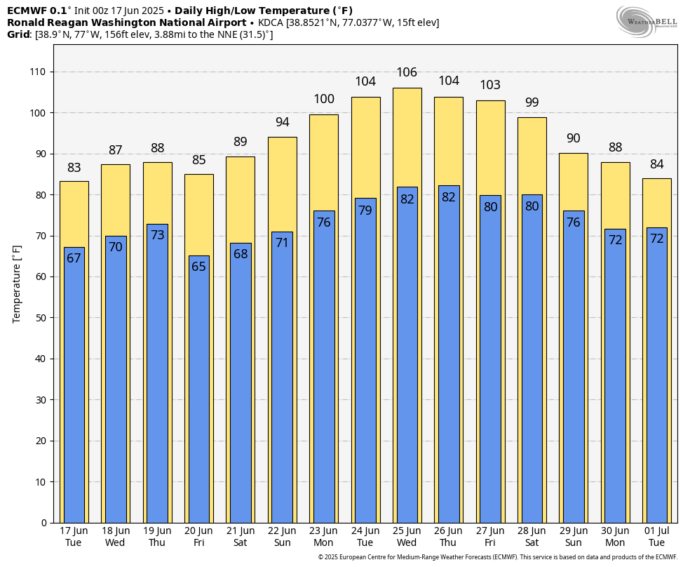
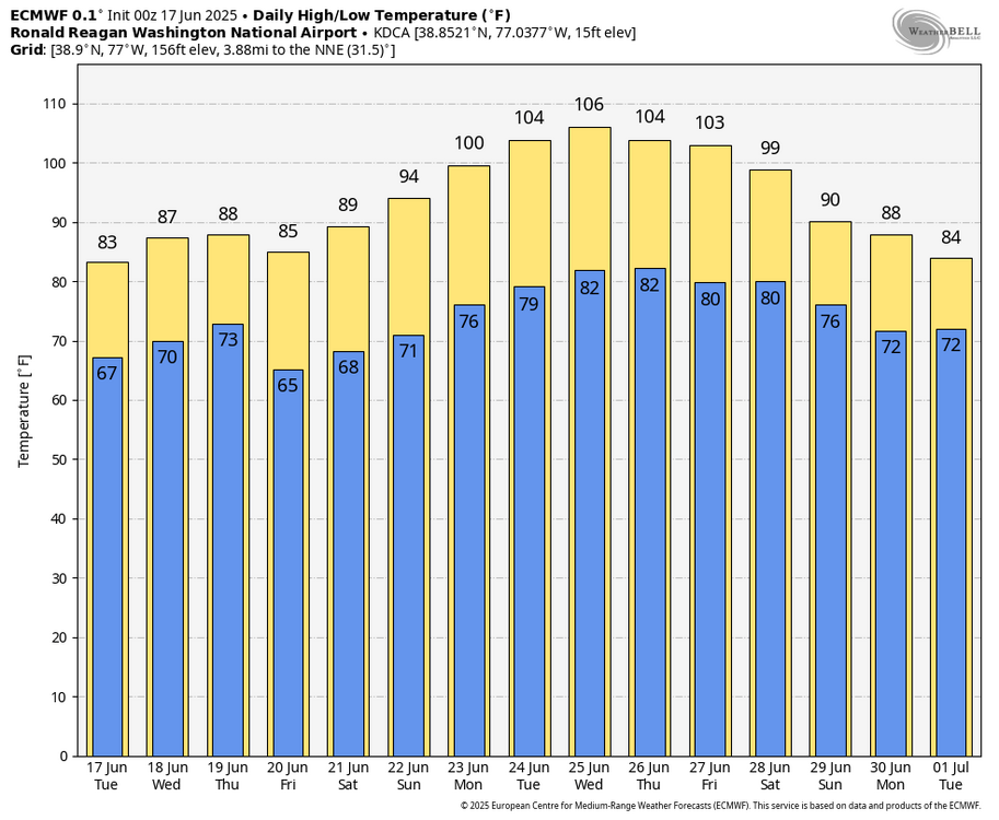
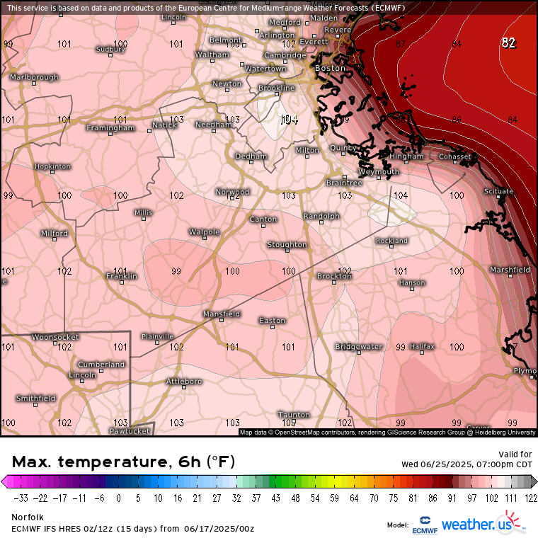
WB 0Z EURO. Get the ac checked. High heat on the way next week.... with low 100s forecasted several days. Peak may be Wednesday: 106 at DCA!
-

2025-2026 ENSO
Stormchaserchuck1 replied to 40/70 Benchmark's topic in Weather Forecasting and Discussion
Continued really strong +NAO/+AO pattern.. the CPC readings don't go that high, but the 500mb over Greenland and the Davis Strait rival a 3-standard deviation trough. We saw the same exact thing last year, weeks after major solar flares (which we had a short time ago) Say what you want about Winter -NAO not correlating with East coast troughs, but we have seen some really extreme ridges under strong +NAO H5 patterns since January 2024. -
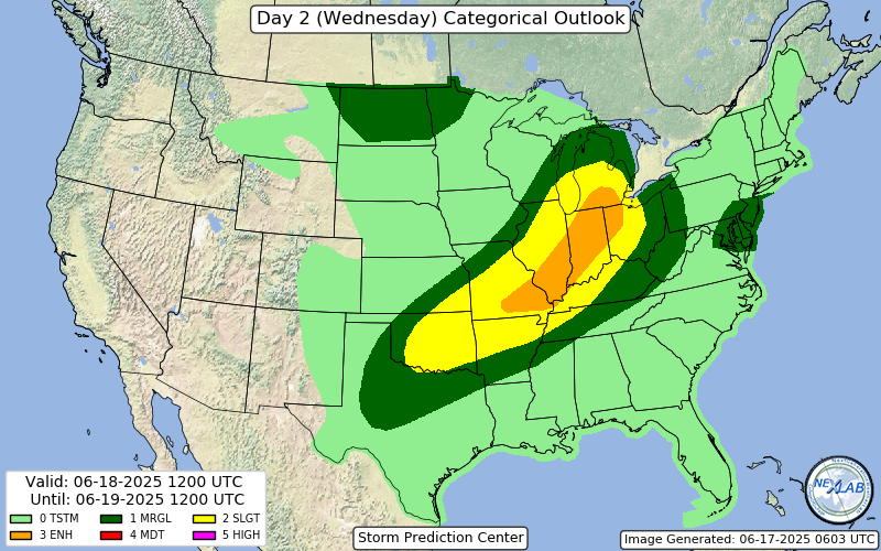
Wind driven enhanced introduced, could see a 10% TOR getting added if the nastier solutions look more likely
-
Picked up another .50" yesterday. This brings my monthly total to 4.06".
-
we have had thunderstorms and i heard thunder a few times here in nyc


.png.b2fe3323af9cb29dfcf12b0acdd4c25d.png)