All Activity
- Past hour
-

2025 Short Range Severe Weather Discussion
yoda replied to Chicago Storm's topic in Lakes/Ohio Valley
Moderate risk on new Day 1 -

2025 Short Range Severe Weather Discussion
MNstorms replied to Chicago Storm's topic in Lakes/Ohio Valley
Wow. - Today
-

July 2025 Obs/Disco ... possible historic month for heat
weathafella replied to Typhoon Tip's topic in New England
The squirrels are dead to me. -

July 2025 Discussion-OBS - seasonable summer variability
Wxoutlooksblog replied to wdrag's topic in New York City Metro
I think it could be just noise but the GFS backed off the extreme heat a little at 00Z. NAM would suggest it's still on for Wednesday. WX/PT -
Jacksonville (tied daily record), Hogtown, and Leesburg (new record for date) joined Tampa at 100 for yesterday’s high.
-
And 113 for peak heat index. Summers are getting unreasonable here.
-
lol. I’m not sure that anyone likes smoke
-

July 2025 Obs/Disco ... possible historic month for heat
Snowedin replied to Typhoon Tip's topic in New England
Tell that to the giant toads hopping around my front walk way! But all joking aside you know we’re gonna get some crazy storm within the next month or two, just not in the way we’ve come to expect it. Think of those cape/south coast spin ups just a couple years back but on a slightly larger and a little less spectacular scale. -

2025 Short Range Severe Weather Discussion
cyclone77 replied to Chicago Storm's topic in Lakes/Ohio Valley
Yeah, Iowa's going to cash in again for the 95th time this summer. -

July 2025 Obs/Disco ... possible historic month for heat
FRWEATHA replied to Typhoon Tip's topic in New England
1983 was a brutally HHH summer even here. -
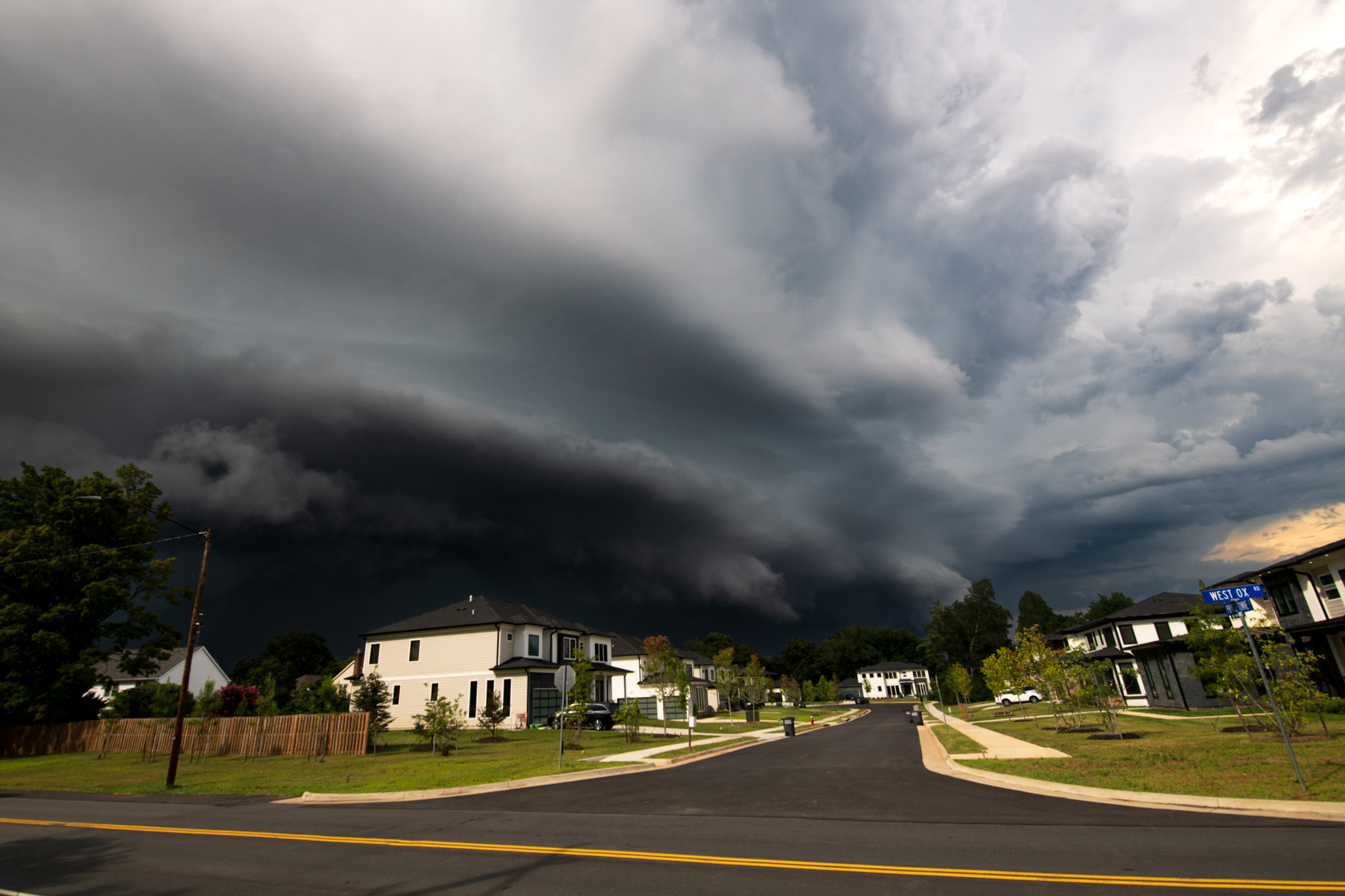
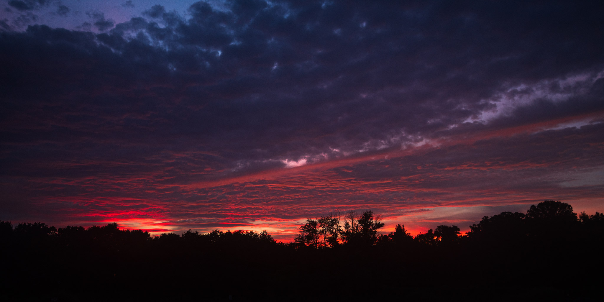
Some fun pictures of clouds from today! Got a cool shelf cloud from the storms that moved into FFX county along with a little cap cloud on some convection and then finished with a nice sunset.


-

2025 Short Range Severe Weather Discussion
CheeselandSkies replied to Chicago Storm's topic in Lakes/Ohio Valley
Models not real keen on the good MCS action from tonight and again tomorrow night making it much east of the Mississippi. Story of the year it seems. -

2025-2026 ENSO
Stormchaserchuck1 replied to 40/70 Benchmark's topic in Weather Forecasting and Discussion
Subsurface is approaching -6c right now.. if that's normally 65F water, right now it's 55F. That's raw, not adjusted for global warming and everything.. I do think that it really can't go much lower than this given how warm everything is, without it being some anomaly. And the subsurface does fluctuate more than the surface (Kelvin/Rossby waves) It's still July.. if Aug comes in <-0.5 ONI, it has a good chance of making it 5 straight months.. even Sept would have to carry only through January for an official Nina. Tropical tidbits currently has Nino 3.4 at -0.6c, but I know CPC is much warmer.. looks like they are -0.1 to -0.2 -
People that want to dim the sun should like the smoke, but yet all they do is complain about it. Frauds
-
Obsessed with him. You would think he posted here or something by the amount of times you bring him up. His x posts get like 3 likes and zero replies. He's pretty much irrelevant, except to you
-
I adjust with the model consensus, with each model adjusted for what I perceive to be its bias. My latest prediction of a -0.4 ONI low was based on July runs. I’ll re-examine in August.
-

2025-2026 ENSO
40/70 Benchmark replied to 40/70 Benchmark's topic in Weather Forecasting and Discussion
Okay...that was a no-brainer IMO. My guess on ONI right now is -0.5 to -0.7. -
2025-2026 ENSO
40/70 Benchmark replied to 40/70 Benchmark's topic in Weather Forecasting and Discussion
If you mean official La Niña, I think it's insane to be confident of that right now. Simply ONI peak, sure. -

July 2025 Discussion-OBS - seasonable summer variability
forkyfork replied to wdrag's topic in New York City Metro
the afd says they're waiting to see how dewpoints look in the morning -
All I’ve gotten is a lot of 5-10 minute lake breeze showers and one weak MCS that just barely brushed me with the better rains splitting north and south. It’s added up to barely over an inch for the month of July. Not nearly enough in this warm weather. It’s crazy dry.
-
This humidity is absolutely ridiculous…
-

July 2025 Discussion-OBS - seasonable summer variability
Stormlover74 replied to wdrag's topic in New York City Metro
Interesting that Mt holly isn't going with any heat advisories or warnings -
July 2025 Discussion-OBS - seasonable summer variability
forkyfork replied to wdrag's topic in New York City Metro
this is better than the 50s and cloudy we get all winter -

July 2025 Obs/Disco ... possible historic month for heat
Typhoon Tip replied to Typhoon Tip's topic in New England
I noticed some extra special sauced DPs spanning IN and IL today. 76-82 with Ts 90 to 92. It’s almost like the GFS is advecting that air over the terrain and DS and so we end up 98/70 -

July 2025 Obs/Disco ... possible historic month for heat
HoarfrostHubb replied to Typhoon Tip's topic in New England
I still think the late June spell was peak heat for SNE this season. But yeah.