All Activity
- Past hour
-

Late February/Early March 2026 Mid-Long Range
winter_warlock replied to WxUSAF's topic in Mid Atlantic
That is a thing if beauty bro! -
So we are noting a trend towards favorable for an event.
-
Bro haha
-
Having trouble keeping up, what’s the quick rundown on what models are showing what
-
Not yet, But “US” is also a broad statement, I think most of these have a better shot down your way then here right now but I’ll take them one at a time for analysis.
-
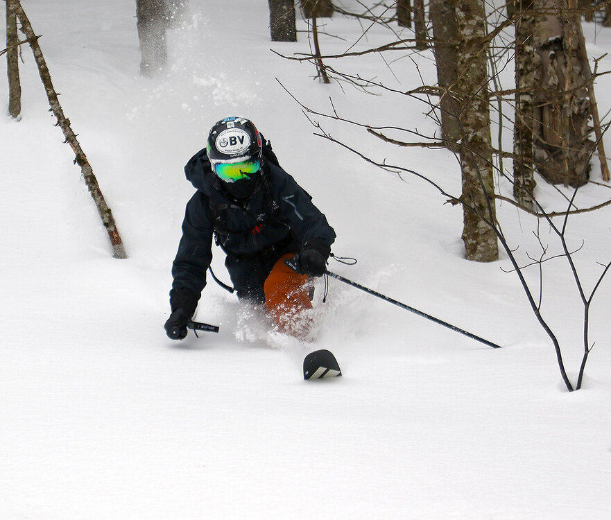
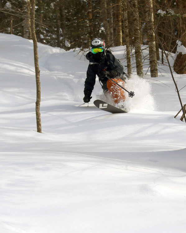
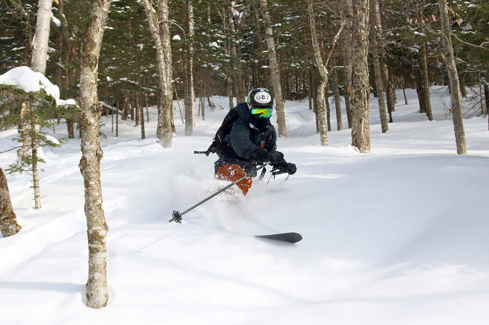
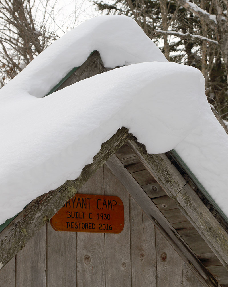
Yesterday my older son and I headed back up to Bolton Valley for another ski session. The powder is still staying in excellent condition, but with another day of holiday weekend skier traffic at the resort, we switched it up from our sidecountry excursions on Sunday to get further into the backcountry on the Bolton Valley Nordic & Backcountry Network. Temperatures were pleasantly seasonable again, but it was cloudy when we arrived in the mid- to late-morning period, and the number of visitors to the resort was much less than what we’d encountered on Sunday. We planned a relatively short tour up the Bryant Trail and then around the Bryant Cabin, but we ended up extending it a bit with a traverse up into the terrain between Heavenly Highway and North Slope. We descended through some fun new terrain down to North Slope, then followed some of the usual glades like Gun Sight through Gotham City and eventually down into some of the lower glades like Cup Runneth Over. We made a brief second lap to hit another glade off World Cup that we’d seen, and that trip helped clarify our understanding of some of those numerous Bryant Trail/World Cup intersections. By the time we were heading out in the mid-afternoon period, the sun was breaking through the clouds and temperatures were creeping up close to the freezing mark in the Village. We didn’t detect any issues with temperatures affecting the quality of the powder at that point, but I wouldn’t be surprised if south-facing lower-elevation areas ultimately saw a bit of thickening in the snow consistency.

-
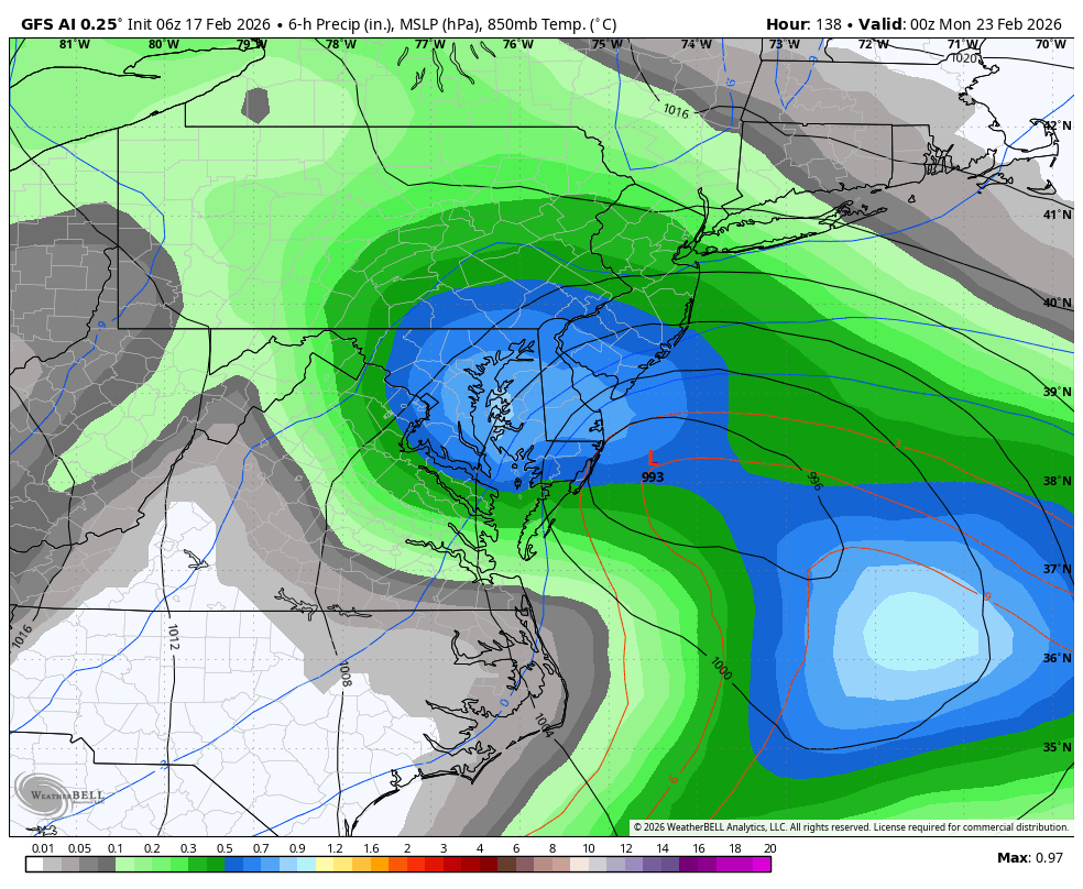
Dunno if anybody talked about it but the GFS AI starts as rain before flipping to heavy, heavy snow at 31-33. Probably at least 6" 10:1 areawide

-

-
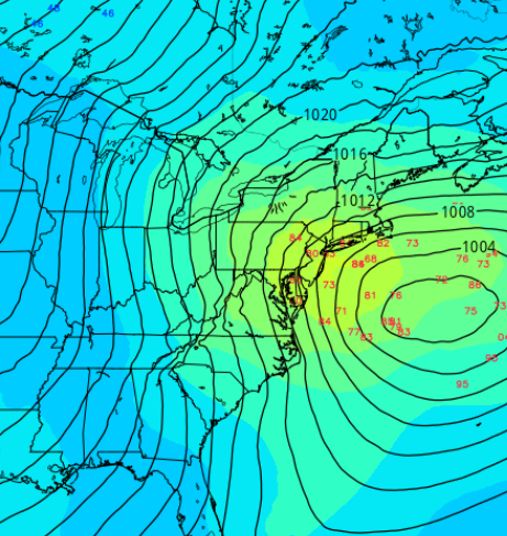
This mean is a bit of a reposition W. Along with the spread ( in particular) opening up with more members closer to the coast, does lean more ominous.. 06z EPS mean. Some deep members there and more of them pulling/morphing the pressure pattern w-nw tends to flag where the correction wants to go, as aspect that has been noted when using ens means prior to other events in climo
-

Late February/Early March 2026 Mid-Long Range
stormtracker replied to WxUSAF's topic in Mid Atlantic

-

Wednesday Feb 18 Mixed event. NoP refresher?
CoastalWx replied to HoarfrostHubb's topic in New England
What a weird system. Very narrow area that may do ok. -
I’m more worried about tucking and a NE/interior event. Models sometimes underplay strengths of shortwaves headed from Colorado region. On the plus side the 50/50 is timed absolutely perfectly. I’m still at the “what could go wrong” stage. This is why we play the game though ha. Cautiously extremely excited, those 6z ai runs were pure porn
-
Pretty sure there was a parade of kickers in that one. While this may be out to sea, this is a different setup.
-
Late February/Early March 2026 Mid-Long Range
stormtracker replied to WxUSAF's topic in Mid Atlantic
You really can’t compare the two worst posters here with a smart, degrees met. We look up to the met, we have faith in him. He and he alone is responsible for the failure or success of this storm. His very membership is on the line. -

Wednesday Feb 18 Mixed event. NoP refresher?
ineedsnow replied to HoarfrostHubb's topic in New England
.thumb.png.226bb7863515e7ca07ad9ab5cb87bcc6.png)
-

February 2026 OBS & Discussion
PhiEaglesfan712 replied to Stormlover74's topic in New York City Metro
94-95 being warm and virtually snowless (with the exception of February), despite being a moderate el nino, shows how things were screwed up after Pinatubo. 92-93 was the backloaded winter with the Storm of the Century in mid-March, while 93-94 and 95-96 were wall-to-wall cold and snowy. -

Is we back? February discussion thread
TauntonBlizzard2013 replied to mahk_webstah's topic in New England
Okay how’s this: Its coming. All 3 events are going to crush us! -
Looks like some inversion tendencies coupled with snow melt and evaporation leading to higher concentrations of fine particulate matter during the mornings and early afternoons. Moderate levels expected, so nothing too crazy, but some localized maxima are certainly plausible in the AM. https://mde.maryland.gov/programs/air/airqualitymonitoring/pages/aqforecast.aspx
-
Is we back? February discussion thread
TauntonBlizzard2013 replied to mahk_webstah's topic in New England
I’m not wrong though. That’s what’s happened -
Plenty of caution flags listening to you tell us about them.
-
Dude you’re ruining my snowgasm lol
-

Wednesday Feb 18 Mixed event. NoP refresher?
weatherwiz replied to HoarfrostHubb's topic in New England
I could see tomorrow too being a case where the radar returns are much stronger than ground truth because of the degree of bright banding we'll see taking place. -
looking forward to this much-needed rain
-
He already porked WOR starting this, Lets see who else is screwed.
-

Wednesday Feb 18 Mixed event. NoP refresher?
Modfan2 replied to HoarfrostHubb's topic in New England
Maybe the hills near Union, Woodstock, and Stafford; Tolland might see a coating


.png.43d4dff72640feae4ab767af792cd0cb.png)


