Massplow
-
Posts
105 -
Joined
-
Last visited
About Massplow

Recent Profile Visitors
2,365 profile views


-
What time does this look to ramp up in the Boston area ?
-
The chickens aren’t hatched yet
-
What’s the word on the rest of the night. Franklin/ Mansfield area? Trying to decide if I’m going to need to have crews in to scrape lots or if we’ll be able to salt whatever falls overnight off? Somebody help me
-
I havnt been keeping up did you put out your map yet
-
Rain/sleet mix in norton that seems to be freezing on contact. What’s the rest of the evening/ night look like for here. We salted lots and it seems to be holding for now but not sure if it’s gonna glaze up again soon?
-
What time is late i gotta rest up
-
Is this gonna be a wet pavement deal where it’s sleet/ mix or is it gonna be a mess? Plowable snow overnight tomorrow or something that can be melted off with salt? Trying to plan for a crew
-
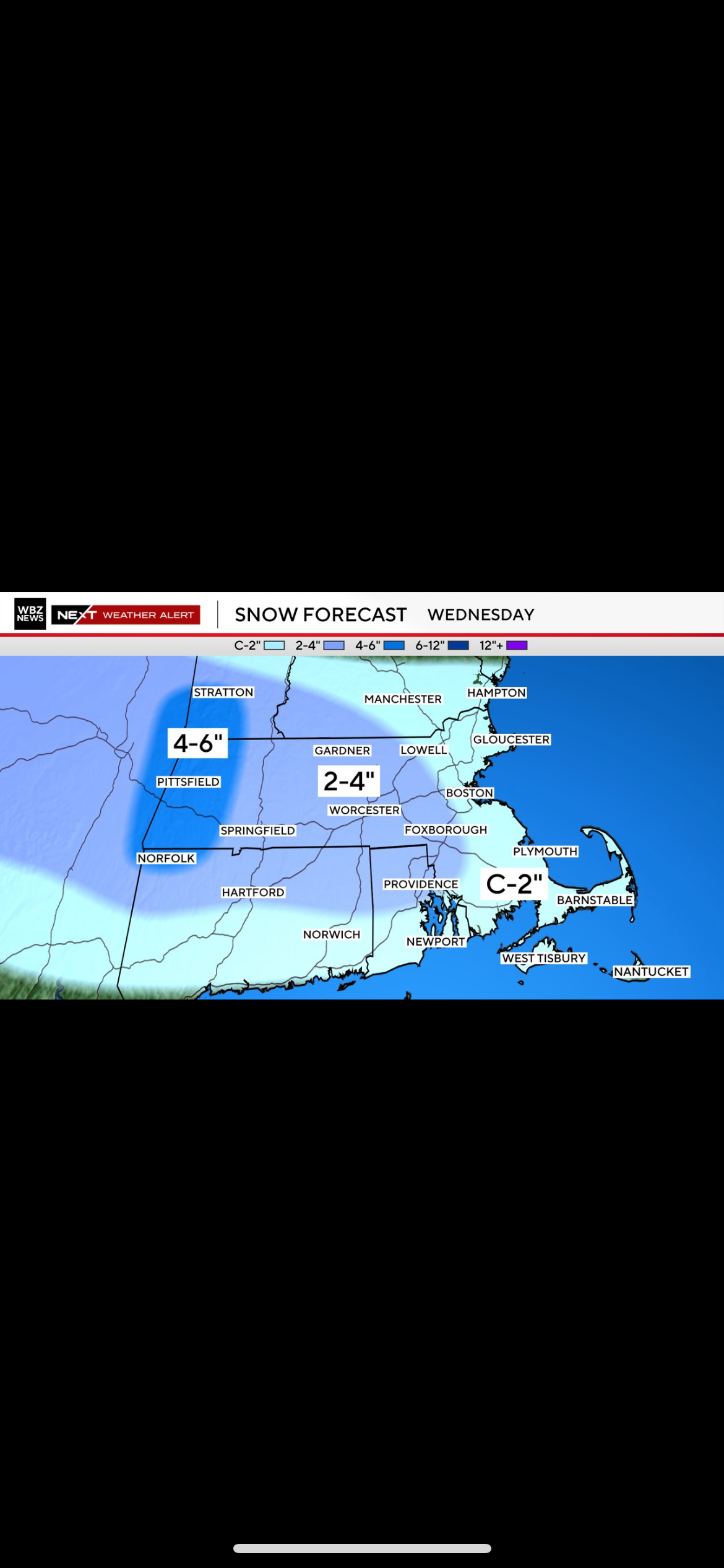
Wednesday Feb 18 Mixed event. NOPE …ain’t happenin’
Massplow replied to HoarfrostHubb's topic in New England
Is the precip going to fill back in at all or is it done where it’s done? -
Wednesday Feb 18 Mixed event. NOPE …ain’t happenin’
Massplow replied to HoarfrostHubb's topic in New England
Every flake is worth it!!! I’ll be waiting for the final call!!! -
Any concerns for freezing fog tonight? Everything seems pretty damp already, wondering if that’s going to make things icy in the morning?
-
Having trouble keeping up, what’s the quick rundown on what models are showing what
-
Wednesday Feb 18 Mixed event. NOPE …ain’t happenin’
Massplow replied to HoarfrostHubb's topic in New England
Wbz with a heavy pour ?
-
There’s a huge salt shortage because of it. Very tough to get salt
-
Friday February 6 FROPA / WINDEX small event
Massplow replied to HoarfrostHubb's topic in New England
Is Mansfield ma area gonna get that?? Probably still under an inch here -
Friday February 6 FROPA / WINDEX small event
Massplow replied to HoarfrostHubb's topic in New England
Never a good sign when I have to put the sunglasses on when I’m supposed to be heading out to plow