All Activity
- Past hour
-
Yes, and good point, but the non-linear nature of atmosphere and the strength of this El Nino? I have learned that what we thought should happen and worked as a good analog prior, well, just when you think you have seen it all, something happens that has one going ???? I do not think there is any clear evidence that an favorable phase of the AMO precludes two suppressed Atlantic seasons in a row. For the sake of argument, lets say "suppressed" is less than 70% of avg ACE. You have 1945-46, 1956-57, 1959-60, and 2013-14, all in the favorable phase of the AMO, but less than 70% ACE each season.
-

Mid-Long Range Discussion 2026
WinstonSalemArlington replied to BooneWX's topic in Southeastern States
-
That anxiety is soon coming lol
-
Isn’t 1938 also about a very high storm surge?
- Yesterday
-
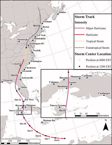
The Oct 1846 hurricane was exceptional as well. A 2021 study showed that if such a HU occurred today, costs would be over $100B for the E Coast. https://www.tandfonline.com/doi/full/10.1080/24694452.2020.1838257 Unfortunately. the paper is behind a paywall.
-
The level of anxiety this forum would have if this system was in January would be through the roof
-
Yes, and POR (period of record) considered is paramount, so mentioning the paleoclimo record of 1000 years is key to historical discussion. I get the distinct impression from the mainstream, it like everything prior to 2000 didn't happen! It's all about here and now, and the past/history be damned! Oh, I know why that is and the media business model, but it misleading so many as to wx events these days. Facts are meaningless w/o context, so you can't treat wx events currently or recently in a vacuum! That's why studying history is so important. Why I said 2000 above as "that's when wx history 'started'?" I've see those little daily wx calendars where you rip off a page each day, and it became quickly obvious to me that most wx events were post-2000! Not that there were not sig wx events on the days post-2000, but why would they *not* list the Tri-State Tor on 3/18/1925 or the GLS HU on 9/8/1900?
-
Hit 93 for a high here. Unbelievable for mid October.
-
Have ya heard? Super El Nino cometh.
-
Rain
-
Dad and beer for starters
-
Let’s see what 18z euro ai does
-
Tomorrow will then turn briefly milder with temperatures topping out in the lower to perhaps middle 70s ahead of another cold front. The cold front could bring showers and thundershowers. A few thundershowers could be strong to severe. Afterward, a piece of the air mass that set a record low temperatures in parts of Canada last weekend will move into the region for the weekend. The arrival of this air mass could trigger a few showers on Friday or Friday night. As a result, the weekend could see the coldest temperatures so far this season. Highs in New York City will struggle to reach 50° on Saturday and rise only to the lower and middle 50s on Sunday. The ENSO Region 1+2 anomaly was +5.2°C and the Region 3.4 anomaly was +3.3°C for the week centered around October 7. For the past six weeks, the ENSO Region 1+2 anomaly has averaged +4.73°C and the ENSO Region 3.4 anomaly has averaged +3.03°C. ENSO Region 3.4 has set a new all-time record. The ongoing strong El Niño, will continue to strengthen through the mid-fall. The SOI was -17.47 today. The preliminary Arctic Oscillation (AO) was +2.229 today. Based on sensitivity analysis applied to the latest guidance, there is an implied near 56% probability that New York City will have a warmer than normal October (1991-2020 normal). October will likely finish with a mean temperature near 58.4° (0.5° above normal). Supplemental Information: The projected mean would be 1.5° above the 1981-2010 normal monthly value.
-
My daughter is 0 for 3 finishing tournaments this fall. 3 bracket days all cancelled. I'm about to finish my season in the night mist which keeps back building over howard county. Baltimore Marathon is Saturday as well. Sounds like it might be a bit wet to start.
-
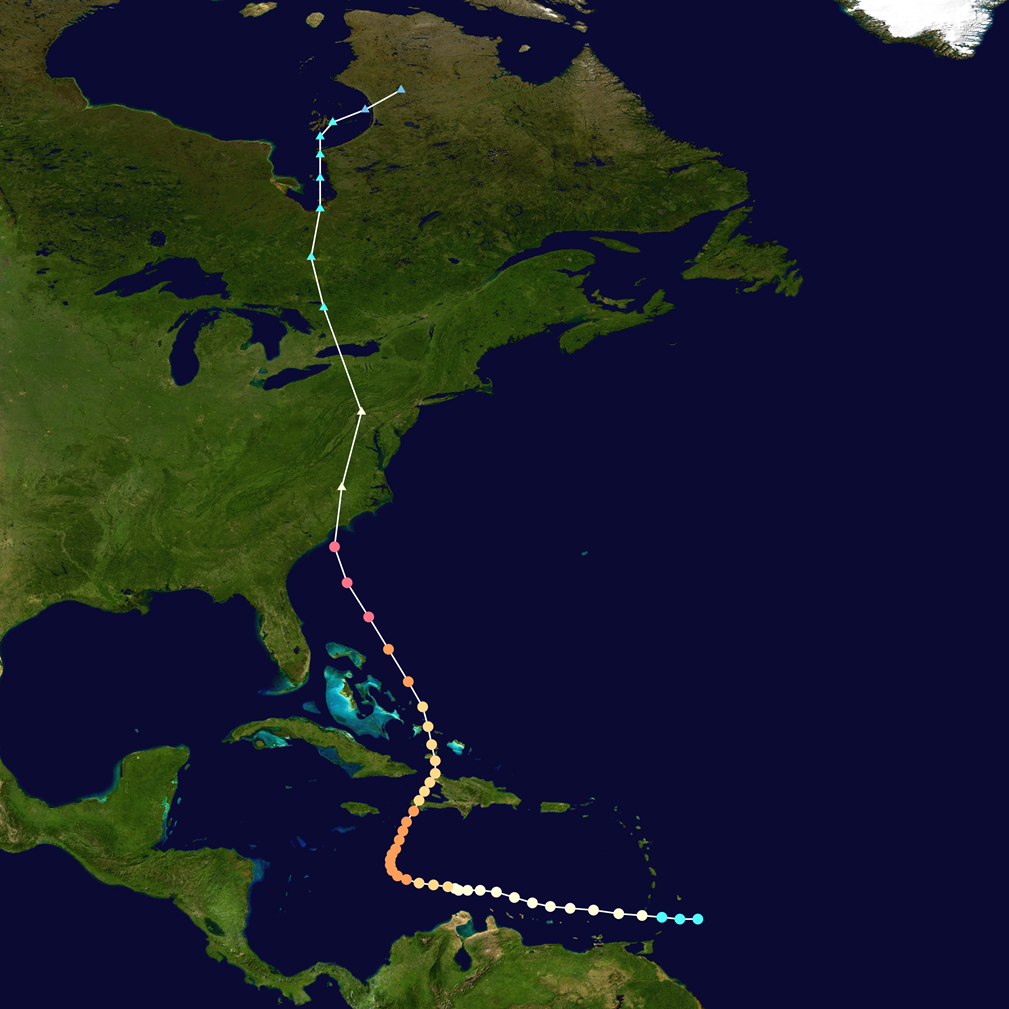
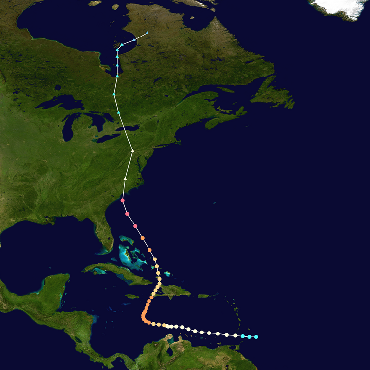
Hazel in Oct 1954 was a rare beast. First, it is strongest, farthest N HU landfall for so late in the season the CONUS on record (115 kt). Second, it likely the quickest ET transition for an intense landfall CONUS HU. HURDAT2 shows it ET only 2.5 hr after landfall! Third, its phase w/ a strong baroclinic trough was about as ideal as you could get, similar to Fiona in Sep 2022 I bet. It still had sustained winds of 70 kt when it was at 40N/77W, which is extraordinary. It was racing N at 42 kt once inland as well. A truly exceptional event, similar to Sandy, but for wind more potent. So is it any surprise such crazy winds occurred so far N? Not only NYC recorded its record gust of 98 kt, but also DC as well (85 kt). It's why I say events like Sandy are not unprecedented or really or not as uncommon as portrayed. Hazel, the 1938 New England HU, and Agnes in 1972, were much like this, getting picked up strongly and eventually phasing in w/ an potent baroclinic trough that would have resulted in a sig storm even w/o the HU present. And they each ended up setting the big records differently. Hazel and 1938 was about wind, Agnes was about rain/flooding, and Sandy was about storm surge.
-
Huh?
-
GFS has something around that time too. Definitely something to watch. If nothing else, it looks like the mountains will get a lot more much needed snow.
-
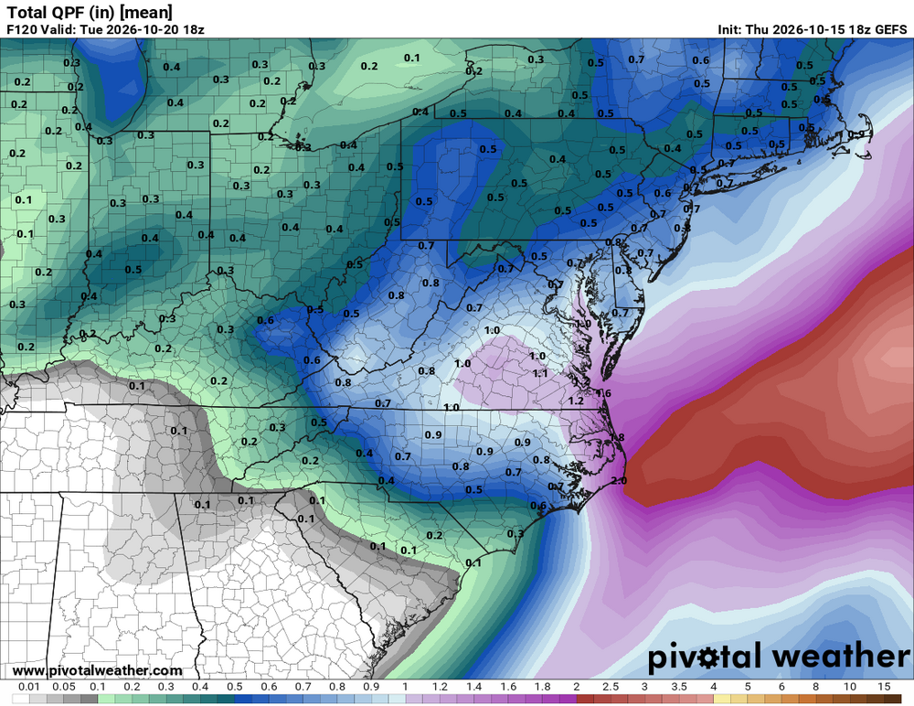
18Z UKMET is even further away from the E coast than the 12Z! So, as of now, the UKMET is by a good margin the least threatening for a close pass of the E coast!
-
At some point a heating climate change has got mean less snow guys Time to eat shit and suck on reality snow does not like warm air if we need to put it in really easy terms It’s especially uneasy for snow if it’s in concurrence with something like a super El Niño. Synergy quotient is both unknown and off the charts. Granted, this latter aspect is sort of uncharted water so we can’t be certain, but from a step back philosophical perspective, you’re talking about a warm state of affairs. And it so kind of follows intuitively that we might be more fucked than not. Just trying to be fair to the reality we’re in There is a pathway to getting more snow based in the fact that we have a negative PDO coupled state in the northern Pacific ; the incongruence between that index mode, and this particular El Niño open some dialogue of intrigue. But in a former forecast framework AccuWeather can’t really go on that. I’d haven’t read their tech discussion; for all we know they could have mentioned a caveat or two in there.
-
-

2026 Atlantic Hurricane Season
vortex95 replied to Stormchaserchuck1's topic in Tropical Headquarters
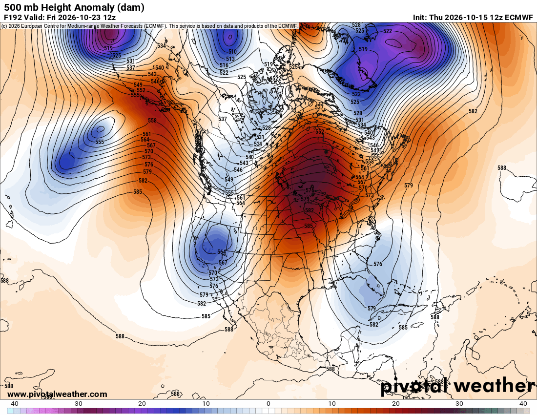
I am just a little surprised at the degree of blocking and amplitude given the very strong El Nino. A strong STJ from the El Nino usually prevents patterns like this (moves things along) and we already saw the STJ quite apparent that impacted Isaias. That was unusually strong STJ trough for the Gulf Coast for early Oct. 12z ECMWF looks like classic omega! What is this, May? I will say this. given the non0-linear nature of the atmosphere and its associated oscillations, something coming in being as the strongest on record (El Nino), unexpected things can and do happen that do not fit "what we thought should happen." I mentioned this before, it was assumed before that in very strong El Nino, Cali gets soaked and the Pac NW is dry. Well the 2015-16 event, the exact opppsite occurred!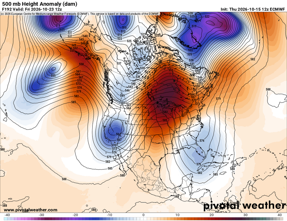
-
From what I have gathered from reading here, if a storm doesn’t exist at the time the long range precipitation forecast was issued, you just back out that precip amount and so on and so forth until you get back to the original forecasted amount. Thereby justifying any emotional attachment you had to said forecast.
-
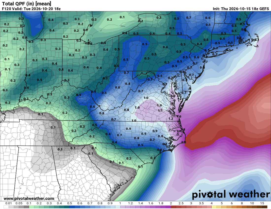
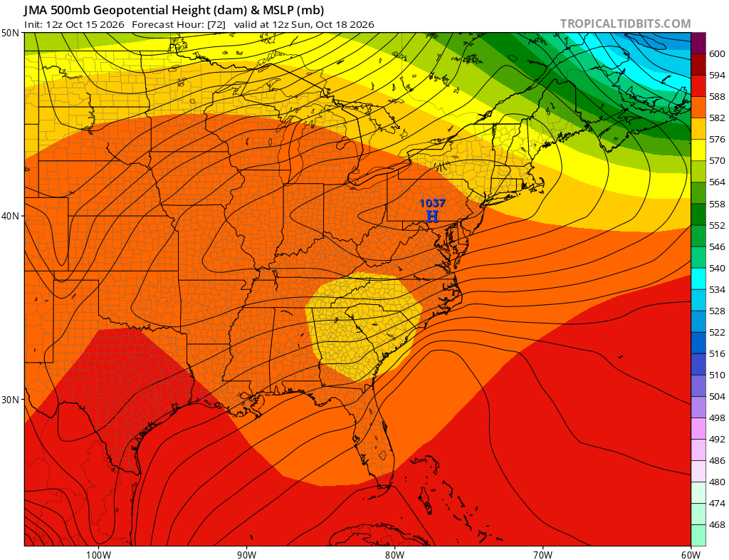
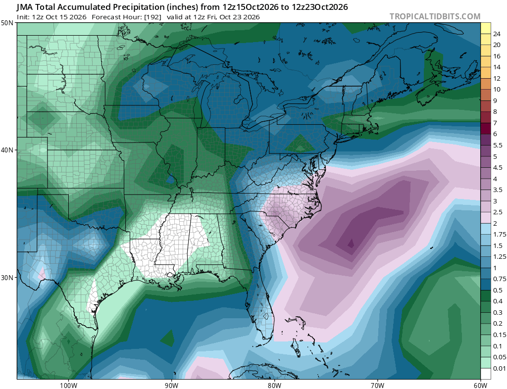
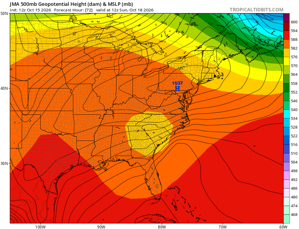
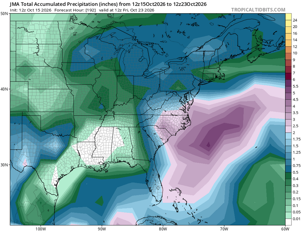
The 18Z GFS came well W and is thus the most threatening GFS run yet by far to the E coast with it only 200 miles ESE of Hatteras as its closest! Also, the 18Z Icon has come back W a bit from the 12Z, which itself was less threatening than its 0Z that was coming into the SE. Back to 12Z, the JMA has it for its first time and hits much of the SE solidly with this with much of the Carolinas and S VA getting a very beneficial 2”+ of rain the next 8 days:
-
So if NY gets like 16 inches, then they would average the average over the last 2 winters. Checks out.
-
Whatever forms off the east coast next week…better not drift closer to coast, for the sake of that forecast.