All Activity
- Past hour
-

Wounded Duck Strikes Back: Dec 26 & 27th Winter Storm Obs
Spanks45 replied to WxWatcher007's topic in New England
Will take a few more measurements, but I had 6.6" before I cleared the deck with an additional 1.2" this morning.....So 7.8" So nice to have a system that is snow from start to finish and hasn't already started melting....Kids are already out roaming around -

Central PA Winter 25/26 Discussion and Obs
Jns2183 replied to MAG5035's topic in Upstate New York/Pennsylvania
I'd wait till it goes above freezing for a few hours Sent from my SM-S731U using Tapatalk -

Wounded Duck Strikes Back: Dec 26 & 27th Winter Storm Obs
WinterWolf replied to WxWatcher007's topic in New England
@The 4 Seasons…8.0” here in Southington. Super satisfied/and a cold storm here. 10.5” on the month/season to date. -

Wounded Duck Strikes Back: Dec 26 & 27th Winter Storm Obs
Great Snow 1717 replied to WxWatcher007's topic in New England
A paltry total of 1.4 in Rainthuen. The multi year snowdrought continues to roll on with no end in sight for the Merrimack Valley and parts of So. New Hampshire. -

Winter cancelled/uncancelled banter 25/26
North and West replied to Rjay's topic in New York City Metro
no one knows. try to enjoy the here and now. . -
It’s an interesting discussion - bust or not - the Park clearly lost a few inches in those first few hours due to poor dynamics and most models didn’t indicate that. There was a point early on where it was literally snowing all around us and we weren’t even flurrying!
-
There actually was ocean effect snow for parts of LI. That’s a real thing. As for nyc, Central Park recorded 4.3”. On the lower end of what they expected but not a total catastrophe.
-
Really beautiful event here just east of the HVN ASOS. It came in as a very heavy wall of snow in the evening. We had 2” per hr rates for the first few hours. Then the rates decreased. Finished up here with a very respectable 5.5”.
-
In the end in my opinion not a bust and much closer to the original totals expected that many especially on social media suggested. 25-50 miles…
-

Wounded Duck Strikes Back: Dec 26 & 27th Winter Storm Obs
Baroclinic Zone replied to WxWatcher007's topic in New England
It did kick in just further south. -
4.3 in NYC. Over 9 in some of the Northern suburbs.
-
I agree that for NYC the issue was dynamics. Yes there was a bit of sleet that mixed in here and there but any time the rates were actually strong it was all snow. We ended up with 4.3” so technically it was on the low end of the 4-8 forecasts but a 35 mile SW shift would have led to 8 or so.
-
December 2025 regional war/obs/disco thread
Baroclinic Zone replied to Torch Tiger's topic in New England
January thread have been give -

Boxing Night Snow/Sleet/Ice Dec 26-27 Storm Thread/Obs.
penndotguy replied to Mikeymac5306's topic in Philadelphia Region
27F Dp24 , not sure how accurate due to fact I didn't get out measure last night. As of this morning .70 IP/ZR we didn't see a flake of snow out this way, Im sure its compacted. That puts me just about 5" for December. -
Eyeballing 2” of snow/ice; but it’s wintry looking outside and snow is falling currently. Never expected all that much, but certainly the sleet-fest was not ideal. Oh well, it should be enough for the kids snow tubes; onto the next storm!
-

Boxing Night Snow/Sleet/Ice Dec 26-27 Storm Thread/Obs.
Physicsteve replied to Mikeymac5306's topic in Philadelphia Region
Solid 1/2” of freezing rain set sleet coating everything but the trees which have noticeable accretion in the daylight. More than that fell but compaction, rain, etc. Though enough pixie dust fell on top where it wasnt all that slippery to walk on this morning. -
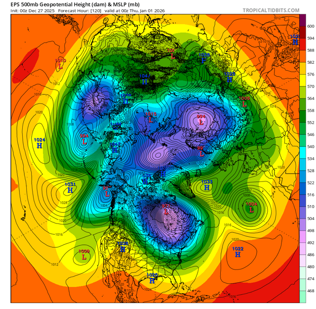
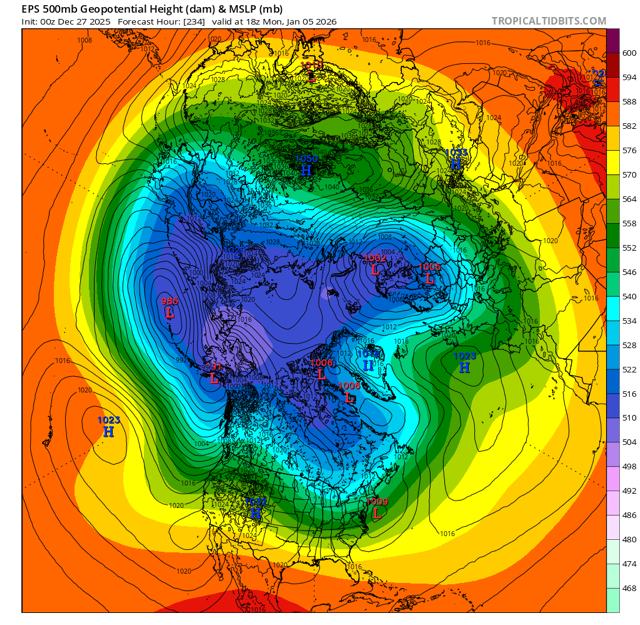
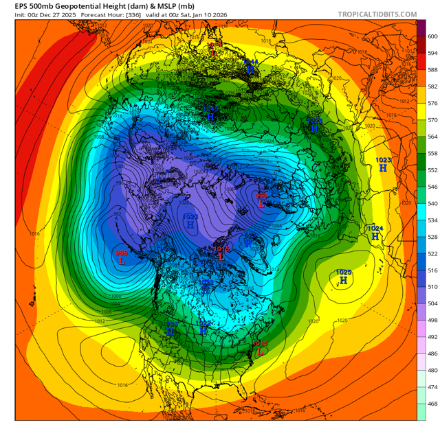
Time to ring in the new year with a new thread. December managed to produce an above average snowfall month for many. What does the new year bring? The patter looks active the first week with the potential for a clipper to start off and more larger synoptic scale events towards the end of the 1st week.
-
Because it's not linear or evenly spread out plus it's weather vs climate. Look at the grand scope and you'll see warmth dominate over both a larger area and time frame. For example despite December being cold in the northeast US it absolutely torched for 2/3 of the country with record breaking all time December warmth in many spots.
-
So according to the stats of a Nina December, the rest of winter should be pretty good.
-
I love having adhd when it snows, I'm a big kid with bigger toys.
-

Wounded Duck Strikes Back: Dec 26 & 27th Winter Storm Obs
HoarfrostHubb replied to WxWatcher007's topic in New England
My “call” was originally 1-2”. So there’s that. I didn’t think more than 4 would happen. -

Wounded Duck Strikes Back: Dec 26 & 27th Winter Storm Obs
CoastalWx replied to WxWatcher007's topic in New England
3-4 out there. About as expected. OE did not kick in. CoastalWx>Vortex95. -
NWS defines a dry slot: Dry Slot A zone of dry (and relatively cloud-free) air which wraps east- or northeastward into the southern and eastern parts of a synoptic scale or mesoscale low pressure system. A dry slot generally is seen best on satellite photographs.
-
Wounded Duck Strikes Back: Dec 26 & 27th Winter Storm Obs
Baroclinic Zone replied to WxWatcher007's topic in New England
4” -
We broke the 4’’ streak!