All Activity
- Past hour
-
 Yeah I mean that’s who quality controlled that! Indeed it does. A whole can of worms that’s probably human nature pushed to the extreme by proliferation of social media and algorithms. Only bound to get worse, unfortunately, and many of us are guilty of it as we rocket through the digital age.
 -
 ....the attention spans of some people shall we say are lacking? Lol
 -

2026-2027 Super El Nino
40/70 Benchmark replied to Stormchaserchuck1's topic in Weather Forecasting and Discussion
Just be careful with that severe-weather-weenie site. -
 I can certainly imagine lol. Its interesting how the human brain works
 -
Anyone having a hard time keeping indoor rh down?
-
https://www.spc.noaa.gov/products/outlook/day3otlk_0730.png day 3 marginal risk issued includes us .
-
There have been numerous psychological studies done on what works to attract viewers/readers..I ve participated in several focus groups on advertising. Ive always been amazed about what prompted some people to react to the ads/commercials....
-
This weekend looks really good.
-
 This. We can blame hype but the amount of video easily available now is something never seen before. It’s the same with any outrageous behavior captured on film. There have always been Karens… since the dawn of time… but now you see video of every single person doing something obnoxious or dumb. Dumb people making bad decisions have always existed, too. You just never saw it. I don’t think people understand the gravity and how our perception has changed on certain things since every human holds an HD camera in their pocket.
 -

2026-2027 Super El Nino
GaWx replied to Stormchaserchuck1's topic in Weather Forecasting and Discussion
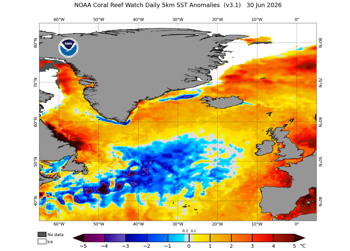
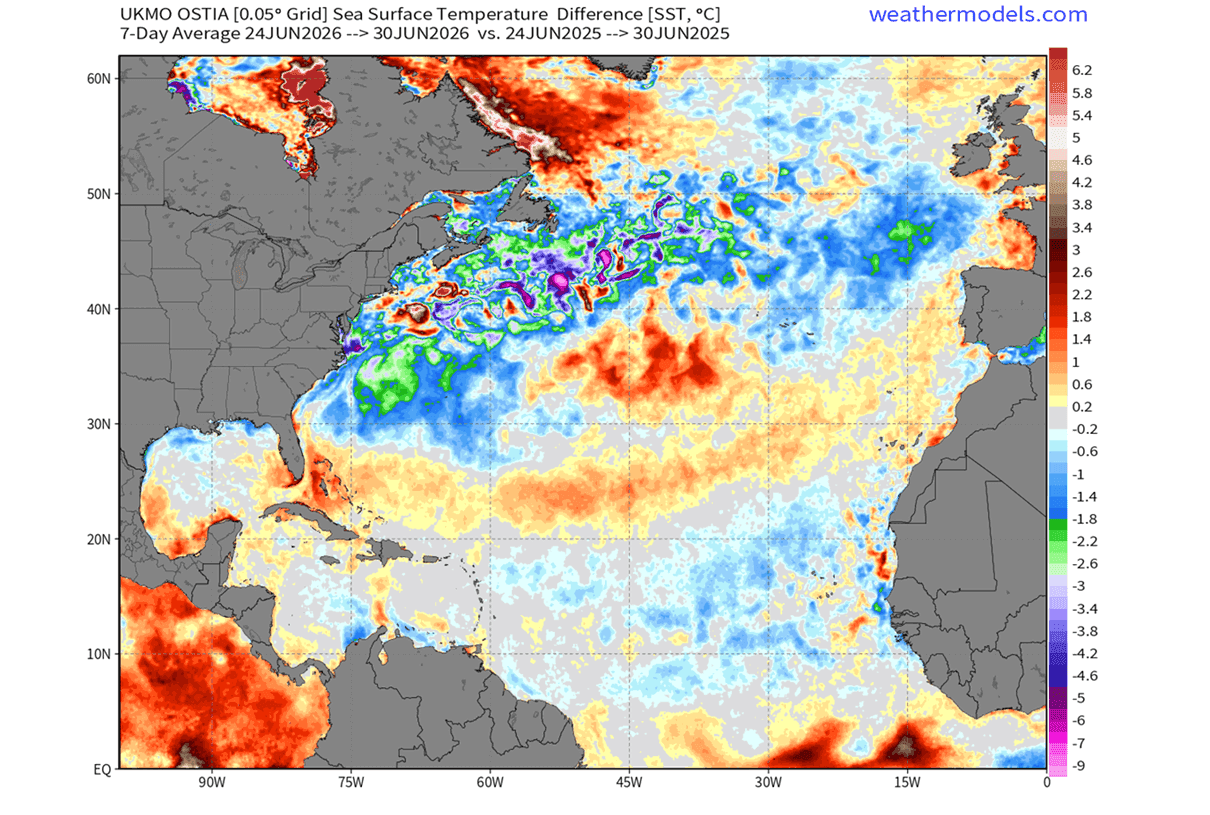
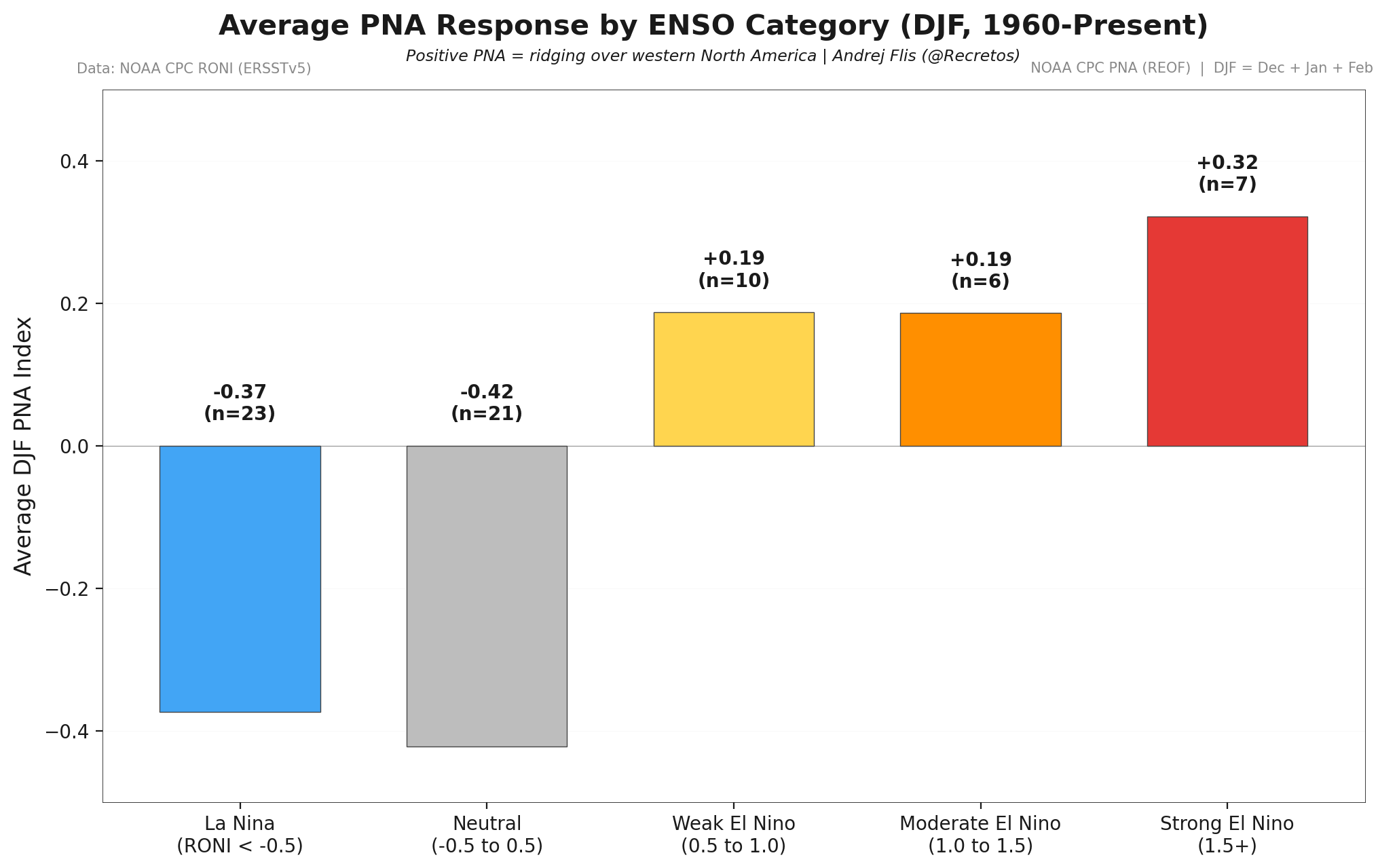
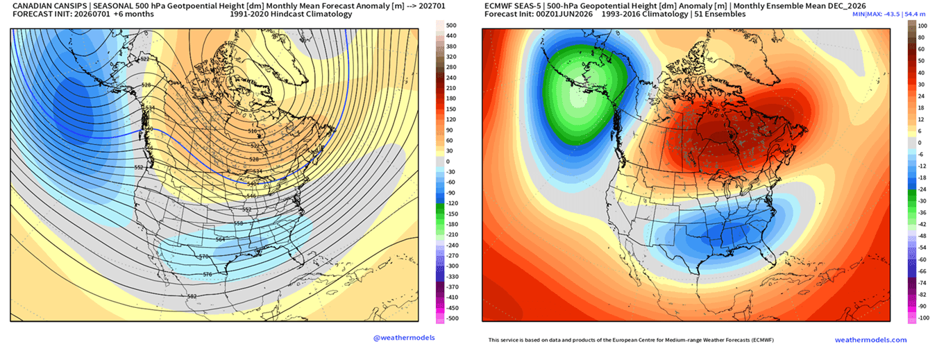
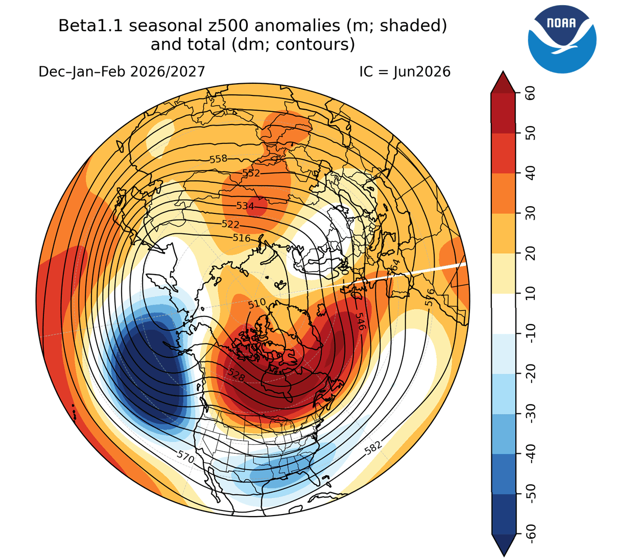
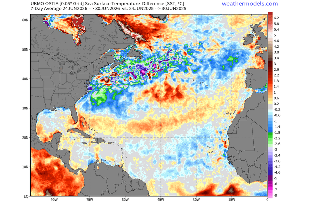
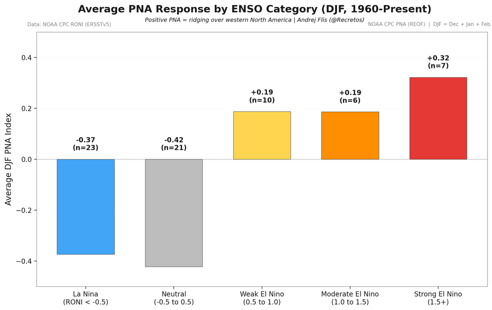
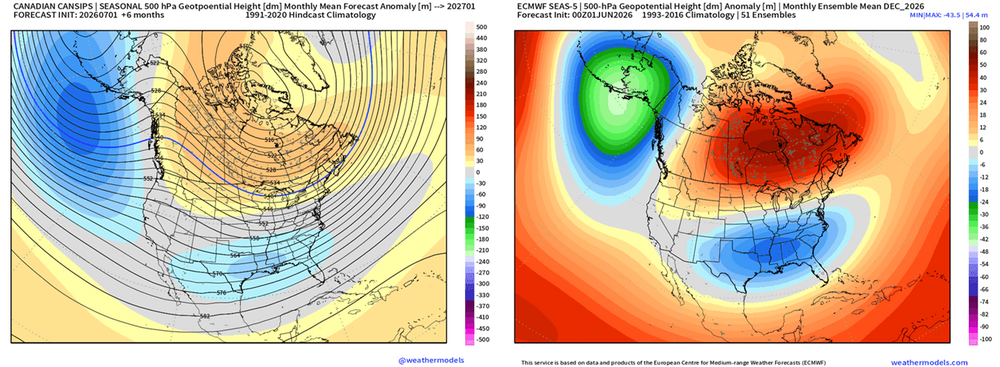
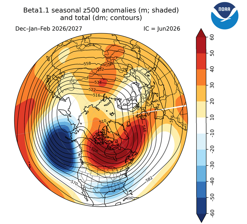
A Cold Atlantic Anomaly Returns as Super El Niño Shapes Winter 2026/2027 Early Forecast Signals Together, the Atlantic cold blob and Super El Niño signals are already giving strong early hints for Winter 2026/2027 pressure and temperature across the United States, Canada, and Europe. If we look at the actual observation image below, it shows the real ocean temperature trends over time. It looks nearly identical to the model simulation of a weakening AMOC. This supports the fact that the AMOC is indeed weakening, even faster than first anticipated. This temperature signature of the warm Gulf Stream area and cold North Atlantic is one of the strongest indicators of the AMOC weakening. Data shows the formation and growth of a new “cold blob” pattern, forecast to last into 2027. You can see a very clear cold ocean anomaly, stretching back towards the Gulf Stream area. This anomaly is much larger than last year, continuing the long-term cooling trend of the subpolar North Atlantic. You can see that the main cold area is linked back into the Gulf Stream and towards the east coast of the United States. Below is an even more dramatic analysis image. It shows the 1-year difference in surface temperature for the last week of June. This shows that the North Atlantic is much colder currently than it was this time last year. What stands out most is the Gulf Stream area, which shows several degrees lower temperatures compared to last year. North Atlantic Cold Anomaly and Super El Niño Forecast North American Pattern: Where Ocean and Atmosphere Collide The atmospheric pattern we found the connection to is called the Pacific-North American pattern, or PNA. This basically tells us that a Fall cold blob anomaly in the Atlantic corresponds to a positive PNA pattern in Winter. Not meaning that the cold anomaly itself is responsible for a colder winter over the eastern United States, but it can be like an indicator of what is to come. But this year, we have a far stronger driver on the rise, the Super El Niño. Below is the analysis of the winter period during the last 4 Super El Niño events. You can actually see a very similar pattern to the +PNA above. Below is the December 2026 pressure forecast from the ECMWF model that we used above for the ocean temperatures. We also added the CanSIPS model to compare different predictions. You can see that both forecasts show a strong positive PNA pattern, with a high-pressure system over Canada, a deep low in the North Pacific, and a low-pressure zone over the central and southern United States. We can add another model into the mix, the CFS from the United States CPCcenter, which covers the whole Winter 2026/2027 period. Below is the pressure forecast that again shows an identical pattern to the two predictions above, with a clear Super El Niño pattern and a positive PNA over North America, with a ridge into Europe. https://www.severe-weather.eu/long-range-2/atlantic-anomaly-and-super-el-nino-shaping-early-winter-2026-2027-predictions-united-states-canada-europe-fa/ @snowman19@40/70 Benchmark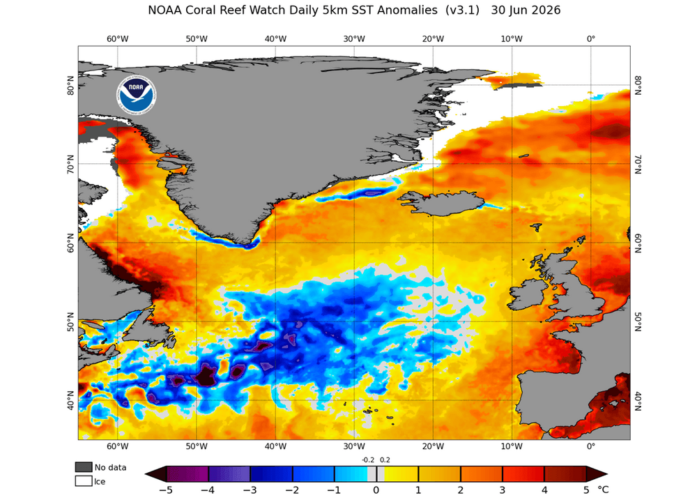
-
Add politics to that, probably more so than sports and weather. People do like to be entertained though.
-
Wish this concept was more easily grasp by the population
-

Central PA Summer 2026 Discussion/Obs Thread
Jns2183 replied to Voyager's topic in Upstate New York/Pennsylvania
Thank you and thank everyone for letting me vent from my swamp castle the past few days. If anything I'm now interested in seeing what DIY solar, backup power solution I dump my weekends into. Because why do things easy when I can program a raspberry pi, a used portable solar generator and whatever gas generator I come across in a couple weeks as some people always sell after the appropriate amount of time. I also will be posting my final heatwave rankings, where I decided to get in the muck of temperature trends to have a defensible adjustment so that every year is as equivalent as possible to 2025. I think the results are absolutely amazing and will spark some fun conversations Sent from my SM-S731U using Tapatalk -
June of this year, just taking Tri as a quick sample, had a high of 94. It rained 5.38 inches at Tri in June after rains came in late month. June of 1957 saw Tri have a high of 93 for the max. And it rained over 4 inches late month to push them to 6 inches of rain for the month. July of 1957 was extremely dry at Tri. .79 inches total. We will see how July plays out there this month but they've already recorded nearly that much rain. Winter that year, there was a minor 1-3 inch snow event for most of the state mid-month with a quick shot of frigid weather in mid-December. Areas that get upslope did best with the 2+ inch totals around the Plateau/SEKy/SWVa, but there was snow on the ground from Memphis to Bristol at the time. January was actually cool and BN, but it was El Nino below normal. Meaning there were only a couple of really cold days in January, with well below freezing highs and no sub zero type cold. But the highs were muted too so Jan of '58 was around -4 to -6 across the area but it wasn't extremely cold at any point. Moisture and cold refused to link up so the biggest snow in January was 1-2 inches for the area but some snow fell on about half the days of the month without amounting to much more than a dusting to a half an inch. In February brutal cold arrived and snow did too, we started the month with a 3 inch event then added 1.5 inches to it as snow showers lasted the next two days with highs in the lower 20s and lows around 12. From Feb 8th-19th it only got above freezing two days imby. We had a 4 day stretch of below 0 lows and there was an 8 inch snow fall, highs in the lower 10s followed the big snow and the coldest low was -10. It was a forum wide snow event, Memphis and Nashville got 3-5 inches. Crossville got 8 inches. Knoxville and Chattanooga 7 inches, Tri got 9.7.
-
It is all about getting people to watch and/or page hits to generate advertising dollars. People are attracted to those types of headlines....if they said something like "it's going to be a typical July day in the east"...their audience would be lower.. It is always best to ignore the hype in weather and sports...
-
Another 1.6" last night. 5 hour power outage thrown in for fun. 5.2" month to date after an above average June. The darn trees will start falling out of the ground due to saturated soils. The ephemeral streams in our neighborhood have returned. They're running for a few hours after the precipitation stops. The watershed is back doing its thing.
-
the headlines with severe weather are a joke. "Tens of thousands under the gun for severe weather". CNN and NY Post loves to do this. Then you have clowns like Ryan Hall and Max Velocity who have to use that headline and that have their stupid looking face making a stupid reaction in their thumbnails.
-
It works well for flower gardens and trees/shrubs....the best thing to do is to clean the rain barrel prior to the first use of the season and then every 2-3 weeks during the season.
-
It doesn’t look like much of any measurable precip the next 10-14 days
-

Hoisting the Sultan Signal: Heavy Rain Event July 5-7
Cyclone-68 replied to WxWatcher007's topic in New England
I’m happy we ended up with some rain. It looked for a little while (to me) we were going to get screwed and not in the fun way lol -
 Weather is just sexier now to show on the news because we are able to catch raw and captivating video like never before. Everyone has a smart phone and can send it to a news network. I will say that when the national news shows clips of severe weather as a headline, you'd think the weather has gone wild, but to me it looks like what summer weather brings lol. But to Jane and John Doe it might not. But that's just how it is. Footage of severe weather captivates people.
 -
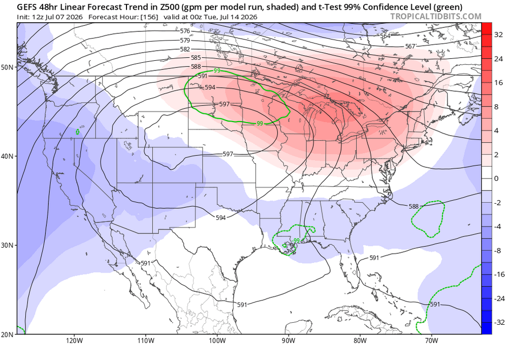
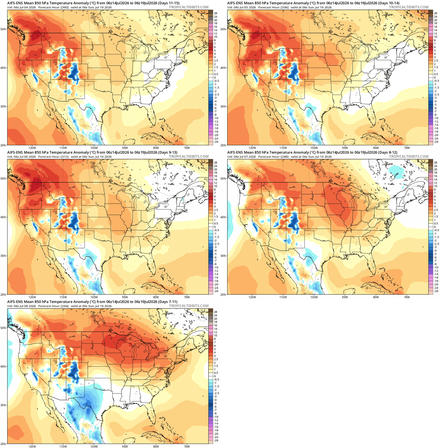
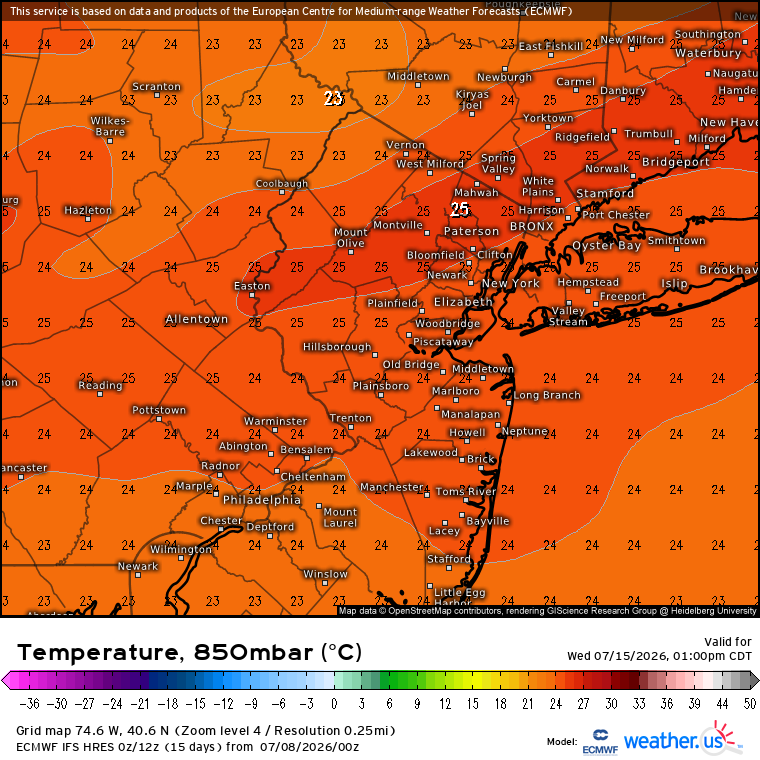
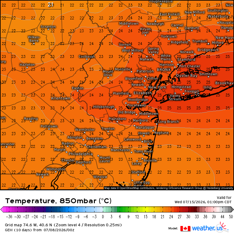
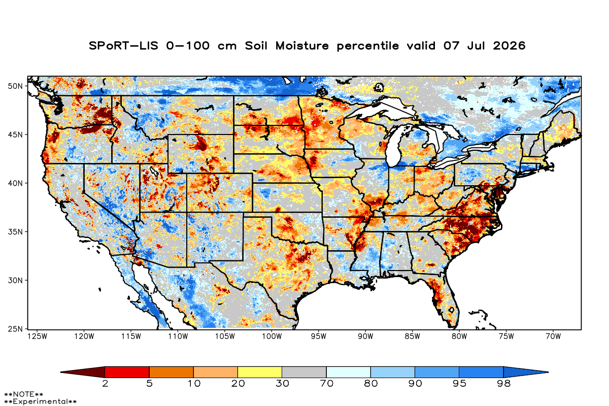
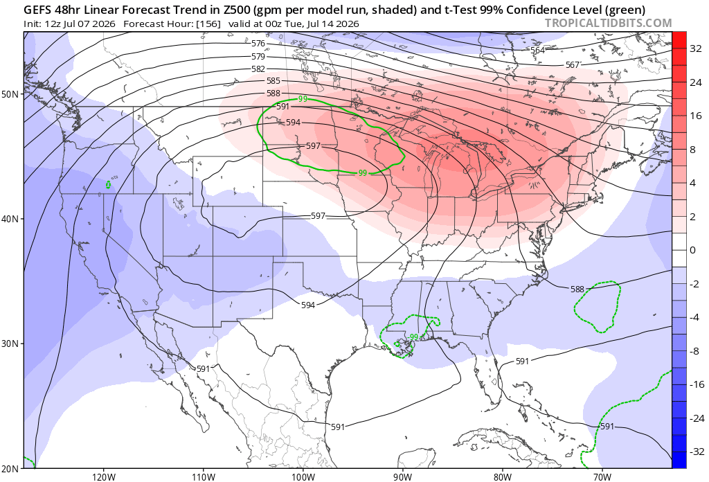
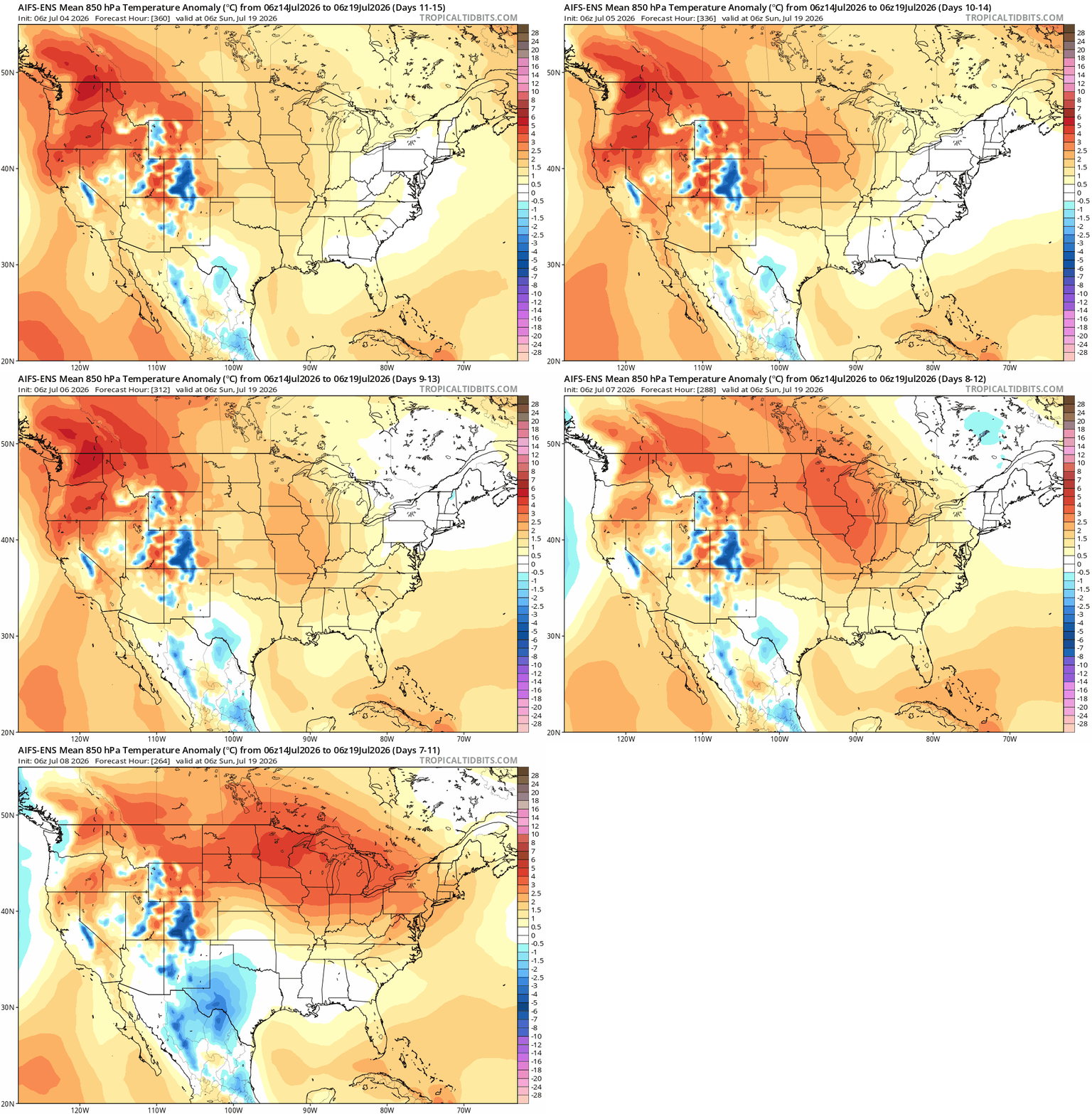
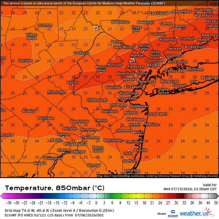
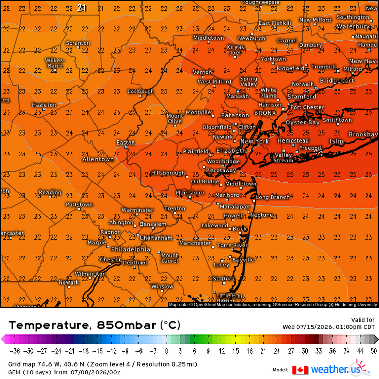
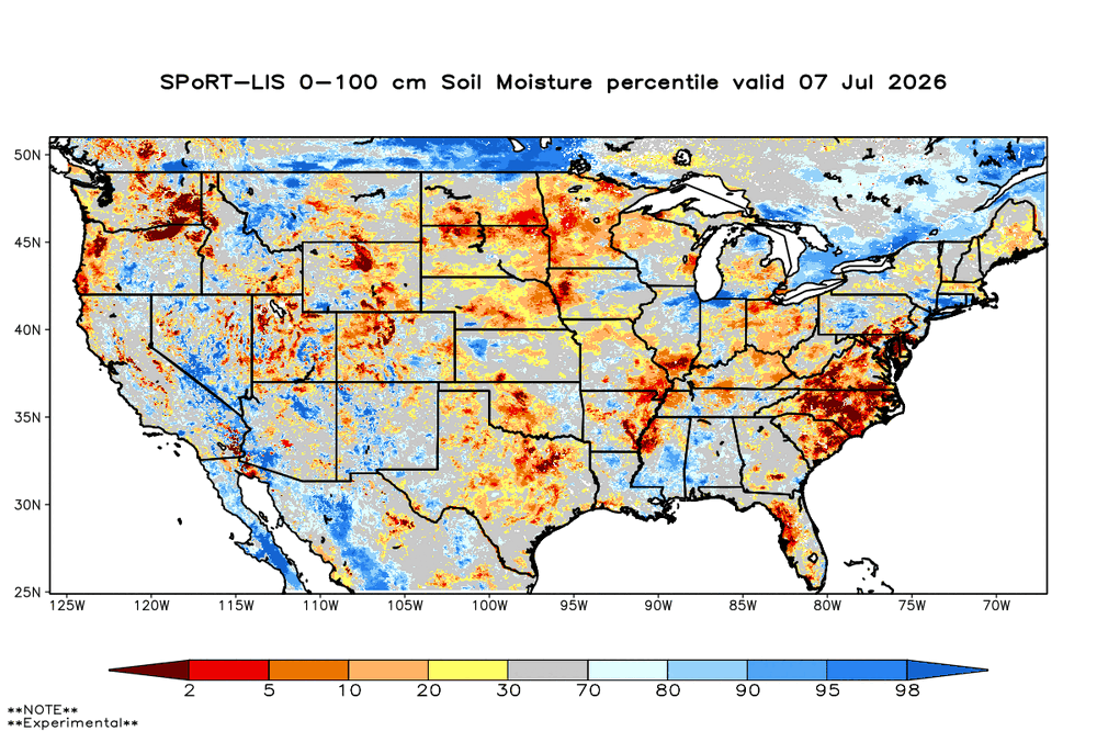
This will be a good experiment coming up on how much increased soil moisture will have on next weeks heatwave vs the recent that maxed out in the 104° to 106° range. The current 850mb temperature forecast from the Euro and GEM is 25C. Made it to around 24C last week. I hope we can avoid the first time that a 104°-106° high temperature range repeated during the same summer. But who knows with this new much warmer climate. This isn’t the kind of new climate precedent that you want to set.
-
We are at 88/82 right now.
- Today
-
Hope we can get more rain this week.
-