All Activity
- Past hour
-
I see Izzy is in the house for LOT folks. All cards are on the table. Preparing for a sunny and 72 flip by morning.
-
All gone here except a few left on Oaks.
-
There's going to be several area's get more than Forecasted.
-

November 2025 general discussions and probable topic derailings ...
Snowedin replied to Typhoon Tip's topic in New England
Just a wee bit chillly out there today with a high chance of napage! Seriously, might have to consider moving down here lol. The weather has been just insanely nice.
-

11/8-11/10 First Snow and Lake Effect Event
cyclone77 replied to Geoboy645's topic in Lakes/Ohio Valley
Ripping cotton balls right now. Ground has quickly whitened. -
Looks like most of the hi-res models are showing some convective streaks of snowfall on Monday into Monday night. If that truly happens, someone who gets under one will have a nice surprise. Temps are generally in the 20s for most areas where they happen.
-
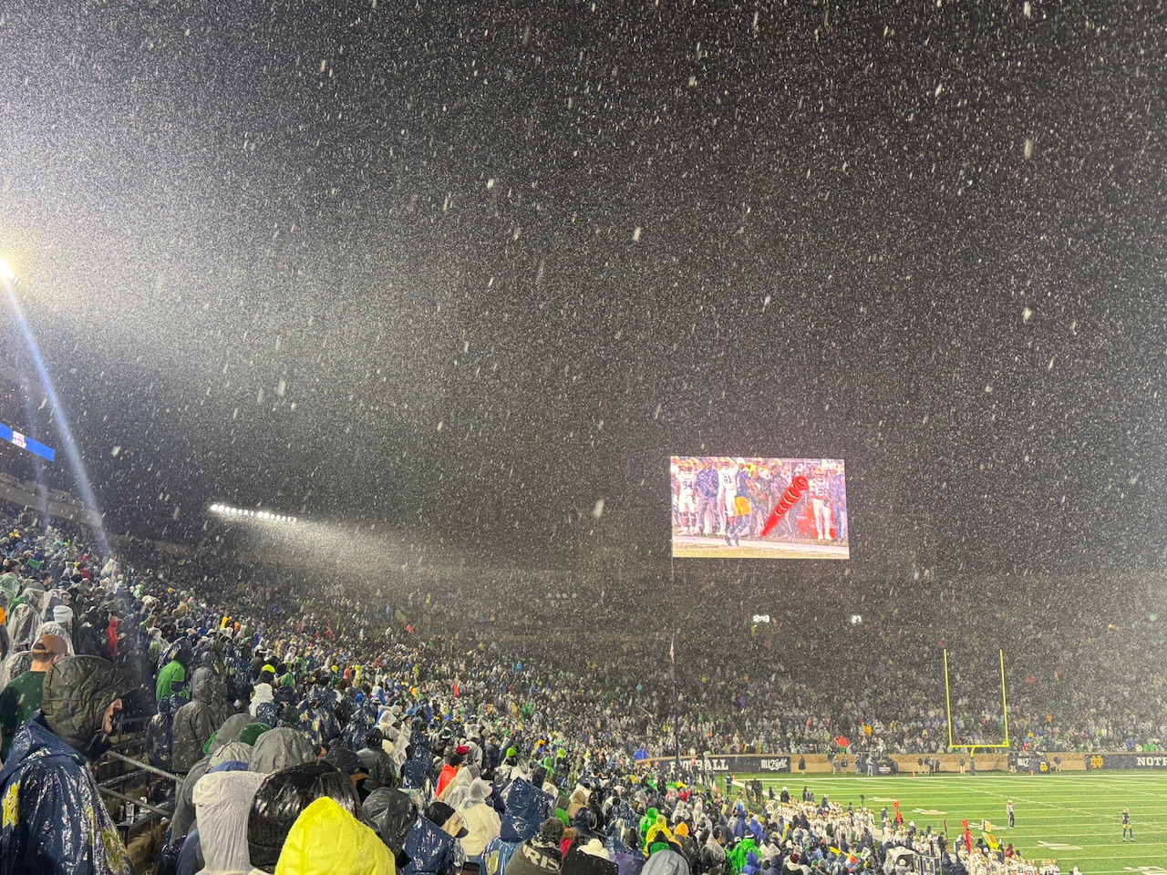
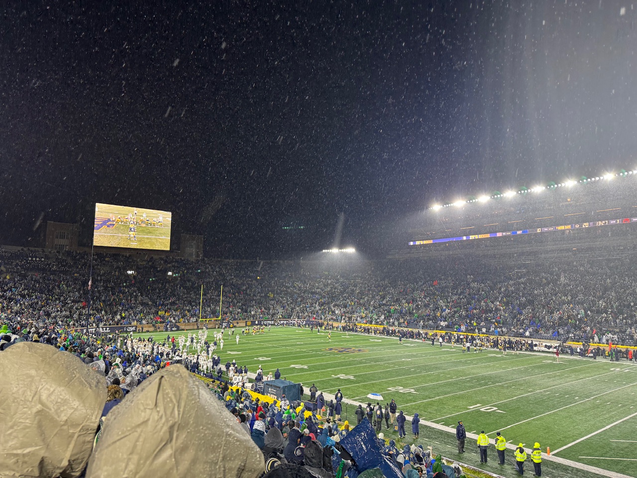
Notre Dame tv snow game.
-

November 2025 general discussions and probable topic derailings ...
Torch Tiger replied to Typhoon Tip's topic in New England
do you bang this out of your cruiser? Crooklyn? -

November 2025 general discussions and probable topic derailings ...
MJO812 replied to Typhoon Tip's topic in New England
Maybe this picture is from 2002 -
November 2025 general discussions and probable topic derailings ...
Torch Tiger replied to Typhoon Tip's topic in New England
bro same clothes from 2000 -

11/8-11/10 First Snow and Lake Effect Event
sbnwx85 replied to Geoboy645's topic in Lakes/Ohio Valley
All snow now.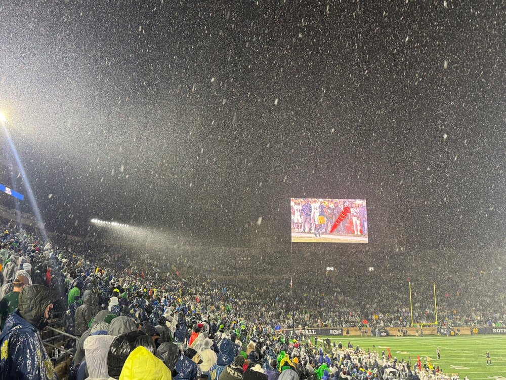
-
- Today
-

11/8-11/10 First Snow and Lake Effect Event
A-L-E-K replied to Geoboy645's topic in Lakes/Ohio Valley
p&c with real accums lakeside -
BWI: 22.0 DCA: 15.0 IAD: 25.0 RIC: 12.0 Tie Breaker SBY: 10.0
-

November 2025 general discussions and probable topic derailings ...
Ginx snewx replied to Typhoon Tip's topic in New England
Snow football first Wisconsin now Notre Dame -
I'm sure it's wonky but the 0z HRRR just walloped me with about 4 inches. It pushes a 2-3 inch streak over deep west Knox county, Loudon County, and into Blount County. The 21z RAP isn't too far off the HRRR except its 2 inch band runs NE of Knox over Morristown.
-
1995 and 2010 were also solar minimums
-
11/8-11/10 First Snow and Lake Effect Event
sbnwx85 replied to Geoboy645's topic in Lakes/Ohio Valley
At the Notre Dame game and snow is already mixing in with the rain.
-
11/8-11/10 First Snow and Lake Effect Event
cyclone77 replied to Geoboy645's topic in Lakes/Ohio Valley
First flakes of the season here, as we now have wet flakes mixing in. Temp dropped pretty quickly from near 40 to 35 in the past hour or so. 0.58" rain so far. -
Anyone see the winter storm watches on the TN side of the smokies?
-

November 2025 general discussions and probable topic derailings ...
powderfreak replied to Typhoon Tip's topic in New England
I guess, but it’s like 5 seconds… -
00z HRRR is rather impressive with the frontal passage tomorrow evening. Decent little line and then we get chilly.
-
 But we shouldn’t have to do all this extra work in this day and age. It should automatically happen .
 -

11/8-11/10 First Snow and Lake Effect Event
donsutherland1 replied to Geoboy645's topic in Lakes/Ohio Valley
Ottawa has a snowfall warming for 4"-8". Detroit to Toronto should also see measurable snowfall. Winter is getting off to a good start parts of the Great Lakes Region. From Environment Canada: 4:00 PM EST Saturday 8 November 2025 Snowfall Warning in effect for: Ottawa North - Kanata - Orléans Significant snowfall expected Sunday. What: Snowfall amounts of 10 to 20 cm. When: Beginning Sunday morning and continuing into Sunday night. Additional information: A low pressure system will bring snowfall to parts of southern Ontario on Sunday. Areas near the St. Lawrence River may see snow mix with ice pellets or freezing rain at times Sunday evening, leading to reduced snowfall amounts in that area. Motorists should expect difficult winter driving conditions and adjust travel plans accordingly. Poor weather conditions may contribute to transportation delays. Visibility will likely be reduced at times. -
I think we will have some through Christmas