All Activity
- Past hour
-
 http://indocureglobal.com/# best online indian pharmacy
 -
Maybe just Sunday night. Should be better late morning Monday. Hopefully.
-
I think so
-
What's the consensus on late Sunday/ Monday and early next week? Ass? Would be a shame to waste any of Octobe.r
-
Jeez, sorry for not responding or seeing this until now. My wife and I made some moves this summer and we were at 750ft in Stowe Village... but we finally cashed in on the location, sold our townhome/condo for 4 times what we paid for it back in 2012 and rolled that equity into a house about 10 minutes outside the village. We were ready to leave the village. We are now only 10 minutes away in a neighboring valley at 1,100ft tucked in closer to the Spine. With higher terrain on three sides of us, we seem to radiate quite well (multiple frosts so far), but I will say the daytime temps don't seem to get up nearly as much as the larger valley from the Village out towards the ASOS. We'll see how the winter goes, but I'm interested to see what the differences are compared to over in the village.
-
Idk…I’ve been a believer in GDM and the ensembles get bullish tonight on the peak. LF intensity is anyone’s guess but I’m probably with you on 90-95mph at landfall. Love me some tropical sunsets. Be safe down there. I’m not chasing this one (wife’s birthday lol) New one should be out there in a few hours. Perfect timing imo.
-
They were scheduled to relocate to Kelly Air Base in San Antonio today and I'm assuming that's where they went too.
-
Looks like it has taken it Northernly turn... You can see how it will be ripped apart with the westerly shear.
-
so many times in the last 5 years a storm in the gulf that was predicted to weaken due to dry air or wind shear has gotten stronger right at landfall.
-
Are we all looking at the same storm?
-
Most structure it’s had. .
-
buy antibiotics online for tooth infection: AntiBio Direct - buy antibiotics online
-
Far too much wind shear and dry air. This thing is going to look like garbage at landfall.
-
Surprise surprise. Isaiah remnants will dump close to two feet of fresh rain on Florida Alabama and Georgia. That region folks, is SMACK DAB in the midst of the Infamous Super Nino Plume. This, is only The Beginning for the Southeast, right thru June 2027. If you live in a low lying community, write it off right now. Those places won't dry off until late next summer.
-
Getting that look now with concentric towers going up on either side of the eye. Shame the Hurricane Hunters had to pull out, hopefully a new mission goes out soon.
- Today
-
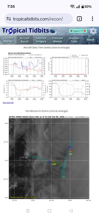
Looks like it had to abort the mission although it's weird it didn't fly back to where it took off
- Yesterday
-
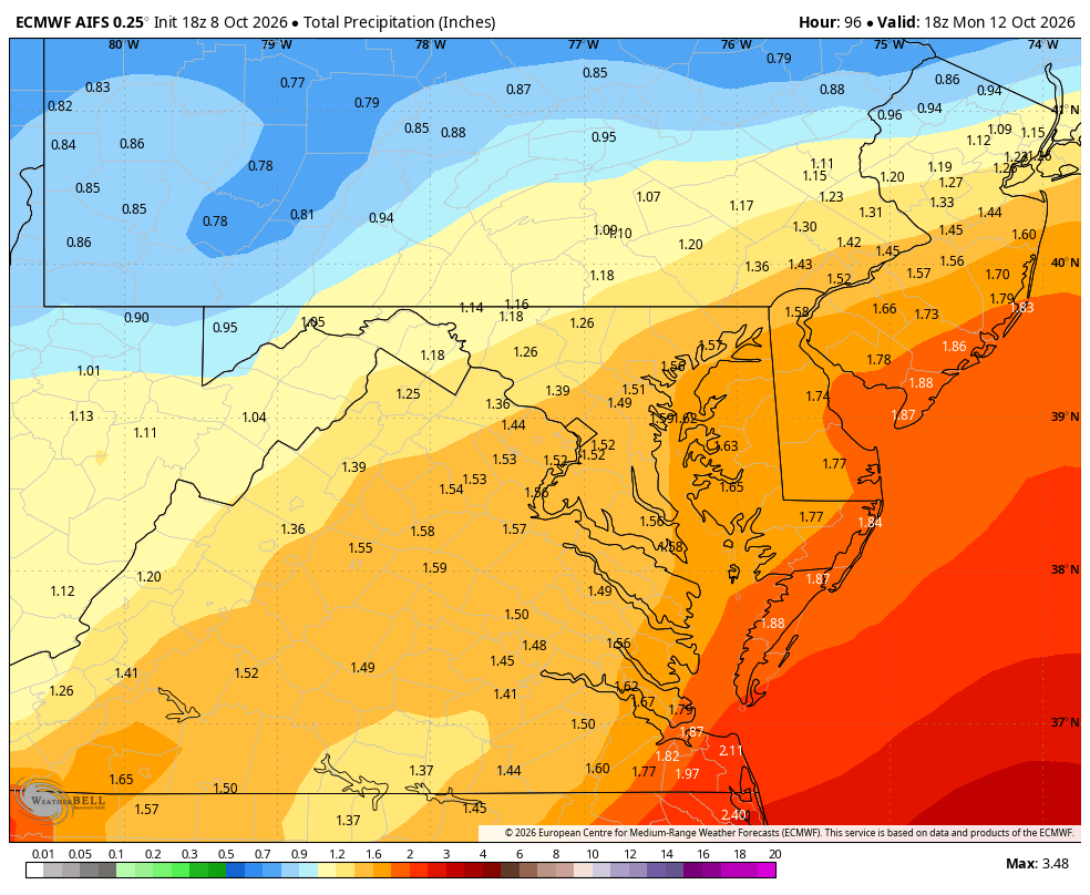
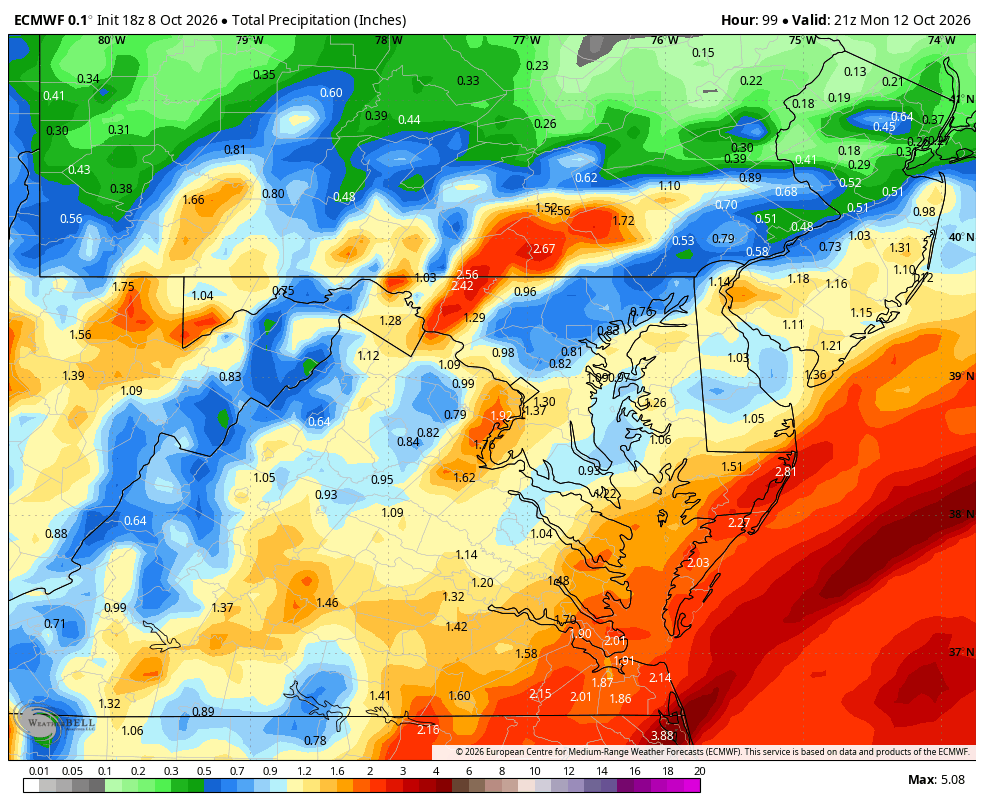
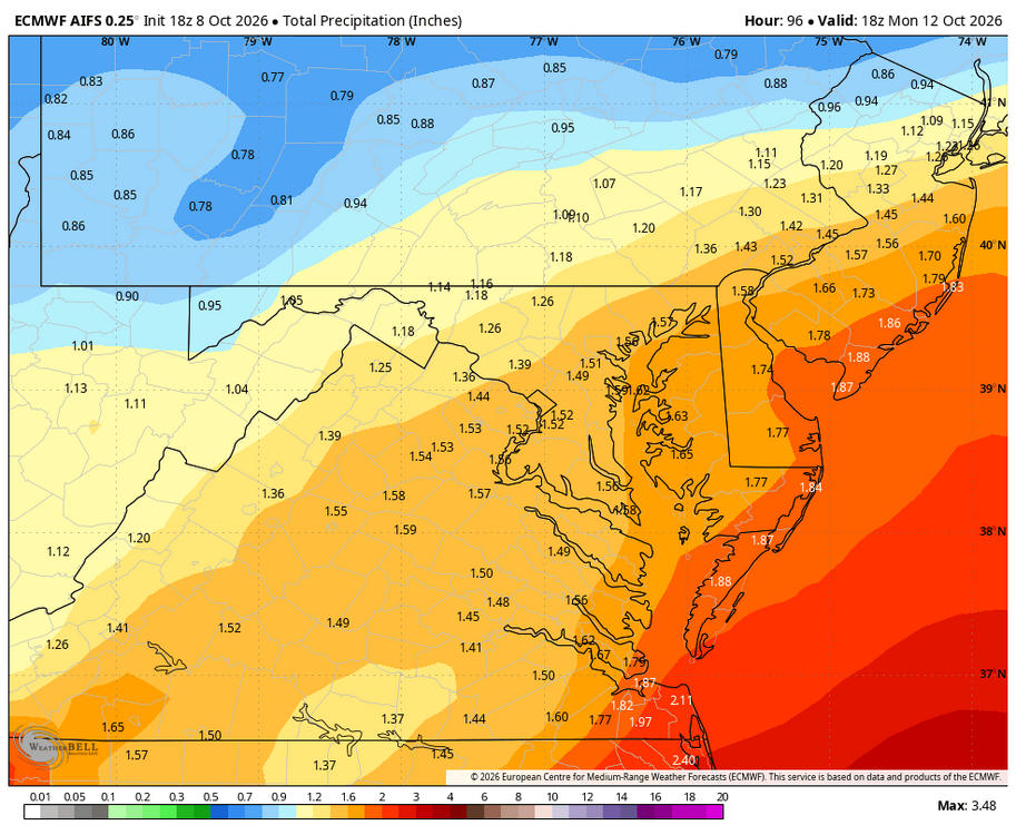
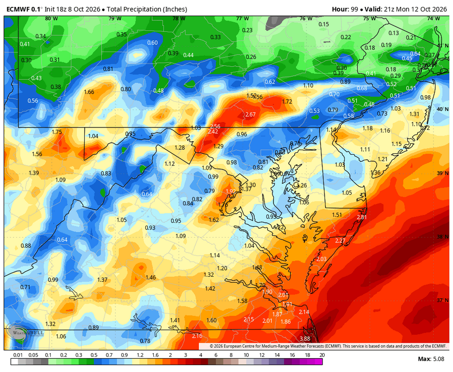
WB 18Z EURO AI and EURO
-
Info I’m on fire Ricky Bobby!
-

2026-2027 Record-breaking El Nino
GaWx replied to Stormchaserchuck1's topic in Weather Forecasting and Discussion
I cannot overemphasize how important what I bolded above is. This idea is well explained at the link below, which I recently posted: Significant Increase in Sea Surface Temperature at the Genesis of Tropical Mesoscale Convective Systems Using satellite observations and a high-resolution global climate model, we show that this threshold has undergone a significant warming trend during the past several decades and will continue to increase in the future. This warming trend is closely related to the changes in the tropical mean SST. A constant relationship between the SST threshold and upper-tropospheric temperature is found in both the current climate and a warming climate, which corroborates the argument that tropospheric temperatures in the tropics approximately follow a moist adiabatic adjustment. https://agupubs.onlinelibrary.wiley.com/doi/full/10.1029/2022GL101950 -
Starting to show its new eye wall. .
-
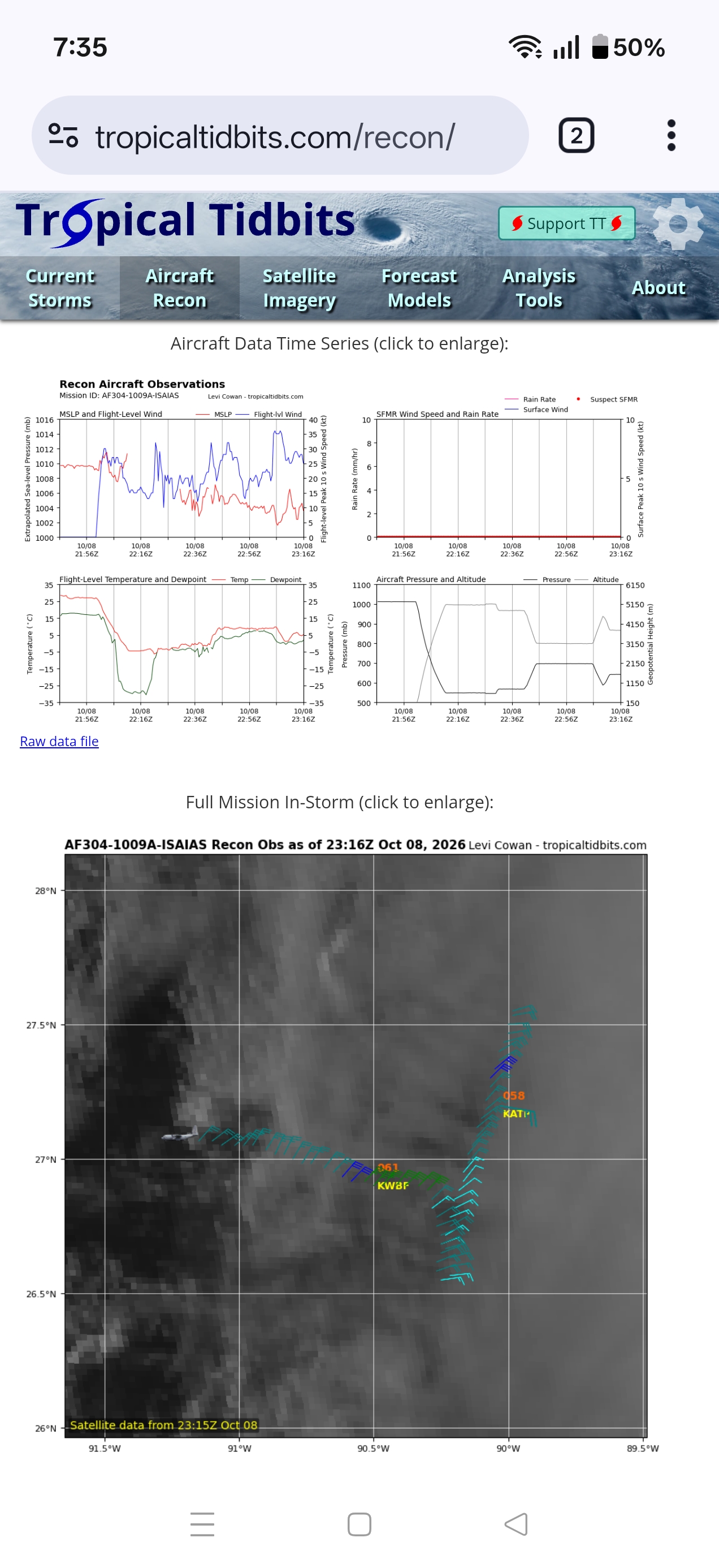
Anyone know what's up with the recon plane? Going in weird directions and altitude is all over the place
-
I have to say, the weather today was amazing. We laid my father to rest, and it felt like he wanted all of us to be in comfort. Just a wonderfully pleasant day at least weather wise.
-
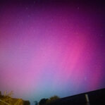
Amazing outflow sunset in the W FL Panhandle tonight! .
-

2026-2027 Record-breaking El Nino
ensonerd1233e343 replied to Stormchaserchuck1's topic in Weather Forecasting and Discussion
No, Cpc uses roni instead of oni because climate change was interfering with the enso signal they made a purposeful effort to remove cc. In fact climate change probably weakened this el nino by keeping the wpac warmer then it normally would be during this strong of a nino that likely prevented as strong ( even if its still be very strong and in many ways record breaking) of a eastward shift in deep convection which has thus meant that while the trade winds have been extremely weak or reversed they are running only slightly ahead of 1997 despite nino 3.4 itself running much higher. Now did climate change raise nino 3.4 sst sure, but because the tropics have warmed the sst threshold for deep convection ( and thus heat distribution thru latent heating) has gone up meaning cc does not mean more heat is being disturbed in the main way enso actually impacts our weather. -
I mean the noreaster last week looked far better than this does