All Activity
- Past hour
-
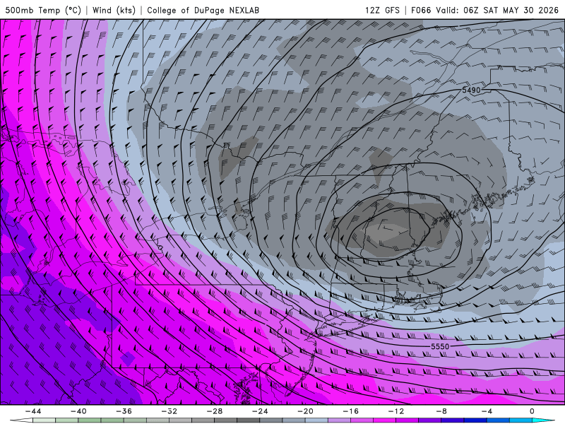
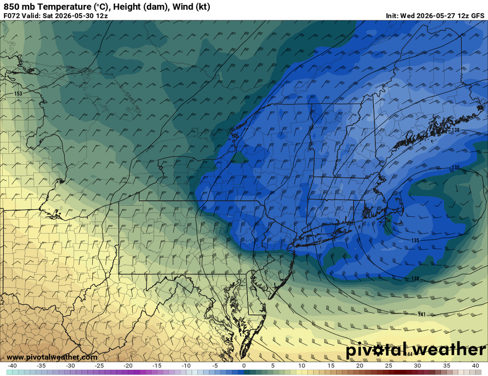
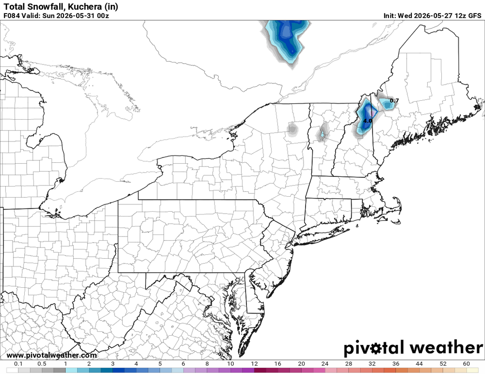
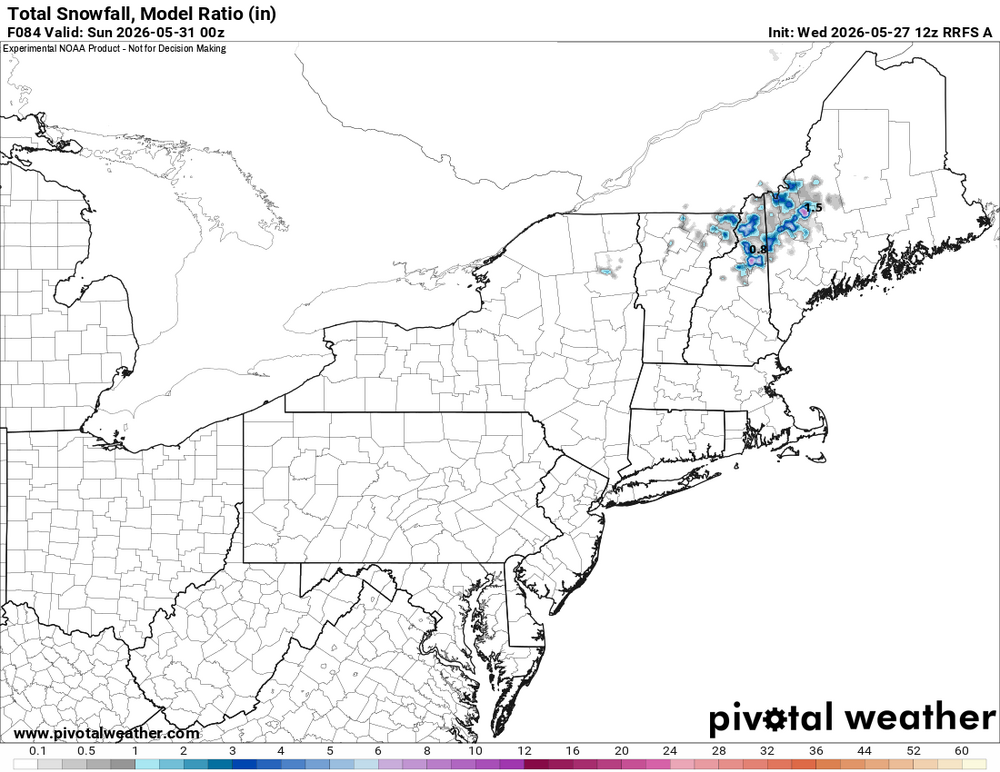
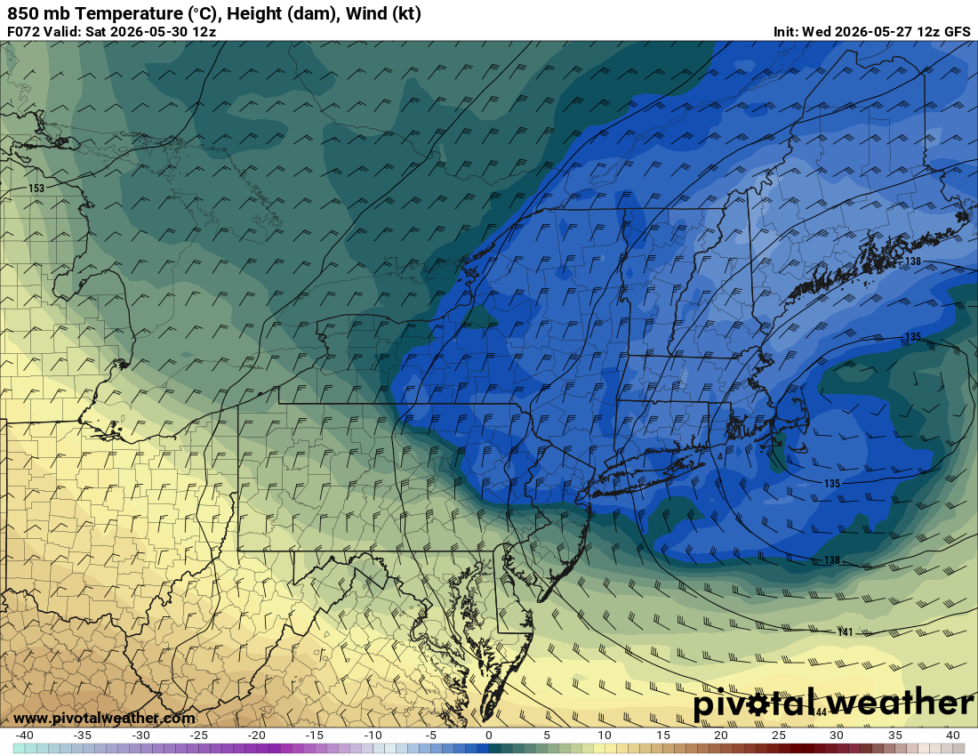
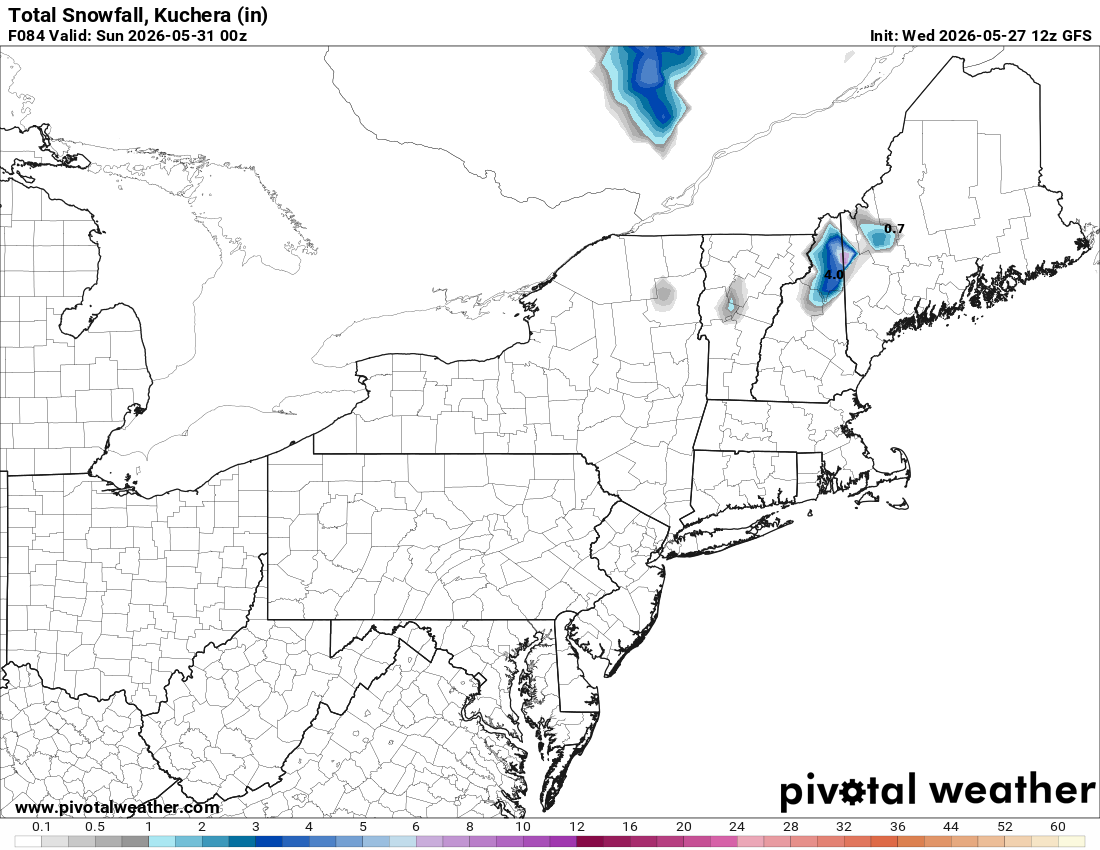
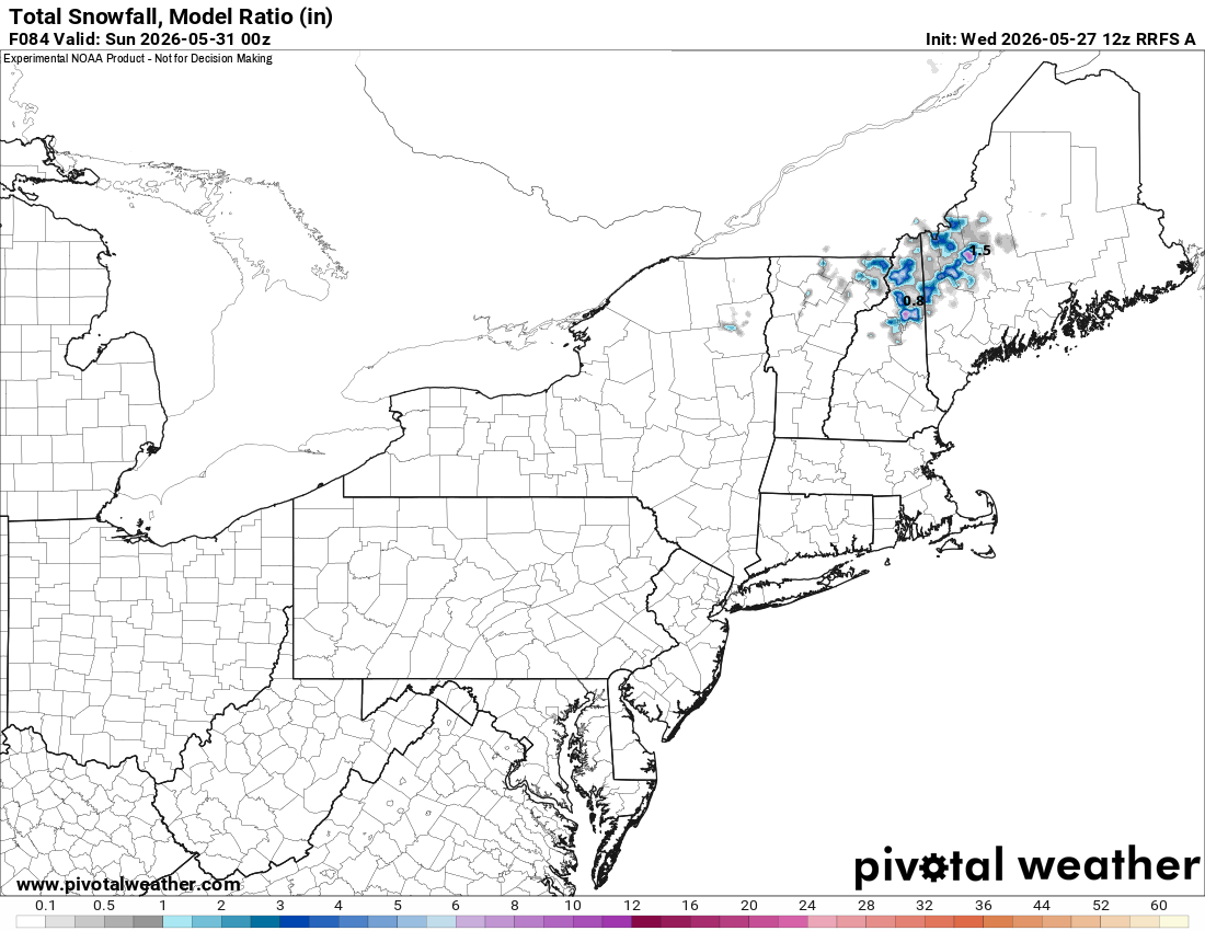
I am surprised there is not more talk about the weekend event. You know how rare these kind of events are in May? And as I said, omega blocks are how you do it this time of year. People like CoastalWx seem to fail to appreciate atypical/rare wx events since it ruins great outdoor weather or the like! In other words, as one example, "if it's not the cold season, I don't want snow!" Or more precisely, "if it's not IMBY, I don't care!" LOL. Grousing all the time seems to be SOP. GFS and RRFS explicitly show accums in nrn NH/NW 4-8" at the higher elevations. Look at the 850 temps valid 12z Sat. That's *cold* and colder than previous runs (as low as -4 C). The 500 low pass directly over the area for max dynamic cooling. Not something to just ignore. Also, and this is huge this time of year, the heaviest precip occurs during the overnight late Fri-early Sat. Every degree counts this time of year for snow. We are talking about say a 0.5 F deg difference in avg temp of the lowest 2000 ft here could mean just a mix of rain/snow or heavy snow w/ rapid accumulation. So being at night given the strong sun angle this time of year (a factor even when thick clouds are present) matters a lot. And given how borderline the temps are, this often results in a very fickle precip type situation. When the precip gets heavier, it goes to all snow, and it lightens up, and goes back to rain. It will be something that needs to be watched very closely in real-time. The "surprise" factor is high here. And you don't need an event like May 9-10, 1977 for the fun 'n games. Look at May 18, 2002. Omega block was much farther N and the 500 cut off was no where near NEUS. We are also talking later than any other snow event here in the last 60 years, later than 1967, 1977, and 2002.
-
I need this modeled squall line moving SE early evening to deliver… .
-
Soup du jour out there. My office's AC has been cranking all day. Even more than last week.
-
I hope not but some of the model models hint at it for a day or two anyways.
-
Just realized I (and most of VA along and south of I-64) under a severe thunderstorm watch until 9 pm.
-
Scott likes the June Nor'easter the GFS has early next week! Wheel of MISFORTUNE at 500 mb!
-
Oh yeah I drive by there every day that I go to work at my old place of employment. Rain is fizzling out again. There seems to be some sort of force field as precip crosses over the Potomac. Maybe this evening we will get something on that final round.
-
lot of beer drinking coming
-
lol I know that. It was a play on words with my last name. I was just being a dork.
-
at least he knows what village he lives in.
-

Occasional Thoughts on Climate Change
donsutherland1 replied to donsutherland1's topic in Climate Change
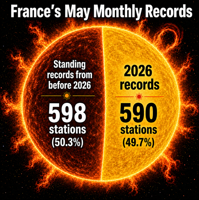
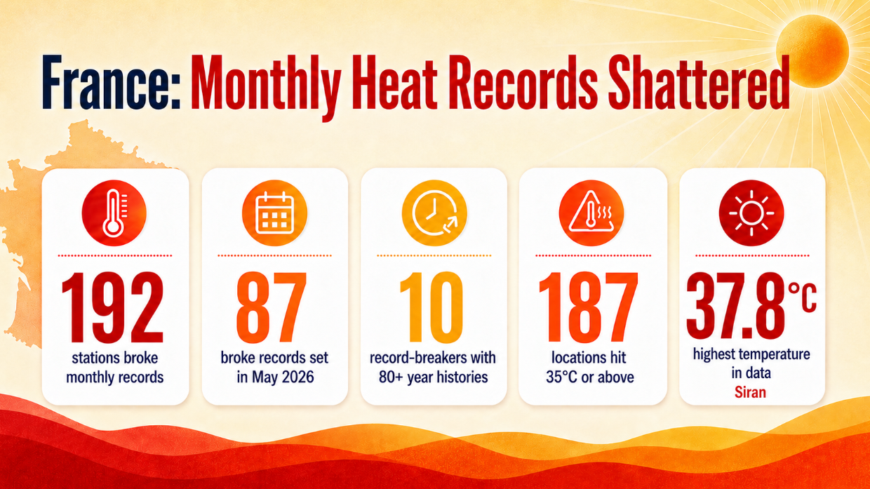
Today was another day of extraordinary heat in France. So far, almost half of all primary and secondary stations in France have set new May monthly record high temperatures during the ongoing heatwave.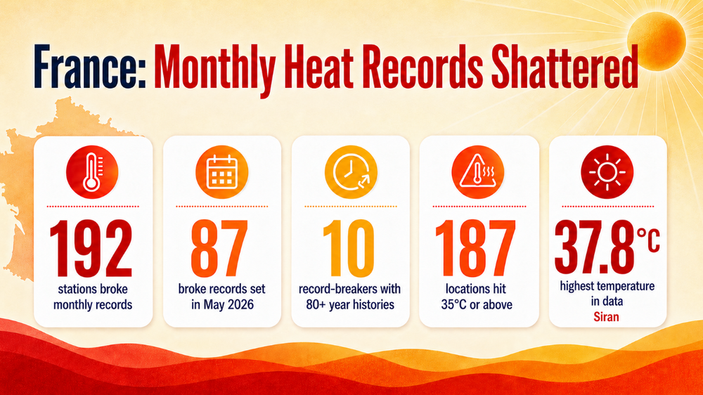
-
Post designed for Maxim(um) effect and Maxim(um) damage
-
I think we escape the worst of it down this way, but it's late May in New England-to be expected-what sucks is that all the storms have been on weekends this spring
-
- Today
-
Yep, I'm in Kinsey's Ridge (Shaefer Homes - a small local builder). Oakland Hall is QBH Sun coming out after a light shower and it is humid! Can't wait for that great weather coming our way.
-
Just some typical "no summer" doomerism from the usual suspects. In all seriousness, this looks like a warm start to meteorological summer.
-
Distant blue and brightening sky with .44" today, and brings the monthly total to 5.46". Obviously, about 75% of that in the last week.
-
National Blend of Models.
-
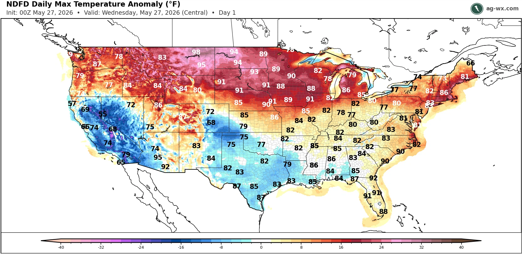
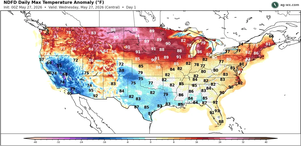
Shifting back to the over the top warming pattern with temperatures approaching 100° in Montana and cooler to the south.
-
We're getting a decent shower down here now, radar looks like more is building toward us possibly. Maybe we can ele out a quarter inch this evening. Are you down in that Kinsey's Ridge development S of Prince fred? Or Oakland Hall? I think that was the QBH developments name....
-
I just did my first cut of the season last week. I've been gradually transitioning my lawn to drought resistant fescue and clover and it's been pretty low maintenance. I don't water or use fertilizer unless I'm planting seed. It's gotten pretty damn dry on occasion but it bounces back much more quickly than when I had more bluegrass to contend with, which would really not deal well with the dry conditions.
-

2026-2027 Strong/Super El Nino
bluewave replied to Stormchaserchuck1's topic in Weather Forecasting and Discussion
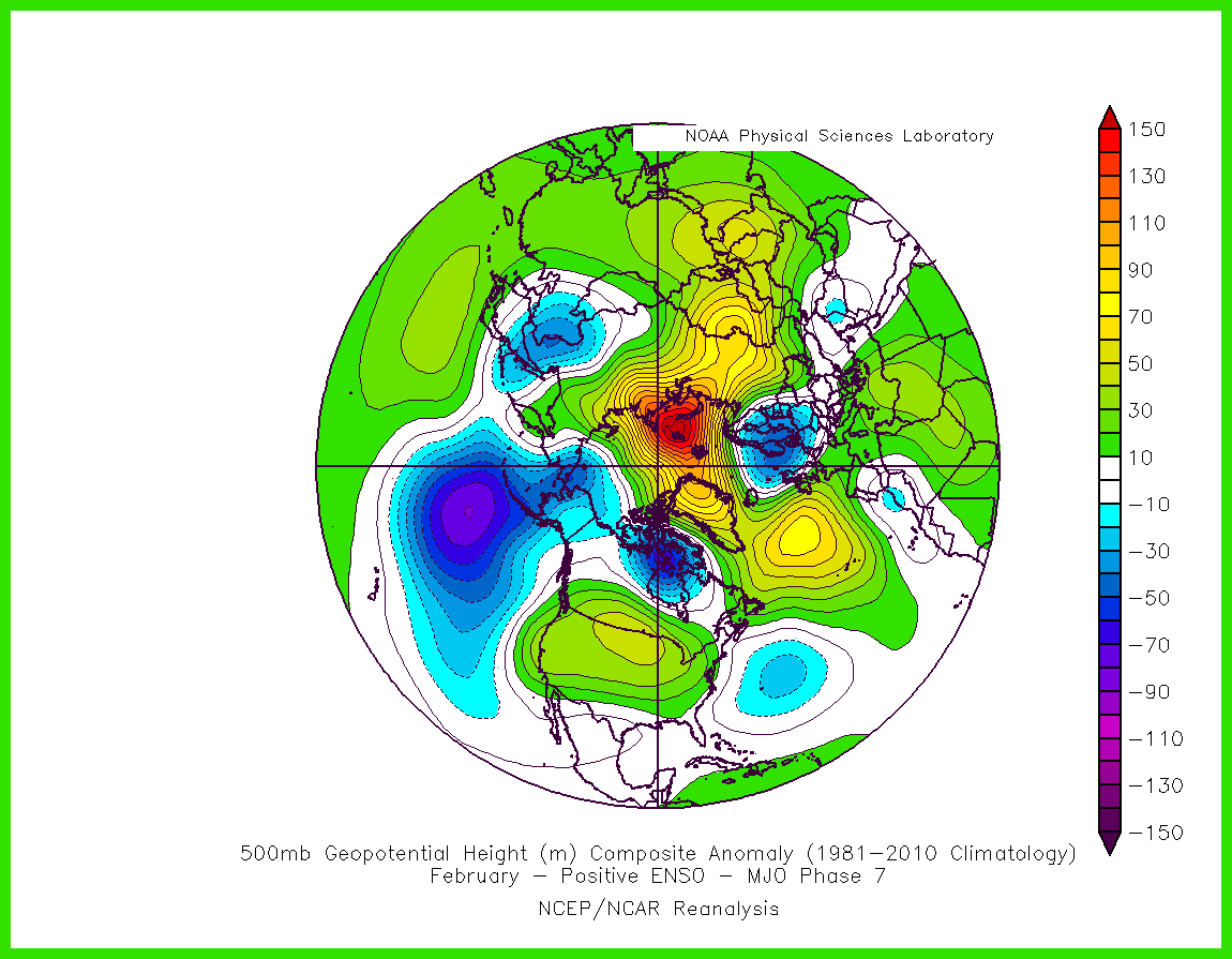
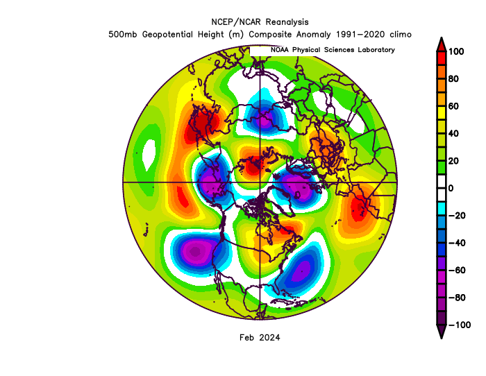
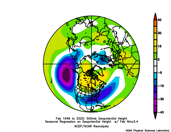
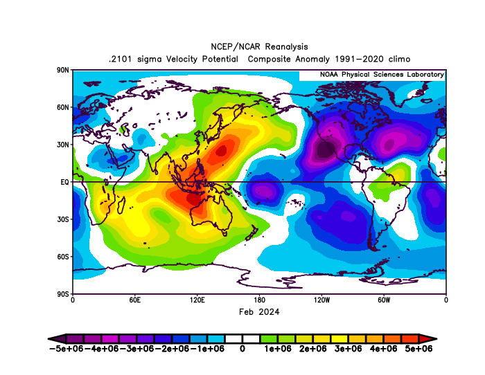
Yeah, a super El Niño can actually be warmer than expected when overlapping with Niña-like influences. First, the westward lean to the forcing back to MJO 7 probably helped drop the Nino-ridge further south than is typical for El Niño in February. Then the big ridge east of Japan and the strong +WPO along with the EPAC Nino forcing carved out a trough just off the West Coast leading to the -PDO. So the Nino trough typically in the Mid-Atlantic was suppressed out toward Bermuda. Also note the Aleutian Low splitting with a piece over the Bering and just off the West Coast. The one bright spot that month was the record STJ streak near DC and narrow snow band into Central NJ. But it was too narrowly focused to extend much beyond the localized geographic region.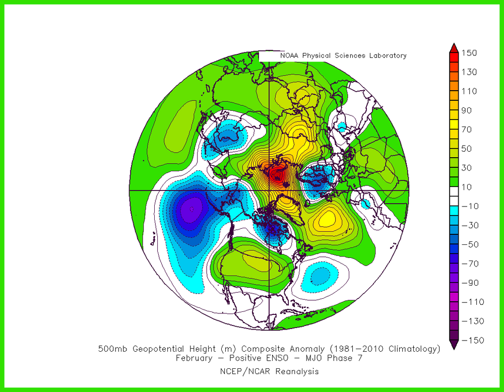
-
The sky is actually blue? In all seriousness, cloud are slowly starting to break up, more and more patches of blue being seen. Got a decent amount of rain earlier looks like, but still so humid at the moment.
-
Saturday looks like 100% ass even where it does not rain. Warmest temps probably before 10a and then it goes to shit after. Sunday is halfway decent but still cool in 60s.
-
Strong Nino's are usually warm with a chance of one blizzard like 83. and 2016..Some strong Nino's you don't get that storm..example 1973,and 1998..It's usually active with storms and precip but there is no cold air.











.thumb.gif.f92b16c631a1d15d405ed77b33f0710d.gif)