All Activity
- Past hour
-
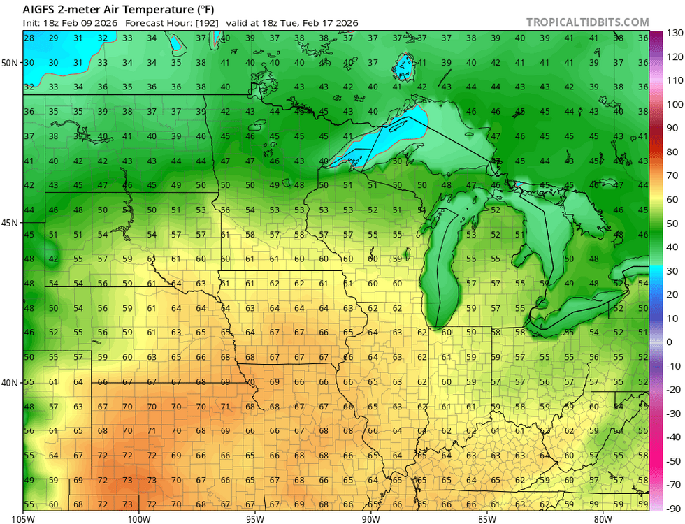
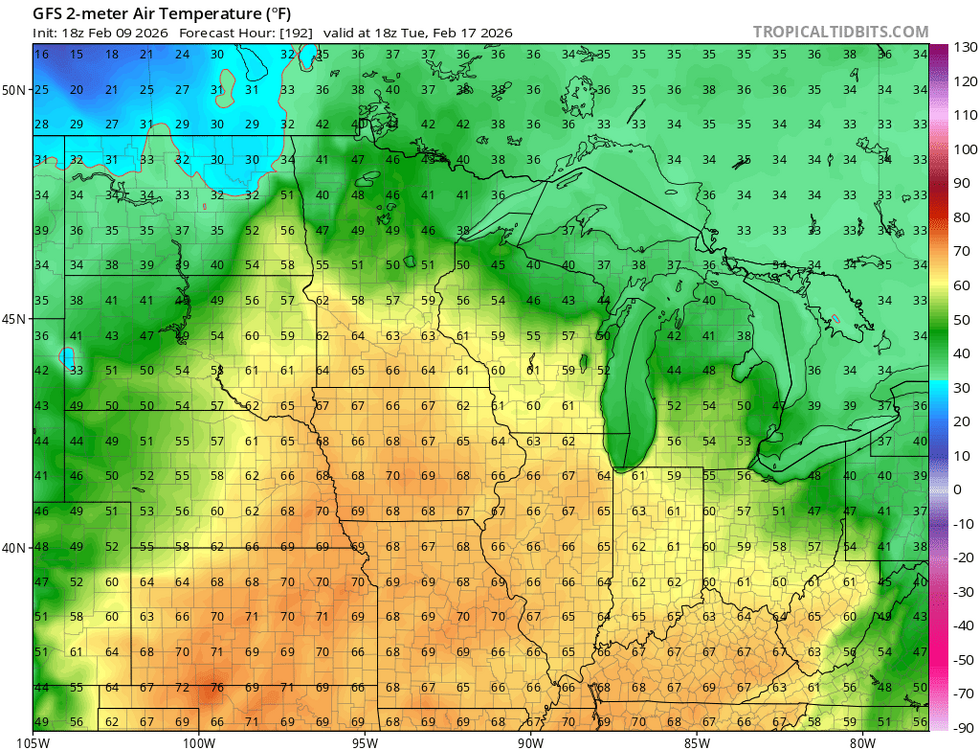
360 hr GFS is OG .
-
One would think
-
 Kind of exhausted tracking the last two weeks; get something showing up inside 5 days and I will get back on the saddle...
 -
No need I can handle myself. The pattern where our temps can produce is obvious. ..
-
I'd imagine the El Niño could help with that, right?
-
Feb 2020 was a blowtorch. Got into the 60s. Something like that would delete negative departures in no time.
-

Feb 10-11 Mid Week Minor Event - Ride the hot hand?
WinterWolf replied to HoarfrostHubb's topic in New England
Scott too…so go tell hime that too. The thing blows. Keep humping it though. -
Just showing the facts.
-

Winter 2025-26 Medium/Long Range Discussion
PositiveEPOEnjoyer replied to michsnowfreak's topic in Lakes/Ohio Valley
Wonder if @cyclone77 will tag 70 next week? I wouldn't rule it out based on recent model runs... -
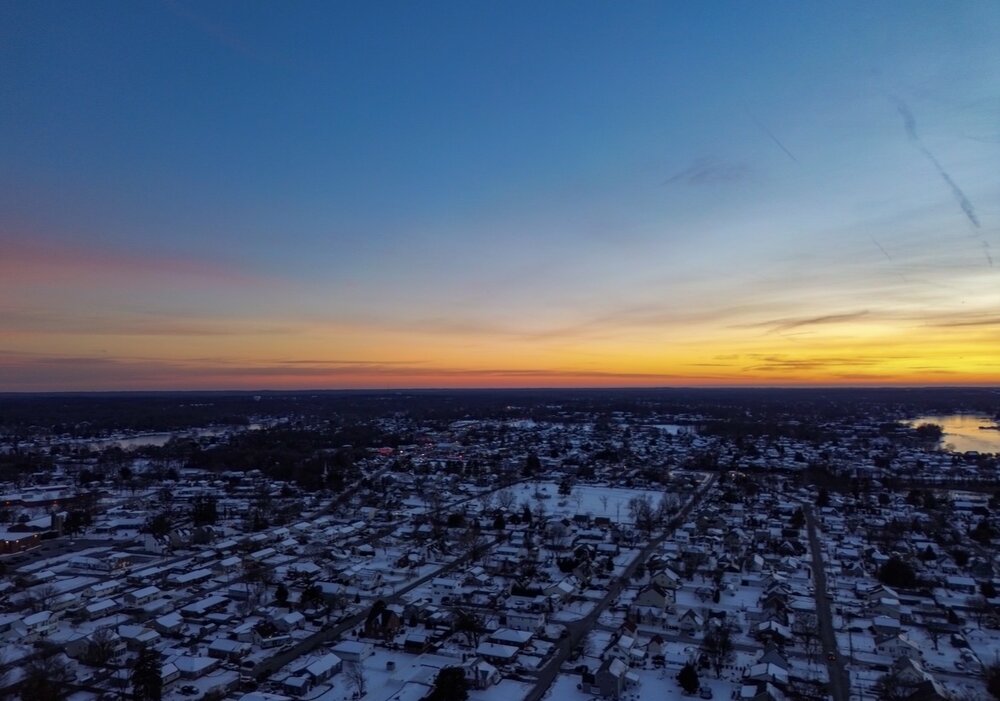
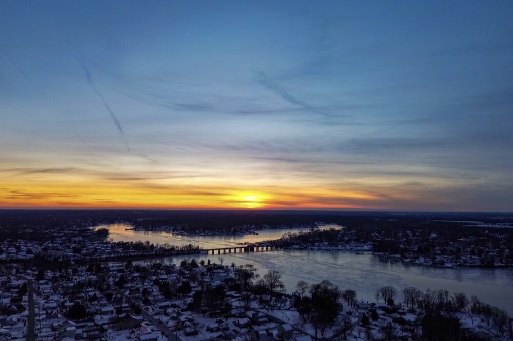
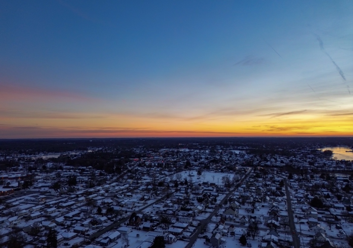
Colorful sunset tonight. Stoney Creek frozen. Hard to believe that there is still so much snow left after all this time.
-
Feb 10-11 Mid Week Minor Event - Ride the hot hand?
WinterWolf replied to HoarfrostHubb's topic in New England
Yup. -
Winter 2025/26 Banter Thread
PositiveEPOEnjoyer replied to Chicago Storm's topic in Lakes/Ohio Valley
In due time...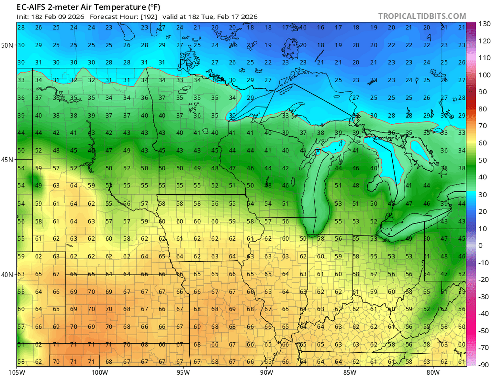
-
Those looked south too. At 18z anyways.
-

Feb 10-11 Mid Week Minor Event - Ride the hot hand?
SouthCoastMA replied to HoarfrostHubb's topic in New England
Euro was bad with the Jan 25th system, last to the party on the Feb 1st whiff, and unable to depict the Essex county invt trough on 2/7. That's a lot to be wrong about in a short amount of time..locally -
2025-2026 ENSO
PositiveEPOEnjoyer replied to 40/70 Benchmark's topic in Weather Forecasting and Discussion
Cherry picking cities will do that -
2025-2026 ENSO
PositiveEPOEnjoyer replied to 40/70 Benchmark's topic in Weather Forecasting and Discussion
Could be like a March 2024 redux where the first half was record warm and the second half cooled off to near or slightly below average, despite completely different ENSO conditions. -

Feb 10-11 Mid Week Minor Event - Ride the hot hand?
Damage In Tolland replied to HoarfrostHubb's topic in New England
Lashing out for what reason though? -

2025-2026 ENSO
Stormchaserchuck1 replied to 40/70 Benchmark's topic in Weather Forecasting and Discussion
GEFS and CFS say MJO as a driver doesn't get cold again until the 2nd week of March -
Yeah. That and to have cities have their 3rd coldest stretch in 152 years is impressive. People keep acting like this happens every winter.
-

February 2026 OBS & Discussion
donsutherland1 replied to Stormlover74's topic in New York City Metro
The persistent and often severely cold pattern is poised to break. However, exceptional warmth appears unlikely through at least mid-February, even as milder readings return. After mid-month, highs could begin to reach the lower 40s. Tomorrow will see the temperature reach or exceed freezing. Wednesday will be even milder with the temperature topping out in the upper 30s. A cold front will likely cross the region, possibly touching off a few snow flurries or showers. It will turn somewhat cooler into the weekend. The ENSO Region 1+2 anomaly was +0.3°C and the Region 3.4 anomaly was -0.5°C for the week centered around February 4. For the past six weeks, the ENSO Region 1+2 anomaly has averaged -0.25°C and the ENSO Region 3.4 anomaly has averaged -0.52°C. La Niña conditions will likely continue into at least late winter. The SOI was +4.66 today. The preliminary Arctic Oscillation (AO) was -2.895 today. Based on sensitivity analysis applied to the latest guidance, there is an implied near 90% probability that New York City will have a cooler than normal February (1991-2020 normal). February will likely finish with a mean temperature near 31.2° (4.7° below normal). Supplemental Information: The projected mean would be 4.1° below the 1981-2010 normal monthly value. Overall, Winter 2025-2026 is on track for a seasonal mean temperature of 31.9°. That would be the lowest winter mean temperature since Winter 2014-2015 when the mean temperature was 31.7°. Winter 2025-2026 would only become the fourth winter of the 21st century with a mean temperature of 32.0° or below. -
 6hr snowfall on 18z Eps at 144hrs. Nothing in oir area before that hour.
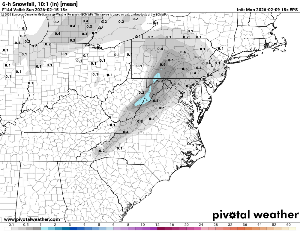
-
2025-2026 ENSO
PositiveEPOEnjoyer replied to 40/70 Benchmark's topic in Weather Forecasting and Discussion
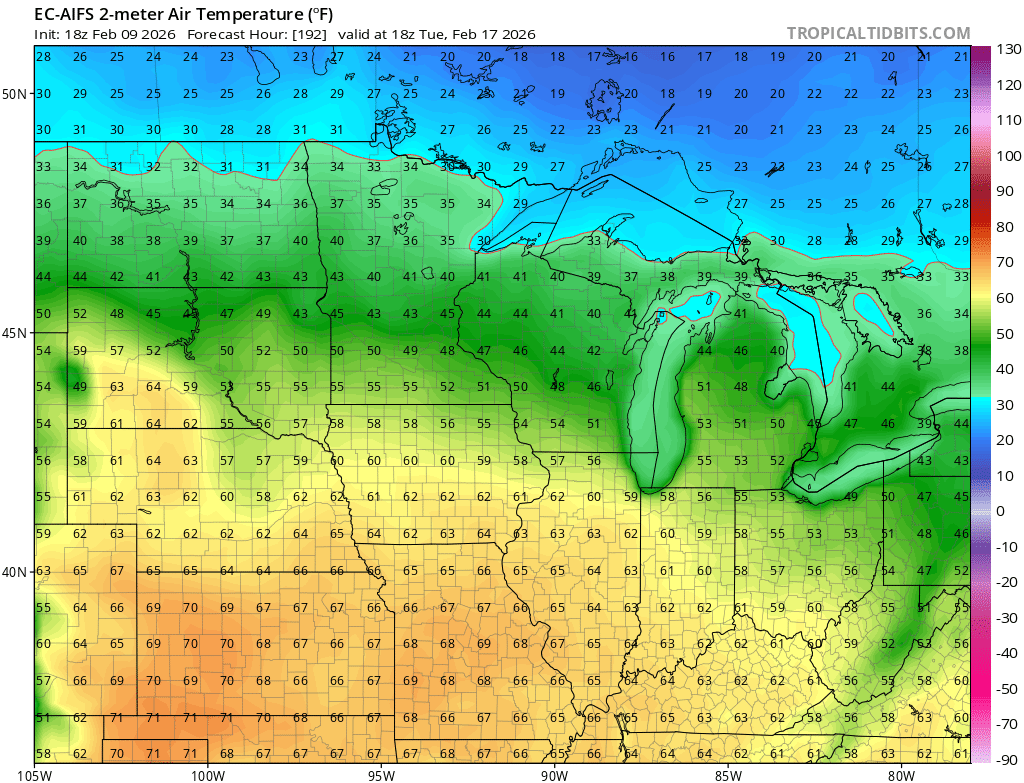
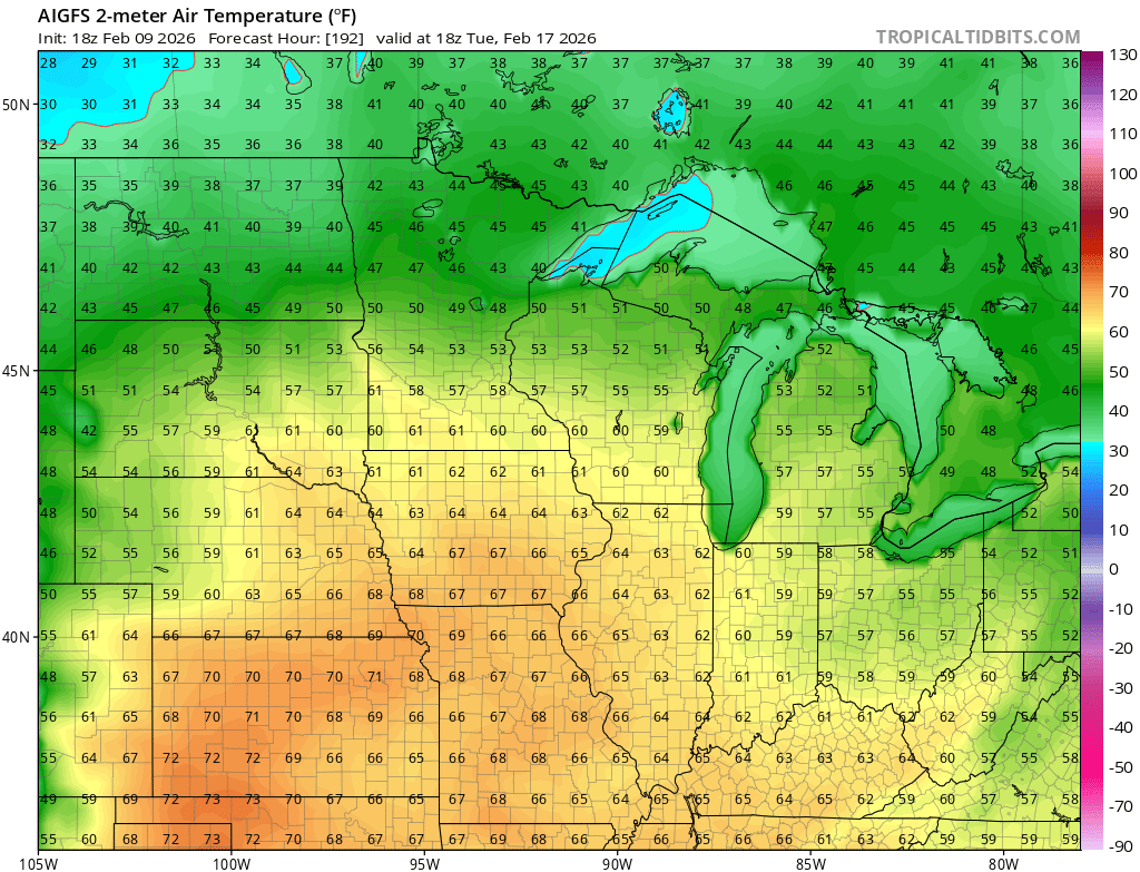
Idk, March still looks pretty torchy to me, at least the first half..thumb.png.6ce417bf74c227da5bcbb390b4784f10.png)
-

Feb 10-11 Mid Week Minor Event - Ride the hot hand?
dendrite replied to HoarfrostHubb's topic in New England
Go to bed -

-
With Wolfie as his corner man.


.png.f2cb8829212a65899030c05ed56a74cb.png)