All Activity
- Past hour
-
 Meh.. lets get a cat3 through SNE
 -
 if the flow end up unidirectional in relation to the isohypses from the NW ? meh
 -
 10 days? How about a month? No power that long, ppl will become unraveled and start doing crazy things. Civil unrest will be rampant in some areas going that long. Since we are so tied to the Internet and mobile devices, that withdrawal from that alone will be very bad for many just on a psychological level. We are actually more vulnerable these days b/c of our reliance on technology. Be careful what you wish for!
 -
Pouring and 71 degrees in Winston-Salem
-
Yes, not really the ENH DY2, but it's location, I can't recall anything confined to NNE quite like this, at least since ENH was a thing. And such a sharp cut off to the tstm risk itself. This screams EML capped, CoastalWx and WxWiz will have to settle for CONS LTGIC IN CB DSNT N-NE! Another post coming soon on the event. Suffice to say, I am very impressed w/ this set up, and it takes a *lot* impress me these days!
-
Heh, not passion. truth - I just don't give a shit to tread lightly around people that haven't earned it. Call-outs suck. too bad.
-
 That's what I'm thinking!
 -
Clouds are shrinking a bit in coverage now. Still cloudy here, 79
-
 A 23" and a 24" storm this winter. 0 complaints. Convection is a fools errand around here.
 -
You get so scared over this!
-
 We did have a couple of big storms locally. I dunno. Maybe my expectations are too high. I think the 90’s spoiled me
 -
You want to see bad for power outages? The next hurricane landfall It will crush anything we have ever seen previously in New England. And all it would take is a min Cat 1 coming in over LI.
-
84/67 then with sun beamin' straight down it's gettin' there
-
A couple 100 readings up near the border currently. One in Meander (RAWS), and another from a PWS just N of Seagull Lake. Some other sites are getting close.
-
(002).thumb.png.6e3d9d46bca5fe41aab7a74871dd8af8.png)
Central PA Summer 2026 Discussion/Obs Thread
ChescoWx replied to Voyager's topic in Upstate New York/Pennsylvania
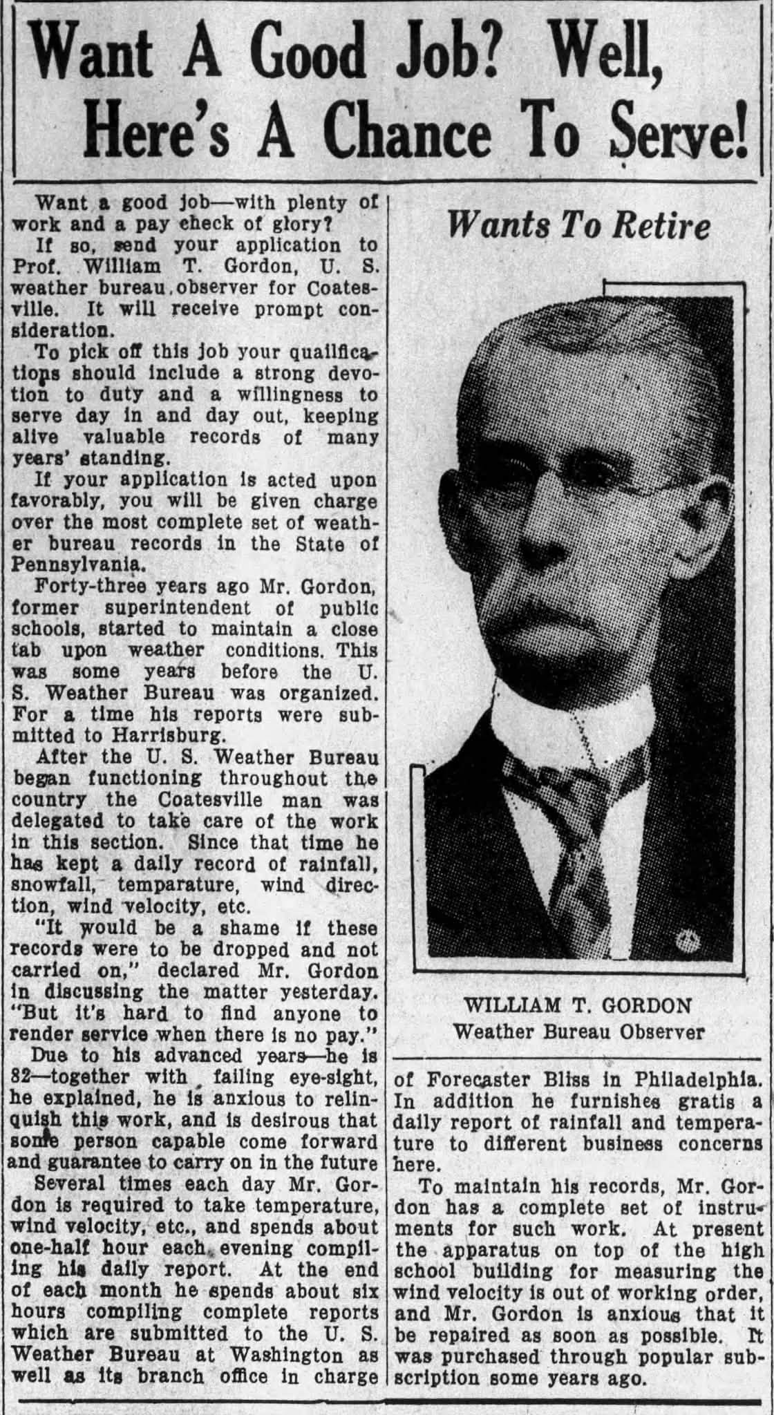
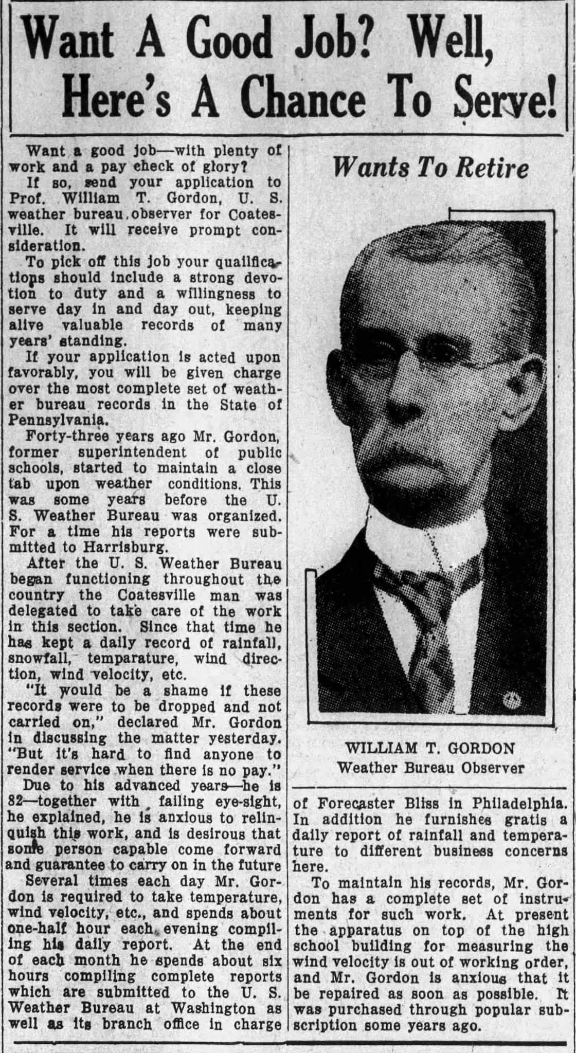
So cool (at least to me). Over on a local Facebook Page they posted the below article from 1930 about the original trained NWS Cooperative Observer for Coatesville PA - WT Gordon. Mr. Gordon (1888-1930) at that time he was looking to retire from observing the weather... but keep his legacy of accurate weather and climate reporting for Coatesville PA alive. Some of you may not know this but back in 1998 I actually purchased all of the handwritten NWS COOP pages from the NWS for Coatesville 1SW for every month from 1894 through 1948 (I know I am a weather nerd!) At the time this data was not available on the internet so during my many plane trips for work and in my spare time I transcribed by hand each and every day for all of those years into an excel spreadsheet the handwritten daily observations for those 54 years. When that was completed I accessed the data from 1948 through 1998 that was available on line to complete the data set for the NWS COOP stations of Coatesville 1SW (1893-1982) and Coatesville 2W (1983-2007).
-
E PA/NJ/DE Summer 2026 Obs/Discussion
ChescoWx replied to PhiEaglesfan712's topic in Philadelphia Region
So cool (at least to me). Over on a local Facebook Page they posted the below article from 1930 about the original trained NWS Cooperative Observer for Coatesville PA - WT Gordon. Mr. Gordon (1888-1930) at that time he was looking to retire from observing the weather... but keep his legacy of accurate weather and climate reporting for Coatesville PA alive. Some of you may not know this but back in 1998 I actually purchased all of the handwritten NWS COOP pages from the NWS for Coatesville 1SW for every month from 1894 through 1948 (I know I am a weather nerd!) At the time this data was not available on the internet so during my many plane trips for work and in my spare time I transcribed by hand each and every day for all of those years into an excel spreadsheet the handwritten daily observations for those 54 years. When that was completed I accessed the data from 1948 through 1998 that was available on line to complete the data set for the NWS COOP stations of Coatesville 1SW (1893-1982) and Coatesville 2W (1983-2007).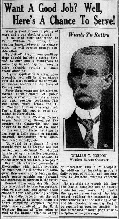
-
From elsewhere:Icon is the first Global that far out (this weekend) that shows low pressure forming in the Big Bend and hanging around the eastern panhandle. It gets to about 1007mb which isn’t particularly low. But it is at the surface. If it is close to being right, look for the other operational models to start going to that type of solution. https://www.tropicaltidbits.com/analysis/models/?model=icon®ion=us&pkg=mslp_pcpn&runtime=2026071312&fh=3
-
cope
-
Getting crushed at the house again.
-
 ....the deniers are going to continue to deny. It is part of their DNA. I can tell you played chess just by your posts because you consider other possibilities that other people write off far too quickly.
 -
 We knew early on this was gonna be a special summer .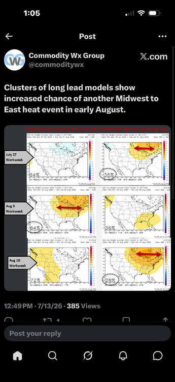
-
Strange summer. All the big heat is north and east of here. They can have it lol.
-
Strange summer. All the big heat is north and east of here. They can have it lol.
- Today
-
I have missed out on most of the real downpours so far this month. Only 2.03" MTD, which isn't horrible, by any means, but it's not making any progress into the deficit. Hopefully my time will come.
-
Odd pattern to the cell movement on the RAH radar at the moment. Some cells moving east, some moving west, some mostly stationary.