All Activity
- Past hour
-
Doesn't it kind of seem a little more like the one we had back in January? That one kind of slid up through Tennessee in the states that surround into our area, but wasn't an actual Nor'easter storm. IDK ..
-

February 2026 OBS & Discussion
North and West replied to Stormlover74's topic in New York City Metro
It was windy and now the sun is out in late February? . -
Our temperatures do spike, but that's because the boundary temps are easily warmed in late February and early March by the increased solar input, but this is not necessarily impacting the wet bulb temperature significantly and that is what matters to our snow chances. I think the fact that it feels warmer, and that any snow we do get will melt real quick, gives the false impression that our chances of snow are going down more than they actually are in late Feb and early March.
-
I believe im at about 29 inches for the season.
-
March 98 laughed at pack in NNE.
-
Our chances of a warning level snowfall event in Baltimore on any given day don't really degrade much until you hit about March 10th when they drop off a cliff quick.
-
Yeah I don’t think I have to think hard about my grade this year.
-
Just wanted to drop in from the Mid Atlantic forum to say congrats to all on these amazing totals and an epic storm. We got shafted yet again here in Baltimore (been a miserable decade for the North Central Maryland specifically), but I’m trying not to be TOO big of a bitter bitch about it. I’m super jealous of y’all, but I really am happy for fellow weenies that got to enjoy such a historic event.
-

"Don’t do it" 2026 Blizzard obs, updates and pictures.
WxWatcher007 replied to Ginx snewx's topic in New England
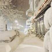
I mean, image of the season stuff right here. -
more than a little, i def tossed it.
-

Winter cancelled/uncancelled banter 25/26
Santa Claus replied to Rjay's topic in New York City Metro
funny how it sounds just like the ticking of clocks -
What could go wrong in 7 days? Ps - I actually like this setup far better for us. Especially for us folks closer to the M/D. Simpler for sure. If this was late January, I’d be honking loudly. I’ll casually watch this until day 3ish. If it’s still there across guidance, I’ll lock in. I can’t do another 7 days of tracking though. I’m getting old [emoji23]
-
-
Seems a little slant to me, but I guess hard to be accurate with all the wind and settling
-
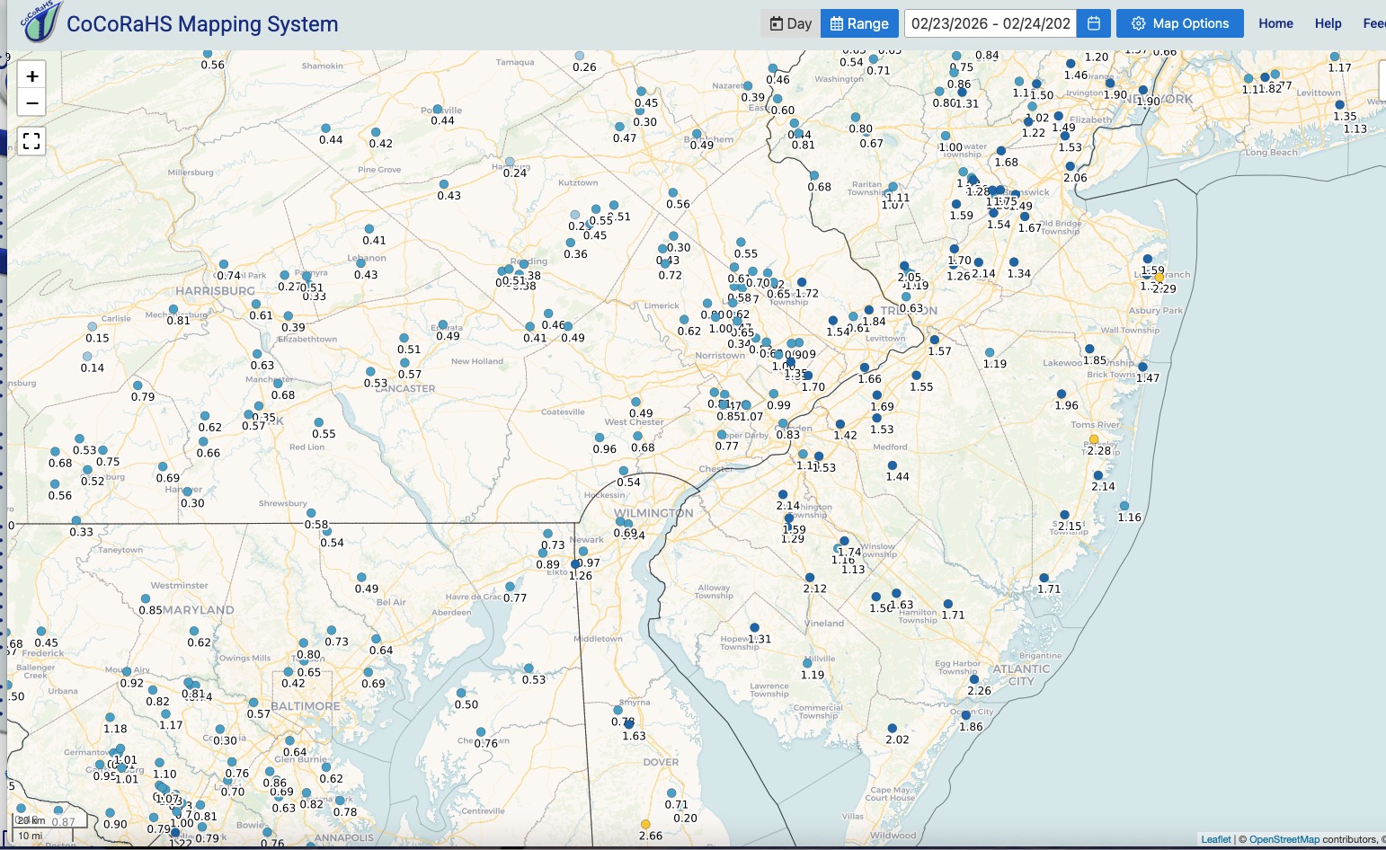
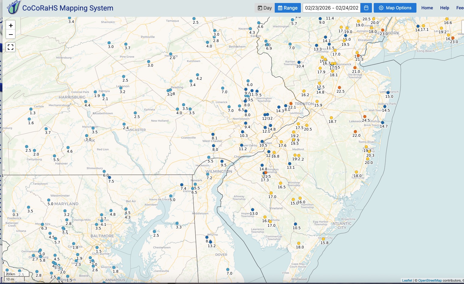
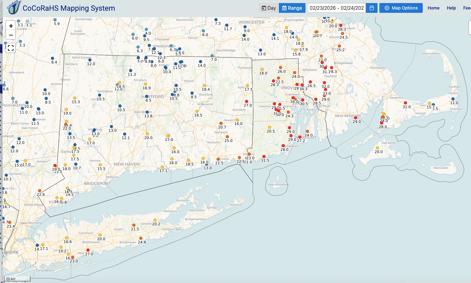
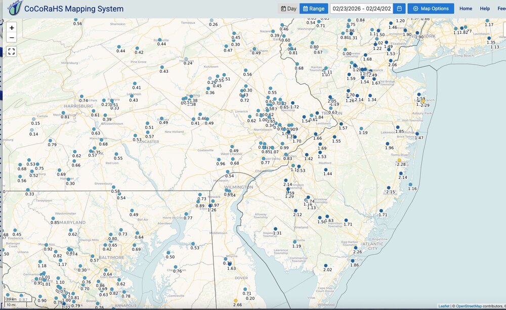
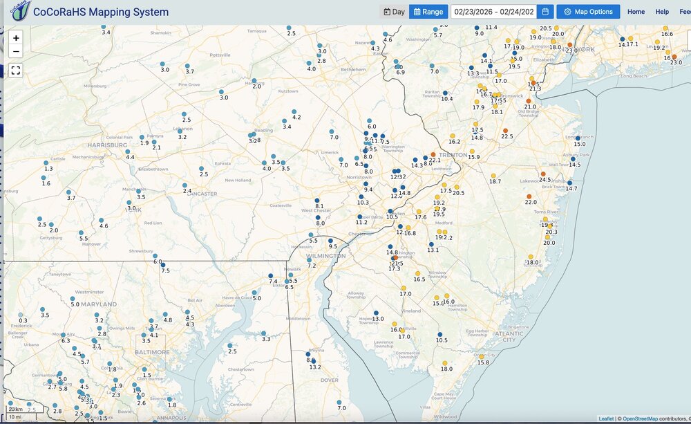
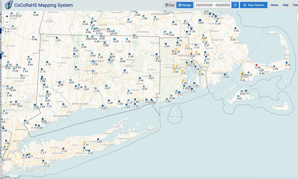
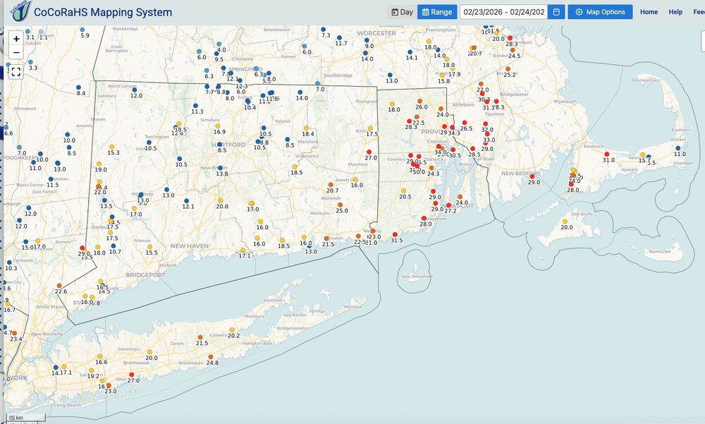
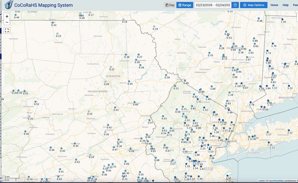
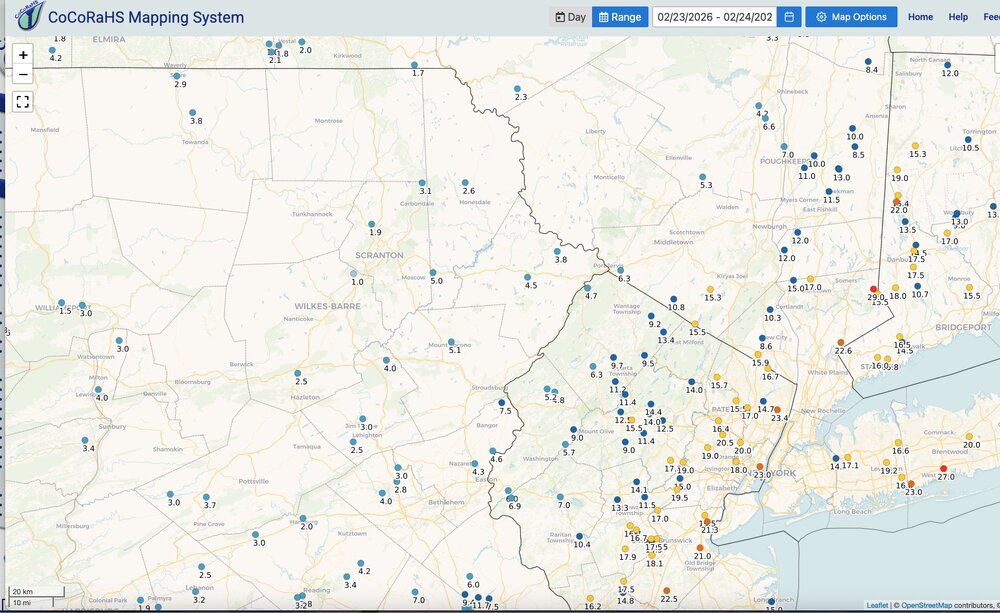
Two day storm totals. Liquid and snowfall. Click maps to enlarge.
-
Yup. That’s when you know which observers to hand out the scarlet letter to.
-
Going with 21" forgotten yardstick in backyard was @ 30", but slightly slanted from the wind (lol). Also started at 7" from previous depth. ESandwich Coop was 18", but my locale was in the death band eastern fringes more frequently. 8-10 miles to my west and north had close to 30". Forestdale reported over 20", to my SE. Depth and drifts with this well exceed Jan 22. I feel confident in my estimate within 1 or 2" Although a bit disappointed I missed out on the extra 9-10" by only a few miles, still a top 5'er personally
-
Ooh, maybe @Chrisrotary12and I can get a tee time for sometime next week.
-

Clipper Fires In Wednesday Feb 25 Disco/ Obs
Chrisrotary12 replied to Damage In Tolland's topic in New England
NWS has me for 3” but honestly expecting just flurries. -

Winter cancelled/uncancelled banter 25/26
donsutherland1 replied to Rjay's topic in New York City Metro
The 21" figure is from 7 am yesterday. This morning's 7 am figure was 39". -

Late February/Early March 2026 Mid-Long Range
stormtracker replied to WxUSAF's topic in Mid Atlantic
Yeah.....for you -
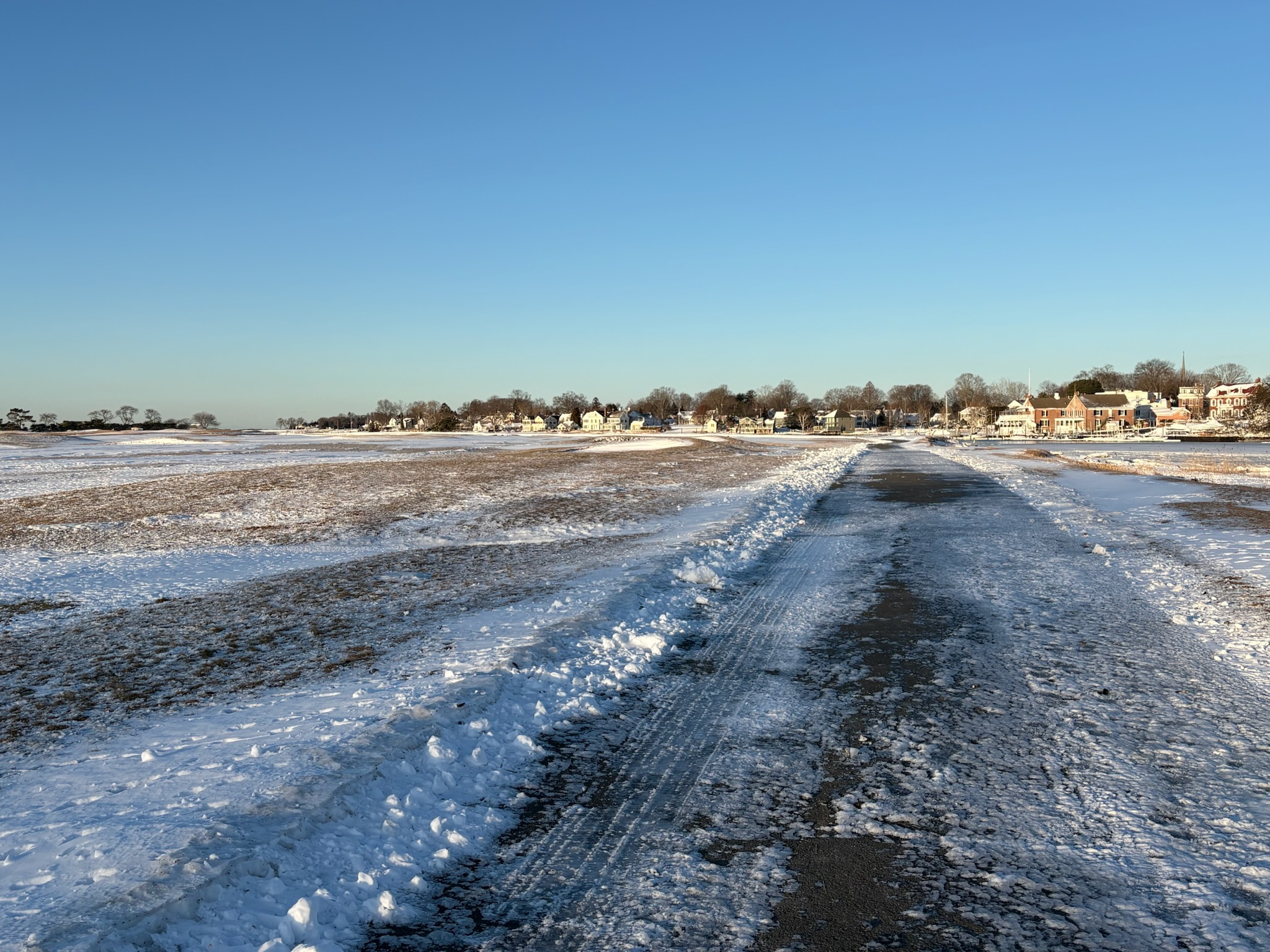
Here is a great pic taken by a friend of mine this morning, while walking his dog on the course at The Country club of Fairfield. This is a classic links course, meaning it abuts the sea. You can see that the wind has scoured every bit of accumulation from the fairways!

-

"Don’t do it" 2026 Blizzard obs, updates and pictures.
NSwx replied to Ginx snewx's topic in New England
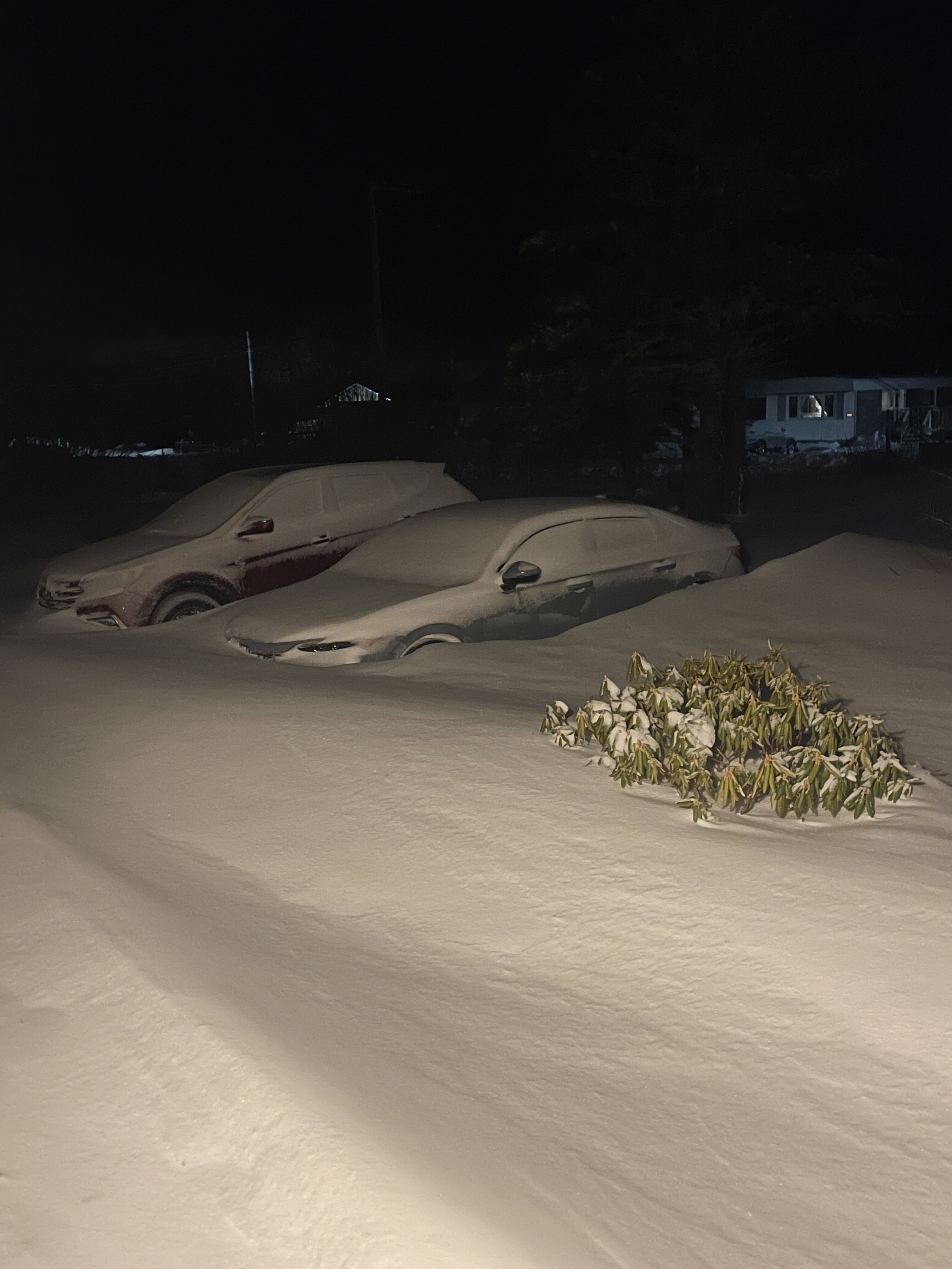
Lots of digging this morning.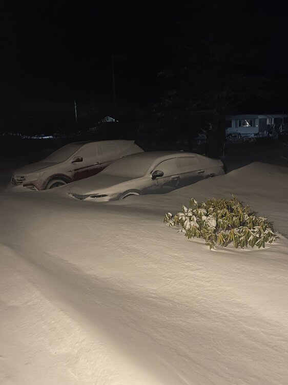
-
Some report on the interactive map OKX plotted yesterday https://www.weather.gov/source/crh/snowmap.html
-
"Don’t do it" 2026 Blizzard obs, updates and pictures.
acoolerclimate replied to Ginx snewx's topic in New England
My back yard is fairly open, as well as the driveway, but there are a lot of trees. My sister on the Northeast side of N Prov, says she measured around 30 inches. I was just in a bad spot, I guess.