All Activity
- Past hour
-

Friday February 6 FROPA / WINDEX small event
CoastalWx replied to HoarfrostHubb's topic in New England
Gonna be 8” totals near PYM to Scituate. -

Friday February 6 FROPA / WINDEX small event
ORH_wxman replied to HoarfrostHubb's topic in New England
Absolutely nuking still but about to slip east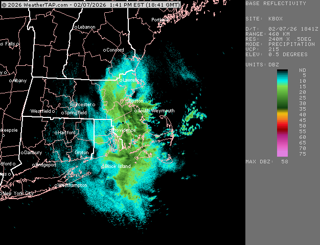
-

Friday February 6 FROPA / WINDEX small event
Damage In Tolland replied to HoarfrostHubb's topic in New England
4.2” total with flurries . Winds really cranking now with gusts to 40 -

Friday February 6 FROPA / WINDEX small event
40/70 Benchmark replied to HoarfrostHubb's topic in New England
6.5" should just about do it. -

Friday February 6 FROPA / WINDEX small event
CT Valley Snowman replied to HoarfrostHubb's topic in New England
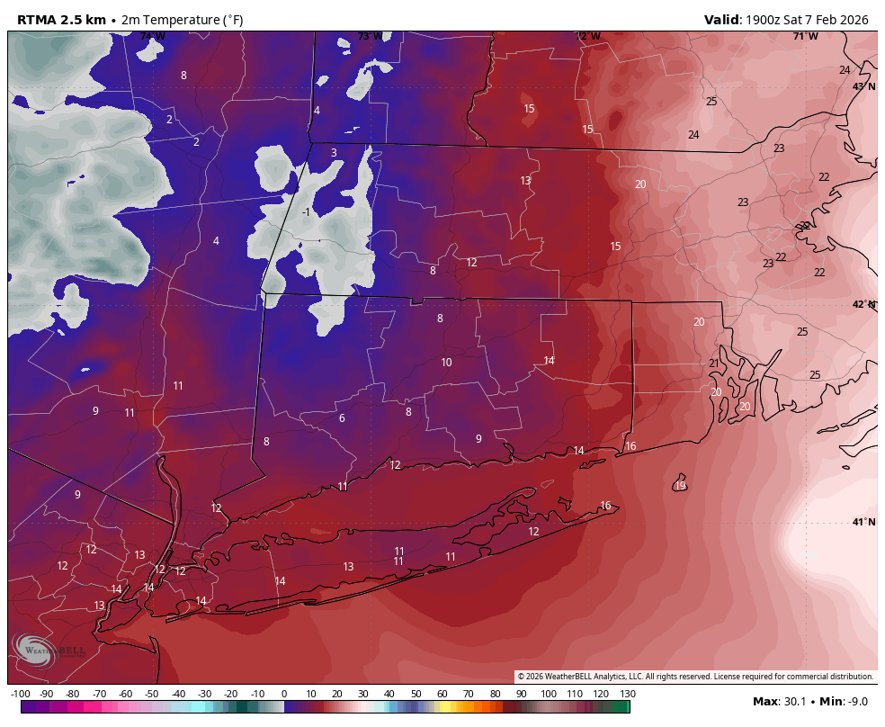
2.2" North Central portion of Enfield CT. Approx. 2.5 miles east of the CT River and 2.5 miles south of the MA border. -
Jan 2018
-

Friday February 6 FROPA / WINDEX small event
Sey-Mour Snow replied to HoarfrostHubb's topic in New England
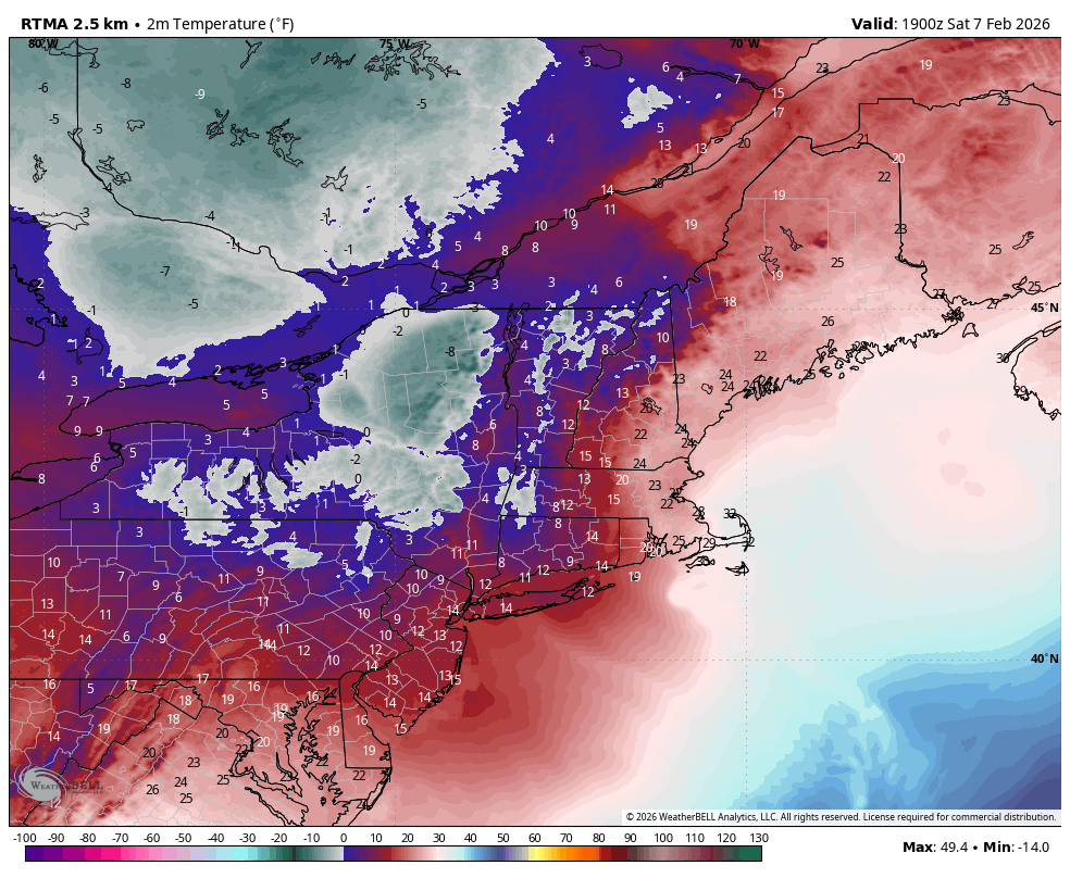
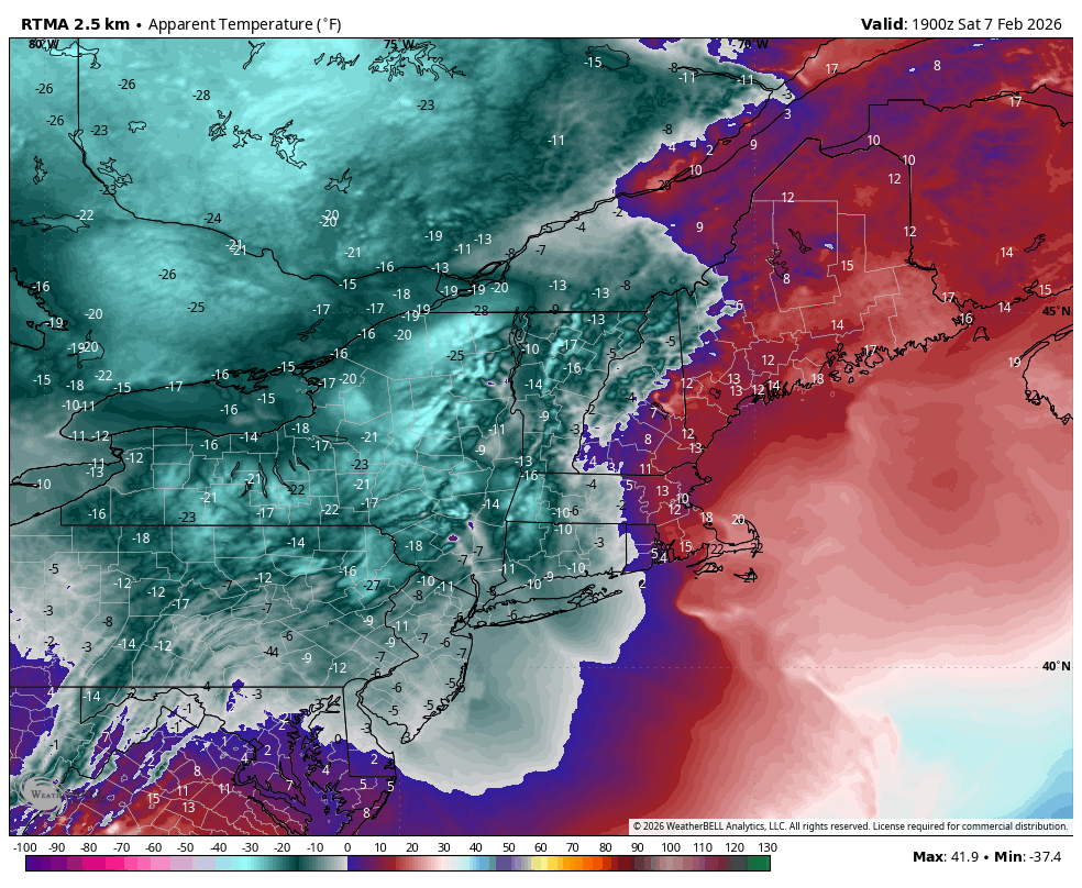
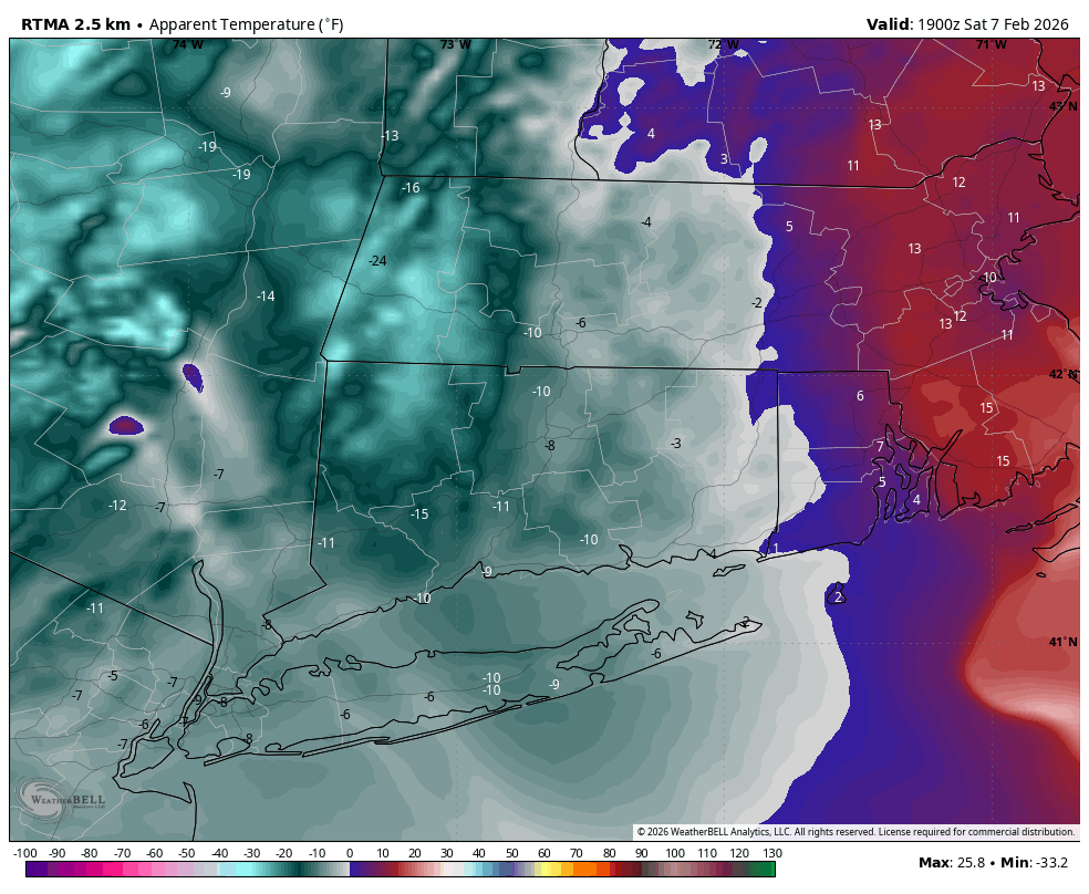
Already below zero in parts of the northwest hills with wind chills 20-30 below -

Friday February 6 FROPA / WINDEX small event
TauntonBlizzard2013 replied to HoarfrostHubb's topic in New England
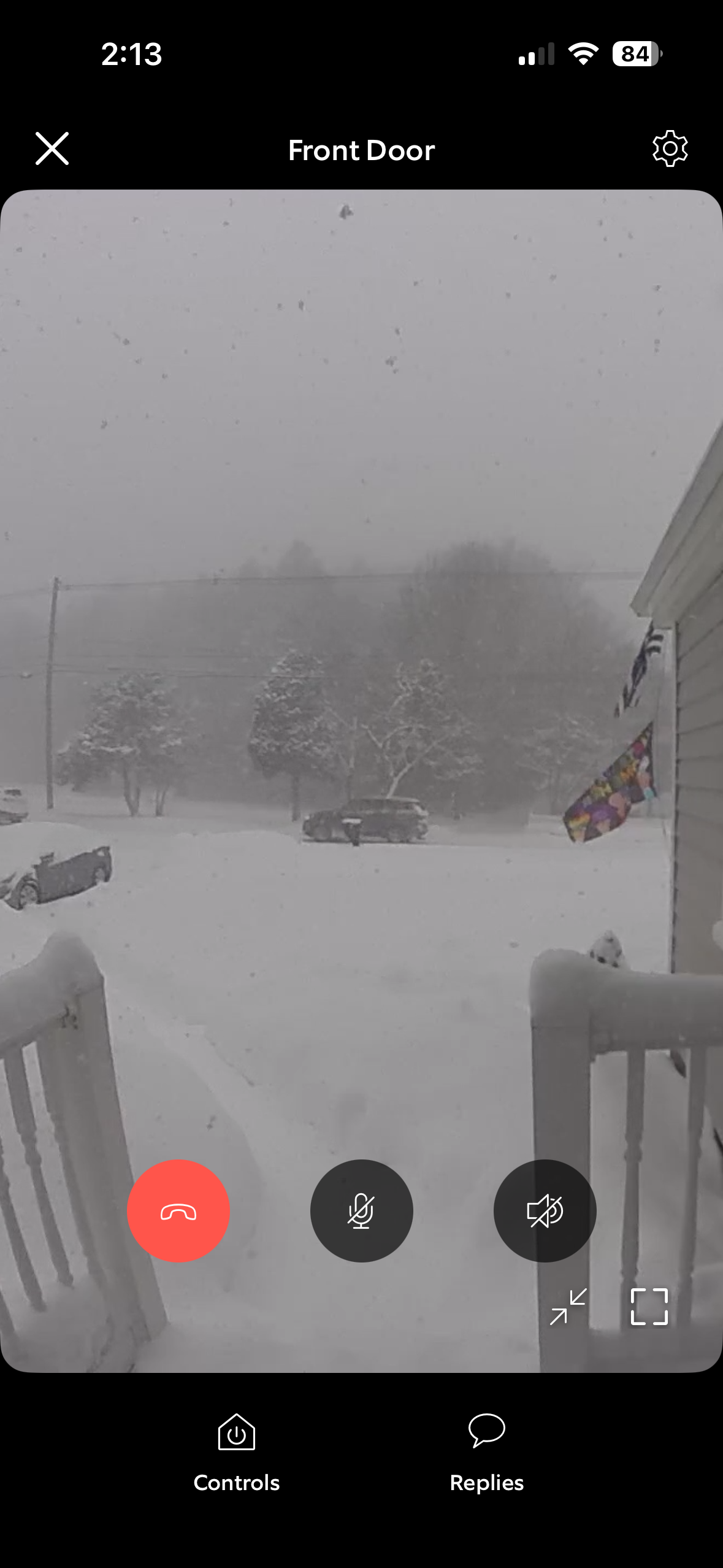
Snowing hard -
Sitting at 2 degrees
-

Friday February 6 FROPA / WINDEX small event
Go Kart Mozart replied to HoarfrostHubb's topic in New England
BOX should consider a blizzard warning for the post-frontal passage time frame. -
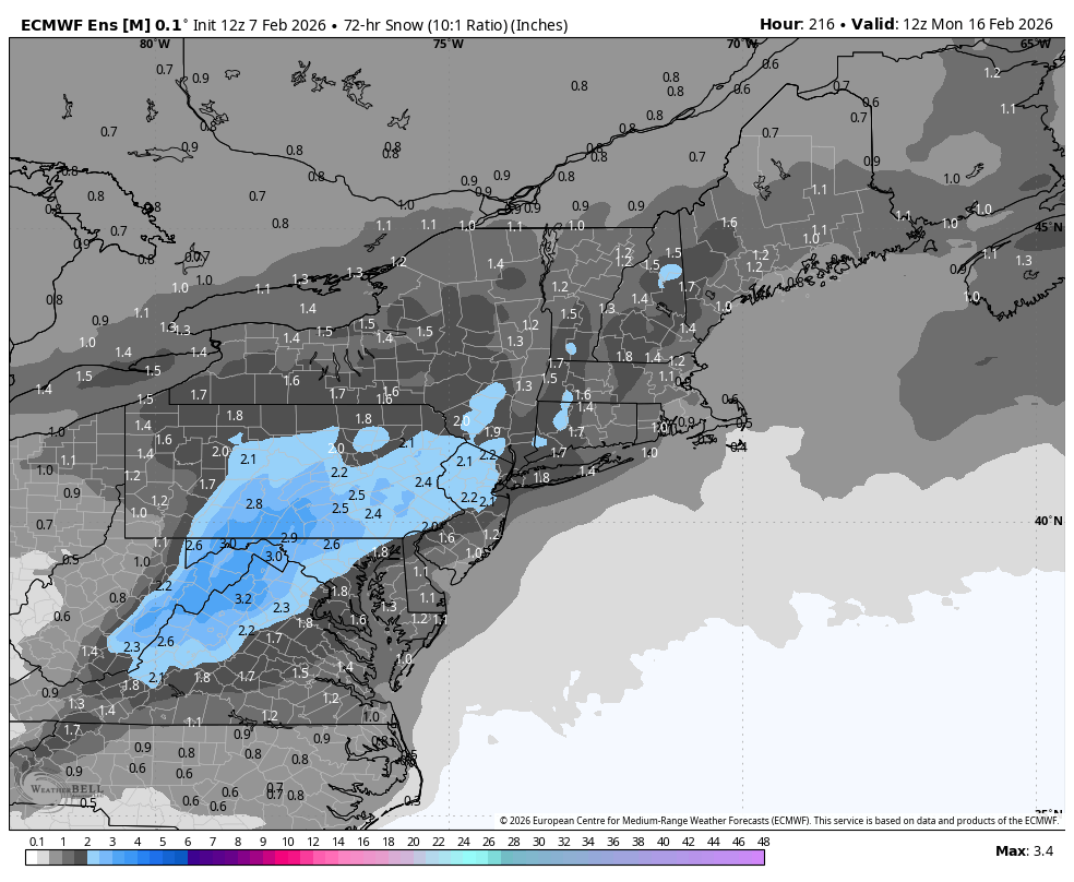
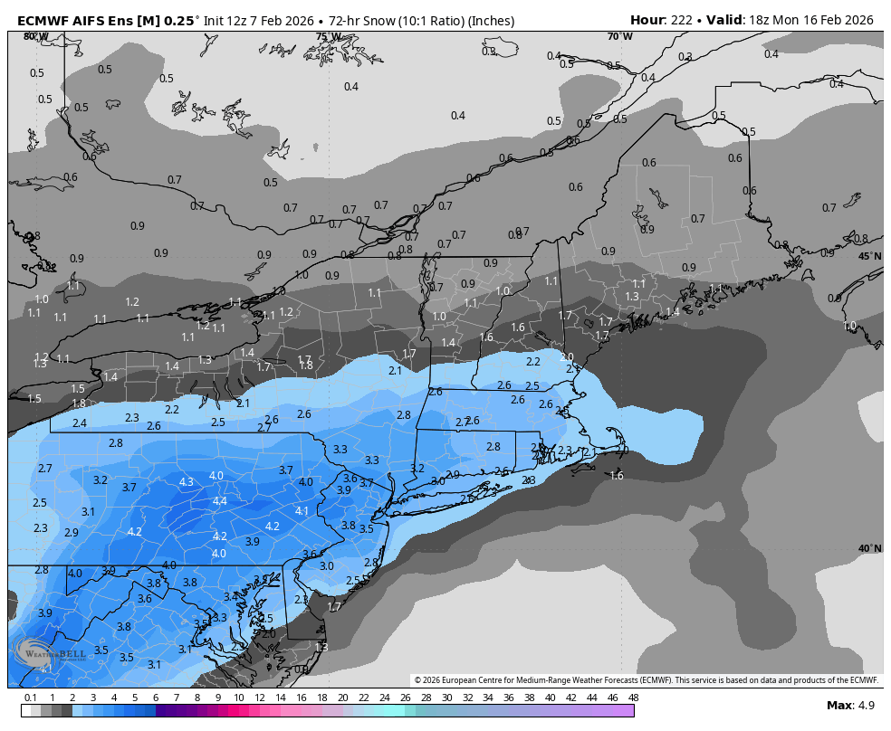
 Here’s AI EPS 3 day snow map as of next Monday afternoon.
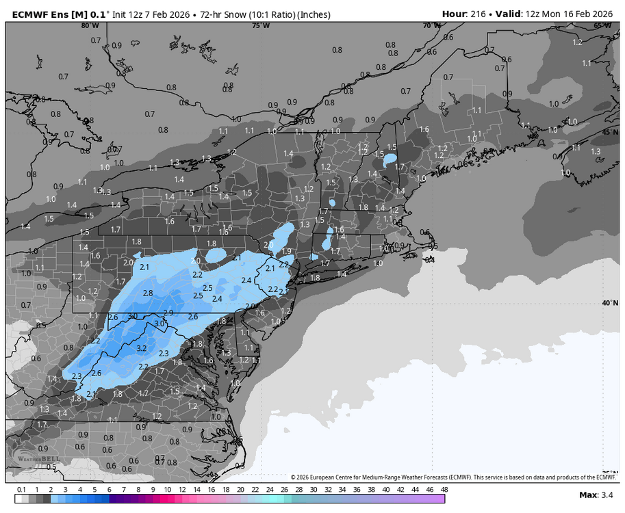

-

Friday February 6 FROPA / WINDEX small event
Henry's Weather replied to HoarfrostHubb's topic in New England
Perfect huge dendrites, West Concord -
I would of thought you cashed in on a little LES. After the fast start its been mostly dusters here since Dec8th. Further east into downtown and north shore they've had some LES events. Every mile east of here matters as far as LES and being more under the clipper track this year. RFD still at 24" for the season but ORD up at 31"+. DTW even better along with a lot of Ohio relative to averages
-

February 2026 Medium/ Long Range Discussion: 150K Salary Needed to Post
CAPE replied to Weather Will's topic in Mid Atlantic
Snow maps galore. 50 miles east or west or north or south. A week out lol. Back to the other thread. I would rather talk to myself. -
Friday February 6 FROPA / WINDEX small event
Go Kart Mozart replied to HoarfrostHubb's topic in New England
I've been out for a while, cannot believe the arctic front still hasn't made it through the far east yet. We had 1" and the roads are treacherous with all the drifting. Just wait! -
Down to 11 degrees. It's a legit airmass. Ground blizzard off the adjacent golf course.
-
Wind has calmed down. Currently 55 and sunny. Beautiful.
-

Friday February 6 FROPA / WINDEX small event
ScituateWX replied to HoarfrostHubb's topic in New England

-
I think maybe 2015 we had a day where the high was like 5 with winds like this
-
Friday February 6 FROPA / WINDEX small event
Henry's Weather replied to HoarfrostHubb's topic in New England
Better snow growth than at any time last storm -
Winter Storm Threat *Technical* Discussion. No Op Run PBP or Snow maps
CAPE replied to CAPE's topic in Mid Atlantic
12z EPS has the same general idea as the op with this 'frontrunning' midwestern wave Friday into early Sat- Then here later with energy ejecting from the SW. They don't play well together like the op. That said there is some precip for our area on the mean. Still a week out and given the likely errors with wave timing at this point, it will evolve/morph into something else. -
Friday February 6 FROPA / WINDEX small event
ScituateWX replied to HoarfrostHubb's topic in New England
Heavy Snow here now!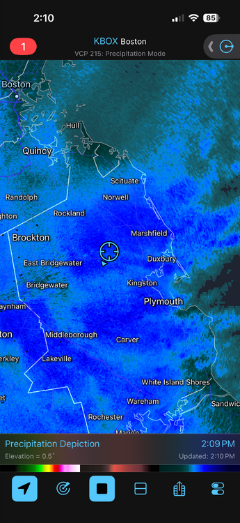
-
That's where this airmass originated from