All Activity
- Past hour
-
Yeah but not this strong though--it's historic. And potentially east-based. That's the part of it that worries me because to me historically strong=97-98 scenario. If it were anything else like moderate to strong, or modoki (I know that one is rare) I'd certainly like our chances much better. I would relish being be HAPPILY wrong though and will wear all of it while I'm measuring in feet
-
 Sildenafil 100mg price [url=http://medmennews.com/#]buy Viagra online[/url] Viagra tablet online
 -
I think it is counted as a “tornadic waterspout”.
-
We could get a bunch of 'perfect track' rainstorms. The irony of your negative stance is that a strong El Nino is statistically more likely to give you what you want(and esp places NW) than the recent Nina winters- a KU storm.
-
That is a legitimate question.
-
https://medmennews.xyz/# Viagra generic over the counter over the counter sildenafil
-
Ok Deb.
-
Late February twice in a row! February 20, 2025 (the more infamous one) and February 22, 2026.
-
Not mention they break your heart with the big storms that miss. You see what happened late February? It's gonna happen 99% of the time with a coastal in a nina. BUT thankfully we got a frickin' glacier and arctic cold to enjoy for over a month--that was pretty fun!
- Today
-
The problem I have is this Nino is looking historically strong, which is by nature an extreme event like 97-98 (or stronger as some in the forum are predicting). I mean looking at the daily high temps for DJF...that year torched through and through with not one period of being cold enough to snow. At least the other dud super nino of 72-73 had a cold chance but we just got unlucky (glad I wasn't around for that southern blizzard). But with an historically strong event? Maaan I question if we even GET cold enough for snow. In no universe would I root for a nina...they break your heart everytime, lol (though last year was about as good as a nina can get...late February hurt though!) And we're gonna get two more of those ninas after next winter anyway which is why a potential fail this winter is more frustrating.
-
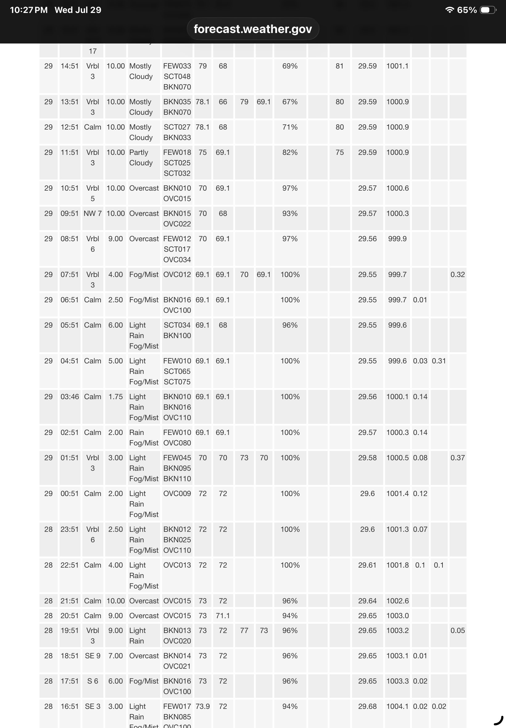
 5.5” and raining again. Yeah, the frogs were crazy tonight walking the dog.
 -
Two areas south of Albany are up to 11" and change for the storm totals. There are some wild photos on facebook if you follow the meterologists.
-

2026-2027 Super El Nino
Jebman replied to Stormchaserchuck1's topic in Weather Forecasting and Discussion
Extending that Y-axis is extremely good news for me. BRING IT THE HELL ON!!!!!!!!!!!!!!!!!!!!!!!!!!!!!!!!!!!!!!!!!!!!!!!!!!!!!!!! -

2026-2027 Super El Nino
George001 replied to Stormchaserchuck1's topic in Weather Forecasting and Discussion
Yep, we are going to shatter the old records. The daily Nino 3.4 already is above 2C before August, and the subsurface warmth continues to go nuclear. I’m taking the over on ONI and RONI >3C -
Little to know damage was reported, it traversed the James River. But a super sweet pic. Since it was associated with a large thunderstorm but never hit land, does it not count as a tornado?
-
Central Park storm total .74. As always …..
-

2026-2027 Super El Nino
raindancewx replied to Stormchaserchuck1's topic in Weather Forecasting and Discussion
Last I looked, Jun-Jul precip totals here were tracking pretty close to 1982. That's generally a sign that pressure patterns and moisture levels are similar. Much colder/wetter than 2023 so far. 1 2023-07-29 T 0 2 1980-07-29 0.09 0 3 1958-07-29 0.36 0 - 1951-07-29 0.36 0 5 2011-07-29 0.39 0 6 1942-07-29 0.41 0 7 1995-07-29 0.52 0 8 2003-07-29 0.61 0 - 1947-07-29 0.61 0 10 1994-07-29 0.66 0 - 1993-07-29 0.66 0 12 1962-07-29 0.71 0 13 1977-07-29 0.73 0 14 2026-07-29 0.80 1 15 1982-07-29 0.86 0 16 2016-07-29 0.87 0 17 1953-07-29 0.88 0 18 1945-07-29 0.89 0 19 1971-07-29 0.93 0 20 1934-07-29 0.98 0 Highs are close too for July 1-29 1 2023-07-29 99.2 0 2 1980-07-29 99.0 0 3 2003-07-29 97.2 0 4 1978-07-29 97.1 0 5 1951-07-29 96.1 0 6 2016-07-29 95.9 0 - 1979-07-29 95.9 0 8 1994-07-29 95.7 0 9 1983-07-29 95.2 0 10 1963-07-29 95.0 0 11 2026-07-29 94.8 1 12 2011-07-29 94.7 0 13 1993-07-29 94.6 0 - 1982-07-29 94.6 0 - 1934-07-29 94.6 0 16 1954-07-29 94.4 0 17 2005-07-29 94.3 0 - 1981-07-29 94.3 0 19 1995-07-29 94.0 0 - 1953-07-29 94.0 0 21 1947-07-29 93.8 0 -
 Saw a report of 5.72" in Suffield. 4.3" BDL.
 -
 4.11” today. Deluge right now. Drove home from Worcester. so. Many. Frogs.
 -
4.39” total.
-
E PA/NJ/DE Summer 2026 Obs/Discussion
KamuSnow replied to PhiEaglesfan712's topic in Philadelphia Region
Received 0.85" here, spread out over about 3 hours. Nice. Had one lightning bolt that had to be 9" diameter, about an eighth of a mile from here, so bright, and the thunder might be the loudest I've heard. Wow! -
 Raining, ended up in Arlington, up in the heights. Hope elevation helps in Winter. [emoji38] .
 -
Kevin Brown's call in the 7th when Taylor Ward's 2 RBI single makes it 7-5, 'A path of destruction in Finnegan's wake!' Pulling out a James Joyce reference is pretty choice. Him and Ben are some of the best
-
.thumb.gif.f92b16c631a1d15d405ed77b33f0710d.gif) you DID win?
you DID win? -
 0.23" today. they all can't be winners