hooralph Posted October 30, 2012 Share Posted October 30, 2012 Someone asked about the flooding map. Here is the zone map again. It's clear that many Zone B places are flooding. Probably Zone C places, too. I don't think that should be a surprise to anyone on this forum, since we knew the potential, but Bloomberg should absolutely take a tremendous amount of flak for this. http://google.org/crisismap/2012-sandy-nyc Link to comment Share on other sites More sharing options...
pman10 Posted October 30, 2012 Share Posted October 30, 2012 Water is all the way across 12th ave/ west side hwy, and is now moving towards 11th ave. I'm in zone B, but I think the surge is goimg to reach my building. Link to comment Share on other sites More sharing options...
blueheronNC Posted October 30, 2012 Share Posted October 30, 2012 I wonder if some debris is floating on top of the water at the Battery gauge which is inflating the value the gauge is detecting. It's just not jiving with Cantore's live measurements... Link to comment Share on other sites More sharing options...
famartin Posted October 30, 2012 Share Posted October 30, 2012 Gusted to 43 mph despite the trees back home.... Link to comment Share on other sites More sharing options...
pazzo83 Posted October 30, 2012 Share Posted October 30, 2012 Damaging winds ripping through midtown right now. Link to comment Share on other sites More sharing options...
gkrangers Posted October 30, 2012 Share Posted October 30, 2012 Subway tunnels are flooded in lower Manhattan per MTA; Joe Lhota. Link to comment Share on other sites More sharing options...
friedmators Posted October 30, 2012 Share Posted October 30, 2012 Sandy Hook upto 12.38' surge. WOW Link to comment Share on other sites More sharing options...
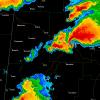
SnowGoose69 Posted October 30, 2012 Share Posted October 30, 2012 11pm it should start to back off, roughly another 3 hrs, storm wear starts to set in as the duration begins to take a toll on ones psyche, can't account for that, this is the worst of it, good 5 hr period from 6-11 for N NJ/NYC/LI. New banding starting to light up south of central LI, east of NJ, could be into the City proper in about an hour, loop OKX, blossoming... There is no question SE CT and Suffolk have markedly dropped the last 30 minutes...Groton and Shirley both near 40 knots....hopefully this is the start of the winds slowing from east to west. Even Islip now has been near 50-55 knots as opposed to 65-70 as they once were. Link to comment Share on other sites More sharing options...
left_gulley Posted October 30, 2012 Share Posted October 30, 2012 I wonder if some debris is floating on top of the water at the Battery gauge which is inflating the value the gauge is detecting. It's just not jiving with Cantore's live measurements... The rises at Sandy Hook have also been incredible. http://water.weather...=phi&gage=sdhn4 Link to comment Share on other sites More sharing options...
calculus1 Posted October 30, 2012 Share Posted October 30, 2012 Some places I highlighted that are seeing flooding. For people who don't know NYC area geography! Someone asked about the flooding map. Here is the zone map again. It's clear that many Zone B places are flooding. Probably Zone C places, too. http://google.org/cr.../2012-sandy-nyc Thank you both! It helps a lot. Link to comment Share on other sites More sharing options...
Moose4 Posted October 30, 2012 Share Posted October 30, 2012 KLGA 292351Z 12037G59KT 4SM -RA BR BKN008 OVC015 17/16 A2865 RMK AO2 PRESRR SLP702 6//// T01740163 10172 20161 53024 PNO $ 59 knots at Laguardia. Yikes. Stay safe up there, guys. Link to comment Share on other sites More sharing options...
hudsonvalley21 Posted October 30, 2012 Share Posted October 30, 2012 SPECIAL WEATHER STATEMENT NATIONAL WEATHER SERVICE NEW YORK NY 800 PM EDT MON OCT 29 2012 CTZ005-006-009-010-NJZ002-004-006-103>108-NYZ067>075-078-080- 176>179-300200- NORTHERN FAIRFIELD-NORTHERN NEW HAVEN-SOUTHERN FAIRFIELD- SOUTHERN NEW HAVEN-WESTERN PASSAIC-EASTERN PASSAIC-HUDSON- WESTERN BERGEN-EASTERN BERGEN-WESTERN ESSEX-EASTERN ESSEX- WESTERN UNION-EASTERN UNION-ORANGE-PUTNAM-ROCKLAND- NORTHERN WESTCHESTER-SOUTHERN WESTCHESTER-NEW YORK (MANHATTAN)- BRONX-RICHMOND (STATEN ISLAND)-KINGS (BROOKLYN)- NORTHWESTERN SUFFOLK-SOUTHWESTERN SUFFOLK-NORTHERN QUEENS- NORTHERN NASSAU-SOUTHERN QUEENS-SOUTHERN NASSAU- 800 PM EDT MON OCT 29 2012 ...OCCASIONAL DAMAGING WIND GUSTS OF 70-90 MPH EXPECTED ACROSS NEW YORK CITY...NORTHEAST NEW JERSEY...THE LOWER HUDSON VALLEY...SOUTHWESTERN CONNECTICUT...AND WESTERN LONG ISLAND THROUGH 10 PM... NATIONAL WEATHER SERVICE DOPPLER RADAR INDICATED WINDS UP TO 110 MPH BETWEEN 1500 AND 3000 FEET. SOME OF THESE VERY STRONG...DAMAGING WINDS WILL OCCASIONALLY REACH THE SURFACE...PRODUCING GUSTS OF 70-90 MPH ACROSS NEW YORK CITY...NORTHEAST NEW JERSEY...THE LOWER HUDSON VALLEY...SOUTHWESTERN CONNECTICUT...AND WESTERN LONG ISLAND THROUGH 10 PM. THE GUSTS TO THESE LEVELS WILL BE MORE FREQUENT OVER THE NEW YORK CITY METRO AREA AND HIGHER ELEVATIONS. GUSTS OF THIS MAGNITUDE WILL DOWN NUMEROUS TREES...INCLUDING LARGE ONES. HIGH RISE BUILDINGS ARE ALSO SUSCEPTIBLE TO DAMAGE WITH THESE GUSTS. PERSONS ARE URGED TO REMAIN SHELTERED IN A STURDY BUILDING DUE TO THE THREAT OF FALLING TREES...LARGE LIMBS AND FLYING DEBRIS. Link to comment Share on other sites More sharing options...
weathermd Posted October 30, 2012 Share Posted October 30, 2012 In frankin lakes transformer flashes all over way worse then Irene Would guess at least 75 Trees and branches all over Link to comment Share on other sites More sharing options...
bikerman262 Posted October 30, 2012 Share Posted October 30, 2012 Any word if the subways are flooded? Yes in lower Manhattan Zone A. FDNY is reporting heavy smoke conditions from numerous subway stations Link to comment Share on other sites More sharing options...
David Reimer Posted October 30, 2012 Share Posted October 30, 2012 NATIONAL WEATHER SERVICE NEW YORK NY 810 PM EDT MON OCT 29 2012 THE KENNEDY TERMINAL DOPPLER WEATHER RADAR TJFK IS NOT AVIALABLE AT THIS TIME DUE TO SANDY. IT IS UNKNOWN WHEN IT WILL RETURN TO SERVICE. Link to comment Share on other sites More sharing options...
David Reimer Posted October 30, 2012 Share Posted October 30, 2012 Engine 206 needs a swiftwater team to the firehouse members trapped in Firehouse. (7 minutes ago) Link to comment Share on other sites More sharing options...
Weathergun Posted October 30, 2012 Share Posted October 30, 2012 All three major airports have reported hurricane force wind gusts! So far: LGA 74mph JFK 79mph EWR 78mph Link to comment Share on other sites More sharing options...
LocoAko Posted October 30, 2012 Share Posted October 30, 2012 Hudson River now 6 blocks into Jersey City and still coming.... Via https://twitter.com/Matthew_Orr/status/263070545053102080/photo/1 Link to comment Share on other sites More sharing options...
chazman Posted October 30, 2012 Share Posted October 30, 2012 Might have just had my biggest wind gust right now..light flickered. Link to comment Share on other sites More sharing options...
Geos Posted October 30, 2012 Share Posted October 30, 2012 That crane is really blowing in the wind on CNN! Incredible water rise at the Battery! Link to comment Share on other sites More sharing options...
tim Posted October 30, 2012 Share Posted October 30, 2012 There is no question SE CT and Suffolk have markedly dropped the last 30 minutes...Groton and Shirley both near 40 knots....hopefully this is the start of the winds slowing from east to west. Even Islip now has been near 50-55 knots as opposed to 65-70 as they once were. ...i hope your right 'snow goose'..gusts seem to have diminished somewhat here in eastport LI..in fact the moon is shining brightly..not out of the woods yet.. but getting there.. Link to comment Share on other sites More sharing options...
XtremeWx Posted October 30, 2012 Share Posted October 30, 2012 Water up to 13.20 ft at the battery. Just incredible. Link to comment Share on other sites More sharing options...
Scott747 Posted October 30, 2012 Share Posted October 30, 2012 Battery rate slowing down - 8518750 20121029 19:06 3.90 11.41 7.16 8518750 20121029 19:12 3.98 11.62 7.07 8518750 20121029 19:18 4.06 11.87 7.31 8518750 20121029 19:24 4.14 12.09 7.06 8518750 20121029 19:30 4.21 12.33 7.06 8518750 20121029 19:36 4.28 12.54 7.24 8518750 20121029 19:42 4.34 12.75 7.13 8518750 20121029 19:48 4.41 12.93 7.16 8518750 20121029 19:54 4.46 13.04 7.09 8518750 20121029 20:00 4.51 13.15 7.16 8518750 20121029 20:06 4.56 13.20 7.16 Link to comment Share on other sites More sharing options...
yl715 Posted October 30, 2012 Share Posted October 30, 2012 Flickering power in Union Square Link to comment Share on other sites More sharing options...
Ottawa Blizzard Posted October 30, 2012 Share Posted October 30, 2012 Wishing all of you guys down there all the best. Stay safe! Link to comment Share on other sites More sharing options...
MJO812 Posted October 30, 2012 Share Posted October 30, 2012 Cops galore around here. Also have some snapped power lines outside my house. Link to comment Share on other sites More sharing options...
earthlight Posted October 30, 2012 Share Posted October 30, 2012 This went from exciting to scary very quickly. Treesare breaking and falling on homes and you can hear it very clearly. Link to comment Share on other sites More sharing options...
ag3 Posted October 30, 2012 Share Posted October 30, 2012 Sad death in Flushing. Tree slammed a home and killed a man. Link to comment Share on other sites More sharing options...
Isotherm Posted October 30, 2012 Share Posted October 30, 2012 65mph gusts here in Colts Neck. Power still out. Crazy out there. Wind is absolutely fierce....... Link to comment Share on other sites More sharing options...
ace0927 Posted October 30, 2012 Share Posted October 30, 2012 This went from exciting to scary very quickly. Treesare breaking and falling on homes and you can hear it very clearly. will the bands developing to the south and east make it into our area? Link to comment Share on other sites More sharing options...

Recommended Posts
Archived
This topic is now archived and is closed to further replies.