

TSSN+
-
Posts
4,772 -
Joined
-
Last visited
Content Type
Profiles
Blogs
Forums
American Weather
Media Demo
Store
Gallery
Everything posted by TSSN+
-
Everyone mentioning wind. It’s calm here.
-
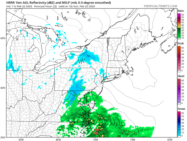
Things to say about this storm. 1. It snowed End of list
-
So it doesn’t extend into pa? lol figures
-
Hrrr gives her an additional dusting to 1/2” at most but let her keep dreaming.
-
32, moderate snow. Slush starting to accumulate. Hopefully can make a run at a few inches.
-
Alex, I’ll take things you don’t usually say for 2000. A place you would want to be for a major coastal. What is Delaware?
-
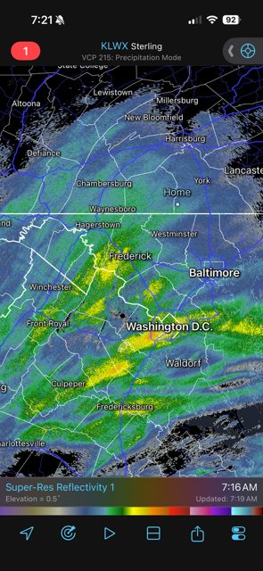
Snowing at the beaches and raining in Hanover Pa. What backwards weather is this.
-
35 and rain in good ole Hanover.
-
Light rain 33
-
Fully expecting 3-5” here but hey whatever haha.
-
33 with light snow. No accumulation. Need rates to get up here. In a zone of weak returns per usual.
-
Right and hrrr shows rain till 5pm. 3k Nam seems closer to current radar and temps. 33 here with light snow now
-
Hrrr can’t even model 1hour our correctly. Toss
-
Yup not much going on here yet. Radar to SW looks nice, if it ever can get up here.
-
33 with some very light rain
-
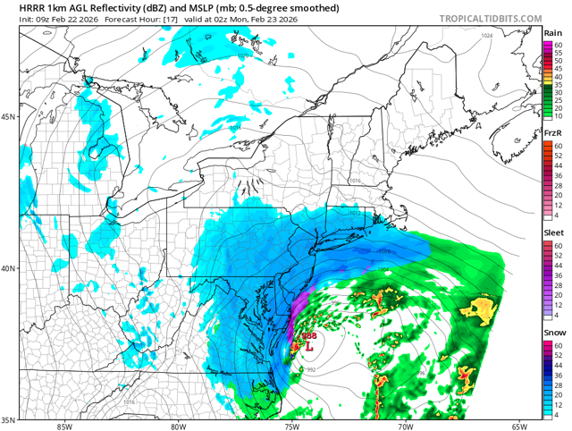
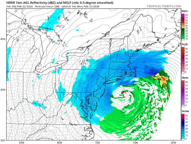
It’s sucks for such a strong low how tiny the precip shield is.
-
When the clouds move in ahead the precip too the temps will bump back up. Always do.
-
Of you read said best since.
-
Sitting in the cooking pot of Hanover PA. 37 here.
-
Ya I’m going to ask for at least a 25 mile push west.
-
It’s still snowing long than 18z run
-
Not really. Also I wouldn’t put much stock in the hrrr outside its normal 18 hour range
-
I think most the accumulation doesn’t come to after 3pm no matter what anyways. If we can get anything during the day that will just help boost totals.
-
Little bit of light snow showing up on obs from central OH
-
@Maestrobjwa you are on call


