TSSN+
-
Posts
4,814 -
Joined
-
Last visited
Content Type
Profiles
Blogs
Forums
American Weather
Media Demo
Store
Gallery
Everything posted by TSSN+
-
 Arw/Arw2 0z runs pretty much duds. Would be a marginal risk at best with those looks. Welp guess we will see what the morning brings.
- 1,093 replies
-
- 1
-

-
- severe
- thunderstorms
- (and 1 more)
-
Little more kick on fv3
-
Sun equals storms. Nam is cloudy and capped thus why not very stormy.
-
Nam doesn’t have any storms in the area till after 6pm
-
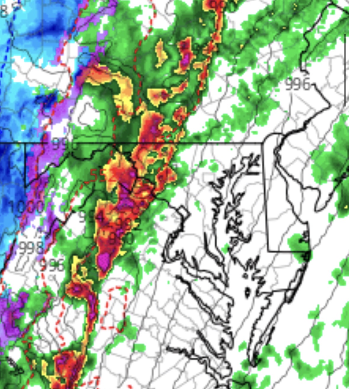
Worst of the 40dbz rain
-
I seen so many hyped up severe days for them only to produce minimal reports. Here’s hoping tomorrow is another.
- 1,093 replies
-
- 4
-

-

-
- severe
- thunderstorms
- (and 1 more)
-
I mean if this setup was in May-August I’d be little more concerned for sure but guess we will see what happens. Also it’s the hrrr so probably will change soon enough.
-
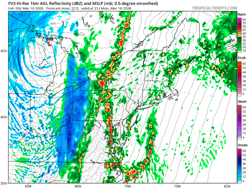
0z hrrr says what severe event. Looks like some showers and garden variety storms lol
- 1,093 replies
-
- 1
-
-
- severe
- thunderstorms
- (and 1 more)
-
I mean honestly wouldn’t go off modeled depiction for cells.
- 1,093 replies
-
- 1
-
-
- severe
- thunderstorms
- (and 1 more)
-
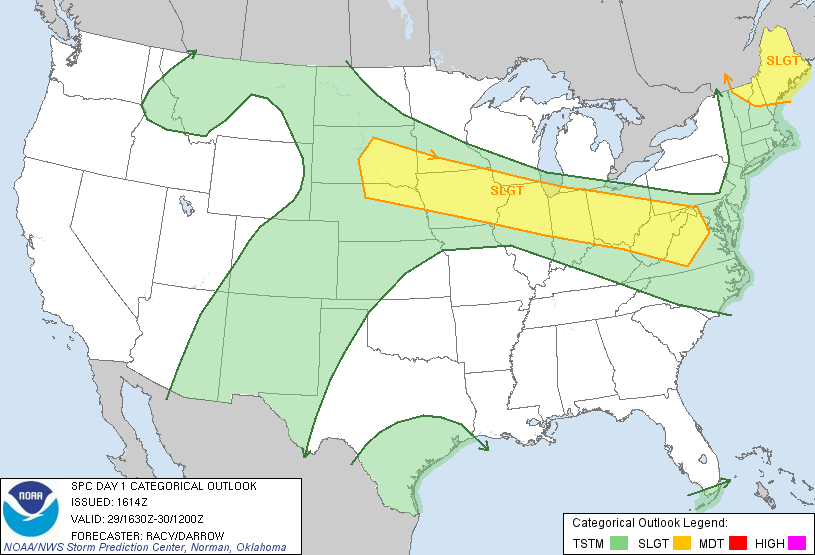
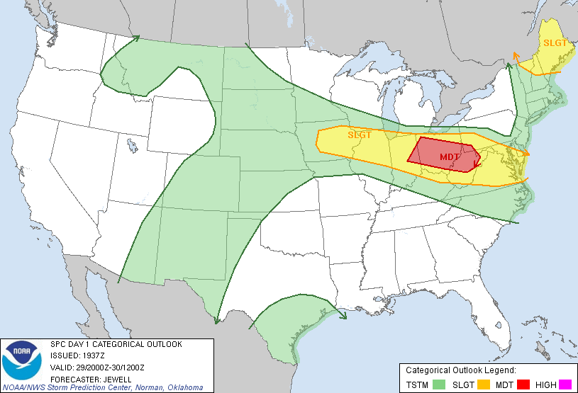
Was not well forecasted at all. This was the outlooks for that day

- 1,093 replies
-
- 1
-
-
- severe
- thunderstorms
- (and 1 more)
-
Can say we never had a high risk but derecho day should have been for sure.
- 1,093 replies
-
- 1
-
-
- severe
- thunderstorms
- (and 1 more)
-
Central Md
-
That’s for Hanover I’m talking Lwx
-
Point and click again not displaying the storm threat. Not even mention severe in grids. Not sure why this keeps happening.
-
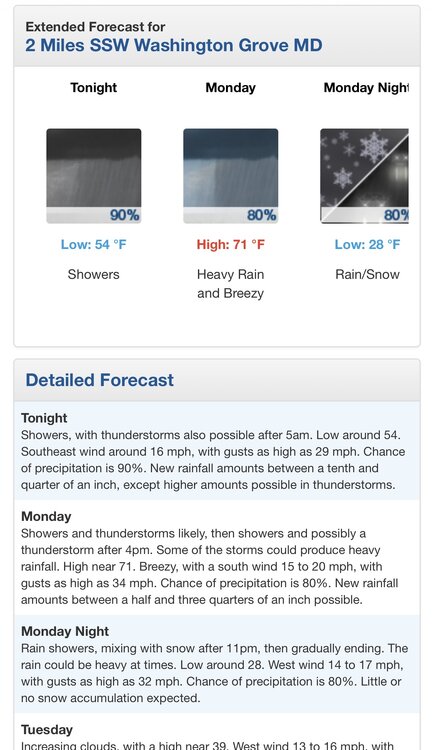
At day 2 ya don’t see it yet. But if we are clearing by afternoon tomorrow then maybe.
-
130 update looks like a hold
-
Can’t really compare that. That day was almost 100 with ton of cape. Also wasn’t even in an Spc outlook for severe in the morning that day.
- 1,093 replies
-
- 1
-
-
- severe
- thunderstorms
- (and 1 more)
-
Anyone else here into working out? Me and my fiance hit the gym 6 days a week and take what we eat seriously. Gym couple goals.

-
I would guess LWX will issue a special weather statement later highlighting the risk. They put one out for the line that blew down all the power lines in Westminster in that moderate risk event like 3 years ago.
-
Local news stations also show Spc outlooks
-
12z hrrr has a few cells west of dc that push ne into Maryland then kinda merge with the line.
-
Too confusing to me and I’m sure even more to general public.
- 1,093 replies
-
- 1
-

-
- severe
- thunderstorms
- (and 1 more)