TSSN+
-
Posts
4,772 -
Joined
-
Last visited
Content Type
Profiles
Blogs
Forums
American Weather
Media Demo
Store
Gallery
Everything posted by TSSN+
-
 If this front line doesn’t blow off my trash can lid, I’m going to riot.
- 1,093 replies
-
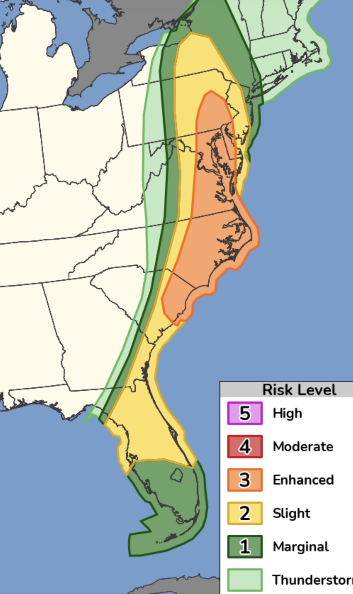
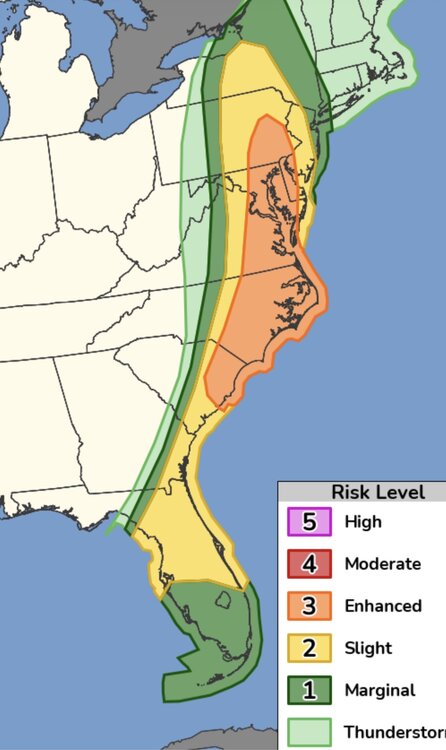
- 5
-

-

-
- severe
- thunderstorms
- (and 1 more)
-
Seeing how there wasn’t even like any warnings in the moderate zone doubt will be many reports
-
Not even sure the moderate zone got like one storm report haha.
- 1,093 replies
-
- 1
-

-
- severe
- thunderstorms
- (and 1 more)
-
Tornado watch canceled
-
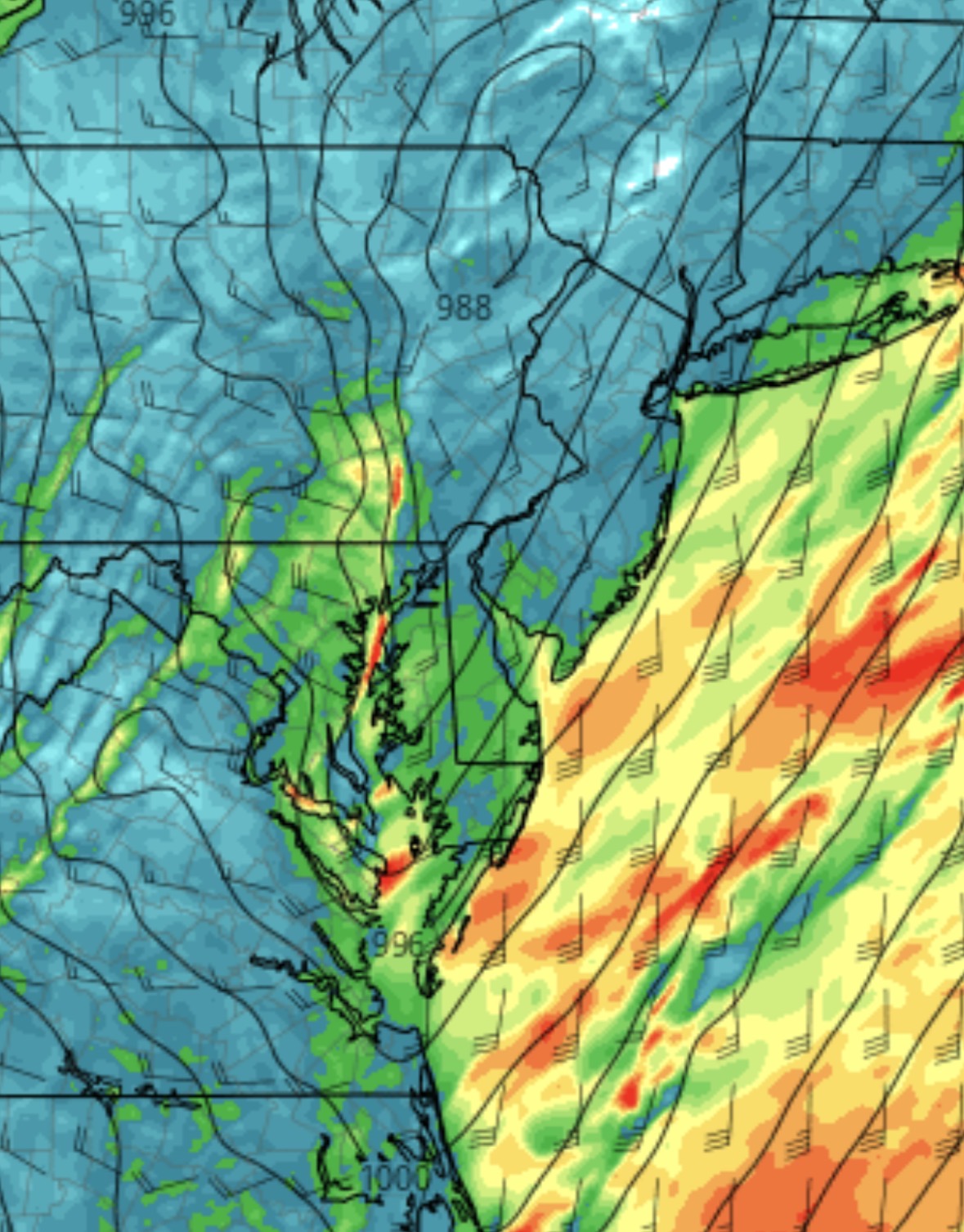
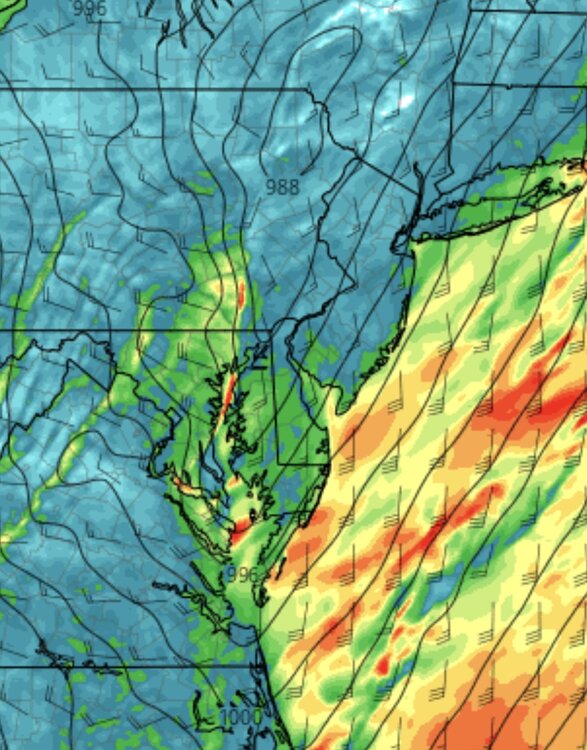
If we can get a low to spin up on the front could see a few low top spins. Also each run increasing winds.
-
Hell let er ride
-
Not sure why anyone was thinking this was going to be big after yesterdays runs. Was looking decent Saturday into yesterday morning but by yesterday evening it became apparent it was not looking as serious.
- 1,093 replies
-
- 1
-
-
- severe
- thunderstorms
- (and 1 more)
-
Good bit of it cut back from the nw. Don’t worry the moderate is just left to save face but literally there should be no moderate today. Yesterday was a bigger day and was only enhanced.
- 1,093 replies
-
- 2
-
-
- severe
- thunderstorms
- (and 1 more)
-
They cut back the risk a good bit. I went from moderate to slight at my work lol.
-
Imo like I said I think that line was pretty much it till little frontal line later.
-
Cause they issued a new one
-
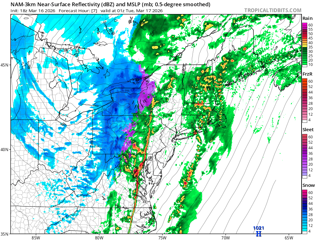
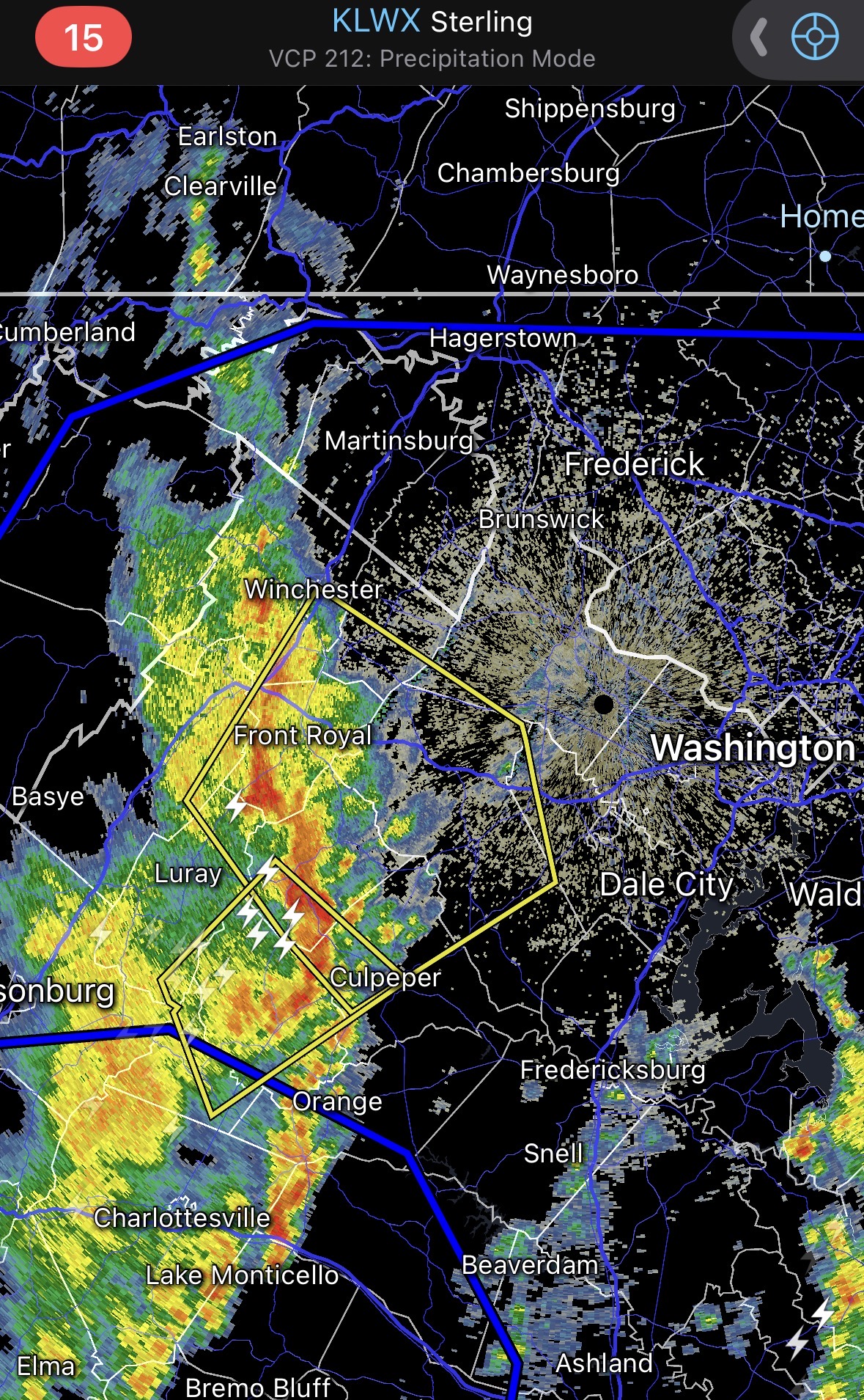
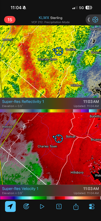
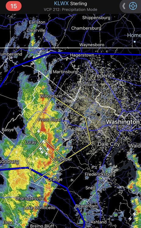
Looks like some decent rotation on the Carroll county warning
-
Heavy rain and wind gusts to maybe 45 nothing to write home about.
-
Let’s see what this does
-
If you read the discos any early stuff will kill the chances for later. This line moves thru around noon then it wipe out the energy.
- 1,093 replies
-
- 1
-
-
- severe
- thunderstorms
- (and 1 more)
-
This is shown on it but weakens it so will have to see if it holds together or not.
-
No it’s not. Storms rolling thru around 12-1 will wipe out any energy for anything later.
-
If we getting severe today feel like it’s mostly coming from this line. Let’s see what it does.
-
13z hrrr essentially shows nothing across Maryland today. Little line of normal storms later.
-
Think central Va south will do decent though. dc north not so sure