TSSN+
-
Posts
4,833 -
Joined
-
Last visited
Content Type
Profiles
Blogs
Forums
American Weather
Media Demo
Store
Gallery
Everything posted by TSSN+
-
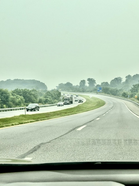
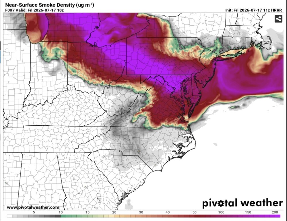
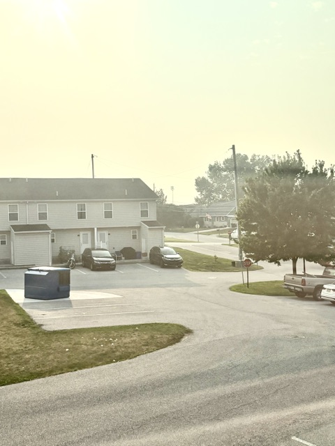
Driving thru Frederick it looks worse than it did when I drove thru this morning.
-
That’s expected improvement up there but, it’s not going to leave our area till Saturday morning.
-
Similar upper level air flow looks possible next week. Wonder if it comes in over us again.
-
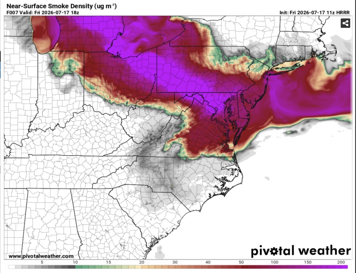
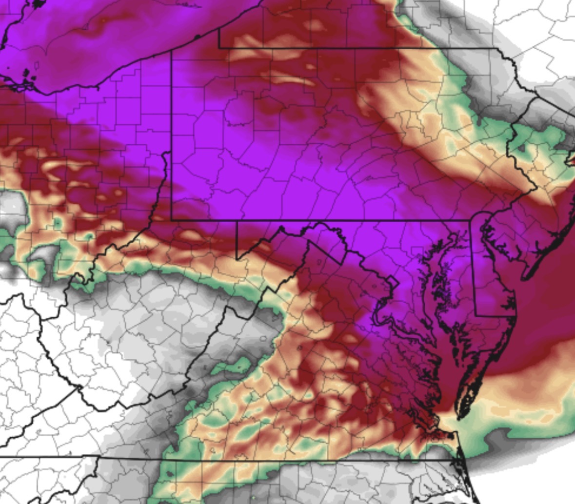
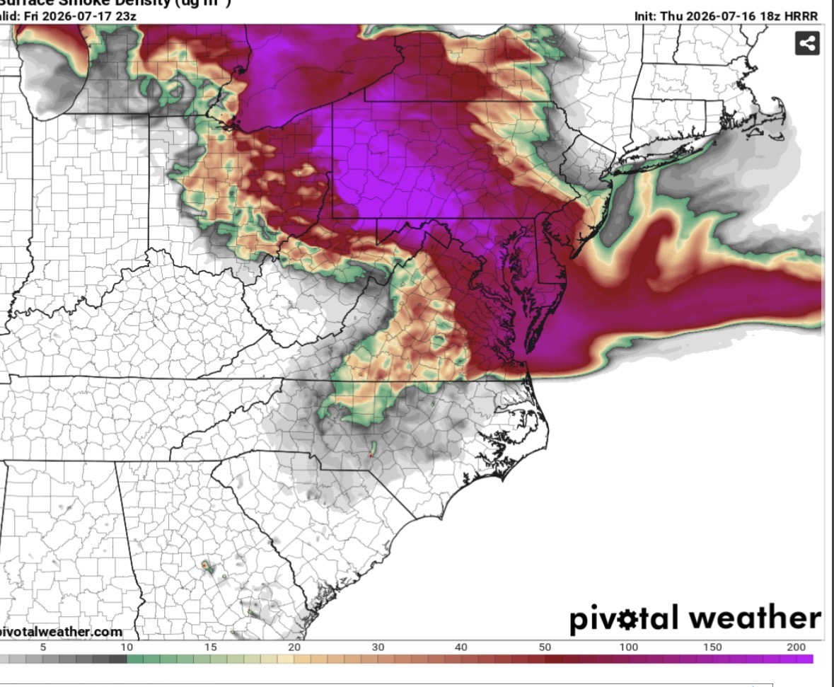
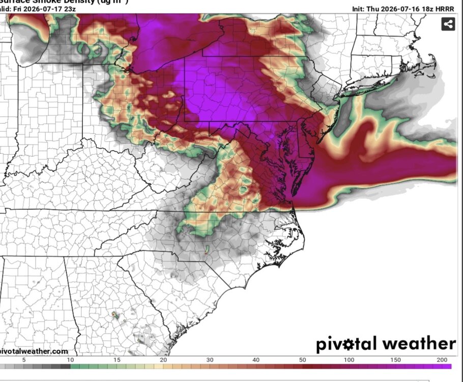
Doubtful HRRR increases surface smoke this afternoon.
-
Nasty. Knew we’d go to code purple with spotty hazardous.
-
Tomorrow going to be brutal out. Smoke filled air.

-
Is that an app?
-
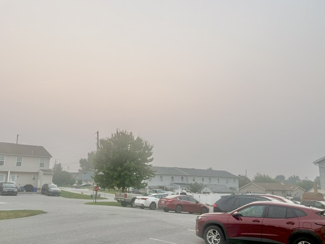
Can start to smell the smoke up here. Vis dropping sky getting orange tint.
-
Not in this case smoke at the surface is pretty much maxed out.
-
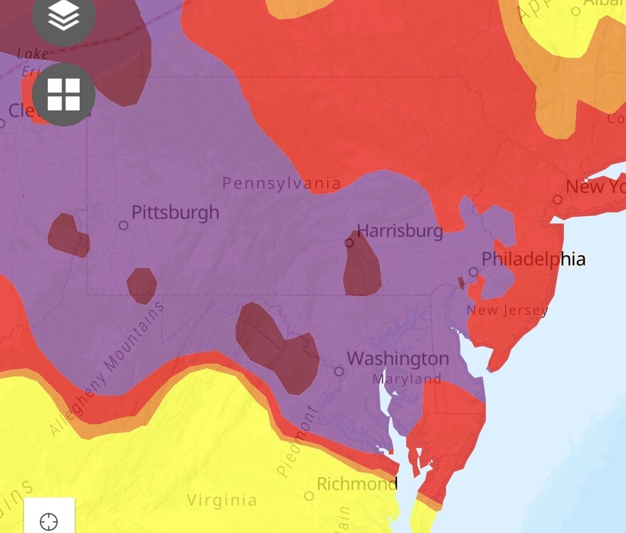
Getting decently smoky up here now. Just popped to code orange here code red about 10 miles north and Harrisburg into code purple. Going to get gross here after 7pm.
-
I think they will end up upgrading. Smoke looks pretty uniform and dense across the whole area tomorrow.
-
Just got a code purple for tomorrow up here. The Pennsylvania Department of Environmental Protection has issued a Code PURPLE Air Quality Alert for all of central Pennsylvania for Friday, July 17th. Wildfire smoke from northern Minnesota and south central Canada will continue to result in unhealthy air quality through Friday. Everyone should limit outdoor strenuous activity and exercise due to poor air quality. Sensitive groups should avoid all outdoor activity. Sensitive groups include children, the elderly, and people suffering from heart disease, asthma, or other lung diseases.
-
Yes
-
Tomorrow is our day.

-
It’s moving in from the nw to se
-
I haven’t seen it back off much from what I seen. And air qualities as worse than forecasted in parts of central Pa nw Pa right now.
-
Have a feeling air going to get nasty around here tonight into tomorrow. Areas in PA going into very unhealthy to hazardous air quality which they only had it getting to code red. Pittsburgh already into very unhealthy levels.
-
Managed to only get about .25” of rain yesterday as it lightning and thundered for 3 hours and 3-5 miles from my place got 2-3” of rain. Classic. Snow hole and now rain hole wherever I am. lol
-
Yet barely anything at my place just south of you lol
-
Can’t buy a break around here. Missed yesterdays rain and missing everything around my by 2-3 miles. 0” here 3 miles away 1.8” in last hour lol
-
Don’t think it’s getting as hot around here today at least. In Westminster right now and it’s getting decently cloudy.
-
91 wow
-
Dca might be close to 90 by 9am woof