TSSN+
-
Posts
4,772 -
Joined
-
Last visited
Content Type
Profiles
Blogs
Forums
American Weather
Media Demo
Store
Gallery
Everything posted by TSSN+
-
Both
-
I am on the IR report. Shitty toilet.
-
Watch this is where the ukmet loses it and euro hammers us. I’d take that trade though.
-
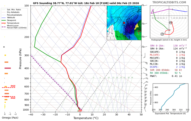
Pivotal maps not always correct on precip type.
-
Looks pretty good to me
-
Go to bed
-
CMC will be fine
-
Go to bed
-
I’d take it but, let’s continue to improve
-
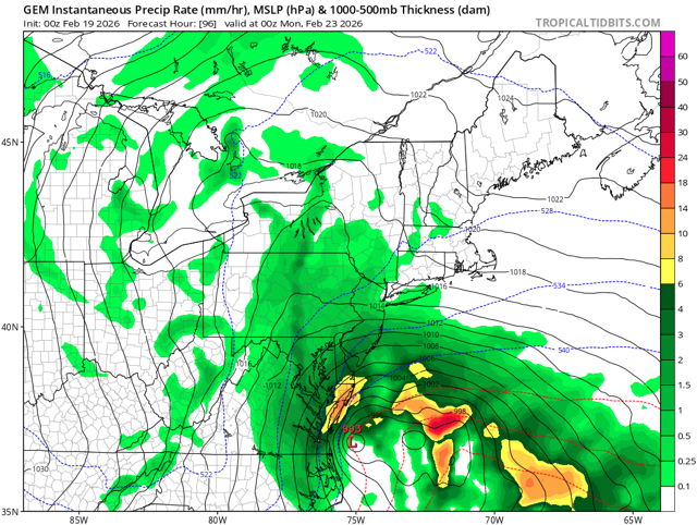
Model war continues. Gefs juiced up

-
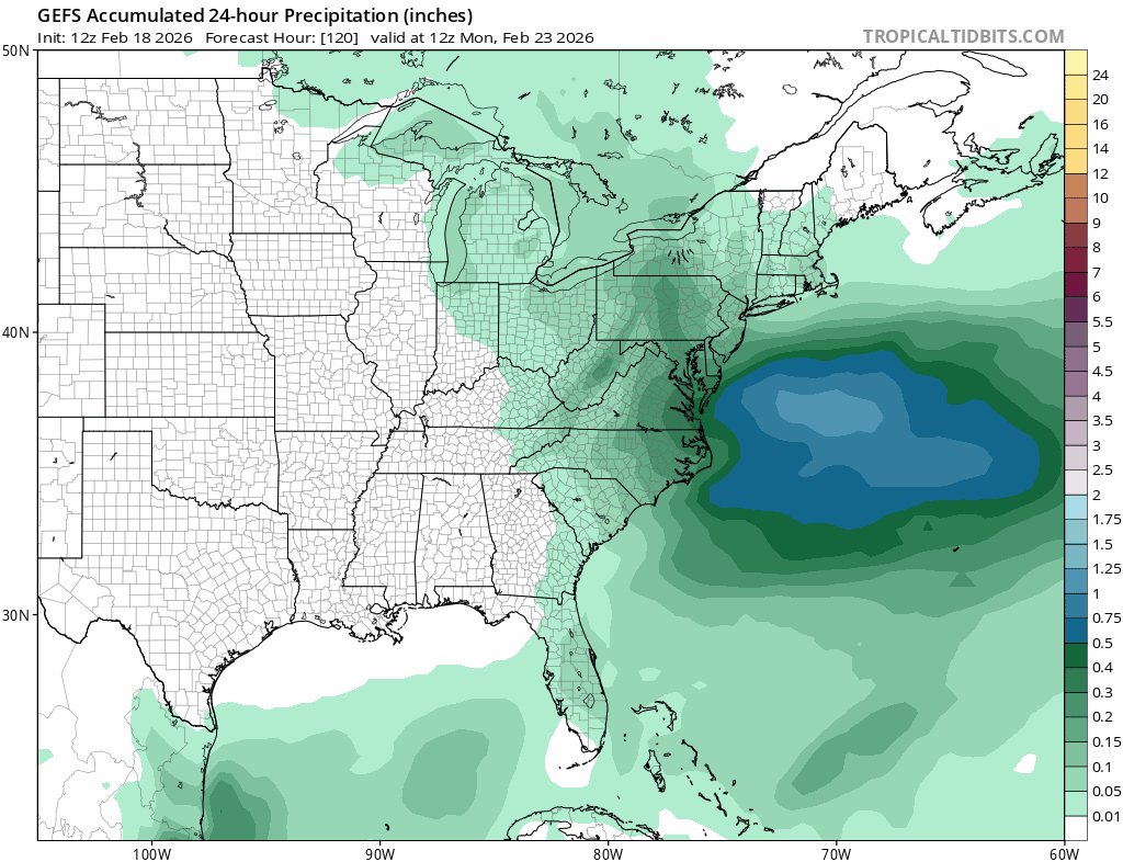
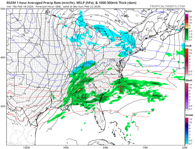
That’s total qpf which includes tomorrows rain
-
Nope same when the legit snow is falling after 7pm
-
29-31 works for me
-
More like Bethany Beach
-
-
Some people just don’t learn
-
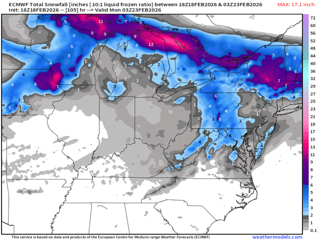
I don’t know what to make of this cause it’s so far different than all the models, even euro ai. Either euro will score a huge coup or will go down in flames on this one.
-
Euro bouncing around with the rest of them. Plenty more runs to go.
-
The other models go back the other way while the euro goes back the other. lol typical
-
It’s not been doing a good job on this one. Taking it with grain of salt like the rest.
-
Euro ai less impressive than 6z
-
Not exactly
-
Long way to go with this one. Lots of adjustments in models to continue for next 2 days at least.
-
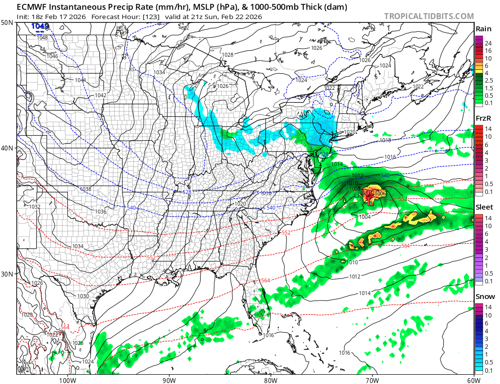
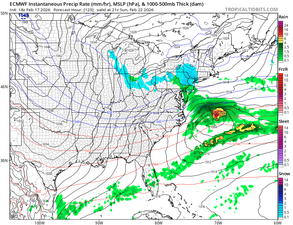
The boom is se. Kills the coast. Need the h5 cut off little more nw but overall not a bad look.
-
Bombs out too early and kills se of us