

TSSN+
-
Posts
4,772 -
Joined
-
Last visited
Content Type
Profiles
Blogs
Forums
American Weather
Media Demo
Store
Gallery
Everything posted by TSSN+
-
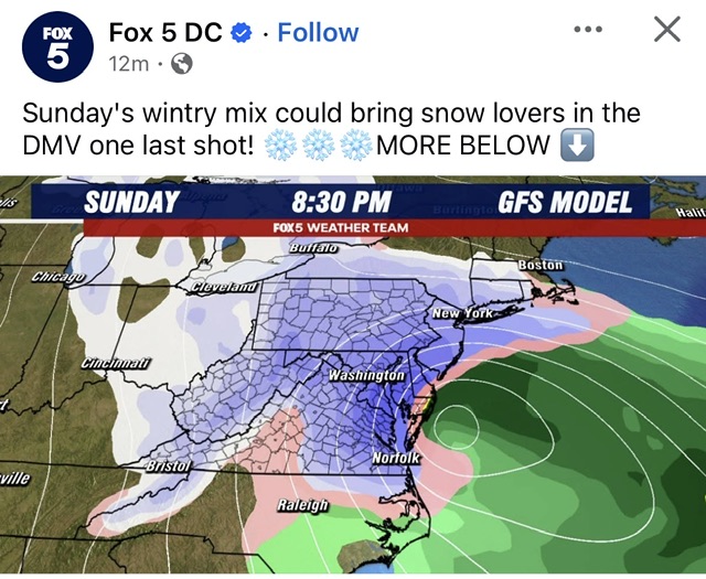
Looks hot!
-
Ready for gfs fold here shortly lol
-
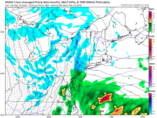
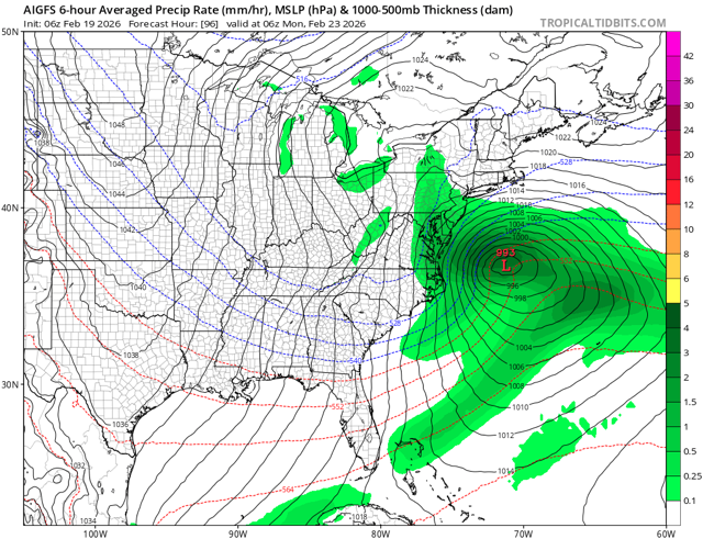
Remember when it showed 15”? Another clunker model
-
Garbage Forecast System
-
Have you seen how it performed this winter? Has had no systems correctly model outside 48hrs
-
Reasons why general public don’t trust forecasting.
-
It can’t get much worse so thank goodness. Hopefully will make tracking next year little less of a headache.
-
Sadly people are pretty stupid. Anyone believing the apple weather app snow output should be arrested.
-
If you follow the page long enough you’d know they aren’t any good.
-
People complain the forecast is never right, yet they go to the worst people forecasting haha
-
A weather page randomly popped up on my fb and the guy only uses the gfs to make his forecasts. How’s he still relevant? Lol.
-
The srefs are just as lousy as the gfs in terms of accuracy anyway.
-
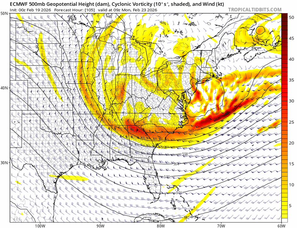
Definitely some improvement upstairs
-
Who wants to tell him?
-
Toss the gfs op and use the ai version and it’s closer to what the euro and rest now show.
-
I mean we all know the gfs is worthless.
-
You guys analysis on here sometimes is awful. One person…it’s better, another it’s worse. How about let the run play out
-
I wish the gfs wasn’t a garbage model lately, I’d be way more excited. Hopefully it is correct for once but…
-
Snowing for 18hrs at 32 or below into the night. Think it would do just fine. But also so I believe any these models are right? No
-
NE MD likes this run. But everyone else doesn’t. Wild how different the solutions are on every model now even inside 96hrs.
-
Maybe for you.
-
Still interesting to see how the ai version is much better than the op. Who wins euro classic or euro hip
-
Great pbp…
-
Euro ai is west
-
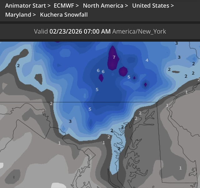
That’s cause your map is 10:1 vs his kuch map


