
Heisy
-
Posts
9,445 -
Joined
-
Last visited
Content Type
Profiles
Blogs
Forums
American Weather
Media Demo
Store
Gallery
Everything posted by Heisy
-
How much snow for Jacksonville? Find it ironic Florida is the only state with blue
-
On a positive note the storm is important to the pattern regardless of whether it ends up a rain event. Helps create blocking.
-

Looking Back: November 15, 2018 -- Early snowstorm
Heisy replied to LVwxHistorian's topic in Philadelphia Region
Wow I actually don't recall this event at all what the heck? Anyone have any model runs or radar shots to refresh my memory? -
You don't see a CCB like that too often. That is one hella nuke. Rain in the Poconos and snow in DC
-
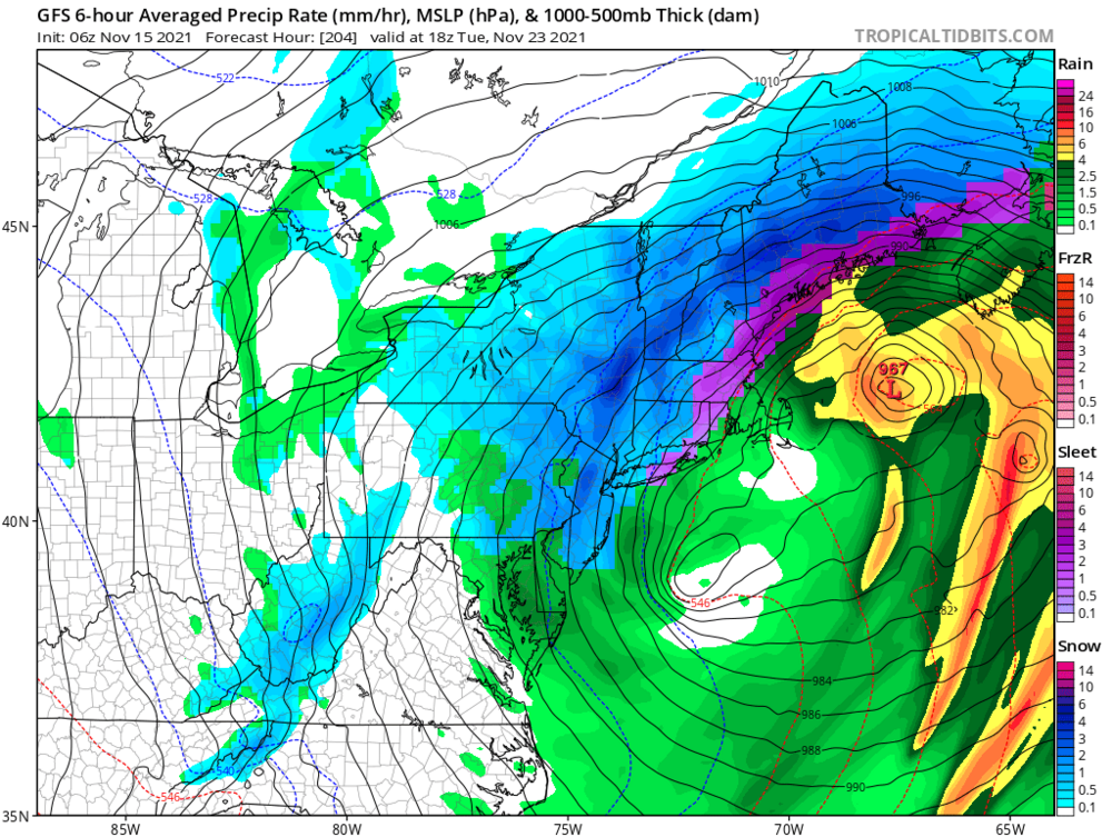
6z GFS has a large closed ULL for 23rd now
-
Absolute bomb on 6z GFS for 22-23rd time frame. I don't have individuals but looking at EPS I'd imagine there's some support for that time frame as well...
-
Pretty good look for me to go on my first LES chase.
-
Bring it.
.thumb.png.757da3a393e67132fa487a0cb7971f5b.png)
-
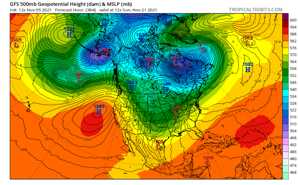
That's a mighty strong ULL on the long range EURO...
-
What's the last +12"+ December event in Philly? I feel a solid 4-8, 6-10 classic Dec 5 event this year
-
Can't believe we're back baby. Less than a month until Dec 1. Felt like it would never get here. Anyway, I feel a lot better going into Winters where everyone expects below average snow. It just seems like winters that are forecasted to be AN snow by the majority are always a let down. I have sneaky good vibes about this winter. No science to back it up, but I like the overall pattern at H5 right now. I think we have accumulating snow before the 10th. I'll bump this after the 00z NAM drops a foot plus in the city a month from now.
-
I have to renew my subscriptions, but does the 00z euro have any flakes from that day 9 event?
-
Not that it's worth talking about for obvious reasons but I meant the overall pattern. Of course heights are going to be higher in Nov than January or December. I just liked the block on the map. PNA ridge axis still too far west on that map, but it's close to the type of look we'd want come winter.
-
I'll take this look in a month or so
-
Nice, the warmer the forecast the colder the winter.
-
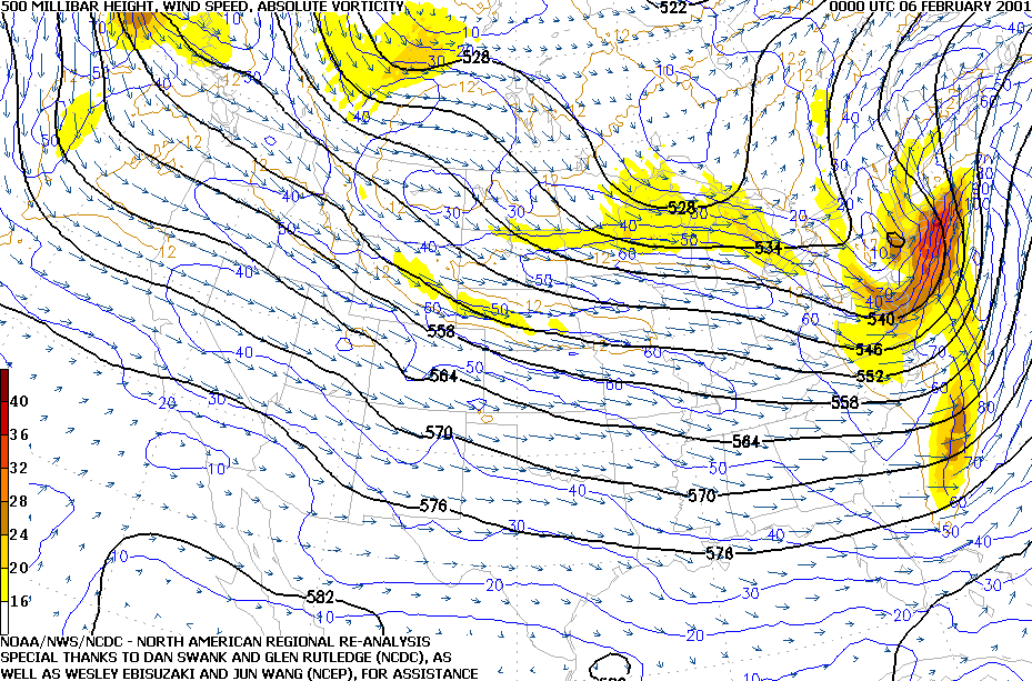
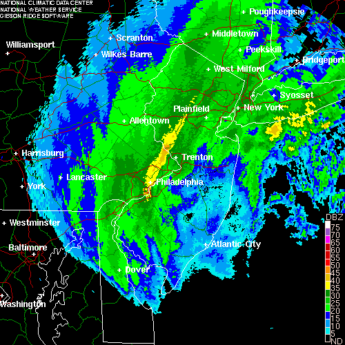
One of my favorite storms down here in Philly. 2000-01 was the winter I became a snow weenie (Wright-weather and TWC forums ftw!). I remember going to school in a complete down pour. Changed to snow around noon and we had 1-3” per hour snows for a few hours. Nothing better than other kids trapped on school busses while your mom picked you up early. Little did I know one of the greatest negative busts of all time would happen just a month later….
-
September Discussion Thread: Bring the frost; kill the bugs.
Heisy replied to moneypitmike's topic in New England
Today’s Long Range GFS kind of shows that look.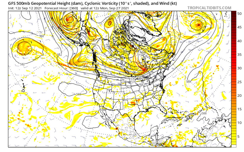
-
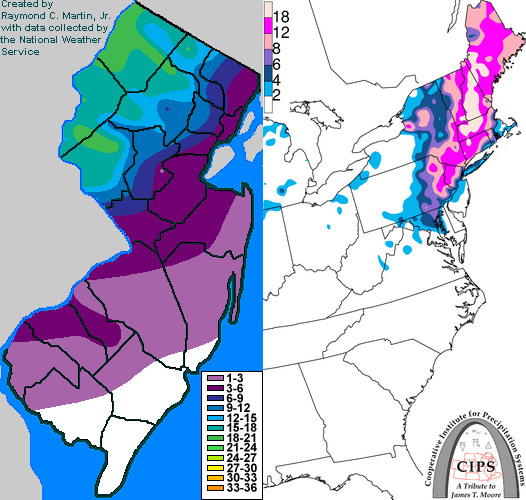
Link: http://www.raymondcmartinjr.com/weather/ It’s NJ focused so it might not have every event up your way, but from 93 on it’s a great resource. his site also includes radar images from those events
-
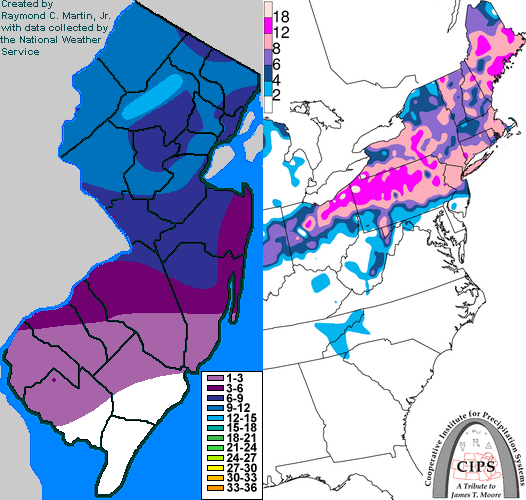
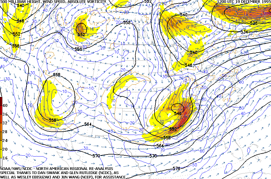
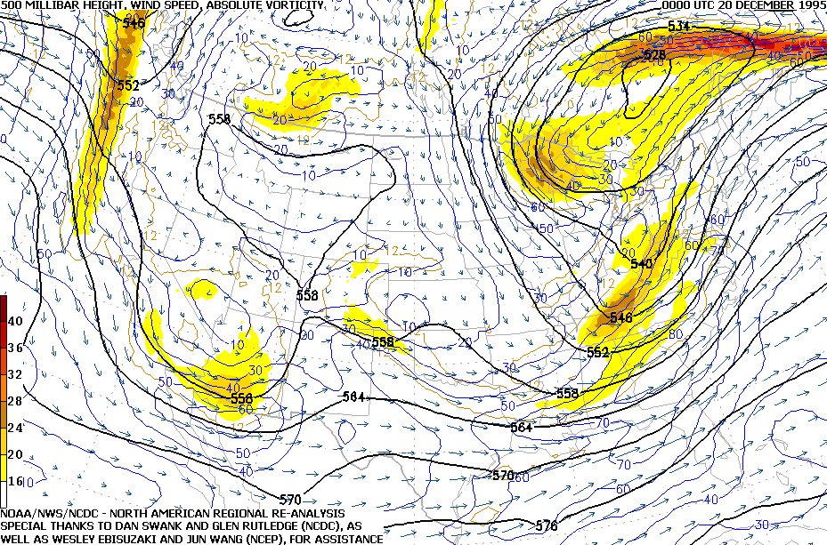
Famartin, Philly region met has a great resource. You can see every 95-96 storm here… here was Dec 20 95’ snowmap. He has H5 maps and everything
-
Welcome to Delaware Tornado-Valley
-
September Discussion Thread: Bring the frost; kill the bugs.
Heisy replied to moneypitmike's topic in New England
I thought this was a famous “surprise” snowstorm https://www.google.com/amp/s/www.inquirer.com/news/blizzard-presidents-day-philadelphia-washington-atlantic-city-20190218.html%3foutputType=amp Grew up in Philly, born 86, Blizzard of 83 is one I wish I got to experience first hand, any memories from that one? -
NE Philly just had debris fall out of sky for a few minutes. Was like raining leafes lol. Must have been from the tornado in NJ
-
My dad lives in Warminster near street and davisville. I think that tornado was just to the west though. Waiting to hear from him. Anyone from near there? those cells SW of city ramping up.
-
I might be wrong but looking at the track of the core it seems like he’ll miss the inner eye wall… Ida still hasn’t turned N yet.


.png.9b641cb404d84d9f596fbd6957feb891.png)

