Heisy
-
Posts
9,445 -
Joined
-
Last visited
Content Type
Profiles
Blogs
Forums
American Weather
Media Demo
Store
Gallery
Everything posted by Heisy
-
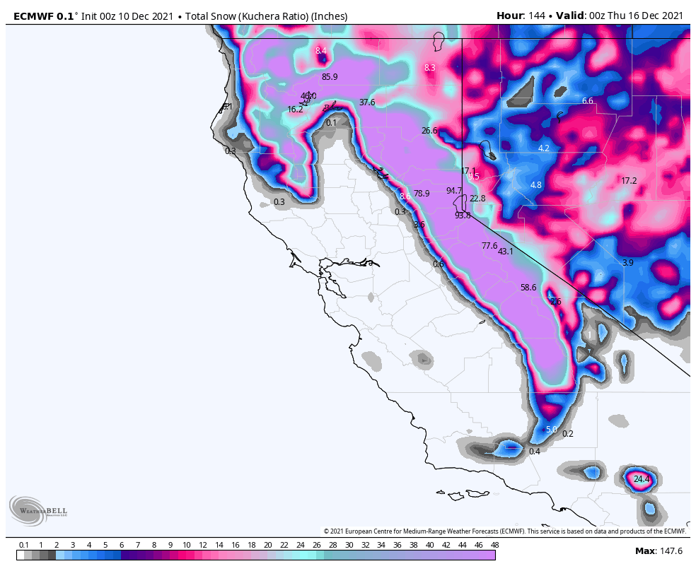
Making sure I can get off work and can afford it, but anyone want to head to Cali for a chase?! Lake Tahoe? This event looks amazing... 00z euro, wtf

-

December 2021 Medium/Long Range Discussion Thread
Heisy replied to North Balti Zen's topic in Mid Atlantic
So you're saying there's a chance! -
December 2021 Obs/Disco...Dreaming of a White-Weenie Xmas
Heisy replied to 40/70 Benchmark's topic in New England
Need that front on the 4th/5th to trend even stronger I guess. It was a little weaker this run so cold air push wasn’t as good as last run prior to main wave -
December 2021 Obs/Disco...Dreaming of a White-Weenie Xmas
Heisy replied to 40/70 Benchmark's topic in New England
Probably too much ridging out ahead of shortwave this run, but signal for a storm is there again…might clobber interior here, we’ll see
-
December 2021 Obs/Disco...Dreaming of a White-Weenie Xmas
Heisy replied to 40/70 Benchmark's topic in New England
I’m saving this username for when Wentz comes back for one last season at age 42, gets hurt week 17, and Nick Foles wins us another super bowl. No really I want to change it but the site doesn’t let me haha -
December 2021 Obs/Disco...Dreaming of a White-Weenie Xmas
Heisy replied to 40/70 Benchmark's topic in New England
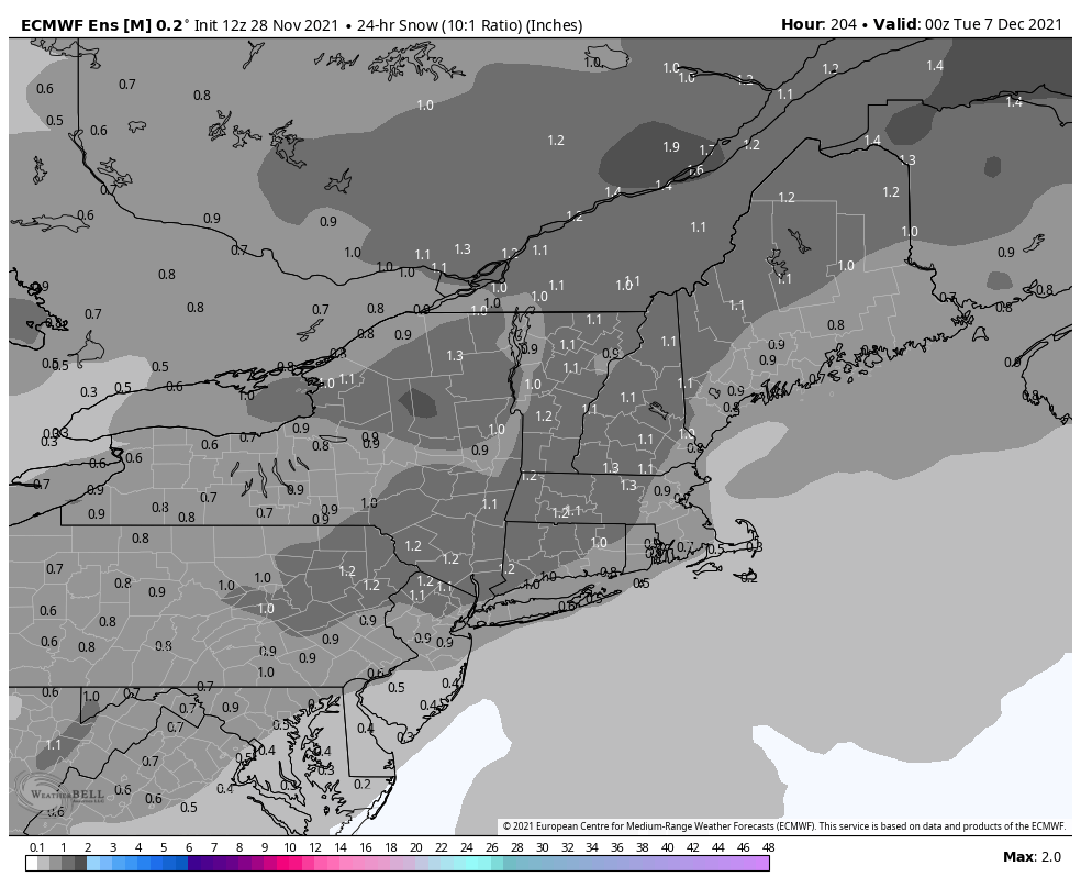
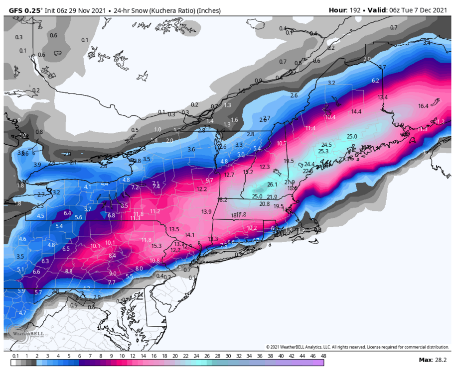
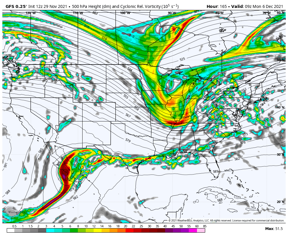
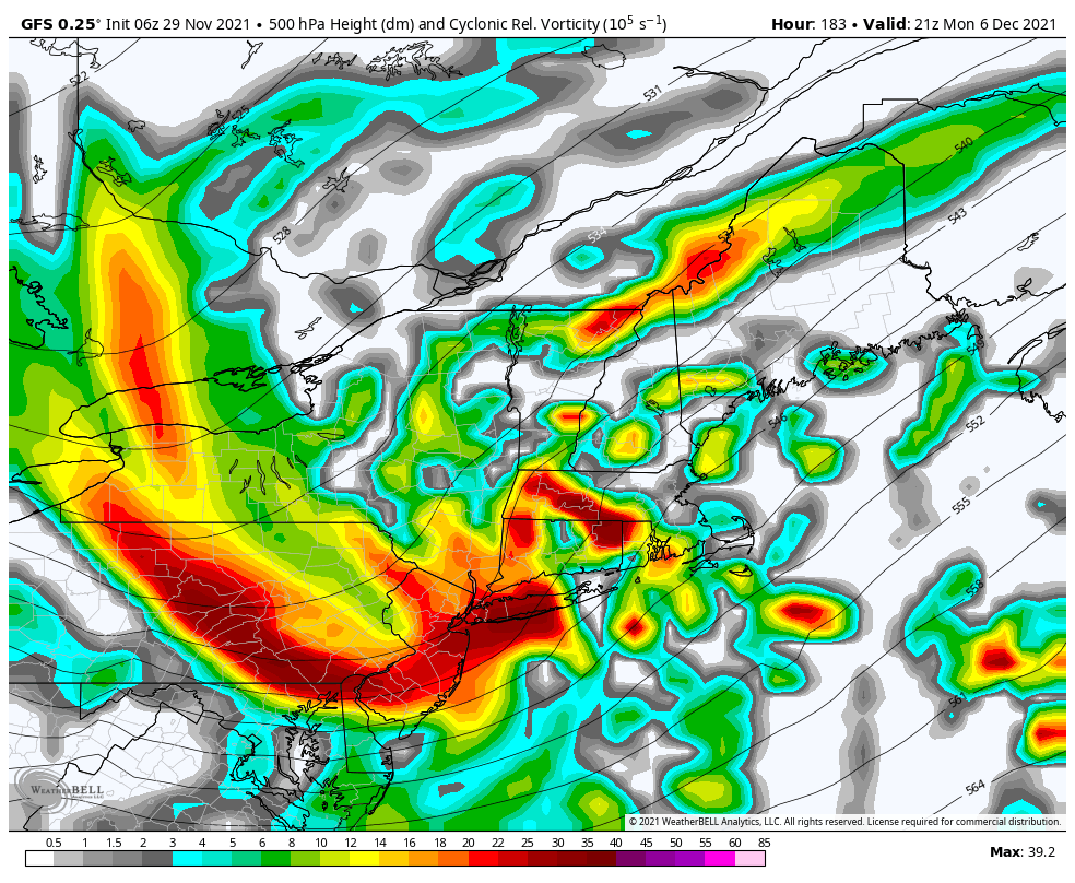
6z gfs has the event on the 6-7th and so does euro but it’s warmer…couple degrees from feet of snow with a vicious shortwave….long way out but something to keep an eye on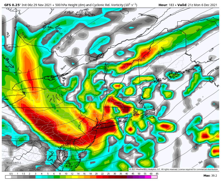
-
December 2021 Obs/Disco...Dreaming of a White-Weenie Xmas
Heisy replied to 40/70 Benchmark's topic in New England
CMC gone wild in the LR.thumb.png.629af803cd2a1176ed205ade398ace3a.png)
-
December 2021 Obs/Disco...Dreaming of a White-Weenie Xmas
Heisy replied to 40/70 Benchmark's topic in New England
Right on cue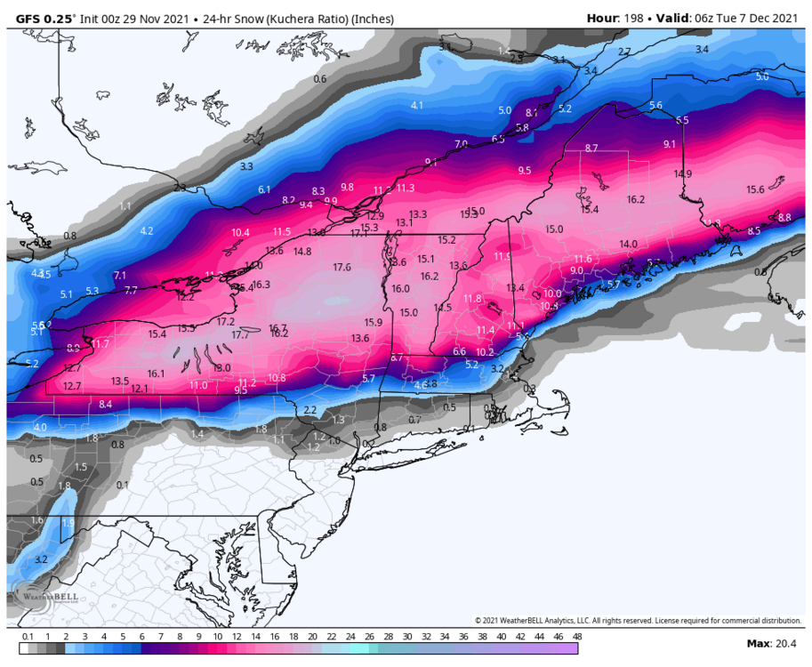
-
December 2021 Obs/Disco...Dreaming of a White-Weenie Xmas
Heisy replied to 40/70 Benchmark's topic in New England
There was also a signal on the 12z euro for a clipper around the 6th on the heels of that Dec 4 front -
Eps has a minor signal for the 6th. Looks like a clipper on the heels of the December 4 front.

-
More favorable NYC… northern stream zipping right now doesn’t want to dip too far S
-
Next ten days about as boring as this first half
-
December 2021 Medium/Long Range Discussion Thread
Heisy replied to North Balti Zen's topic in Mid Atlantic
Ugly 00z euro run. Not much to get excited about on tonight's model suite that's for sure. -
That would have been a snowstorm day 10 on the euro. Euro has an upstate my/interior blizzard which lays down the cold for the follow up wave. Gfs and Canadian also show this. Something to keep an eye on
-
Upstate/Eastern New York-Into Winter!
Heisy replied to BuffaloWeather's topic in Upstate New York/Pennsylvania
Classic upstate blizzard, Drools. -
December 2021 Medium/Long Range Discussion Thread
Heisy replied to North Balti Zen's topic in Mid Atlantic
Seeing some agreement for a +PNA in this time frame. Cold air possibly available, but as always will need timing between two waves to get the job done. For example, on the 18z GFS you see how the trough kind of elongates where the lead wave lays the cold air down and the back end of the trough digs and turns the corner...something like that. Euro is an example of what wouldn't work where you just get one really strong low out of the trough at 240 hrs. Something to keep an eye on because there isn't much potential until then -
Don't be jealous, chase. It's only a short drive to wherever you need to be. I was supposed to be living in Worcester this winter, but things changed. If there's a shot for 12-18" somewhere I'll head up.
-
Northern branch energy seems a little stronger and has a better angle of approach through 87 hrs on 12z euro
-
Yea that was a close call, could be the euro over developing systems, but we'll see...any support for this on the individuals?
-
Correct. These type of events kind of reappear on modeling in the day 4-6 range so we'll see if it has legs. That was damn close on the euro though
-
Upstate/Eastern New York-Into Winter!
Heisy replied to BuffaloWeather's topic in Upstate New York/Pennsylvania
Enjoy it! I’m hoping for a major event soon for a chase out there. -
December 2021 Medium/Long Range Discussion Thread
Heisy replied to North Balti Zen's topic in Mid Atlantic
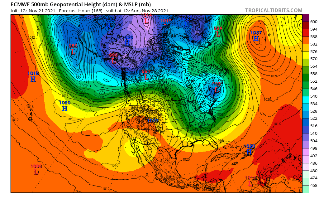
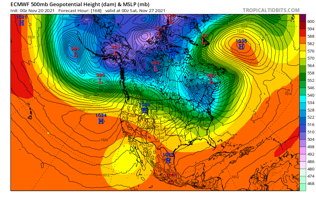
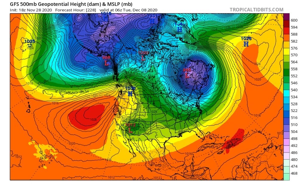
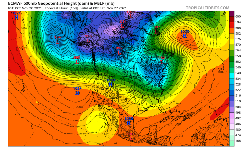
The other day I was going through photos and screen shots from last year and came across this. I saved it for some reason lol... This is today's Day 7 12z Euro vs a day 9 GFS run from last year. They're about a week apart. I don't know how well this verified last year...but fwiw....pretty similar. I wonder if we see a similar progression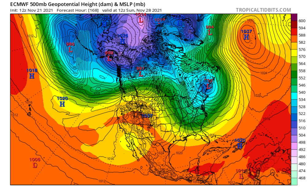
-
I was going through old pictures/screen shots this morning….I don’t know how well this verified, but here is last nights euro day 7 vs a 9 day GFS run from last year around the same time. Found them to be pretty similar

-
Anyone know if Rob22 is still around? He used to be a mod here. Was one of my friends back in the day. We both went to the same university for op. Meteorology. @Ralph Wiggumyou remember him right? DT used to call him Rib. He is one of the original wright weather posters. I haven't seen him post in years, just hoping he's okay. He used to run the weenie of the year contest, which I of course won years ago.
-
Upstate/Eastern New York-Into Winter!
Heisy replied to BuffaloWeather's topic in Upstate New York/Pennsylvania
Just realized the video ive seen on YouTube of someone shoveling snow off their roof was your house. I wish I was chasing back then. Couldn't imagine that much snow


.png.1c246a44d43b29eb07eeee33d1d4c160.png)