Heisy
-
Posts
9,445 -
Joined
-
Last visited
Content Type
Profiles
Blogs
Forums
American Weather
Media Demo
Store
Gallery
Everything posted by Heisy
-
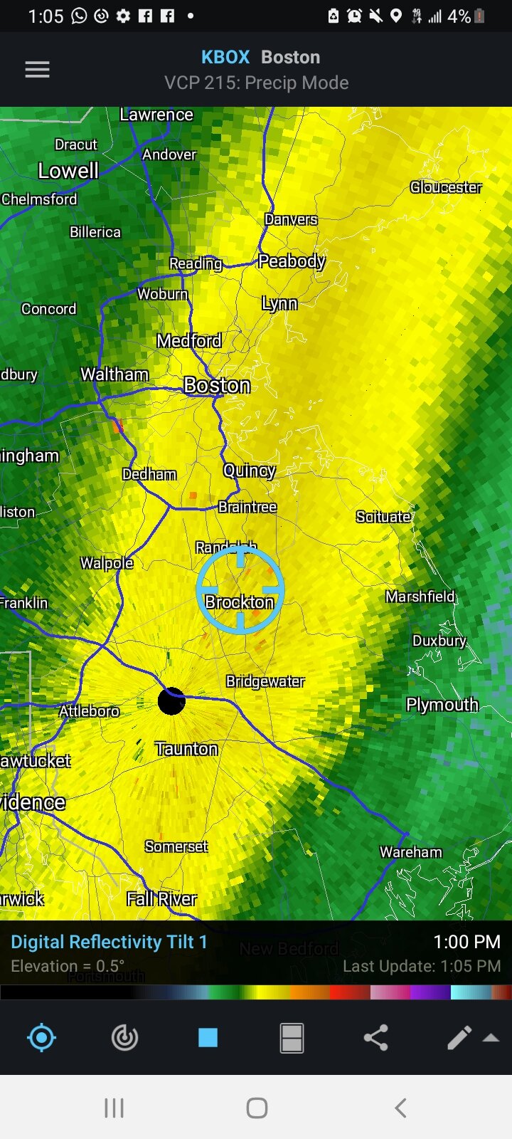
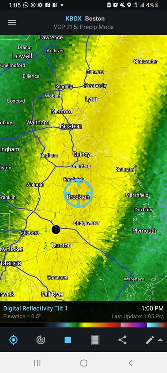
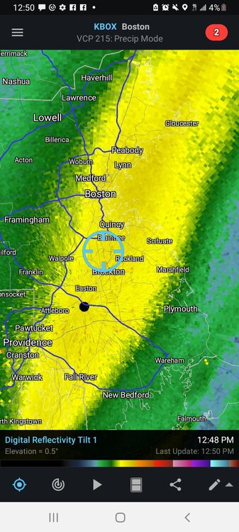
Little bit, this ride to Brockton has been worth it though. Drifts over cars now
-
Whats a site I can use to host videos to post here?
-
This is the heaviest snow I've ever experienced.
-
Plow guy giving me a ride to gas station, getting pummeled. Insane
-
Scott what do you think we end up with? It's insane out there right now. Owner of hotel giving me free room for helping him shovel hah
-
Wow.

-
Think the band around Plymouth will stay together and make it to Boston? That looks insane down there
-
Little gravity wave action there? Or just a graphical thing
-
It is brutal out here. Impossible to measure as everyone has noted.. Hoping these bands can rotate a bit farther NW. Can see the ocean effect on radar a bit. I tried to get farther SE towards Plymouth but there was nothing available any where for a reasonable price. Any posters from around where I am?
-
 @ORH_wxman is a prophet. The euro hinting that the region kf heavy totals south of LI would start to creep up towards CT and RI. This run gives me shades of 2013
 -
Driving through Providence now, about 45 to Braintree MA. Can we squeeze 2 feet? Should be close. Think 15 to 20 sounds reasonable
-
This seems to happen every event. You get those western shifts about 36-48 hours then some last second eastern adjustments. Im on 95 headed towards Boston. Trying to stay near Rockland but can't find a hotel that isn't booked. I found one in Braintree Mass. Not that it will be that big a change but will I still be at a decent* (damn auto correct) spot for OES? Places must be booked from the storm
-
Oh yea I didn't read that all, that's a damn hike. Especially if you have to drive through the storm you're screwed
-
I flew from Philly to Colorado for last year's March event. I'm headed up to NE his morning, though I still haven't decided on a location. Its worth it screw it
-
Probably way overdone on the Nam obviously, but you never know, it nailed 2016 when every other model was farther E
-
It's already corrected big time down here in Philly. You guys probably not paying attention but notice the snowfall amounts changing down here between 12 18 and now 00z. It's a joke. It will keep adjusting
-
Hey I'm headed up tomorrow if you want to pick you up on the way lmk! Hah
-
I remember chasing to C MA for the 2013 event. Great event but S of me crushed. Then 2015 I head to RI and the goods go back to C MA Each storm I chased I went to where the model consensus was for the best totals. You just never know. Last December I chased to Lewishburg PA and models kept bumping N. I'm headed up there tomorrow with the girl. Can't wait! Haven't decided on a destination yet but it will likely be somewhere in SE MA. I honestly think that I may have seen more snow fall at my location, wherever that is, then any person in the country. Guinness WW are you listening?
-
Going to head up from Philly Friday barring any more shifts east. Probably somewhere in SE MA, cape idk. Always enjoy my time up in NE. Was up there for 2013 and 2015, let's bring it home. Ps. Sorry for the jinx
-
Pretty painful that just the small change of having the wave eject faster would have locked up this storm as a HECS. As is there is still potential for a large event. I plan to chase as long as we don't see any more substantial shifts and the euro holds. SE LI could could a destination for me
-
It's absolutely devastating, especially down here in Philly, that mother nature deciding to hold back this wave just slightly cost us a potential MECS. Absolutely brutal. Still rooting for you all because I plan to chase somewhere in MA
-
Top 3 worst winter of my life. I can deal with no snow, but to get constantly teased by the euro is an absolute nightmare
-
Been a long time since we got NAMED
-
Agreed. Can't wait for the upgrade they're giving to euro this year. Adding 50 ensemble members, extending 6 and 18z runs, better reslution....it's well over due
-
While you guys up in SNE can cash in regardless of early track the euro is really the only model showing this type of snow down here in Philly. I would urge caution right now with it. Early on in the run it looked like it was going to actually tick east. It held back more energy. It has caved towards other modeling many times this year, and for some reason during its off runs it seems to double down before doing so. You guys should do damn good regardless though. Even eastern adjustment SNE would crush it still