andyhb
-
Posts
20,454 -
Joined
-
Last visited
Content Type
Profiles
Blogs
Forums
American Weather
Media Demo
Store
Gallery
Everything posted by andyhb
-
Who says anyone is out to get each other? It's this attitude and pushback that "such things should not be criticized" that gets a lot of people annoyed. I also see the "who cares what the rating is" thrown around a lot. Well, it turns out, that isn't as trivial as it may seem!
-
Are you acting like I am somehow unaware of this information? Plus lol @ the money thing. I get the impression that you haven't been on surveys since you seem to be unable to actually respond to my points or questions and instead keep referring me or anyone else to Tim Marshall, Mark Fox, or Rick Smith. If you knew these things, you'd be able to answer at least some of them, even if this was not a tornado that you surveyed.
-
You came in with 4-5 consecutive quotes of previous posters saying they were wrong or some snarky reference to NWS, excuse the use of "quote tweet" as an eponym. I'm debunking your insistence that the Mayfield survey was thorough and you referring me to various people, who I would indeed have more questions for. You keep saying you've been on multiple surveys and yet I don't really get that impression. Not only that, but you taking shots at my career is a pretty pathetic attempt at ad hominem, which last I checked, I have not used against you.
-
What? You're the one who came in here with like 5 straight quote tweets trying to start a ruckus, give me a break. I'm not even supporting his points, I'm debunking yours. Also, my career is my business, thank you very much. It'd be a little difficult for me to get a government job being a Canadian citizen and given the current status of applying for citizenship.
-
Because you're the one that came in here guns ablazing saying everyone else was wrong. In fact, I do mean to talk with some of these people about this, not to mention I'd like to take part in surveys in the future.
-
You just said the survey was thorough.
-
You saying this and then telling me to talk to somebody else when I punch a hole in it doesn't really work.
-
My point is how am I supposed to formulate a questioning with one of these folks over one rating or another when there are no damage indicators given in the first place? Like, that's a dead end.
-
Well then why do you keep speaking for them then? Saying "talk to Tim Marshall" isn't a valid response considering he only visited Mayfield and Dawson Springs along the path. Furthermore, his report on the Vilonia tornado did not mention any of the structures that were missed along the path, nor the house that was the strongest candidate for EF5. I read it myself multiple times.
-
To that article, which I have read, I would be more than happy to participate in some sort of reanalysis project like Jim LaDue is suggesting there, as with HURDAT.
-
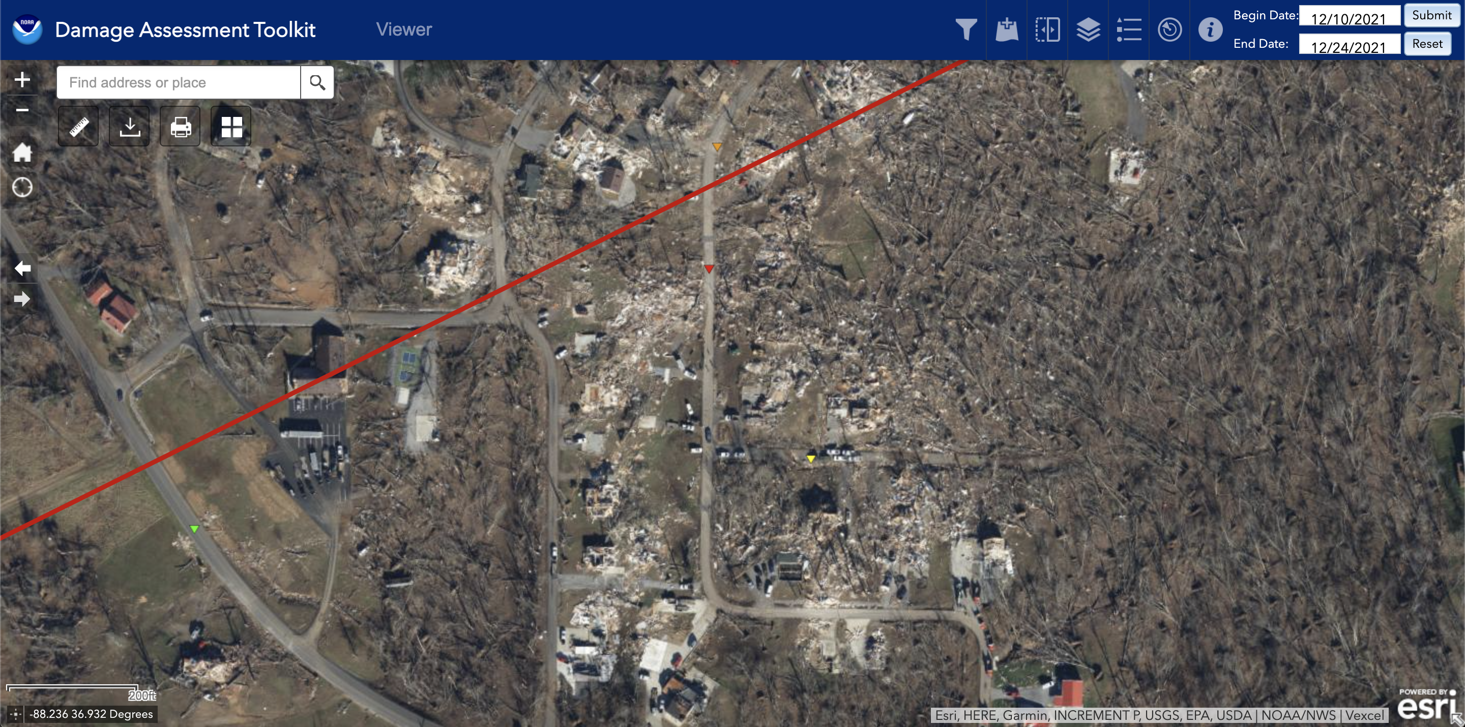
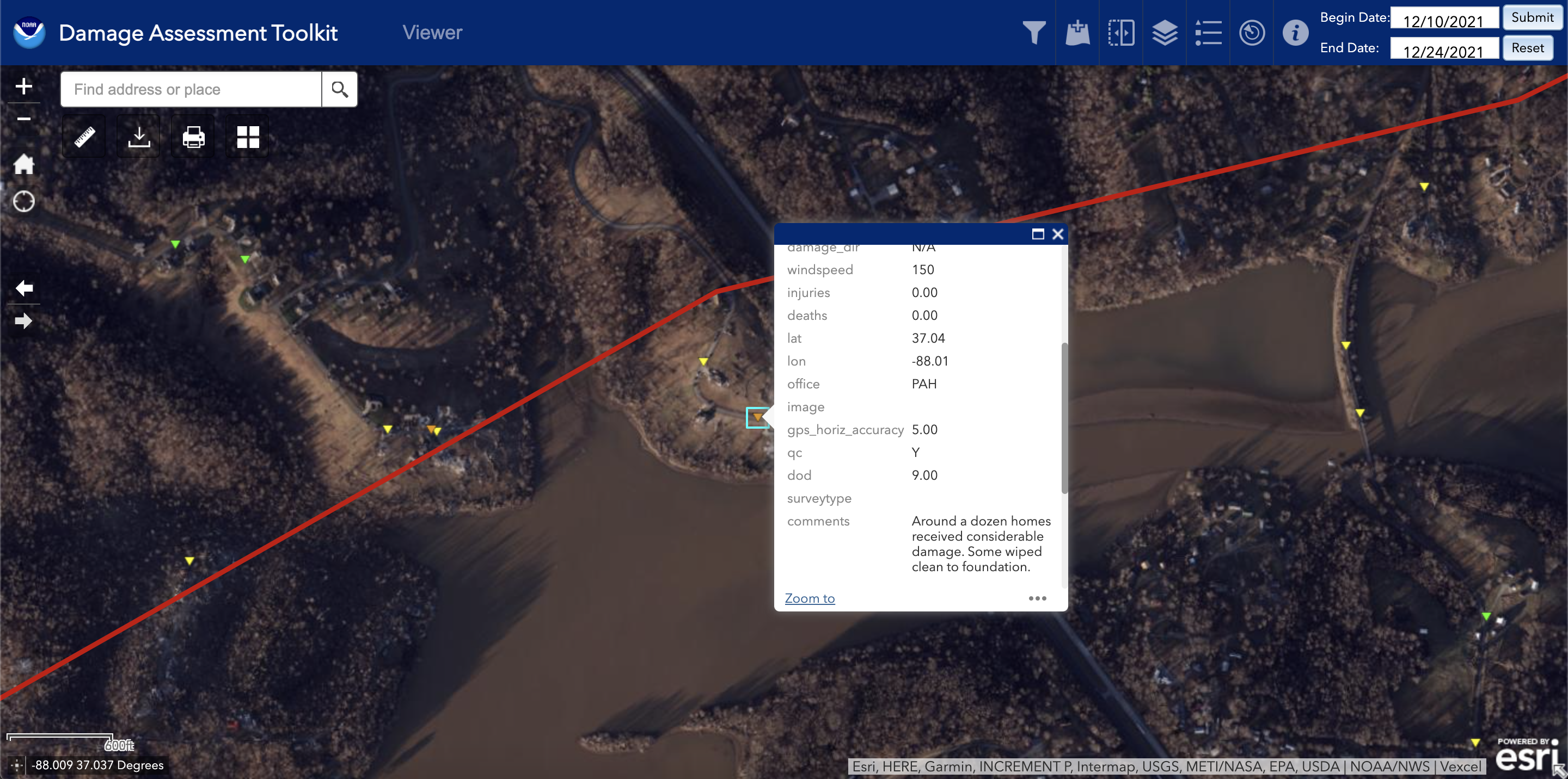
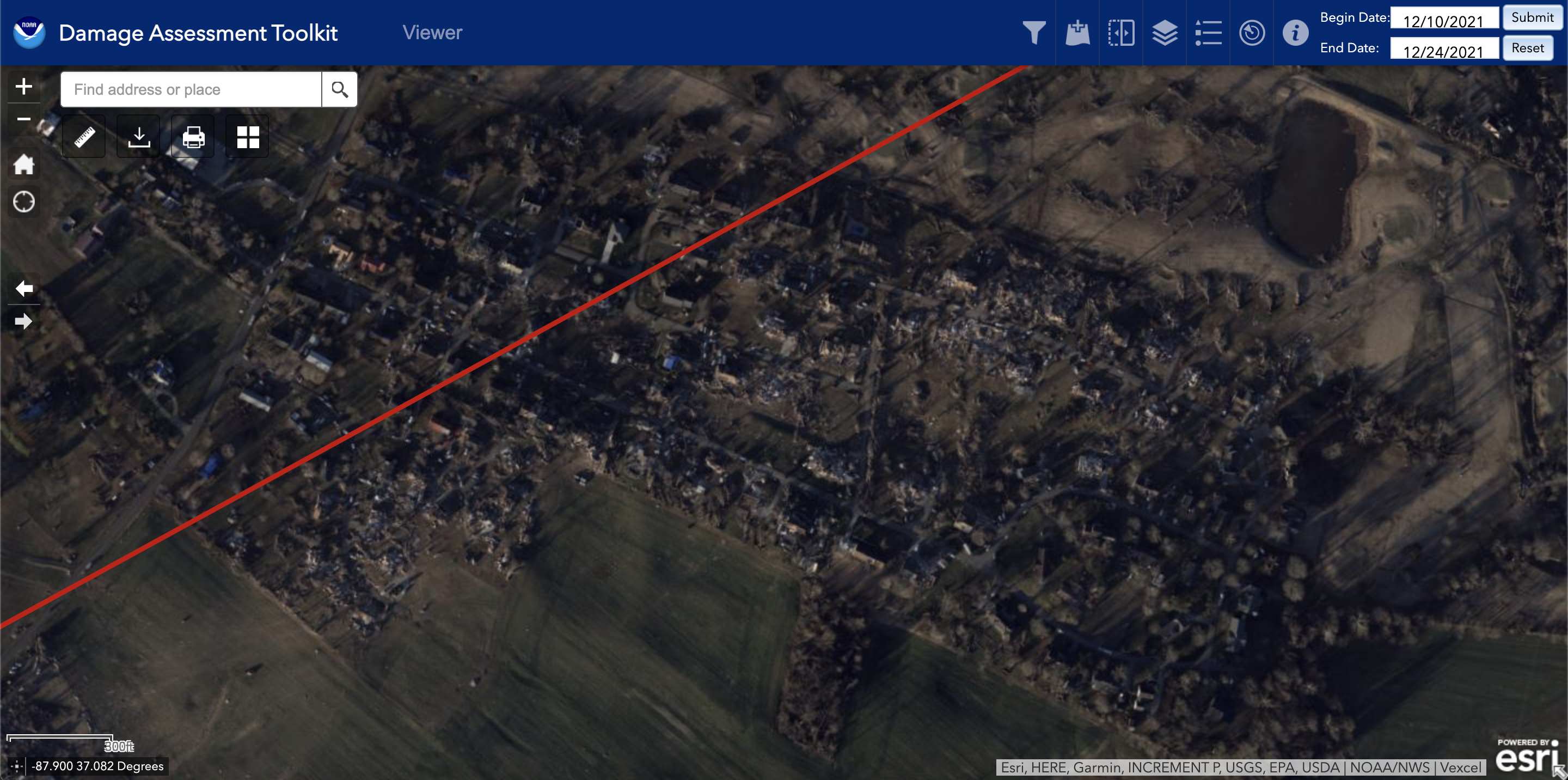
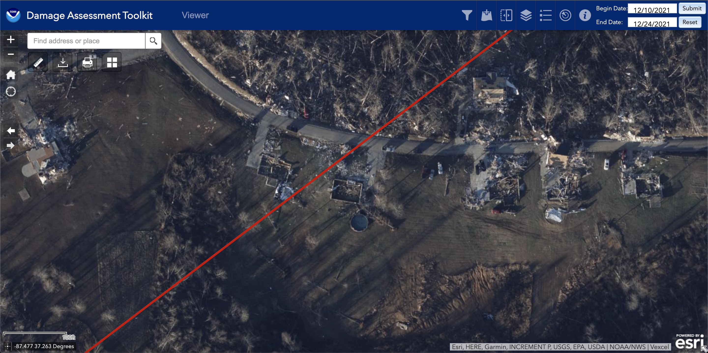
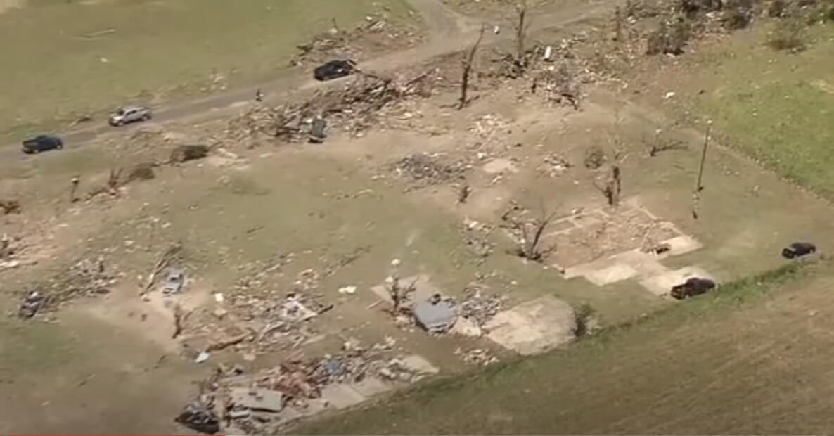
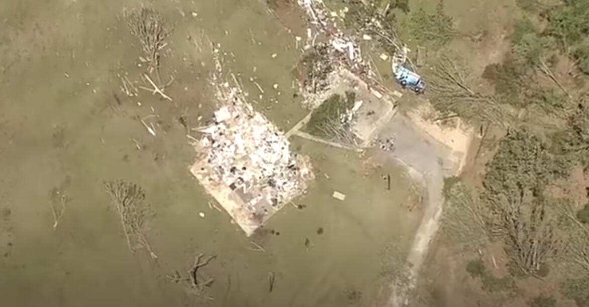
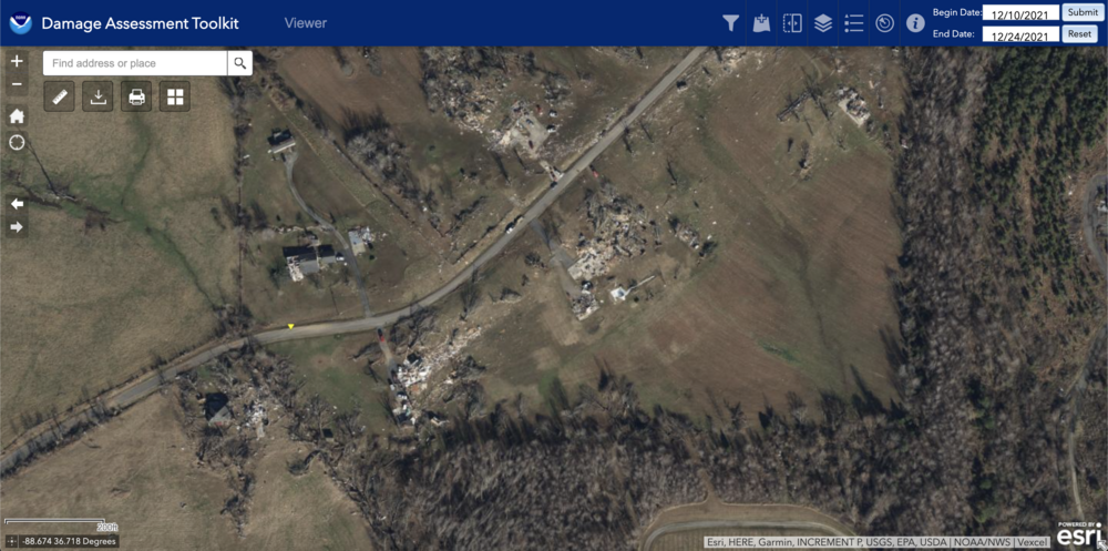
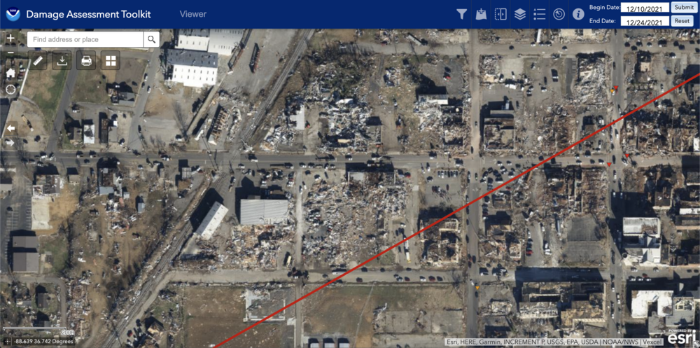
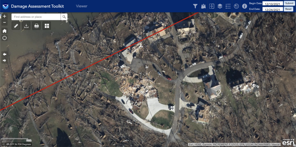
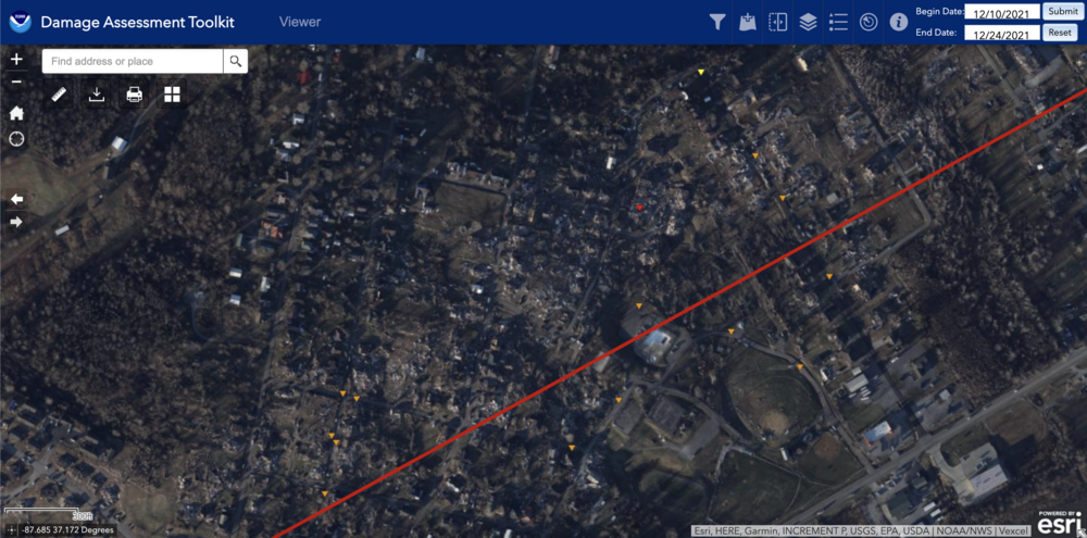
You want to argue that Mayfield was a thorough survey? Well explain these to me then. This group of houses SW of Mayfield on Pritchett Road was completely destroyed, and yet we have only a single EF2 rating (the house to the north of the road on the left) that wasn't even in the core of the damage path. Entire blocks of structures, including the First Presbyterian Church that was leveled to the ground in downtown Mayfield are missing DIs. This entire subdivision of homes that was destroyed SW of the lake in Cambridge Springs only have 3 DIs to represent them. Furthermore, these houses that were destroyed in Cambridge Springs have no DIs. The damage assessment mentions that some of these homes were wiped clean to their foundations east of the Lakes near the interstate, but we get a blanket rating of 150 mph for them. The entire area near the Princeton Golf Club has no DIs, including many houses that were leveled per both satellite and drone shots. There are very few DIs in Dawson Springs, given the number of structures that were impacted there. This entire group of houses northeast of Earlington has no DIs. I'm sorry, but that is just not thorough surveying if this is indeed the final product, and I'm not even necessarily saying that NWS Paducah is at fault here. It seems to me they should've had more help, perhaps from NWS SRH that has recently had many intense tornadoes.


-
Then why are there so many holes in the DAT from it?
-
You're saying the same thing over and over again. How about I post this thread where I specifically ask questions of those with greater knowledge than myself of the process?
-
I'm allowed to point out inconsistencies based on previous cases amongst many other things. For example, Rick Smith tweeted at one point that one structure could be the basis for the rating of a tornado, but in the Vilonia survey, it was specifically argued as a reason to not upgrade it to EF5 despite a house that clearly was built to code and even had anchor bolts to its interior walls.
-
Sure, I'd ask him why this entire group of structures from the EF3 Canton TX tornado in 2017 was missed in the survey.

-
Yes I would ask him about why their Moore survey was so thorough and why the Vilonia and Mayfield ones weren't. You name dropping people isn't really supporting your arguments.
-
That wouldn't be rated EF0 because the tree damage would probably warrant EF3 at minimum.
-
Then you really haven't been paying much attention.
-
More like I don't just blindly believe what people tell me without doing my own research first. Tim Marshall only visited a couple of locations (Mayfield and Dawson Springs) along the path in the first place.
-

December 15th-16th Warmth, Wind, and Severe Threat
andyhb replied to Geoboy645's topic in Lakes/Ohio Valley
Might be as anomalous as the 5/31/1985 event. -
Of course the scale has not changed, but how it's applied does over time and depending on location.
-
Because a tornado's max winds are rated based on the max 3 second gust, and unless this tornado was moving >100 mph (which it wasn't), its size would expose at least certain structures to high winds (including the UK Grain Center) for a longer period than that. Edit: maybe to say that point was nonsense was too harsh, because I do understand the angle (contrasting with something like the Jarrell tornado), but I think given that there have been a number of other fast-moving EF5 tornadoes and this one did produce a lot of higher end damage, it seems there was enough exposure for total destruction in many instances.
-
That first point is nonsense. And I also don't see how the second conclusion can be drawn with large holes with no survey results along the path, blanket ratings of several spots that seem to discount the highest end damage in certain locations, and various instances of poor photography of the actual damage sites.
-
Well regardless of the validity of his statement, I'd like to know why there are so many missing DIs from tornadoes like Mayfield and Vilonia then, especially when others like Moore 2013, Bassfield, and the like are handled much differently. I'd also like to know why there is so much inconsistency for how both conventional and non-conventional DIs are applied.
-
Not overly. May was much busier in the Plains though.