andyhb
-
Posts
20,454 -
Joined
-
Last visited
Content Type
Profiles
Blogs
Forums
American Weather
Media Demo
Store
Gallery
Everything posted by andyhb
-
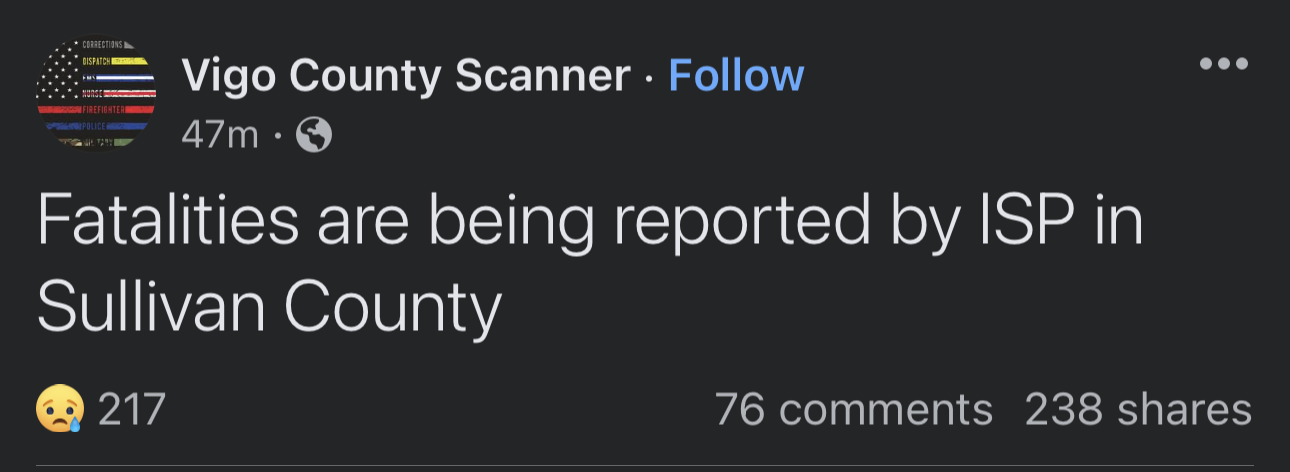
2 dead in Sullivan IN per police thus far.
-
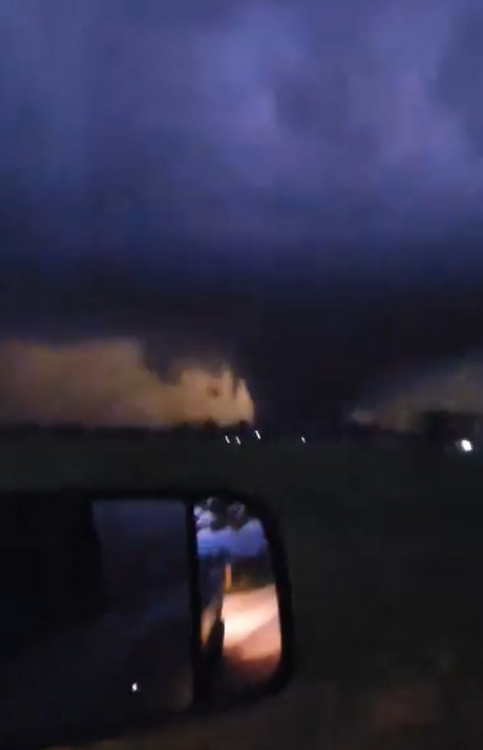
Robinson IL tornado from earlier.
-
Not good in SW IN.

-
Fred Gossage (alumni from here) has a large wedge tornado near Clifton on this stream.
-
https://t.co/kwW04YxofI Video of the Robinson/Palestine IL tornado from earlier (may be the same as the Sullivan tornado).
-
Sullivan tornado had debris evident at 29k feet from KLOT after it struck town. Was likely violent. Initial reports are not good.
-
Sullivan IN just took a direct hit. TDS exploded.
-
Violent tornado in progress near Robinson IL. Large debris ball. Edit: Tornado emergency, 5th of the day.
-
Two tornadoes with the storm E of Springfield IL, one of them may head towards Decatur.
-
Large and potentially violent tornado near Covington TN.
-
An absolute beast.
-
Large tornado NE of Ottumwa per Spencer Dant.
-
That E Peoria storm is big trouble.
-
06z HRRR has a trio of long tracked supercells across the northern third of IL, endangering several large population centers including Chicagoland from 3-6 pm. Very dangerous solution.
-
Northeast IL/Chicagoland sure, north-central IL is definitely in a fairly high threat area though.
-
When the 3 km NAM comes in looking like the hyped up runs of the FV3/HRRR, you might have a problem. 18z run is crazy for the northern MDT/vicinity.
-
I won't make any comparisons to such high end outcomes this far out, but the synoptics with this one are screaming major severe weather outbreak, to say the least. Still comes down to the mesoscale on the day of and day before, but the potential here is at a level rarely seen given the consensus from the 12z guidance. Putting it another way for the long-timers, back in the day, this would be a level of threat that @CUmet would come out of the woodwork for.
-
Lol you don't have to imagine it, there's 2000-4000 CAPE across the entire warm sector with tornadic supercell wind profiles.
- 499 replies
-
- 10
-

-

-
Unbelievable run again. All of those are occurring in environments favorable for strong/violent tornadoes.
-
Put it this way, I would be in favor of moving Tuesday's thread to the main board if this place wasn't so poorly organized. Feel like both C/W and GL/OV are going to be involved in some manner here.
-
These are some of the most dangerous model solutions I've seen in a very long time within reasonable range.
-
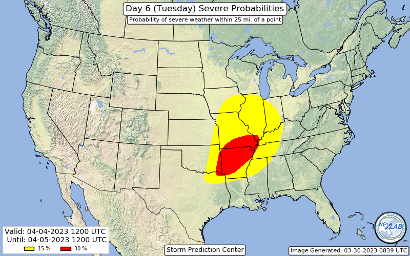
30% D6 issued, with some pretty strong wording (understandably) for being that far out.
-
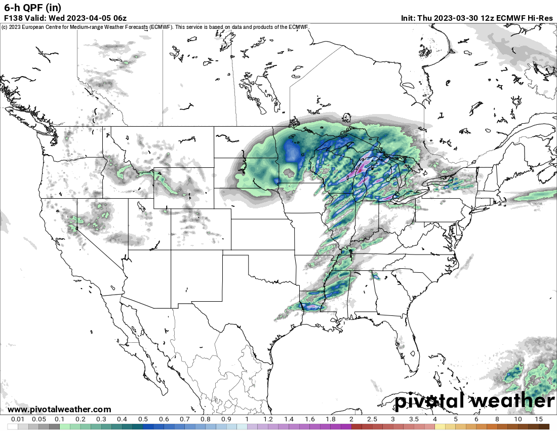
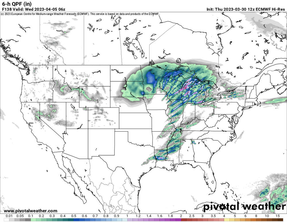
Euro once again is a high end event for 4/4 (Tuesday). Massive trough with a wavelength of more than half the CONUS slams into a huge warm sector with mid-upper 60s dewpoints throughout. Other models definitely slowed so there is a bit of split now in the solutions.
-
Bimodal D2 MDT, one closer to the surface low with a 10 hatched tornado risk (wind driven), the other in the Mid South with a 15 hatched tornado risk.
-
Predictably, the 00z HRRR is insane.